did-you-know? rent-now

Amazon no longer offers textbook rentals. We do!

did-you-know? rent-now

Amazon no longer offers textbook rentals. We do!

We're the #1 textbook rental company. Let us show you why.

9780226534039

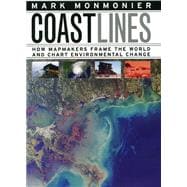
Coast Lines

by
  • ISBN13:

    9780226534039

  • ISBN10:

    0226534030

  • Format: Hardcover
  • Copyright: 2008-05-15
  • Publisher: Univ of Chicago Pr

Note: Supplemental materials are not guaranteed with Rental or Used book purchases.

Purchase Benefits

  • Free Shipping Icon Free Shipping On Orders Over $35!
    Your order must be $35 or more to qualify for free economy shipping. Bulk sales, PO's, Marketplace items, eBooks and apparel do not qualify for this offer.
  • eCampus.com Logo Get Rewarded for Ordering Your Textbooks! Enroll Now
List Price: $25.00 Save up to $8.75
  • Rent Book $16.25
    Add to Cart Free Shipping Icon Free Shipping

    TERM
    PRICE
    DUE
    USUALLY SHIPS IN 24-48 HOURS
    *This item is part of an exclusive publisher rental program and requires an additional convenience fee. This fee will be reflected in the shopping cart.

Supplemental Materials

What is included with this book?

Summary

In the next century, sea levels are predicted to rise at unprecedented rates, causing flooding around the world, from the islands of Malaysia and the canals of Venice to the coasts of Florida and California. These rising water levels pose serious challenges to all aspects of coastal existencechiefly economic, residential, and environmentalas well as to the cartographic definition and mapping of coasts. It is this facet of coastal life that Mark Monmonier tackles inCoast Lines. Setting sail on a journey across shifting landscapes, cartographic technology, and climate change, Monmonier reveals that coastlines are as much a set of ideas, assumptions, and societal beliefs as they are solid black lines on maps. Whether for sailing charts or property maps, Monmonier shows, coastlines challenge mapmakers to capture on paper a highly irregular land-water boundary perturbed by tides and storms and complicated by rocks, wrecks, and shoals.Coast Linesis peppered with captivating anecdotes about the frustrating effort to expunge fictitious islands from nautical charts, the tricky measurement of a coastline's length, and the contentious notions of beachfront property and public access. Combing maritime history and the history of technology,Coast Linescharts the historical progression from offshore sketches to satellite images and explores the societal impact of coastal cartography on everything from global warming to homeland security. Returning to the form of his celebratedAir Apparent, Monmonier ably renders the topic of coastal cartography accessible to both general readers and historians of science, technology, and maritime studies. In the post-Katrina era, when the map of entire regions can be redrawn by a single natural event, the issues he raises are more important than ever.

Author Biography

Mark Monmonier is distinguished professor of geography at Syracuse University's Maxwell School of Citizenship and Public Affairs.

Table of Contents

Preface and Acknowledgments
Depiction and Measurement
Definitions and Delineations
New Worlds and Fictitious Islands
Triangles and Topography
Overhead Imaging
Electronic Charts and Precise Positioning
Global Shorelines
Baselines and Offshore Borders
Calibrating Catastrophe
Rising Seas, Eroding Surge
Close-ups and Complexity
Epilogue
Notes
Bibliography
Table of Contents provided by Publisher. All Rights Reserved.

Supplemental Materials

What is included with this book?

The New copy of this book will include any supplemental materials advertised. Please check the title of the book to determine if it should include any access cards, study guides, lab manuals, CDs, etc.

The Used, Rental and eBook copies of this book are not guaranteed to include any supplemental materials. Typically, only the book itself is included. This is true even if the title states it includes any access cards, study guides, lab manuals, CDs, etc.

Rewards Program