did-you-know? rent-now

Amazon no longer offers textbook rentals. We do!

did-you-know? rent-now

Amazon no longer offers textbook rentals. We do!

We're the #1 textbook rental company. Let us show you why.

9780809053414

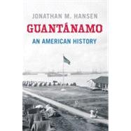
Guantánamo An American History

by
  • ISBN13:

    9780809053414

  • ISBN10:

    0809053411

  • Format: Hardcover
  • Copyright: 2011-10-11
  • Publisher: Hill and Wang
  • Purchase Benefits
  • Free Shipping Icon Free Shipping On Orders Over $35!
    Your order must be $35 or more to qualify for free economy shipping. Bulk sales, PO's, Marketplace items, eBooks and apparel do not qualify for this offer.
  • eCampus.com Logo Get Rewarded for Ordering Your Textbooks! Enroll Now
List Price: $35.00 Save up to $21.51

Summary

At once wholly American and something in between, Guantanamo Bay, Cuba, sits at the intersection of Cuban sovereignty, American control, and international law. In this fascinating new book, Jonathan M. Hansen, a historian at Harvard University, tells the complete story of this interstitial place for the first time. Since the Spanish-American War, the Guantanamo naval base has been home to a rare breed of soldiers and civilians (and their families) who consider themselves model Americans. A self-described Mayberry in the middle of a Communist nation, Guantanamo's "citizens" hold the values of liberty and the rule of law in highest regard, even as their home plays host to one of the most controversial prisons of the modern world. But America's presence at Guantanamo did not start with the Spanish-American War. Guantanamo figured centrally in the making of the United States long before the American colonies declared independence from Britain. At once prized and neglected by imperial Spain, Guantanamo's generous harbor and strategic location at the epicenter of the Atlantic world tempted American empire builders over many generations. Lawrence Washington (George's half brother), Thomas Jefferson, and James K. Polk are just a few of the venerable Americans who tried and failed to bring Cubaand Guantanamointo the U.S. orbit. Truly more than a book about Guantanamo Bay, this is a story about the making of modern America, one that places post-9/11 America in its proper historical context.

Author Biography

Jonathan M. Hansen, a historian at Harvard University, is the author of The Lost Promise of Patriotism: Debating American Identity, 1890–1920.

Table of Contents

Guantanamo
1
REDISCOVERING GUANTNAMO
On the afternoon of April 29, 1494, Guantnamo Bay bustled with activity. Hunters from a village up the Guantnamo Valley gathered food for a celebratory feast.1 Using traps, nets, hooks, and harpoons, and perhaps working from canoes, the hunters were having a good time of it. Within a few hours, they had hauled in roughly one hundred pounds of fish, which they set about preserving for the journey home. Meanwhile, a second group of hunters pursued alligators that made their homes along the banks of the rivers that fed Guantnamo Bay. They, too, were enjoying a good day, and before long the bay was perfumed by wood smoke from fires sizzling with fresh fish and alligator meat hung from wooden spits.2
An ordinary day at Guantnamo became memorable sometime in the midafternoon, when three large vessels topped by billowing white sails appeared off the entrance to the bay. News of the foreign fleet's return to the Americas had preceded it to Cuba, borne by fleeing villagers from nearby Hispaniola.3 With scarcely time to conceal themselves, the hunters withdrew into the hills and bushes bordering the bay, leaving their game roasting over the fires. Aware of the strangers' advantage in weaponry, the hunters could only watch as the strangers disembarked and devoured the fish, all the while eschewing the alligator, the more precious delicacy in local circles.4
With their stomachs full, the strangers set out to explore the surroundings,as if to identify if not thank the people who had so amply provided for them. Still, the hunters shrank back, until finally appointing an envoy to find out what the strangers wanted. Moving forward, the envoy was met not by one of the newcomers but by a fellow Arawak speaker whom the strangers had snatched off one of the Bahama islands.5 Convinced at last that the strangers had stopped at the bay for only a quick visit, the hunters abandoned their hiding places and approached their guests with caution and generosity. Never mind the hundred pounds of fish, the interpreter was assured; the hunters could recover that in a matter of hours. There followed an exchange of gifts and pleasantries, after which the strangers reboarded their vessels and went to bed, the better to rise early, set sail, and finally put to rest the impious notion that Cuba was an island and not the continent of Asia.6
 
The people who discovered Columbus helping himself to their dinner that day had preceded him by nearly a millennium. The Tano, as Columbus's unwitting hosts are known today, were themselves recent arrivals in eastern Cuba.7 They had been beaten to the bay by still earlier discoverers, who began to harvest Guantnamo's resources as early as 1000 BCE.8 Guantnamo's first discoverers hailed from the west, hopping over islands, now submerged, that once connected Central America to Cuba via Jamaica some seven thousand years ago.9 These so-called Casimiroid people found in Guantnamo a cornucopia of flora and fauna with no one to compete for it. The Casimiroids exploited Guantnamo Bay more as a hunting ground than as a home. For them, the bay comprised part of a larger ecosystem that met the requirements of Stone Age living. From the mudflats and mangrove-lined terraces of the outer harbor, the Casimiroids took shellfish, fish, and game, and materials for the simple tools that facilitated their hunting and scavenging. Along the streambeds and river valleys that fed the inner harbor, they drew water and collected wild fruit and vegetation. Theirs was a difficult, prosaic life. Their impact on the Guantnamo Basin was negligible. The vast bay easily absorbed their sparse population, and for their first two thousand years in Cuba, they had few if any rivals.10
As the Casimiroids were wending their way toward Guantnamo, another people--horticultural, sedentary, ceramic--began to stir deep in the Orinoco River basin of South America. These were the ancestors of Columbus's Tano hosts. What set them in motion is anybody's guess, but sometime after 2000 BCE they took to the sea, riding a branch of the South Equatorial Current along the northeast coast of South America, over the equator, to the base of the Antilles archipelago. Over the next two thousand years, they migrated up the archipelago from island to island, all the while appropriating cultural elements of the Stone Age peoples they displaced. By the late first century BCE, they had arrived at Hispaniola, where Tano civilization reached its zenith several centuries before Columbus. The Tano first crossed the Windward Passage from Hispaniola to eastern Cuba around 700 CE. There their westward progress stalled, their assimilative powers outmatched by the guns, germs, and steel of the conquistadors.
In the American imagination, Columbus's so-called discovery of America in 1492 represents a watershed second only to the birth of Christ. In the eyes of Columbus and his royal sponsors, the mission to the Orient was merely a logical extension of the reconquista, the centuries-old (and vastly expensive) effort to drive the Moors (and Jews) from Spain. Only in hindsight can the expulsion of the Moors in 1492 be taken for granted. At the time Columbus was charting his journey west, the success of that battle could hardly be assumed, and Spain's newly consolidated kingdom of Aragon and Castile wanted nothing so much as funds sufficient to finish the job. Promise of access to lucrative Oriental markets induced Castile's queen Isabella to sponsor an audacious navigator from Genoa.11
On the Iberian Peninsula, the rise of Aragon and Castile was achieved by the creation of what were in effect colonies established in the wake of the retreating Moors. King Ferdinand and Queen Isabella granted rights to their most trusted and valued lieutenants to rule over these new colonies in their names. But there were only so many such grants to be won at home, and after 1492 the Orbe Novo beckoned to a cohort of second-tier conquistadors flush from the heat of battle, no less ambitious for fame and fortune, and no less committed to the project of making the world safe for Christianity than the royal favorites themselves. Columbus was more sailor than warrior, but warriorsaccompanied him on his several voyages to the Americas, where violence became the Spaniards' stock-in-trade.12
Columbus's brief sojourn at Guantnamo signaled the beginning of a cataclysmic social and economic revolution that permanently transformed not only Cuba and Hispaniola but North and South America, Europe, and Africa besides. The islands and continents that Columbus and his successors "discovered" at the end of the fifteenth century were worthless without a labor force. Spain was merely the first in a series of aspiring European and North American empires that defended the enslavement and annihilation of millions of indigenous inhabitants and imported Africans on the basis of putative cultural and racial differences. The contradiction between the universalism latent in Western theology and philosophy and the West's historic treatment of Indians, slaves, and countless "others" inspired a long argument about just who was fit to be counted as a "human being," an argument that continues to this day (women? indigenous Americans? African slaves? stateless enemy combatants?). But all of this was unimaginable upon that first encounter at Guantnamo Bay.13
 
No doubt Columbus's impatience at Guantnamo Bay suited the Tano hunters just fine. With the admiral on his way to China, they were free to complete the task that had brought them to the bay. Compared with their cousins on Hispaniola, they had gotten off easily that day. At Isabella, Columbus's headquarters across the Windward Passage, the psychological and physical demands of conquest had begun to take a toll on the Europeans, with one of the first formal incidents of Spanish-on-Tano violence recorded earlier that same month.14 A local Indian had allegedly stolen a Spaniard's clothes; as punishment, one of Columbus's lieutenants cut off the ear of a Tano vassal, taking into custody the responsible cacique and several members of his family. Columbus wanted to teach the Indians a lesson by cutting off all his prisoners' arms, but a Tano ally dissuaded him. Nevertheless, a precedent had been set, and over the course of the next twenty years, the Spanish so brutalized Hispaniola that within a single generation there remained scarcely any Tano left.
Cuba, meanwhile, enjoyed what can only be called a grace period,its inhabitants going about their lives as if they could avoid their neighbors'fate simply by ignoring it.15 When Spain finally turned its attention to Cuba in 1511, it did so with brutal efficiency. To pacify Cuba, the Crown selected Diego Velzquez de Cullar, author of spectacular atrocities in the Spanish conquest of Hispaniola, including the burning alive of eighty-four Tano caciques assembled at the village of Xara-gua in autumn 1503.16 Velzquez arrived in Cuba with a vengeance, indeed, in hot pursuit of a cacique named Hatuey, who had fled across the Windward Passage rather than submit to Spanish authority--a capital offense.17
By 1511 the Crown had introduced in Hispaniola a scheme of land and labor distribution called encomienda, a feudal system for the New World. By the terms of encomienda, Spanish colonists received land along with right to the labor of the Indians who dwelt upon it. Technically, the Indians owned the lots on which they lived, and if less than independent, they were not formally slaves. Until they ran away, that is, thus depriving the Spanish encomendero the means of making a living (and the Crown itself its reason for being in the New World). A Tano in flight from encomienda was for all intents and purposes a runaway slave, and no amount of hand-wringing by Bartolom de las Casas and a whole order of Dominican monks could alter his or her fate.18
Hatuey landed in Cuba at Punta de Mais, just across the Windward Passage from today's northwest Haiti. Punta de Mais lacks a harbor, so Velzquez headed for Guantnamo Bay, hoping to corner Hatuey in the eastern end of the island and thereby stop the rebellion from spreading. For three months, Velzquez combed the mountains east of Guantnamo in search of a leader who knew his pursuer too well, and who aimed to avoid a face-to-face showdown at all cost. Cuban history is full of guerillas; Hatuey simply wanted to be left alone. But with eastern Cuba rallying around the Tano chief, Velzquez treated the region to a barn burning, razing villages, terrorizing women and children, and torturing local residents for information.19
Before burning Hatuey at the stake, Velzquez offered him the opportunity of redemption. When a Catholic father asked Hatuey if he wanted to be baptized into the Christian faith, Hatuey wondered why he should want to become a Christian when Christians were thesource of his undoing. Because Christians go to heaven and remain in the company of God, came the reply. Are you going to heaven? Hatuey asked. Of course, replied the father, like all who are holy. Then no thanks, said Hatuey, who had had quite enough of Christian company already. A match was struck, and the Tano resistance went up in smoke.20
 
Guantnamo's centrality in these early cultural encounters will be surprising only to readers who have forgotten their natural history. The genesis of this "Great Port" (Puerto Grande), as Columbus named it, dates back to the geological upheaval that splintered the superconti-nent Pangaea some 180 million years ago, when, driven by upwelling magma along a rift that would become the mid-Atlantic ridge, "North America" pulled away from "Africa" and "South America." At first the rupture left only a teardrop, an intimation of the Gulf of Mexico. But the drop became an ocean whose relentless expansion sundered Pangaea into bits.
Tectonic activity of this magnitude produces considerable flotsam. Off the western coast of the Americas sat chunks of the continental margin, as if patiently awaiting conveyance. Conveyance arrived, for some at least, in the form of the Caribbean plate. Originating in the Pacific Ocean, the plate moved north and east like a saucer. Along its starboard rim, like running lights, perched a volcanic island arc. This arc would become the islands of the Lesser Antilles. Nearby, on the leading edge of the saucer, rode pieces of future Cuba, Hispaniola, and Puerto Rico, not yet in recognizable form. Hispaniola and Puerto Rico clung to Cuba's southern coast as the saucer shot the gap between the Americas, scraping off Jamaica from the Yucatn along the way. For several thousand miles, the saucer sped unimpeded toward the northeast. It slammed to a halt at the Bahama Banks, southern boundary of North America, where a combination of oceanic and upper mantle crust, continental margin, and island arc stacked up to produce the foundation of today's Cuba, one of the most complex geological conglomerations on earth.21
Toward the end of this monumental migration, Cuba sat along the southern rim of the North American plate, originally little more than achain of islands. Meanwhile, southeast Cuba, future home to Guantnamo, constituted a world of its own. In the immediate aftermath of the collision, it straddled the boundary of the North American and Caribbean plates, Hispaniola and Puerto Rico still firmly attached. But the forces propelling the saucer were unassuaged. With its passage northward blocked by the Bahamas, the saucer veered sharply east in a wrenching motion that nearly carried southeast Cuba out to sea. Southeast Cuba held as Hispaniola and Puerto Rico tore away, exposing a gap along the Cuban coastline that would become the setting of Guantnamo Bay.
Guantnamo Bay is located at W 759' longitude and N 1954' latitude, about three quarters of the way along Cuba's southeast coast, running west to east. Southeast Cuba is extraordinarily rugged. Comprising roughly one fifth of Cuba's territory, it boasts more mountains than the rest of Cuba combined. The Guantnamo Basin is the notable exception in the region. Its 250-odd square miles lie at or close to sea level. Backed by the sea and surrounded by mountains, the basin resembles a vast amphitheater, with the bay itself at center stage.
Guantnamo Bay is very young geologically. It assumed its present shape as recently as 6000 BCE. The principal agent in Guantnamo's creation was water. Since first arriving at the Bahama Banks forty million years ago, Cuba has been repeatedly inundated by and drained of seawater, a result of fluctuating global temperatures and the rise and fall of the Cuban landmass. Flooding seas littered coastal Cuba with marine terraces, inland lakes, and seabeds. Ebbing seas produced erosion, the source of river valleys, basins, and bays. Guantnamo is the sum of these geological processes, of the wearing away of old terraces and seabeds by erosion and the subsequent drowning of the hollows and cavities the erosion left behind.
Officially Guantnamo Bay extends ten miles long by six miles wide and measures between thirty and sixty feet deep. But practically speaking, it consists of two discrete bodies of water, an inner and outer harbor, connected by a narrow strait. The inner harbor is large and shallow. It has a smooth, billowing shoreline and resembles a good-size lake. The outer harbor is ragged and irregular. Smooth to the west, it is rough to the east, and its north is strewn with cays. The contrast between the two harbors derives from their different physical composition.The inner harbor rests atop an old tidal flat that yielded easily and evenly to erosion. The outer harbor is lined by fossilized coral terraces, harder and more defiant of erosion. Where there is fossilized coral at Guantnamo, there will be found the cays, coves, and promontories that comprise the outer harbor (home of the U.S. base); where coral is absent, the shoreline will be smooth and uniform, as along the lower western shore of the outer harbor and throughout the whole of the inner bay.22
Individually distinctive, the two harbors combine to create a coastal environment of wondrous diversity. From the sea, Guantnamo stands out among the world's great bays for its accessibility. Some bays are so camouflaged by the surrounding countryside that it is possible to sail right past them without noticing. The harbor entrance at Santiago de Cuba, for instance, is so tortuous and cluttered that it has confounded sailors for centuries. By contrast, Guantnamo's entrance is deep, uncluttered, and virtually impossible to miss. Now nearly two miles wide, it sits within a wide gap in the mountain rampart of southeast Cuba detectable far out to sea.
The narrower a harbor entrance, the more vulnerable approaching vessels to the whims of those who call the harbor home. The mouths of many Cuban harbors are not only narrow but sheer, affording hosts the advantage of significantly higher ground. Again, Santiago de Cuba comes to mind, where Morro Castle commands the harbor from high atop an imposing bluff; again, Guantnamo presents a striking contrast. Windward Point, the southeast corner of the bay, rises four hundred feet above sea level, but not until a half mile from the coast. Meanwhile, Leeward Point remains flat for several miles, barely reaching thirty feet above sea level. Guantnamo's broad mouth would make it a challenge to defend in the years before modern weaponry. Conversely, ships that dared not test the welcome at Havana or Santiago would find Guantnamo Bay an open and inviting place.
On approach, Guantnamo Bay appears not only welcoming but vast. Beyond the entrance to the bay, the Guantnamo Basin seems to stretch out indefinitely, making the bay feel much larger than its sixty square miles. Once inside the bay, visitors confront a wealth of possible destinations, further adding to the sense of scale. Immediately inside Leeward Point, moving clockwise around the bay, is a channeltwo hundred feet wide and a mile long that is both the estuary of the Guantnamo River and the passage to secluded Mahomilla Bay. The Guantnamo River is brackish well before it meets the bay, but it is navigable far upstream, thus connecting the outer harbor to the Cuban hinterland and providing its only access to freshwater.
Just past the estuary lies Hicacal Beach, three miles of coarse sand carved from the delta of the Guantnamo River. Most of Guantnamo Bay is sheltered from the prevailing southeast wind by the hills of Windward Point. Hicacal Beach is decidedly not. It meets the prevailing southeast wind, brisk by early afternoon most days, squarely on the nose, taming its often boisterous waves and deflecting them harmlessly up the channel. The most exposed territory in Guantnamo Bay, Hicacal is also the most dynamic. Reshaped by tides and passing storms, its fertile and abundant seabeds suggest the benefits of its buffeting by wind and sea.
From its foot inside Leeward Point, Hicacal Beach arches sharply north and east, directing incoming traffic toward the opposite shore. The eastern shore of the outer harbor is a peninsula roughly six miles long and tapering from five to three miles wide as it frames the southeast corner of the bay. Down the spine of the peninsula is a range of hills, nearly five hundred feet tall, that dominate the outer harbor and the nearby Cuban coastline. At the base of the hills, along the outer shore of the peninsula, lies a broad, flat terrace, current site of the U.S. prison camp. Along the inner shore of the peninsula, old coral terraces protrude like fingers into the bay. Roughly thirty feet high, these terraces range from several hundred yards to half a mile long, creating a succession of natural coves and jetties. The terraces proliferate across the top of the outer harbor, too, where some take the form of islands. Here the terraces tend to be long and the coves deep; a few reach inland for nearly a mile. The net effect of this diverse seascape is a prized refuge and an explorer's paradise: behind every promontory a little cove, within every cove a beguiling shoreline.
Past the old coral terraces at the top of the outer harbor lies the opening to the inner harbor, a broad, uncluttered expanse notable less for its topographical interest than for its geographical orientation. If the outer harbor belongs inexorably to the sea, the inner harbor is indisputably Cuba's own. It sits at the foot of the Guantnamo Basin, anancient drainage system laced with rivers and streams and tied to the rest of Cuba by a ribbon of fertile plain. In contrast to the inhospitable terrain that surrounds the outer harbor, the land framing the inner harbor is irrigated, arable, and hence suited to human habitation. Rich salt deposits line the shoreline; the harbor itself fairly boils with fish. But it is as a link to the outside world that the inner harbor is most significant. Communication is cumbersome in this rugged corner of southeast Cuba, making access to the sea a condition of its economic and cultural vitality.
In sum, the two harbors are complementary, their differences felicitous, at least so long as traffic between them remained open and unfettered. Together, they sustain distinct yet interdependent worlds. Divided, their value depreciates, as, landlocked the one and exposed the other, each becomes merely the sum of its individual parts. Since 1898, when the United States first occupied the outer harbor in the Cuban Spanish-American War, the U.S. naval base has effectively cut the bay in two.23
 
Magnificent in its own right, Guantnamo Bay occupies a strategic geographical position in Cuba, the Caribbean Basin, and the Western Hemisphere. Paradoxically, Guantnamo's significance within Cuba derives from its isolation from the center of Cuban social and political life. Six hundred miles distant from the capital, Havana, and surrounded by mountains, Guantnamo has functioned historically as Cuba's safety valve--a land of exile and refuge accommodating marginalized people from within Cuba and across the Caribbean basin.
Guantnamo's role in Cuba is a function of the island's natural history. Tectonic boundaries tend to be mountainous. Plate collisions cause tectonic folding, and volcanoes are common along plate seams. Scientists call the process of mountain formation orogeny, and southeast Cuba is a case in point. The region consists essentially of two large mountain chains, the fabled Sierra Maestra and the no less formidable Nipe-Sagua-Baracoa Massif. The Sierra Maestra rises just west of Guantnamo Bay and runs 180 miles down the coastline to Cabo Cruz, southeast Cuba's westernmost tip. Pico Turquino (6,476 feet), Cuba's tallest peak, commands the middle of the range.Slightly lower than its rivals in Jamaica and Hispaniola, Pico Turquino is comparable in height to New Hampshire's Mount Washington (6,288 feet) and North Carolina's Mount Mitchell (6,684 feet), the highest elevations in the eastern United States. For much of its span the Sierra Maestra climbs straight out of the sea, which lends it extraordinary grandeur. Its status is enhanced by the celebrated people who have sought the sanctuary of its caves and copses over the centuries, starting, it is said, with Hatuey, and continuing through the runaway slaves, insurgents, revolutionaries, and counterrevolutionaries of more recent days.
To the east of Guantnamo Bay rise the foothills of the Nipe-Sagua-Baracoa Massif. The great massif sprawls in a sideways V shape one hundred or so miles from Guantnamo Bay to Punta de Mais, then back to the high plains over Baha de Nipe. Less magnificent than the Sierra Maestra, its effect on Guantnamo is more constant. Green, luxuriant, expansive, the Nipe-Sagua-Baracoa Massif is a jealous sentinel, at once protecting the bay from wind and weather while simultaneously cheating it of meaningful rainfall. Few roads connect the great massif to the rest of Cuba. Relatively few people live there. Among these few are said to be the final remnants of Cuba's Tano people.24
 
Remote from the heart of Cuba, Guantnamo enjoys a front-row seat along the Windward Passage, one of the hemisphere's busiest sea-lanes and an integral link in the circum-Caribbean communication system. The passage takes its name from the breeze that blows in off the Atlantic between Cuba and Haiti, hurtling crews and cargo into the heart of the Caribbean basin. From its perch along the passage, Guantnamo affords access not only to the Antilles archipelago and the Gulf of Mexico, but also to coastal Central and South America and the Pacific Ocean, via the Isthmus of Panama.
Fifty-five miles wide, the Windward Passage is exceptionally deep. The passage marks the eastern end of the Cayman Trench, a 1,000-mile-long gash in the Caribbean floor formed by the easterly lurch of the Caribbean plate, which separated Cuba from Hispaniola 40 million years ago. At its deepest, the Cayman Trench plummets over25,000 feet. The Windward Passage plunges only about one-fifth that deep, but it does so vertiginously, dropping from 60 feet at the mouth of Guantnamo Bay to 1,500 feet a mile out, to 5,760 feet within 25 miles. Ships and cargo lost in the passage are lost forever. More than merely menacing, however, the passage is a boon to Caribbean ecology, allowing nutrients from deep ocean waters to ventilate and replenish the Cayman and Yucatn basins. The passage also proved a benefit to the U.S. Navy and its submarine training program, which has enjoyed the rare luxury of deepwater access just minutes out of port.25
The Windward Passage is Guantnamo's ticket to ride. No sooner had the North and South American plates separated from Europe and Africa than temperature and wind and their constant companion current conspired to reunite the hemispheres in an oceanic conveyance system that laid the foundations for the modern Atlantic world. To a considerable degree, that world revolves around Cuba and Guantnamo Bay.
The system draws its energy from the sun. Due to the tilt of the earth's axis, the sun strikes the earth more directly at the equator than at the tropics and poles. When hot air rises over the equator it leaves behind a vacuum of low pressure that draws in cooler, more pressurized air from the tropics in the form of wind. This is the source of the trade winds, the steady easterly breeze that blows between latitude 30 and the equator in both the Northern and Southern Hemispheres. The trade winds blow east to west, thanks to the eastward rotation of the earth, which bends prevailing winds to the right north of the equator and to the left south of it, a result of the so-called Coriolis effect.26
But the trade winds are only part of what makes the Atlantic world go round. There is no limit to the amount of sunshine that warms the equator, but there is a limit to how high hot air can rise through the earth's atmosphere: approximately ten miles. At that point the rising air hits an atmospheric ceiling called the tropopause and is propelled toward the poles by still more air behind it, where it begins to cool. This equatorial air can go only so far toward the poles due to resistance from air already there. The air pressure thus increases just as its temperature drops, returning the air to the surface of the earth. This happens, north and south, at approximately latitude 30, creating bands of high pressure known as tropical highs. Much of this highlypressurized air gets sucked back into the vacuum of low pressure over the equator, but not all of it. Another band of low pressure at 60 draws some of the cold, dense, highly pressurized air still closer to the poles, again in the form of wind. This wind, too, is bent to the right north of the equator, and to the left south of it, generating west-to-east winds this time, the so-called westerlies, a source of weather systems on the North American continent.
Just as heat generates wind, so wind generates current. North of the equator, the two bands of prevailing wind produce the North Equatorial and North Atlantic currents. The North Equatorial Current flows east to west between the equator and the tropics; the North Atlantic Current flows west to east between the tropics and 60. Like the winds that spawn them, these currents also bend in the direction of the earth's rotation, creating the North Atlantic Gyre, a vast clockwise rotating current system that facilitates navigation in the North Atlantic.27
It is no coincidence that Christopher Columbus first made landfall off eastern Cuba and the entrance to the Windward Passage, somewhere in the vicinity of Grand Turk Island.28 Before wind yielded to steam in the second half of the nineteenth century, ships bound to the Americas from Europe and the Mediterranean rode the Canary Current, eastern boundary of the North Atlantic Gyre, down the coast of Africa, past the Canary Islands, in search of the trade winds. The trade winds blow in a belt roughly two thousand miles wide between the tropics and the equator. Vessels originating from the north join the belt at first opportunity--just past the calm of the Horse Latitudes--in the neighborhood of 25.29 Allowing for five or ten degrees leeway, the sideways skid of a vessel before the wind, and the absence of contravening action, ships will arrive in the Western Hemisphere off the Turks and Caicos Islands, beyond which lie the Windward Passage and, ultimately, Guantnamo Bay.
 
After capturing Hatuey, it took Velzquez and his lieutenants a matter of weeks to subjugate Cuba. Over the course of the next five years, Velzquez parceled out the country on terms of encomienda, resettling natives, introducing livestock, and establishing seven major towns. Inthe zero-sum game that was Spanish mining, the discovery of gold in the hills of central Cuba drained Hispaniola, Jamaica, and Puerto Rico of settlers. When these local settlers were joined by an influx of colonists from Spain, Cuba experienced a population boom. The colonization of Cuba coincided with the launching of Spain's continental empire in the New World, for which Cuba proved an ideal staging ground. There followed a decade or more of steady development, as if Cuba might avoid the boom-and-bust cycle plaguing the rest of the Antilles archipelago.30
By 1525, Cuba had become a casualty of the continental exploration it helped launch. The discovery of vast silver deposits in Mexico and later Peru did to Cuba as Cuba had done to its neighbors, depleting it of human and material resources. When no amount of threats by Spain's Council of the Indies could compel Spanish colonists to remain in Cuba, the Crown ultimately gave up. By mid-century, Cuba had been virtually abandoned, its capital, Santiago, reduced to thirty households, its Spanish population down to seven hundred solitary souls.31
And yet a phoenix stirred among the ashes. The very mines of Mexico and Peru that had been the cause of nascent Cuba's undoing became the source of its regeneration. Cuba became essential to the task of transporting the bullion back to Spain. The quantity of silver found in Mexico and Peru exceeded anyone's imagination. More than creating a few fortunes, it promised to reshape the political map. France and England had long looked skeptically on Spain's claim to exclusive sovereignty in the New World. Now they began to prey on Spanish galleons and settlements, at the same time that they began to contemplate settlements of their own. At the very least, they would severely tax Spain's harvest of treasure.32
Cuba commands the three essential passageways of the communication system that unites the Atlantic world: the Windward Passage, the Yucatn Channel, and the Florida Straits. It was simply a matter of time before Cuba became the focus of imperial competition in the New World. To patrol all three Cuban passages simultaneously was beyond anyone's ability; Spain devoted its resources to the Florida Straits, egress of the Gulf of Mexico and Caribbean Sea, and site of a spacious harbor at Havana. Spain made Havana, moved to its currentlocation in 1519, the base of the flota, the yearly rendezvous of Spanish treasure galleons for the journey home. Now an indispensable link in the Spanish empire, Havana became the recipient of royal largesse and soon developed into Cuba's most important city.33
Havana was not the sole beneficiary of the flota. The scale of the rendezvous promoted new industries and markets and spawned new communities and towns throughout western Cuba. As the sixteenth century progressed, increasing numbers of sailors, soldiers, administrators, craftsmen, and laborers poured into Cuba, along with the personnel of associated hospitality industries.34 Fortifications needed erecting, munitions provided, security maintained. The yearly visit of the fleet swelled the streets of Havana with thousands of Spaniards, who provided the local population with all means of opportunity for work. Food, shelter, entertainment for the men, on land and at sea; rigging, furniture, navigational equipment; new ships, tender ships, coast guard ships--there was plenty of work and increasingly people to do it, compounding the need for housing, food, clothing, and other commodities, and thus contributing to Havana's transformation into a major Caribbean market. The bustle of Havana spilled over into the adjacent countryside, where a domestic market emerged tied to international commerce, and through which local farmers and ranchers exchanged produce for manufactures made in or filtered through Havana. In 1553, Spain's Council of the Indies formally recognized Havana's ascendance, declaring it the residence of the governor of Cuba. In 1594, Havana achieved the status of city, along with which came commercial prerogatives and trading rights, and increased scrutiny. Finally, in 1607, Havana's position as Cuba's first city was formally acknowledged when the Crown split the island into two jurisdictions, "Havana" in the west and "Cuba" (Santiago) in the east. Havana became the island's capital and seat of the governor and captain-general.35
 
In Spain's overextended empire, the rise of Havana and the West precipitated the neglect of Santiago and the area around Guantnamo Bay. In 1608, Havana's population exceeded ten thousand, more than half that of the entire island. Official Crown policies contributed to the demographic imbalance. Rather than encouraging the developmentof a network of commercial centers throughout the island, Crown officials named Havana Cuba's official seaport, restricting Santiago and other seaports to the coasting trade. Economically, culturally, socially, Santiago and eastern Cuba lagged behind Havana and its surroundings. The domestic production and internal markets that developed in the west did not emerge in the east, where a lack of human investment compounded inadequate material commitment. In Santiago, all but the most essential political and military offices remained vacant, leaving eastern resources untapped and communities there isolated and stunted.36
Which is not to say that nobody benefited from the official neglect. The downgrading of Santiago and the disregard for the east created opportunities as well as adversity. Unable to count on royal largesse, the east became less dependent on the Crown for its welfare, more imaginative, more ingenious. Perhaps predictably, eastern Cuba attracted a population different from that of tightly controlled Havana. The people in the east met their needs in unconventional ways, tapping less coveted resources and striking irregular alliances. In Cuba, east and west regarded one another with mutual suspicion. As if the independence and recalcitrance of eastern settlers were not bad enough, French corsairs began buzzing southeast Cuba in the early sixteenth century, preying on Spanish shipping, raiding farms, and sacking towns. By the end of the century, British pirates and privateers had joined the fray.37
The general lawlessness of eastern Cuba would vex the Crown for three centuries running. Jealously opposed to the contraband activity, the Crown was in no position to do much about it. Fight it here, it rears up there; Crown resources were perennially overstretched. At one point, Crown officials contemplated depriving black marketeers of their market by resettling colonists in a tight nucleus around Santiago, just as they had resettled Indians a century before. But depopulating southeast Cuba would only make the region more vulnerable than ever to foreign incursion. Instead, the Crown took no initiative whatsoever, leaving southeast Cuba largely unsupervised and underdeveloped.38
Both in Spain and throughout the New World, the Crown's policy of emphasizing mineral procurement over agricultural and commercialdevelopment inspired criticism on political, economic, and moral grounds. Extractive industries such as mining are hard on natural resources as well as people. Mining promotes a uniquely narrow concept of the value of land. So long as minerals are present, the land is valuable; when the minerals are gone, the miners move on. To get to the minerals, owners will stop at nothing, regardless of the human or environmental cost. Moreover, while Havana's development spawned new industries and even an internal market, the balance of Spain's New World trade remained radically skewed in favor of silver. By the turn of the seventeenth century, silver constituted 80 to 90 percent of Spain's New World exports, leaving little room for investment in other minerals, manufacturing, or agriculture.
The Crown's narrow focus on silver left Spain vulnerable to the larger, diversified naval and merchant fleets of rivals England and France.39 Moreover, Spain's policy of treating local populations as nothing but means to imperial ends was as politically misguided as it was morally indefensible. Once the vast scale of the continental treasure became known, Spain elevated its scrutiny of Cuba and other colonies, centralizing and honing its administration in order to wring from them every last ounce of profit. When the new Bourbon monarchs came to power in the early eighteenth century, they were determined to usher Spain into a modern political economy. But well past mid-century, modern accounting practices vied with Crown-dominated trading monopolies to discourage individual initiative and enterprise. The fate of early Cuban tobacco production is a case in point. Thanks in part to increasing demand in Europe, tobacco production accelerated in Cuba in the first few decades of the eighteenth century, affording local farmers in places such as the Guantnamo Basin an opportunity to dabble in the world market. But soon royal officials curtailed this activity, regulating production, setting prices, and marketing the tobacco abroad. When the Crown was not appropriating outright the farmers' product, it was overtaxing their profits, inspiring a series of armed showdowns between tobacco farmers and Spanish officials.40
A Cuban myth suggests that the U.S. occupation of Guantnamo Bay in 1898 robbed Cuba of one of its great harbors and doomed the Guantnamo Basin to economic and cultural stagnation.41 While therecan be no denying Guantnamo's virtues, the underdevelopment of the bay and basin preceded the U.S. presence there. For two centuries before the United States arrived at Guantnamo, Spanish and Cuban officials implored the Crown to populate and develop the region. For two centuries the Crown refused, thus setting the stage for the final collapse of the Spanish empire in the New World.
Two centuries after Velzquez first parceled out Cuba among a small circle of barons, the Guantnamo Basin remained sparsely settled, its lands formally monopolized by absentee landlords, who regarded their estates more as status symbols than as sources of income. Over the course of the next century and a half, efforts to populate and develop the Guantnamo Basin met with little success, in part because the landlords themselves had a stake in the flourishing contraband trade.42 By the end of the seventeenth century, only the Catholic Church had succeeded in making inroads in the east, though these were meager. They included the establishment of San Anselmo de los Tiguabos, a small church located twenty-five miles up the Guantnamo Basin in a hamlet inhabited mostly by Indians. Around 1695 the official neglect of Guantnamo Bay and its surroundings, together with the much-regretted attention of pirates and smugglers, induced Severino Manzaneda, governor-general of Cuba, to launch the first in a series of sustained appeals to Spain's Council of the Indies to develop Guantnamo Bay. Empty, Manzaneda observed, Guantnamo would remain a site of illicit activity; populated and developed, it might emerge as one of Cuba's great ports. Manzaneda's call went unheeded.43
 
Which is more or less where things stood on July 18, 1741, when British admiral Edward Vernon led sixty-two ships bearing three thousand British troops plus one thousand Jamaican slaves through the entrance of Guantnamo Bay. Among the British troops were several hundred American colonists, survivors of a much larger colonial contingent that had joined a British expeditionary force the previous autumn targeting Spain's New World settlements in the War of Jenkins' Ear.44
Vernon took an immediate liking to Guantnamo Bay. Indeed, he had been at the bay not ten days before renaming it, along with tworivers, and selecting the ideal spot on which to build a new city. (He called the bay Cumberland Harbour, after Prince William, Duke of Cumberland, younger son of George II.) He was not alone in thinking this "the finest harbor in the West Indies," with "room for all the shipping in the Thames." The "Americans," too, he was quick to report, "begin to look on it as the Land of Promise already."45
Vernon had charted a circuitous course to the Land of Promise. Santiago de Cuba, not Guantnamo, was the intended target of the flotilla that cleared Port Royal, Jamaica, on the thirtieth of June. Vernon had set his eyes on Cuba only after a humiliating retreat from the Spanish bastion Cartagena the previous month. By taking Santiago, haven of Spanish privateers, he thought to burnish his image while redeeming at least a fraction of the colossal expenditure of blood and treasure his expedition had cost the king. The British force assembled at Port Royal on the eve of Cartagena had been the largest ever to visit the New World. All England expected something to show for it.46
Vernon's American charges had come by the Land of Promise no less fortuitously. Just a year earlier most of the 3,300 colonists mustered into the British ranks at Port Royal had been struggling to make ends meet in a sluggish colonial economy. While opportunity abounded for individuals from well-connected families with access to land and capital, the majority of colonists coming of age at mid-century had reason to regard the future warily. At home, a burgeoning population combined with conflict along the colonial frontier to limit access to land; abroad, a Spanish monopoly on trade to the West Indies throttled colonial commerce and industry. The result was a society characterized by frenzied geographical mobility. Whether running from debt, skirting the law, or leaping at chance, this generation was desperately on the move.47
No wonder, then, the "vast number of spectators" assembled in Boston on April 19, 1740, to hear Massachusetts governor Jonathan Belcher announce a levy of troops to fight in the newly declared war with Spain. The king had resolved "to distress and annoy" Spain's "most considerable Settlements in the West Indies." Massachusetts would do its part by enlisting all willing and able-bodied men under the most generous terms: arms, clothing, payment, conveyance, and "a Share in any Booty which shall be taken from the enemy."48 Belcherhad read his audience astutely. Massachusetts had to turn away four hundred volunteers. Other colonies met with equal success--such as Maryland, which sweetened the deal with debt, tax, and toll relief.49
If war is plunder, as Governor Belcher's proclamation suggests, plunder was both the trigger and the underlying cause of the conflict that introduced Americans to Guantnamo. For decades leading up to April 1740, colonial newspapers bristled with tales of abuse visited on British shipping by privateers policing Spain's West Indian monopoly--a monopoly made all the more vexing by Spain's refusal to take advantage of it.50 In the twenty-six years leading up to the war, Spain's desultory trading fleet sailed but nine times. In one seven-year period, it never left port at all. Not content to squander an opportunity, British merchants took up a lucrative smuggling operation checked only by Spain's licensed pirates, who found it more convenient to raid British vessels than to engage in legitimate trade themselves.51 One such raid, at the hands of the notorious Juan de Len Fandino and "his crew of Indians, Mulattoes and Negroes," relieved Robert Jenkins, captain of the British merchantman Rebecca, of his ear.52 When, eight years later, Jenkins paraded his pickled ear before an exercised Parliament, Britain declared war on Spain.53
Making the rounds of their final good-byes in autumn 1740, the sons of Massachusetts and Maryland and the other colonies might have been excused for exuding a certain level of confidence. The troop levy whose unanticipated success they embodied coincided with news out of Jamaica of Admiral Vernon's capture of Porto Bello the previous November. In the run-up to war, Vernon, then sitting in Parliament, had boasted that he could take the Spanish stronghold with just six ships. In England, news of Vernon's feat sparked jubilation.54 In the colonies, it inspired visions of a grand payout. Typical is a column from the Boston Post Boy, which, after noting how amply Vernon's men had "enriched themselves with the Plunder of one Town," invited readers to imagine "how much more will those who serve in this Expedition enrich themselves by the Plunder of many!" And not "of Towns only, but of a wide extended Country, abounding in Gold, Silver, and every other sort of Riches." So confident was Vernon in the odds of the new campaign that before re-embarking for the West Indies, he commissionedmedals depicting his Spanish adversary, Admiral Blas de Lezo, kneeling at his feet.55
American hopes for the expedition faded upon the colonists' arrival in Jamaica. Within a matter of days some three hundred American troops were stricken with yellow fever, which, along with dysentery, cholera, malaria, and scurvy, would claim more lives than did any Spanish arms. Inexplicable delays plagued the campaign from the start. For over two months the British force languished in Port Royal, thus forfeiting the element of surprise, inviting further disease, and introducing the colonists to that peculiar brand of snobbery known as British disdain. Going out, the Americans regarded Spain as the principal impediment to colonial interests. Heading home, their perspective had changed considerably. Surely, being included on this campaign reinforced some colonists' sense of Britishness.56 But more seem to have developed lasting resentment toward their British cousins, who treated them like pawns, splintering colonial companies to fill shipboard vacancies, setting Americans to common labor alongside Jamaican slaves, and using Americans and Jamaicans as cannon fodder to clear the way for British regulars.57 British army officers, particularly, refused to undertake any action that might be perceived as benefiting specifically colonial interests.58
In this unhappy climate Vernon stood out not only for regarding British and colonial interests as one and the same but also for his frank solicitude for the Americans. Though not beyond branding some as lazy, he took pains to assure his superiors that "the Americans have had nothing to complain of from the Sea, and have never expressed themselves dissatisfied at being employ'd on board his Majesty's Ships."59 An experienced politician as well as a seasoned sailor, Vernon was drawn to the more cultivated Americans, and to one in particular, Lawrence Washington, a twenty-three-year-old captain in one of the Virginia companies. British-educated and immensely ambitious, Washington came to Vernon's attention for his leadership in one of the signal achievements of the ill-fated Cartagena campaign, the storming of the Barradera battery, which helped open the harbor to the British fleet. In the end no amount of individual daring could overcome the incapacity of the British army and navy to act in concert. British forceswithdrew from Cartagena in mid-April 1741, after six weeks' futile engagement and amid heavy losses due mostly to disease.60
Later, at Guantnamo, Vernon would demonstrate intimate acquaintance with the motives and aspirations of the colonists.61 At Port Royal, he struck up a lasting friendship with the young Washington before embarking for Cuba. To Washington, Vernon's attentiveness almost made up for the discomfort and inconvenience of Port Royal. "We are all tired of the heat and wish for a cold season to refresh our blood," Washington wrote his father, Augustine. "I mentioned the extravagance of this Island before but they have now raised the prices of everything so that I really believe I shall be under a necessity of drawing Bills" (i.e., taking out a loan). Nor was Washington's regiment receiving the treatment he had expected. Still, he assured his father, "I have remained on Admiral Vernon's ship ... vastly to my satisfaction."62
No record survives of Washington and Vernon's conversation in the wardroom aboard the Boyne, but it is possible to imagine something of its content. Washington likely confirmed Vernon's impression that all talk in the colonies was of land.63 Washington himself grew up in a family for whom land was a vehicle of wealth and advancement rather than the means of subsistence. From the year 1657, when Lawrence's great-grandfather John Washington first appeared off the mouth of the Potomac, the Washingtons had proved themselves keen speculators and cunning bachelors, snatching up much of the tidewater's prized real estate along with several of its most eligible brides. Augustine Washington, Lawrence's father, was a surveyor, a vocation that afforded him firsthand knowledge not only of the Virginia countryside but also of the frontier territory west of the Appalachians. British treaties with the Indians and French delayed opening the so-called Ohio Country to colonial settlement until after Augustine had died. But Augustine was among the first colonists to tap iron deposits around Fredericksburg, Virginia, eventually trading his local mining rights for a large stake in a London mining and manufacturing firm.64
Lawrence Washington was every bit his father's son. Exposure to the ravages of war could not distract him from the issue of the day. "I hope my Lotts are secured," he wrote Augustine from Port Royal, "which if I return I shall make use of as my dwelling."65 The "lotts" in question consisted of 2,500 acres along Little Huntington Creek, Virginia,which Augustine had transferred to Lawrence just before he embarked for the West Indies. Called Epsewasson at the time, Lawrence's Virginia estate would be renamed Mount Vernon after his Port Royal interlocutor.
Besides describing his plans for Epsewasson, Lawrence likely confided to Vernon his hopes for the Ohio Country, which, judging from his activity upon returning to Virginia, was always topmost in his mind. Home by January 1743, the year his father died, Lawrence carried on in the family tradition, marrying the wealthy Anne Fairfax, forging powerful social and political alliances, and pursuing his land and iron interests back and forth across the sea.66 Lawrence's transatlantic peregrinations paid off in 1747, when, along with a group of prominent Virginia and English investors, he founded the Ohio Company of Virginia, eventually winning a grant of two hundred thousand acres near present-day Pittsburgh, Pennsylvania. Given the competition from like-minded colonists (Benjamin Franklin was a partner in the rival Vandalia Company; Thomas Jefferson's father, Peter, in the Loyal Land Company), never mind the standard established by his forebears, the king's endorsement of his land scheme could be counted a crowning success.67
But those who thought to tap the resources of the Ohio Country had to figure out a way to bring its fruit to market. It was simply too hard to carry it east over the Appalachian Mountains to the old ports of New York, Philadelphia, and Baltimore. Better to ship it down the Allegheny and Ohio Rivers, ultimately to the Mississippi River and Gulf of Mexico. This only raised bigger questions about access not only to the French port of New Orleans but also to regional and hemispheric shipping lanes, then largely in the control of Spain.
Here is where Vernon must have cut in. By the time Washington came to his attention at Cartagena, Vernon had been commuting between England and the West Indies off and on for forty years. Later, in Cuba, when his hopes for Guantnamo seemed to be disintegrating on the shoals of army indifference, Vernon reminded his superiors back home that his estimation of Guantnamo's virtues was based on unrivaled knowledge of the Indies.68 Had Washington not already heard it from his father, the surveyor, he would almost certainly have learned from Vernon that plans for developing the American hinterlandhinged on command of three key waterways: the Yucatn Channel, the Florida Straits, and the Windward Passage. The Mississippi River drains into the Gulf of Mexico, as everybody knows, but the Gulf of Mexico is part of a regional circulation system that governs access to its various parts. Current in the Gulf of Mexico flows clockwise, entering through the Yucatn Channel, between today's Cancn and northwest Cuba; it exits through the Florida Straits, between north-central Cuba and the Florida Keys. In the age of sail, travel against this current was difficult, often impossible, which meant that ships accessed the Gulf of Mexico through the Caribbean Sea. The Caribbean, in turn, has many entryways but few deep passages, none deeper and more convenient to Europe and North America than the Windward Passage, home to Guantnamo Bay.
At the time Washington was hatching his land scheme, Spain dominated both the Caribbean Sea and the Gulf of Mexico. Spain patrolled the western side of the Windward Passage from the port of Santiago; Spain's ally, France, the eastern side from today's Port-au-Prince . Both the Yucatn Channel and the Florida Straits were convenient to Spanish-held Havana and to Spanish Florida. Cuba, Vernon well knew, was the gravitational center around which this system churned. The country that controlled Cuba would command the trade and traffic not only of the Atlantic seaboard and North American continent, but of the Western Hemisphere itself.
Vernon and Washington prepared to depart for Cuba in late June 1741. After Cartagena, Vernon had thought to remain in Port Royal for six weeks, giving men and ships ample time to recover. But Port Royal proved no healthier than before. In six short months, twelve thousand men had been reduced to three thousand, and Vernon resolved to engage the enemy while there remained troops at his command. Havana and Vera Cruz were among the targets considered by a British council of war meeting in mid-June.69 Ultimately, it settled on Santiago de Cuba, which, if less significant than the other ports, was crucial both "to the security of British trade," as the council put it, and to "cutting off the baneful correspondence between the Spaniards and [the French at] Hispaniola."70
Vernon had had his eye on southeast Cuba for some time. While pooling local resources in advance of Cartagena, one of his lieutenantscaptured a British privateer, pressing its "marooning" crew into the king's service. Among the harvest taken on that raid was a displaced New Englander named John Drake who had been plying the waters of the western Atlantic for over two decades and whose description of southeast Cuba changed Vernon's understanding of the goal of this campaign.71
In a deposition obtained on board the Boyne as Vernon sailed for Cuba, Drake described being seized off a British trader bound for Boston by a Spanish privateer sometime in the late 1720s. Released on the island of Trinidad, Drake made for Puerto Prncipe, in central Cuba, where he hoped to catch a ride to Jamaica and, ultimately, home. But Cuba suited Drake just fine. Finding that he "could get a very comfortable living there by fishing," he decided to remain, and over the course of the next decade he moved with the seasons back and forth between Puerto Prncipe and the eastern towns of Bayamo and Santiago. By the time he was hauled aboard Vernon's ship, Drake had more or less settled down, exchanging a third of his bounty for hunting rights in a spot on Cuba's southern coast just east of Guantnamo Bay.72
This Caribbean Leatherstocking knew the Santiago-Guantnamo region as only a hunter-gatherer could. Having fished its rivers and traipsed its fields, Drake could calculate times and measurements down to the hour and even ankle ("farther than which even a dory cannot pass, being only ankle deep"). While debating Spanish targets back in Port Royal, Vernon had learned from another source that a frontal assault on Santiago harbor would be suicidal thanks to the harbor's tortuous, precipitous entrance, which made it easy to protect. But the source described Santiago as vulnerable to a land-based attack, and Drake's testimony convinced Vernon that Guantnamo Bay, forty miles down the coast, would make an ideal staging ground.73 Emptying into the southwest corner of Guantnamo Bay flowed a significant river (Rio Guantnamo), navigable in twenty-five to thirty feet of water for about three miles, and in over nine feet of water for up to fifteen. From there the advancing army would have to strike out on foot, skirting the mountains that made direct progress up the coast impossible. Drake estimated that a soldier could cover the remaining sixty circuitous miles to Santiago in less than two days. "Very good" in dry weather, theroute was passable even when inundated, though the road to Santiago was "for the most part woody." These woods would become a sticking point between Vernon and his army counterpart, General Thomas Wentworth, who feared the woods, as he feared an ambush, and who took cold comfort in Drake's description of a route "so broad that ten Men may very well go a-breast."74
Striking in its detail, Drake's testimony is notable too for what it omits: mention of any fortifications at Guantnamo Bay, for instance, or local garrisons, or even significant settlement. A few isolated saltworks and a couple of cattle pens lined the river above where it shoaled. Roughly forty miles from the mouth of the bay lay the little village of Santa Catalina ("an hundred Houses and one Church" inhabited by "Indians and Mulattoes who lived by hunting and raising of Stock").75 In short, nothing in Drake's report led Vernon to conclude that this territory was anything but ripe for the picking; a few odd farms and a colored village posed no obstacle to the plan crystallizing in his mind for a new American colony.
Vernon arrived at Guantnamo that July with high hopes. What he found exceeded his expectations. It was not simply that Guantnamo afforded ready access to Santiago; nor that the bay could absorb the entire fleet; nor that it offered better protection from tropical storms than Port Royal; nor, finally, that it was ideally situated to safeguard British shipping in the heart of the Caribbean. All of this was true. What put Guantnamo over the top in Vernon's mind was its native splendor: its navigable rivers, rolling hills, and fertile plains.
Vernon spent the first week at Guantnamo Bay unpacking. Though not unnoticed by Spanish authorities, his arrival went unopposed. Spanish defenses in the vicinity of Santiago were light. Just how light became clear after the interception of a packet of letters from the Spanish governor of Santiago to the captain of the local militia acknowledging the British arrival and promising to release arms and ammunition for at most a hundred men. Later testimony from a Spanish captive put the actual number of enemy troops in the area at seventy-five, giving the British a numerical advantage of more than forty to one.76 The only significant skirmishes of the campaign occurred at the end of the second week, when a scouting party dispatched to confirm Drake's intelligence flushed the Spanish militia from its lair. For twodays the Spaniards peppered the invading army from the bushes, after which the Spaniards essentially disappeared. In their wake lay three British casualties (one fatality) and an open road to Santiago.77
Yet the British Army never advanced. No amount of intelligence, however favorable, could compel Wentworth forward. Vernon had witnessed such foot-dragging before--at Cartagena, where the army's hesitation before the central citadel effectively halted that campaign. Determined to avoid another such debacle, Vernon spent the next two months trying to cajole his army counterpart, whose irresolution was evident by the second day. "I hope it will please God we shall avoid splitting on the Rock of Discord," the admiral wrote the general, "as I think, if this be but heartily set about, it can never fail of Success." 78 Within a week, Vernon saw so little evidence of heart among the army that he began to fear for the safety of his guide, Drake. "It cannot but be apprehended," Vernon warned a lieutenant, that "there are some might even be glad our Guide should be destroyed."79 When, after nine days, neither the absence of an enemy nor the establishment of a secure camp proved any inducement to Wentworth, Vernon set off to canvass the local countryside for himself.
Descending the ladder of the Boyne, he boarded a longboat and headed up the Guantnamo River, his delight at what he found apparently exaggerated by his fear of losing it. "I thought it the most beautiful Prospect I ever saw," he wrote the Admiralty back at Whitehall, "to row five Leagues up a navigable River, of about a hundred Yards wide all the Way, with green Trees on both Sides appearing like a green Fence." Skirting Wentworth's camp, he crested a hill to come face-to-face with "the finest Plains" in the West Indies, watered "by a River the farthest navigable." Wentworth, meanwhile, occupied a rise along the river, "as beautiful a Situation for a Town as this Country can afford, with a fertile soil behind it."80 Vernon was a confident, egotistical man, as his eager forging of "victory" medals suggests. Might he have confided to Washington, who remained by his side at Guantnamo Bay, his hope that such a town would one day bear his name? The sources do not say, but the similarity between this site and another back home in Virginia is uncanny and must have left a lasting impression in Washington's mind.
As days leached into weeks and Wentworth's intransigence stiffened,relations between the admiral and the general deteriorated.81 En route to Cuba from Jamaica, a navy captain had overheard an army officer grumbling that "the Army would not land in Cuba"; once landed, this officer was said to have remarked "that the Army would not move from the Encampment on the River Side."82 When, by mid-August, Wentworth had come to justify his inaction by pointing to a lack of reinforcements, Vernon called his bluff and dispatched one of his fleetest ships, the Sea-Horse, to the colonies to beat the bushes for more men.83 No doubt Wentworth's numbers were dwindling; this was a self-fulfilling prophecy in the face of tropical disease. But talk of reinforcements was a distraction, as Wentworth himself acknowledged the next month when he allowed that no number of reinforcements would compel him on to Santiago. Over the ensuing days, excuse followed excuse until the army finally retrained its sights on, of all places, Cartagena.
Glowing accounts of Guantnamo Bay began to sweep the colonies just as Vernon came to recognize that the campaign was over. In early autumn 1741, newspapers up and down the Atlantic seaboard announced almost accurately that "Admiral Vernon was arriv'd at S. Jago de Cuba, and the Land Forces had got safe ashore at a Village a small Distance from the City."84 More detailed descriptions of Guantnamo accompanied the Sea-Horse north: "the finest Harbour that ever I saw," "a pleasant Island, far exceeding all the West Indies that I have been in," a country laden with "Cattle, Goods, and Horses," "a place as healthy as Man can wish," "no want of good Beef, Cabaritas, wild Hogs, Indian Corn in abundance," "Water plenty and pure, as good as any I have seen among us"--these just some of the images calculated to distract beleaguered colonists anticipating another long winter. "Rigg out and make the best of [your] way here," one writer urged, "for I make no doubt but we shall in a very short time have quiet possession of the whole Place, and then first come first served; now or never for a plantation on the island of Cuba."85
Most recruiters appealed to individuals' private interests to raise the new troop levy. Massachusetts's new governor, William Shirley, saw in this campaign the embodiment of "the publick good." To be sure, Guantnamo promised land to individuals and families "on the easiest terms yet ever were." But as the "chief mart of Trade in theBritish America," Massachusetts had something particular to gain, namely "opening a more extensive, rich and beneficial trade for ourselves in the West Indies, than we ever yet enjoyed"--trade sure to redound to the king's benefit, too.86 In Shirley's and other pamphlets and proclamations from the second troop drive, the message was all "mission accomplished" and "danger over" as Guantnamo took on the character of a vacation retreat. This would be no new errand into a hostile wilderness. Construction on the new colony proceeded apace, with secure perimeters, cleared roads, and "1000 huts" already in place.87
Unfortunately for the Americans and their supporters--for Shirley and Washington, for Vernon and Drake--British land officers did not cling to so generous an understanding of the "publick." Colonial troops overheard the "Europeans," as they called them, protesting being asked "to expose their lives for procuring settlements for the Americans." 88 In a military lacking unified command, the army's opposition to this venture was enough to carry the day. As the odds of delivering this Land of Promise dwindled, Vernon consoled himself with the thought that he had at least understood the Americans correctly. "I think my inclinations have been entirely conformable to what, I believe, was the principal motive of all the American officers engaging in the service," he wrote Whitehall, "the hopes of being settled in the West Indies, and in Cuba preferably to all other places."89 Weeks of butting heads with Wentworth had left Vernon dispirited and ready to return to higher latitudes. Still, the wistful admiral could do nothing but stand aside as his American dream went up in smoke. "We discerned the huts of the camp to be on fire," he reported on November 16, 1741, "Mr. Wentworth having that morning marched down with his remaining well men, and embarked ... on board his Majesty's ship the Grafton."90 Cruelly, to Vernon fell the burden of completing the self-immolation. Three weeks later, on December 6, a Sunday, he set fire to a fine new fascine battery at the center of the bay and sailed out of Guantnamo, never to return.91
The Americans, by contrast, would be back. Not these Americans, to be sure, not anytime soon, but soon enough--before any rival power (including Spain) could occupy Guantnamo and exploit its riches. Very few of the original American recruits survived the expedition.Massachusetts sent five hundred troops and returned fifty; Rhode Island sent two hundred troops and returned twenty--figures replicated throughout the colonies.92
Lawrence Washington was among the fortunate to return to the colonies, thus securing Edward Vernon's place in U.S. history. But Washington left Cuba with more than a new name for Epsewasson; a stubborn case of tuberculosis accompanied him home. Latent in 1743, it blossomed by the end of the decade, ultimately killing him on July 26, 1752, at the unripe age of thirty-three. It was left to Lawrence Washington's half brother, George, to transform Mount Vernon from a solemn epitaph to a bungled military campaign into a triumphant symbol of a new nation. But the more Mount Vernon became associated with its new owner, the further its connection to Guantnamo Bay receded, so that, today, Guantnamo's place in early American history is all but forgotten. Guantnamo was there at the beginning. It has been there ever since, reflecting, sometimes shaping, the aspirations and institutions of the people who like to call themselves "Americans" and of the American peoples to whom they have been so closely and controversially tied.
 
Cuban sources describe the British retreat from Guantnamo Bay in November 1741 as the product of a heroic Spanish-Cuban military campaign.93 But Francisco Cajigal, Santiago's governor, seems to have recognized how lucky Spain was that Cuba survived the British occupation intact. The safety of the east, indeed, of Cuba itself, could never be secure, Cajigal informed Crown officials the next year, so long as the region remained unpopulated. He commissioned a study of the bay and its surroundings to determine what could be done to ensure that it not fall into enemy hands again. Among other measures, Cajigal proposed constructing defenses at the bay, the costs of which could be borne by exploiting copper deposits back of Santiago. He praised the fertility of the Guantnamo Basin, and criticized its Creole landlords for ignoring the agricultural potential of their vast estates, many of them seemingly abandoned. He also called for the establishment of two towns at strategic locations near the bay, capable of promoting and maintaining local manufactures and markets whileensuring the security of the entire region. Like the former governor-general Manzaneda's proposal a half century before, Cajigal's proposition fell on not so much deaf as distracted ears. Santiago was now safe, but the War of Jenkins' Ear dragged on in Europe, drawing the attention and resources of the Crown to matters closer to home.94
In ensuing years, others echoed Manzaneda's and Cajigal's calls to populate and develop what the prominent Santiago attorney Nicolas Joseph de Rivera described as "a jewel of the monarchy"--to equally little effect. These proposals illuminate Guantnamo's position in the social fabric of Cuba and anticipate its later uses. Empty, Guantnamo became a void into which Spain and Cuba and even America projected solutions to their pressing problems. Long before refugees from Haiti and Cuba began to crowd the tarmac at the U.S. Naval Base at Guantnamo Bay in the 1990s, Guantnamo functioned as Spain's social safety valve in the New World: as a refuge for displaced settlers from Florida, Santo Domingo, and, eventually, revolutionary Haiti.
In 1757 an informal census of the Guantnamo Basin identified 15 cattle ranches, 24 hog farms, 6 tobacco plantations, a sugar mill, and 419 people in an area of roughly 250 square miles. Formally, most of the land in the region remained the property of a few great lords. The single town mentioned in the census, San Anselmo de los Tiguabos, suffered from disrepair, the destruction of its church unfairly blamed on the British occupation sixteen years before. Like others before him, the author of this tally, Bishop Pedro A. Morell de Santa Cruz, called for the construction of three new towns, an odd--and perhaps particularly Spanish--way of envisioning colonial development. If we build it they will come.
After 1757 the Guantnamo region began to stir, at least a little. It did so as a result not of top-down and seemingly artificial projects to create towns "on spec," but of individual initiative. Cuba also got a brief shot in the arm when next the concentrated power of Britain's navy appeared off the coast of Cuba during the Seven Years' War (known to North Americans as the French and Indian War). A yearlong British occupation of Havana threw Cuba open to free trade and inspired a short-lived commercial bonanza that gave merchants and the old landed elite a lesson in the limitations of mercantilism they would never forget. Before the British capture of Havana, Cuba'spolitical elite had always been able to keep colonial policy tilted in their favor. After the British withdrawal, it was hard to get the genie back in the bottle, not least because the Crown realized that it would be the primary beneficiary of commercial reform.
Besides demonstrating the dynamism of free trade, the British occupation of Havana revealed Cuba's continuing vulnerability to rival attacks. In 1763 the Crown charged Ambrosio de Funes y Villalpando, conde de Ricla and new governor-general of Cuba, with the task of fortifying Havana along with strategic sites along the Cuban coastline. Ricla set to work constructing at Havana what would become upon completion twelve years later the largest fortress in the New World. He also commissioned a careful study of the island. Based on the results, Ricla called for the further liberation of commerce, the encouragement of agricultural production, and the promotion of white migration to the island. Together these initiatives would create the economic vitality on which true security and adherence to law depended.
Ricla's emphasis on white migration reflected growing concern about the most salient effect of the British occupation: an end to the Asiento, the contract between Britain and Spain giving Spain a monopoly on the African slave trade, which soon transformed Cuba into the largest slave market in the world. Ricla's desire to whiten Cuba competed with others' sense that the way to stimulate the Cuban economy was to unleash the slave trade. While Ricla was reconnoitering Cuba, a Santiago surveyor named Baltasar Daz de Priego presented the Crown with the first practical plan to promote the island's eastern economy. The price of Spain's recovering Havana from England in 1763 had been the ceding of Spanish Florida. When Florida became a colony of Britain, many Spanish colonists abandoned their homes there for Cuba. In Cuba, they sought a place where they could pursue the things they knew how to do--namely, raise cattle and cultivate tobacco and other vegetables. To Daz de Priego, the Floridians were just what the Guantnamo region needed to move it toward a market economy. To lure the Floridians east, Daz de Priego suggested a series of incentives. For six years the refugees would pay no taxes. They would be granted the right to buy and trade everything but tobacco (the province of a Havana syndicate) anywhere in Cuba.Finally, they would be permitted to import up to three hundred slaves tax-free. None of this could happen, however, unless Guantnamo Bay had suitable port facilities, and Daz de Priego urged the Crown to construct infrastructure worthy of the bay's natural endowments. Daz de Priego saw Guantnamo as far more than an auxiliary of Havana or Santiago. Together with Santo Domingo, Puerto Rico, Cartagena, Veracruz, and Havana, Guantnamo would ensure Spanish supremacy in the Caribbean, vanquishing pirates and black marketeers while securing the welfare of the Spain's commercial and naval fleets.95
By now readers may have guessed the outcome. Daz de Priego's vision was never realized. The Floridians did not want to settle in the Guantnamo Basin, where blacks outnumbered whites by more than five to one, and where a diminishing population lived an isolated, bleak, subsistence. But when the eastern economy did advance in the early nineteenth century, it advanced along the lines Daz de Priego suggested, spurred by the sort of incentives he proposed. 96
A set of seemingly unconnected political events combined with an atmosphere of intellectual creativity to finally populate the Guantnamo Basin at the turn of the nineteenth century. By the second half of the eighteenth century, more and more politicians, public figures, and businessmen throughout the Spanish Empire had begun to mimic their counterparts in England and France by showing a greater interest in economic and political reform based on rationalized administration and scientific principles. Extended to colonial policies, this bred skepticism of the old mercantilist premise that the surest way to amass wealth was to wrest it from the ground, and a corresponding openness to free trade. Cuba's yearlong flirtation with the market during the British occupation of 1762-63 had planted the seed of interest. In the late eighteenth and early nineteenth centuries, Cuba became a laboratory for imperial reform and the site of demographic and economic transformation. In 1778 the Bourbon monarchy proved its commitment, solidifying the commercial gains by passing the landmark "free trade law."97
The new way of thinking spawned new partnerships between former adversaries. The old landed, Spanish-born (peninsular) elitejoined forces with a less established, mostly Cuban-born (Creole) class of merchants and entrepreneurs to form commercial societies such as the Economic Society of Friends of the Country (1792), the Royal Economic Society of Havana (1793), and the Royal Havana Chamber of Agriculture and Commerce (1795). These societies popularized market ideas, demanded infrastructure improvements, and helped establish the technical, administrative, and educational institutions associated with market liberalism.98 Most of this intellectual and commercial activity was centered in Havana and transpired in the west. As always, Santiago and the east lagged behind. Still, the oligarchs of Santiago could not help but notice the new alliances struck and the opportunities created as old estates were divided into sugar, tobacco, and coffee plantations.99
As Spain came to regard Cuba and its other colonies as sources of staple agriculture and markets for domestic manufactures, it updated and tightened its administration, but did so finally sensitive to the need to give as well as to take. The giving took the form not just of more favorable trade terms, but also of the introduction into Cuba of a modern professionalized bureaucracy designed to facilitate commerce. The changing worldview coincided with the importation of some seventy thousand slaves in the last third of the eighteenth century to jump-start the Cuban sugar industry. Between 1764 and 1769, Cuban sugar exports increased to seven times the level of the decade before. In the 1770s sugar exports were five times greater than they had been in the 1760s; between 1789 and 1818, they increased almost tenfold. By 1820, Cuba had become Spain's richest colony and the largest sugar exporter in the world. The rise of Cuban sugar brought improvements in infrastructure, new demand for labor and capital, and a host of associated business and industries.100
Cuba's economic expansion took place amid a series of dramatic political events that further fed the island's economic development, particularly in the east. In 1776 the outbreak of the American Revolution opened the vast American market to Cuban sugar. But the game changer occurred in 1791, when slaves in the French colony of Saint-Domingue, hitherto the most valuable colony in the world and the leading exporter of sugar, burst their chains. Over the next decade and a half, first Britain and then France would try unsuccessfullyto restore slavery in the colony. In the meantime, the black revolution sent French refugees and planters to Cuba in droves, to be followed a few years later by still more refugees when Spain ceded Santo Domingo (eastern Hispaniola) to France, this time uprooting Spanish colonists, who, like the Floridians of 1763, headed straight for Cuba.101
In 1803 and continuing thereafter, the old estates of the Guantnamo Basin were dismembered and parceled out to French and Spanish colonists and others on favorable terms, thus opening them to agriculture. In 1817 a royal decree promoted white settlement in Cuba on especially generous terms. In 1818, Spain opened the port of Havana to free trade. Like the Floridians before them, the Spanish refugees from Santo Domingo refused to settle in the long-neglected Guantnamo Basin, and made instead for Mariel and other towns and cities to the west. But with fewer connections and less to lose, the French stayed, and they took advantage of the available land on favorable terms to establish a foundation of commercial agriculture.102
 
While the French refugees from Haiti joined a few Dominican exiles to establish coffee, cotton, and sugar plantations and to lay the foundation for Guantnamo City, the Crown itself commissioned one final study designed to propel the Guantnamo Basin into the modern world. The inspiration for what would come known as La Real Comi-sion de Guantnamo (The Royal Commission of Guantnamo), seems to have come from Jos Solano, marques de Socorro, captain-general of the Spanish navy and former captain-general of Santo Domingo. Like Daz de Priego, Solano recognized in Guantnamo a bay every bit the equal of Havana, Veracruz, San Juan, Puerto Bello, and Cartagena. Like Daz de Priego, Solano advocated assigning Guantnamo Bay a permanent naval squadron, accompanied by ground troops, which could once and for all rid the east of contraband while defending it from enemy attack.
Solano's appeal was hardly new. Still, coming from the man in charge of the Spanish navy, it was difficult to ignore. Its timing was fortuitous, given the recent Spanish cession of Santo Domingo. With Solano's report still ringing in his ears, Spain's prime minister, ManuelGodoy, looked to Guantnamo as a potential site for the latest round of refugees. But before settling on Guantnamo, Godoy resolved to learn more about it. At his urging, King Carlos IV constituted the Royal Commission, known colloquially as the Mopox Commission, after Joaqun Beltrn de Santa Cruz, conde de Mopox y Jaruco, the man selected to carry it out.
In conception, design, and operation, the Mopox Commission reflected the new intellectual climate in Spain. Though associated with Guantnamo Bay, the commission encompassed all of Cuba, its goal a scientific accounting of the island's natural resources, including flora and fauna, soil and minerals, rivers, harbors, and bays. Detailed diagrams of proposed canals and fortifications accompanied painstaking blueprints of new cities and meticulous sketches of plants and animals. With this information, the Crown expected to modernize Cuba economically, socially, and militarily.103
Determined to secure Cuba's borders and exploit its natural resources, the Mopox Commission was no less committed to saving Cuba from the social conflagration afflicting Haiti. The decades following the British occupation of Havana saw a precipitous rise in Cuba's slave population, and Spain's military leaders had not been idle. The impressive fortification of Havana was matched by the dissemination across Cuba of trained militias and artillery brigades, acknowledged to be among the most effective in the world. So afraid were Spanish officials of black insurrection across the Windward Passage that Cuba's captain-general introduced a law in 1795 prohibiting the immigration of "negroes" from foreign colonies. Spain also contemplated replacing Cuba's African slaves with Indian slaves. The Mopox Commission took the race problem to heart. The cities it proposed were to be white cities, their populations organized into disciplined militias. It was not for commercial purposes only that the commission aimed to knit the country together with a fabric of canals, sea-lanes, and roads. Modern infrastructure would facilitate a rapid militia response.104
The Mopox Commission called for the construction of two cities located near Guantnamo Bay. The first, La Paz, was to be located on the Guantnamo River at or near the spot that had so captivated Admiral Vernon on that afternoon in June 1741. The other city, Alcudia,would lie slightly north and west. Six miles apart, the cities were to be joined by both road and canal and connected by highway to the regional capital at Santiago. The commission called for La Paz and Alcudia to be populated originally with settlers from the Spanish regions of Catalonia and Galicia, as well as from the Canary Islands; these settlers might be joined at a later date by others from within Cuba itself. The commission explicitly enumerated the incentives to be offered prospective settlers, including land, a pair of mules, an ox, a yoke, farming implements, a slave, birds, a hog, the right to exploit local minerals, and finally, a twenty-year grace period on local fees and taxes. To help the settlers establish themselves, each settler would receive two royals (Crown silver currency) per head, reduced to one in the second year. In return, they would be expected to produce basic staple crops for local consumption and to repay the cost of their establishment in Cuba.
"Negroes" were not the only ones to be excluded from citizenship at La Paz and Alcudia. There would be no room for vagabonds or other individuals unable to maintain their end of the bargain. Meanwhile, prizes awaited citizens who excelled in producing coffee, sugar, indigo, honey, and tobacco. To promote commerce and industry on Guantnamo Bay, boatbuilding would be encouraged and individuals with surplus would be granted access to Spain's markets while reaping the benefit of an open commerce in slaves and other provisions.105
In elaborate technical sketches never to be realized, Mopox's engineers transformed Guantnamo's naturally open and inviting mouth into a deadly trap. The engineers exploited all of Guantnamo's natural endowments. On the outermost terrace of Windward Point a large battery commanded the Cuban coastline, north and south, affording the bay's defenders ample warning of approaching vessels. Along the mile-long ridge overlooking Windward Point ran a wall, several hundred yards long, connecting three batteries, some four hundred feet above the bay. Halfway along the same side of the entrance lay another large battery atop the thirty-foot terrace, capable of treating enemy vessels to withering fire. Finally, at the north end of the Windward Point, the engineers designed a jetty protruding half a mile into the bay at the end of which sat yet another battery. Beyond the jetty, on Fisherman's Point, sat the major fortification of the bay, comprising anarsenal, storehouses, dikes, troop quarters, and houses for officers' families and servants. Beyond the fort and jutting into the bay was a harbor, protected on four sides and capable of sheltering the largest vessels. Here were the beginnings of a new garrisoned city.106
Meanwhile, on Leeward Point, opposite the battery at the end of the Windward jetty, would sit another rampart, smaller than its counterpart only in degree. Across from these two forts, halfway down Hicacal Beach would be yet a third large fort, the three together forming an equilateral triangle of death and destruction. And that was it. The engineers saw no need for other fortifications farther up the harbor. The bay was now impregnable. An ambitious plan, surely, but no more so than that which had made Havana the securest port in the New World in the aftermath of the British occupation of 1762.107
Had Spain carried out the commission's plans for Guantnamo Bay, the United States would not occupy it today. But like other, far less ambitious plans to develop the bay that preceded it, the Mopox Commission was never put into effect. The reasons are by now familiar: an overextended Crown committed its resources elsewhere; the refugees from Santo Domingo were unenthusiastic about Guantnamo Bay. Mopox himself actually came out against developing Guantnamo Bay, "despite its importance, on account of the costs that it demands."108 It would take the investment and machinations of an up-and-rising empire to finally give Guantnamo the economic boost it needed.
Copyright 2011 by Jonathan M. Hansen Map copyright 2011 by Jeffrey L. Ward

Supplemental Materials

What is included with this book?

The New copy of this book will include any supplemental materials advertised. Please check the title of the book to determine if it should include any access cards, study guides, lab manuals, CDs, etc.

The Used, Rental and eBook copies of this book are not guaranteed to include any supplemental materials. Typically, only the book itself is included. This is true even if the title states it includes any access cards, study guides, lab manuals, CDs, etc.

Excerpts

Guantanamo
1
REDISCOVERING GUANTNAMO
On the afternoon of April 29, 1494, Guantnamo Bay bustled with activity. Hunters from a village up the Guantnamo Valley gathered food for a celebratory feast.1 Using traps, nets, hooks, and harpoons, and perhaps working from canoes, the hunters were having a good time of it. Within a few hours, they had hauled in roughly one hundred pounds of fish, which they set about preserving for the journey home. Meanwhile, a second group of hunters pursued alligators that made their homes along the banks of the rivers that fed Guantnamo Bay. They, too, were enjoying a good day, and before long the bay was perfumed by wood smoke from fires sizzling with fresh fish and alligator meat hung from wooden spits.2
An ordinary day at Guantnamo became memorable sometime in the midafternoon, when three large vessels topped by billowing white sails appeared off the entrance to the bay. News of the foreign fleet's return to the Americas had preceded it to Cuba, borne by fleeing villagers from nearby Hispaniola.3 With scarcely time to conceal themselves, the hunters withdrew into the hills and bushes bordering the bay, leaving their game roasting over the fires. Aware of the strangers' advantage in weaponry, the hunters could only watch as the strangers disembarked and devoured the fish, all the while eschewing the alligator, the more precious delicacy in local circles.4
With their stomachs full, the strangers set out to explore the surroundings,as if to identify if not thank the people who had so amply provided for them. Still, the hunters shrank back, until finally appointing an envoy to find out what the strangers wanted. Moving forward, the envoy was met not by one of the newcomers but by a fellow Arawak speaker whom the strangers had snatched off one of the Bahama islands.5 Convinced at last that the strangers had stopped at the bay for only a quick visit, the hunters abandoned their hiding places and approached their guests with caution and generosity. Never mind the hundred pounds of fish, the interpreter was assured; the hunters could recover that in a matter of hours. There followed an exchange of gifts and pleasantries, after which the strangers reboarded their vessels and went to bed, the better to rise early, set sail, and finally put to rest the impious notion that Cuba was an island and not the continent of Asia.6
 
The people who discovered Columbus helping himself to their dinner that day had preceded him by nearly a millennium. The Tano, as Columbus's unwitting hosts are known today, were themselves recent arrivals in eastern Cuba.7 They had been beaten to the bay by still earlier discoverers, who began to harvest Guantnamo's resources as early as 1000 BCE.8 Guantnamo's first discoverers hailed from the west, hopping over islands, now submerged, that once connected Central America to Cuba via Jamaica some seven thousand years ago.9 These so-called Casimiroid people found in Guantnamo a cornucopia of flora and fauna with no one to compete for it. The Casimiroids exploited Guantnamo Bay more as a hunting ground than as a home. For them, the bay comprised part of a larger ecosystem that met the requirements of Stone Age living. From the mudflats and mangrove-lined terraces of the outer harbor, the Casimiroids took shellfish, fish, and game, and materials for the simple tools that facilitated their hunting and scavenging. Along the streambeds and river valleys that fed the inner harbor, they drew water and collected wild fruit and vegetation. Theirs was a difficult, prosaic life. Their impact on the Guantnamo Basin was negligible. The vast bay easily absorbed their sparse population, and for their first two thousand years in Cuba, they had few if any rivals.10
As the Casimiroids were wending their way toward Guantnamo, another people--horticultural, sedentary, ceramic--began to stir deep in the Orinoco River basin of South America. These were the ancestors of Columbus's Tano hosts. What set them in motion is anybody's guess, but sometime after 2000 BCE they took to the sea, riding a branch of the South Equatorial Current along the northeast coast of South America, over the equator, to the base of the Antilles archipelago. Over the next two thousand years, they migrated up the archipelago from island to island, all the while appropriating cultural elements of the Stone Age peoples they displaced. By the late first century BCE, they had arrived at Hispaniola, where Tano civilization reached its zenith several centuries before Columbus. The Tano first crossed the Windward Passage from Hispaniola to eastern Cuba around 700 CE. There their westward progress stalled, their assimilative powers outmatched by the guns, germs, and steel of the conquistadors.
In the American imagination, Columbus's so-called discovery of America in 1492 represents a watershed second only to the birth of Christ. In the eyes of Columbus and his royal sponsors, the mission to the Orient was merely a logical extension of thereconquista, the centuries-old (and vastly expensive) effort to drive the Moors (and Jews) from Spain. Only in hindsight can the expulsion of the Moors in 1492 be taken for granted. At the time Columbus was charting his journey west, the success of that battle could hardly be assumed, and Spain's newly consolidated kingdom of Aragon and Castile wanted nothing so much as funds sufficient to finish the job. Promise of access to lucrative Oriental markets induced Castile's queen Isabella to sponsor an audacious navigator from Genoa.11
On the Iberian Peninsula, the rise of Aragon and Castile was achieved by the creation of what were in effect colonies established in the wake of the retreating Moors. King Ferdinand and Queen Isabella granted rights to their most trusted and valued lieutenants to rule over these new colonies in their names. But there were only so many such grants to be won at home, and after 1492 theOrbe Novobeckoned to a cohort of second-tier conquistadors flush from the heat of battle, no less ambitious for fame and fortune, and no less committed to the project of making the world safe for Christianity than the royal favorites themselves. Columbus was more sailor than warrior, but warriorsaccompanied him on his several voyages to the Americas, where violence became the Spaniards' stock-in-trade.12
Columbus's brief sojourn at Guantnamo signaled the beginning of a cataclysmic social and economic revolution that permanently transformed not only Cuba and Hispaniola but North and South America, Europe, and Africa besides. The islands and continents that Columbus and his successors "discovered" at the end of the fifteenth century were worthless without a labor force. Spain was merely the first in a series of aspiring European and North American empires that defended the enslavement and annihilation of millions of indigenous inhabitants and imported Africans on the basis of putative cultural and racial differences. The contradiction between the universalism latent in Western theology and philosophy and the West's historic treatment of Indians, slaves, and countless "others" inspired a long argument about just who was fit to be counted as a "human being," an argument that continues to this day (women? indigenous Americans? African slaves? stateless enemy combatants?). But all of this was unimaginable upon that first encounter at Guantnamo Bay.13
 
No doubt Columbus's impatience at Guantnamo Bay suited the Tano hunters just fine. With the admiral on his way to China, they were free to complete the task that had brought them to the bay. Compared with their cousins on Hispaniola, they had gotten off easily that day. At Isabella, Columbus's headquarters across the Windward Passage, the psychological and physical demands of conquest had begun to take a toll on the Europeans, with one of the first formal incidents of Spanish-on-Tano violence recorded earlier that same month.14 A local Indian had allegedly stolen a Spaniard's clothes; as punishment, one of Columbus's lieutenants cut off the ear of a Tano vassal, taking into custody the responsible cacique and several members of his family. Columbus wanted to teach the Indians a lesson by cutting off all his prisoners' arms, but a Tano ally dissuaded him. Nevertheless, a precedent had been set, and over the course of the next twenty years, the Spanish so brutalized Hispaniola that within a single generation there remained scarcely any Tano left.
Cuba, meanwhile, enjoyed what can only be called a grace period,its inhabitants going about their lives as if they could avoid their neighbors'fate simply by ignoring it.15 When Spain finally turned its attention to Cuba in 1511, it did so with brutal efficiency. To pacify Cuba, the Crown selected Diego Velzquez de Cullar, author of spectacular atrocities in the Spanish conquest of Hispaniola, including the burning alive of eighty-four Tano caciques assembled at the village of Xara-gua in autumn 1503.16 Velzquez arrived in Cuba with a vengeance, indeed, in hot pursuit of a cacique named Hatuey, who had fled across the Windward Passage rather than submit to Spanish authority--a capital offense.17
By 1511 the Crown had introduced in Hispaniola a scheme of land and labor distribution called encomienda, a feudal system for the New World. By the terms of encomienda, Spanish colonists received land along with right to the labor of the Indians who dwelt upon it. Technically, the Indians owned the lots on which they lived, and if less than independent, they were not formally slaves. Until they ran away, that is, thus depriving the Spanish encomendero the means of making a living (and the Crown itself its reason for being in the New World). A Tano in flight from encomienda was for all intents and purposes a runaway slave, and no amount of hand-wringing by Bartolom de las Casas and a whole order of Dominican monks could alter his or her fate.18
Hatuey landed in Cuba at Punta de Mais, just across the Windward Passage from today's northwest Haiti. Punta de Mais lacks a harbor, so Velzquez headed for Guantnamo Bay, hoping to corner Hatuey in the eastern end of the island and thereby stop the rebellion from spreading. For three months, Velzquez combed the mountains east of Guantnamo in search of a leader who knew his pursuer too well, and who aimed to avoid a face-to-face showdown at all cost. Cuban history is full of guerillas; Hatuey simply wanted to be left alone. But with eastern Cuba rallying around the Tano chief, Velzquez treated the region to a barn burning, razing villages, terrorizing women and children, and torturing local residents for information.19
Before burning Hatuey at the stake, Velzquez offered him the opportunity of redemption. When a Catholic father asked Hatuey if he wanted to be baptized into the Christian faith, Hatuey wondered why he should want to become a Christian when Christians were thesource of his undoing. Because Christians go to heaven and remain in the company of God, came the reply. Are you going to heaven? Hatuey asked. Of course, replied the father, like all who are holy. Then no thanks, said Hatuey, who had had quite enough of Christian company already. A match was struck, and the Tano resistance went up in smoke.20
 
Guantnamo's centrality in these early cultural encounters will be surprising only to readers who have forgotten their natural history. The genesis of this "Great Port" (Puerto Grande), as Columbus named it, dates back to the geological upheaval that splintered the superconti-nent Pangaea some 180 million years ago, when, driven by upwelling magma along a rift that would become the mid-Atlantic ridge, "North America" pulled away from "Africa" and "South America." At first the rupture left only a teardrop, an intimation of the Gulf of Mexico. But the drop became an ocean whose relentless expansion sundered Pangaea into bits.
Tectonic activity of this magnitude produces considerable flotsam. Off the western coast of the Americas sat chunks of the continental margin, as if patiently awaiting conveyance. Conveyance arrived, for some at least, in the form of the Caribbean plate. Originating in the Pacific Ocean, the plate moved north and east like a saucer. Along its starboard rim, like running lights, perched a volcanic island arc. This arc would become the islands of the Lesser Antilles. Nearby, on the leading edge of the saucer, rode pieces of future Cuba, Hispaniola, and Puerto Rico, not yet in recognizable form. Hispaniola and Puerto Rico clung to Cuba's southern coast as the saucer shot the gap between the Americas, scraping off Jamaica from the Yucatn along the way. For several thousand miles, the saucer sped unimpeded toward the northeast. It slammed to a halt at the Bahama Banks, southern boundary of North America, where a combination of oceanic and upper mantle crust, continental margin, and island arc stacked up to produce the foundation of today's Cuba, one of the most complex geological conglomerations on earth.21
Toward the end of this monumental migration, Cuba sat along the southern rim of the North American plate, originally little more than achain of islands. Meanwhile, southeast Cuba, future home to Guantnamo, constituted a world of its own. In the immediate aftermath of the collision, it straddled the boundary of the North American and Caribbean plates, Hispaniola and Puerto Rico still firmly attached. But the forces propelling the saucer were unassuaged. With its passage northward blocked by the Bahamas, the saucer veered sharply east in a wrenching motion that nearly carried southeast Cuba out to sea. Southeast Cuba held as Hispaniola and Puerto Rico tore away, exposing a gap along the Cuban coastline that would become the setting of Guantnamo Bay.
Guantnamo Bay is located at W 759' longitude and N 1954' latitude, about three quarters of the way along Cuba's southeast coast, running west to east. Southeast Cuba is extraordinarily rugged. Comprising roughly one fifth of Cuba's territory, it boasts more mountains than the rest of Cuba combined. The Guantnamo Basin is the notable exception in the region. Its 250-odd square miles lie at or close to sea level. Backed by the sea and surrounded by mountains, the basin resembles a vast amphitheater, with the bay itself at center stage.
Guantnamo Bay is very young geologically. It assumed its present shape as recently as 6000 BCE. The principal agent in Guantnamo's creation was water. Since first arriving at the Bahama Banks forty million years ago, Cuba has been repeatedly inundated by and drained of seawater, a result of fluctuating global temperatures and the rise and fall of the Cuban landmass. Flooding seas littered coastal Cuba with marine terraces, inland lakes, and seabeds. Ebbing seas produced erosion, the source of river valleys, basins, and bays. Guantnamo is the sum of these geological processes, of the wearing away of old terraces and seabeds by erosion and the subsequent drowning of the hollows and cavities the erosion left behind.
Officially Guantnamo Bay extends ten miles long by six miles wide and measures between thirty and sixty feet deep. But practically speaking, it consists of two discrete bodies of water, an inner and outer harbor, connected by a narrow strait. The inner harbor is large and shallow. It has a smooth, billowing shoreline and resembles a good-size lake. The outer harbor is ragged and irregular. Smooth to the west, it is rough to the east, and its north is strewn with cays. The contrast between the two harbors derives from their different physical composition.The inner harbor rests atop an old tidal flat that yielded easily and evenly to erosion. The outer harbor is lined by fossilized coral terraces, harder and more defiant of erosion. Where there is fossilized coral at Guantnamo, there will be found the cays, coves, and promontories that comprise the outer harbor (home of the U.S. base); where coral is absent, the shoreline will be smooth and uniform, as along the lower western shore of the outer harbor and throughout the whole of the inner bay.22
Individually distinctive, the two harbors combine to create a coastal environment of wondrous diversity. From the sea, Guantnamo stands out among the world's great bays for its accessibility. Some bays are so camouflaged by the surrounding countryside that it is possible to sail right past them without noticing. The harbor entrance at Santiago de Cuba, for instance, is so tortuous and cluttered that it has confounded sailors for centuries. By contrast, Guantnamo's entrance is deep, uncluttered, and virtually impossible to miss. Now nearly two miles wide, it sits within a wide gap in the mountain rampart of southeast Cuba detectable far out to sea.
The narrower a harbor entrance, the more vulnerable approaching vessels to the whims of those who call the harbor home. The mouths of many Cuban harbors are not only narrow but sheer, affording hosts the advantage of significantly higher ground. Again, Santiago de Cuba comes to mind, where Morro Castle commands the harbor from high atop an imposing bluff; again, Guantnamo presents a striking contrast. Windward Point, the southeast corner of the bay, rises four hundred feet above sea level, but not until a half mile from the coast. Meanwhile, Leeward Point remains flat for several miles, barely reaching thirty feet above sea level. Guantnamo's broad mouth would make it a challenge to defend in the years before modern weaponry. Conversely, ships that dared not test the welcome at Havana or Santiago would find Guantnamo Bay an open and inviting place.
On approach, Guantnamo Bay appears not only welcoming but vast. Beyond the entrance to the bay, the Guantnamo Basin seems to stretch out indefinitely, making the bay feel much larger than its sixty square miles. Once inside the bay, visitors confront a wealth of possible destinations, further adding to the sense of scale. Immediately inside Leeward Point, moving clockwise around the bay, is a channeltwo hundred feet wide and a mile long that is both the estuary of the Guantnamo River and the passage to secluded Mahomilla Bay. The Guantnamo River is brackish well before it meets the bay, but it is navigable far upstream, thus connecting the outer harbor to the Cuban hinterland and providing its only access to freshwater.
Just past the estuary lies Hicacal Beach, three miles of coarse sand carved from the delta of the Guantnamo River. Most of Guantnamo Bay is sheltered from the prevailing southeast wind by the hills of Windward Point. Hicacal Beach is decidedly not. It meets the prevailing southeast wind, brisk by early afternoon most days, squarely on the nose, taming its often boisterous waves and deflecting them harmlessly up the channel. The most exposed territory in Guantnamo Bay, Hicacal is also the most dynamic. Reshaped by tides and passing storms, its fertile and abundant seabeds suggest the benefits of its buffeting by wind and sea.
From its foot inside Leeward Point, Hicacal Beach arches sharply north and east, directing incoming traffic toward the opposite shore. The eastern shore of the outer harbor is a peninsula roughly six miles long and tapering from five to three miles wide as it frames the southeast corner of the bay. Down the spine of the peninsula is a range of hills, nearly five hundred feet tall, that dominate the outer harbor and the nearby Cuban coastline. At the base of the hills, along the outer shore of the peninsula, lies a broad, flat terrace, current site of the U.S. prison camp. Along the inner shore of the peninsula, old coral terraces protrude like fingers into the bay. Roughly thirty feet high, these terraces range from several hundred yards to half a mile long, creating a succession of natural coves and jetties. The terraces proliferate across the top of the outer harbor, too, where some take the form of islands. Here the terraces tend to be long and the coves deep; a few reach inland for nearly a mile. The net effect of this diverse seascape is a prized refuge and an explorer's paradise: behind every promontory a little cove, within every cove a beguiling shoreline.
Past the old coral terraces at the top of the outer harbor lies the opening to the inner harbor, a broad, uncluttered expanse notable less for its topographical interest than for its geographical orientation. If the outer harbor belongs inexorably to the sea, the inner harbor is indisputably Cuba's own. It sits at the foot of the Guantnamo Basin, anancient drainage system laced with rivers and streams and tied to the rest of Cuba by a ribbon of fertile plain. In contrast to the inhospitable terrain that surrounds the outer harbor, the land framing the inner harbor is irrigated, arable, and hence suited to human habitation. Rich salt deposits line the shoreline; the harbor itself fairly boils with fish. But it is as a link to the outside world that the inner harbor is most significant. Communication is cumbersome in this rugged corner of southeast Cuba, making access to the sea a condition of its economic and cultural vitality.
In sum, the two harbors are complementary, their differences felicitous, at least so long as traffic between them remained open and unfettered. Together, they sustain distinct yet interdependent worlds. Divided, their value depreciates, as, landlocked the one and exposed the other, each becomes merely the sum of its individual parts. Since 1898, when the United States first occupied the outer harbor in the Cuban Spanish-American War, the U.S. naval base has effectively cut the bay in two.23
 
Magnificent in its own right, Guantnamo Bay occupies a strategic geographical position in Cuba, the Caribbean Basin, and the Western Hemisphere. Paradoxically, Guantnamo's significance within Cuba derives from its isolation from the center of Cuban social and political life. Six hundred miles distant from the capital, Havana, and surrounded by mountains, Guantnamo has functioned historically as Cuba's safety valve--a land of exile and refuge accommodating marginalized people from within Cuba and across the Caribbean basin.
Guantnamo's role in Cuba is a function of the island's natural history. Tectonic boundaries tend to be mountainous. Plate collisions cause tectonic folding, and volcanoes are common along plate seams. Scientists call the process of mountain formation orogeny, and southeast Cuba is a case in point. The region consists essentially of two large mountain chains, the fabled Sierra Maestra and the no less formidable Nipe-Sagua-Baracoa Massif. The Sierra Maestra rises just west of Guantnamo Bay and runs 180 miles down the coastline to Cabo Cruz, southeast Cuba's westernmost tip. Pico Turquino (6,476 feet), Cuba's tallest peak, commands the middle of the range.Slightly lower than its rivals in Jamaica and Hispaniola, Pico Turquino is comparable in height to New Hampshire's Mount Washington (6,288 feet) and North Carolina's Mount Mitchell (6,684 feet), the highest elevations in the eastern United States. For much of its span the Sierra Maestra climbs straight out of the sea, which lends it extraordinary grandeur. Its status is enhanced by the celebrated people who have sought the sanctuary of its caves and copses over the centuries, starting, it is said, with Hatuey, and continuing through the runaway slaves, insurgents, revolutionaries, and counterrevolutionaries of more recent days.
To the east of Guantnamo Bay rise the foothills of the Nipe-Sagua-Baracoa Massif. The great massif sprawls in a sideways V shape one hundred or so miles from Guantnamo Bay to Punta de Mais, then back to the high plains over Baha de Nipe. Less magnificent than the Sierra Maestra, its effect on Guantnamo is more constant. Green, luxuriant, expansive, the Nipe-Sagua-Baracoa Massif is a jealous sentinel, at once protecting the bay from wind and weather while simultaneously cheating it of meaningful rainfall. Few roads connect the great massif to the rest of Cuba. Relatively few people live there. Among these few are said to be the final remnants of Cuba's Tano people.24
 
Remote from the heart of Cuba, Guantnamo enjoys a front-row seat along the Windward Passage, one of the hemisphere's busiest sea-lanes and an integral link in the circum-Caribbean communication system. The passage takes its name from the breeze that blows in off the Atlantic between Cuba and Haiti, hurtling crews and cargo into the heart of the Caribbean basin. From its perch along the passage, Guantnamo affords access not only to the Antilles archipelago and the Gulf of Mexico, but also to coastal Central and South America and the Pacific Ocean, via the Isthmus of Panama.
Fifty-five miles wide, the Windward Passage is exceptionally deep. The passage marks the eastern end of the Cayman Trench, a 1,000-mile-long gash in the Caribbean floor formed by the easterly lurch of the Caribbean plate, which separated Cuba from Hispaniola 40 million years ago. At its deepest, the Cayman Trench plummets over25,000 feet. The Windward Passage plunges only about one-fifth that deep, but it does so vertiginously, dropping from 60 feet at the mouth of Guantnamo Bay to 1,500 feet a mile out, to 5,760 feet within 25 miles. Ships and cargo lost in the passage are lost forever. More than merely menacing, however, the passage is a boon to Caribbean ecology, allowing nutrients from deep ocean waters to ventilate and replenish the Cayman and Yucatn basins. The passage also proved a benefit to the U.S. Navy and its submarine training program, which has enjoyed the rare luxury of deepwater access just minutes out of port.25
The Windward Passage is Guantnamo's ticket to ride. No sooner had the North and South American plates separated from Europe and Africa than temperature and wind and their constant companion current conspired to reunite the hemispheres in an oceanic conveyance system that laid the foundations for the modern Atlantic world. To a considerable degree, that world revolves around Cuba and Guantnamo Bay.
The system draws its energy from the sun. Due to the tilt of the earth's axis, the sun strikes the earth more directly at the equator than at the tropics and poles. When hot air rises over the equator it leaves behind a vacuum of low pressure that draws in cooler, more pressurized air from the tropics in the form of wind. This is the source of the trade winds, the steady easterly breeze that blows between latitude 30 and the equator in both the Northern and Southern Hemispheres. The trade winds blow east to west, thanks to the eastward rotation of the earth, which bends prevailing winds to the right north of the equator and to the left south of it, a result of the so-called Coriolis effect.26
But the trade winds are only part of what makes the Atlantic world go round. There is no limit to the amount of sunshine that warms the equator, but thereisa limit to how high hot air can rise through the earth's atmosphere: approximately ten miles. At that point the rising air hits an atmospheric ceiling called the tropopause and is propelled toward the poles by still more air behind it, where it begins to cool. This equatorial air can go only so far toward the poles due to resistance from air already there. The air pressure thus increases just as its temperature drops, returning the air to the surface of the earth. This happens, north and south, at approximately latitude 30, creating bands of high pressure known as tropical highs. Much of this highlypressurized air gets sucked back into the vacuum of low pressure over the equator, but not all of it. Another band of low pressure at 60 draws some of the cold, dense, highly pressurized air still closer to the poles, again in the form of wind. This wind, too, is bent to the right north of the equator, and to the left south of it, generating west-to-east winds this time, the so-called westerlies, a source of weather systems on the North American continent.
Just as heat generates wind, so wind generates current. North of the equator, the two bands of prevailing wind produce the North Equatorial and North Atlantic currents. The North Equatorial Current flows east to west between the equator and the tropics; the North Atlantic Current flows west to east between the tropics and 60. Like the winds that spawn them, these currents also bend in the direction of the earth's rotation, creating the North Atlantic Gyre, a vast clockwise rotating current system that facilitates navigation in the North Atlantic.27
It is no coincidence that Christopher Columbus first made landfall off eastern Cuba and the entrance to the Windward Passage, somewhere in the vicinity of Grand Turk Island.28 Before wind yielded to steam in the second half of the nineteenth century, ships bound to the Americas from Europe and the Mediterranean rode the Canary Current, eastern boundary of the North Atlantic Gyre, down the coast of Africa, past the Canary Islands, in search of the trade winds. The trade winds blow in a belt roughly two thousand miles wide between the tropics and the equator. Vessels originating from the north join the belt at first opportunity--just past the calm of the Horse Latitudes--in the neighborhood of 25.29 Allowing for five or ten degrees leeway, the sideways skid of a vessel before the wind, and the absence of contravening action, ships will arrive in the Western Hemisphere off the Turks and Caicos Islands, beyond which lie the Windward Passage and, ultimately, Guantnamo Bay.
 
After capturing Hatuey, it took Velzquez and his lieutenants a matter of weeks to subjugate Cuba. Over the course of the next five years, Velzquez parceled out the country on terms of encomienda, resettling natives, introducing livestock, and establishing seven major towns. Inthe zero-sum game that was Spanish mining, the discovery of gold in the hills of central Cuba drained Hispaniola, Jamaica, and Puerto Rico of settlers. When these local settlers were joined by an influx of colonists from Spain, Cuba experienced a population boom. The colonization of Cuba coincided with the launching of Spain's continental empire in the New World, for which Cuba proved an ideal staging ground. There followed a decade or more of steady development, as if Cuba might avoid the boom-and-bust cycle plaguing the rest of the Antilles archipelago.30
By 1525, Cuba had become a casualty of the continental exploration it helped launch. The discovery of vast silver deposits in Mexico and later Peru did to Cuba as Cuba had done to its neighbors, depleting it of human and material resources. When no amount of threats by Spain's Council of the Indies could compel Spanish colonists to remain in Cuba, the Crown ultimately gave up. By mid-century, Cuba had been virtually abandoned, its capital, Santiago, reduced to thirty households, its Spanish population down to seven hundred solitary souls.31
And yet a phoenix stirred among the ashes. The very mines of Mexico and Peru that had been the cause of nascent Cuba's undoing became the source of its regeneration. Cuba became essential to the task of transporting the bullion back to Spain. The quantity of silver found in Mexico and Peru exceeded anyone's imagination. More than creating a few fortunes, it promised to reshape the political map. France and England had long looked skeptically on Spain's claim to exclusive sovereignty in the New World. Now they began to prey on Spanish galleons and settlements, at the same time that they began to contemplate settlements of their own. At the very least, they would severely tax Spain's harvest of treasure.32
Cuba commands the three essential passageways of the communication system that unites the Atlantic world: the Windward Passage, the Yucatn Channel, and the Florida Straits. It was simply a matter of time before Cuba became the focus of imperial competition in the New World. To patrol all three Cuban passages simultaneously was beyond anyone's ability; Spain devoted its resources to the Florida Straits, egress of the Gulf of Mexico and Caribbean Sea, and site of a spacious harbor at Havana. Spain made Havana, moved to its currentlocation in 1519, the base of the flota, the yearly rendezvous of Spanish treasure galleons for the journey home. Now an indispensable link in the Spanish empire, Havana became the recipient of royal largesse and soon developed into Cuba's most important city.33
Havana was not the sole beneficiary of the flota. The scale of the rendezvous promoted new industries and markets and spawned new communities and towns throughout western Cuba. As the sixteenth century progressed, increasing numbers of sailors, soldiers, administrators, craftsmen, and laborers poured into Cuba, along with the personnel of associated hospitality industries.34 Fortifications needed erecting, munitions provided, security maintained. The yearly visit of the fleet swelled the streets of Havana with thousands of Spaniards, who provided the local population with all means of opportunity for work. Food, shelter, entertainment for the men, on land and at sea; rigging, furniture, navigational equipment; new ships, tender ships, coast guard ships--there was plenty of work and increasingly people to do it, compounding the need for housing, food, clothing, and other commodities, and thus contributing to Havana's transformation into a major Caribbean market. The bustle of Havana spilled over into the adjacent countryside, where a domestic market emerged tied to international commerce, and through which local farmers and ranchers exchanged produce for manufactures made in or filtered through Havana. In 1553, Spain's Council of the Indies formally recognized Havana's ascendance, declaring it the residence of the governor of Cuba. In 1594, Havana achieved the status of city, along with which came commercial prerogatives and trading rights, and increased scrutiny. Finally, in 1607, Havana's position as Cuba's first city was formally acknowledged when the Crown split the island into two jurisdictions, "Havana" in the west and "Cuba" (Santiago) in the east. Havana became the island's capital and seat of the governor and captain-general.35
 
In Spain's overextended empire, the rise of Havana and the West precipitated the neglect of Santiago and the area around Guantnamo Bay. In 1608, Havana's population exceeded ten thousand, more than half that of the entire island. Official Crown policies contributed to the demographic imbalance. Rather than encouraging the developmentof a network of commercial centers throughout the island, Crown officials named Havana Cuba's official seaport, restricting Santiago and other seaports to the coasting trade. Economically, culturally, socially, Santiago and eastern Cuba lagged behind Havana and its surroundings. The domestic production and internal markets that developed in the west did not emerge in the east, where a lack of human investment compounded inadequate material commitment. In Santiago, all but the most essential political and military offices remained vacant, leaving eastern resources untapped and communities there isolated and stunted.36
Which is not to say that nobody benefited from the official neglect. The downgrading of Santiago and the disregard for the east created opportunities as well as adversity. Unable to count on royal largesse, the east became less dependent on the Crown for its welfare, more imaginative, more ingenious. Perhaps predictably, eastern Cuba attracted a population different from that of tightly controlled Havana. The people in the east met their needs in unconventional ways, tapping less coveted resources and striking irregular alliances. In Cuba, east and west regarded one another with mutual suspicion. As if the independence and recalcitrance of eastern settlers were not bad enough, French corsairs began buzzing southeast Cuba in the early sixteenth century, preying on Spanish shipping, raiding farms, and sacking towns. By the end of the century, British pirates and privateers had joined the fray.37
The general lawlessness of eastern Cuba would vex the Crown for three centuries running. Jealously opposed to the contraband activity, the Crown was in no position to do much about it. Fight it here, it rears up there; Crown resources were perennially overstretched. At one point, Crown officials contemplated depriving black marketeers of their market by resettling colonists in a tight nucleus around Santiago, just as they had resettled Indians a century before. But depopulating southeast Cuba would only make the region more vulnerable than ever to foreign incursion. Instead, the Crown took no initiative whatsoever, leaving southeast Cuba largely unsupervised and underdeveloped.38
Both in Spain and throughout the New World, the Crown's policy of emphasizing mineral procurement over agricultural and commercialdevelopment inspired criticism on political, economic, and moral grounds. Extractive industries such as mining are hard on natural resources as well as people. Mining promotes a uniquely narrow concept of the value of land. So long as minerals are present, the land is valuable; when the minerals are gone, the miners move on. To get to the minerals, owners will stop at nothing, regardless of the human or environmental cost. Moreover, while Havana's development spawned new industries and even an internal market, the balance of Spain's New World trade remained radically skewed in favor of silver. By the turn of the seventeenth century, silver constituted 80 to 90 percent of Spain's New World exports, leaving little room for investment in other minerals, manufacturing, or agriculture.
The Crown's narrow focus on silver left Spain vulnerable to the larger, diversified naval and merchant fleets of rivals England and France.39 Moreover, Spain's policy of treating local populations as nothing but means to imperial ends was as politically misguided as it was morally indefensible. Once the vast scale of the continental treasure became known, Spain elevated its scrutiny of Cuba and other colonies, centralizing and honing its administration in order to wring from them every last ounce of profit. When the new Bourbon monarchs came to power in the early eighteenth century, they were determined to usher Spain into a modern political economy. But well past mid-century, modern accounting practices vied with Crown-dominated trading monopolies to discourage individual initiative and enterprise. The fate of early Cuban tobacco production is a case in point. Thanks in part to increasing demand in Europe, tobacco production accelerated in Cuba in the first few decades of the eighteenth century, affording local farmers in places such as the Guantnamo Basin an opportunity to dabble in the world market. But soon royal officials curtailed this activity, regulating production, setting prices, and marketing the tobacco abroad. When the Crown was not appropriating outright the farmers' product, it was overtaxing their profits, inspiring a series of armed showdowns between tobacco farmers and Spanish officials.40
A Cuban myth suggests that the U.S. occupation of Guantnamo Bay in 1898 robbed Cuba of one of its great harbors and doomed the Guantnamo Basin to economic and cultural stagnation.41 While therecan be no denying Guantnamo's virtues, the underdevelopment of the bay and basin preceded the U.S. presence there. For two centuries before the United States arrived at Guantnamo, Spanish and Cuban officials implored the Crown to populate and develop the region. For two centuries the Crown refused, thus setting the stage for the final collapse of the Spanish empire in the New World.
Two centuries after Velzquez first parceled out Cuba among a small circle of barons, the Guantnamo Basin remained sparsely settled, its lands formally monopolized by absentee landlords, who regarded their estates more as status symbols than as sources of income. Over the course of the next century and a half, efforts to populate and develop the Guantnamo Basin met with little success, in part because the landlords themselves had a stake in the flourishing contraband trade.42 By the end of the seventeenth century, only the Catholic Church had succeeded in making inroads in the east, though these were meager. They included the establishment of San Anselmo de los Tiguabos, a small church located twenty-five miles up the Guantnamo Basin in a hamlet inhabited mostly by Indians. Around 1695 the official neglect of Guantnamo Bay and its surroundings, together with the much-regretted attention of pirates and smugglers, induced Severino Manzaneda, governor-general of Cuba, to launch the first in a series of sustained appeals to Spain's Council of the Indies to develop Guantnamo Bay. Empty, Manzaneda observed, Guantnamo would remain a site of illicit activity; populated and developed, it might emerge as one of Cuba's great ports. Manzaneda's call went unheeded.43
 
Which is more or less where things stood on July 18, 1741, when British admiral Edward Vernon led sixty-two ships bearing three thousand British troops plus one thousand Jamaican slaves through the entrance of Guantnamo Bay. Among the British troops were several hundred American colonists, survivors of a much larger colonial contingent that had joined a British expeditionary force the previous autumn targeting Spain's New World settlements in the War of Jenkins' Ear.44
Vernon took an immediate liking to Guantnamo Bay. Indeed, he had been at the bay not ten days before renaming it, along with tworivers, and selecting the ideal spot on which to build a new city. (He called the bay Cumberland Harbour, after Prince William, Duke of Cumberland, younger son of George II.) He was not alone in thinking this "the finest harbor in the West Indies," with "room for all the shipping in the Thames." The "Americans," too, he was quick to report, "begin to look on it as the Land of Promise already."45
Vernon had charted a circuitous course to the Land of Promise. Santiago de Cuba, not Guantnamo, was the intended target of the flotilla that cleared Port Royal, Jamaica, on the thirtieth of June. Vernon had set his eyes on Cuba only after a humiliating retreat from the Spanish bastion Cartagena the previous month. By taking Santiago, haven of Spanish privateers, he thought to burnish his image while redeeming at least a fraction of the colossal expenditure of blood and treasure his expedition had cost the king. The British force assembled at Port Royal on the eve of Cartagena had been the largest ever to visit the New World. All England expected something to show for it.46
Vernon's American charges had come by the Land of Promise no less fortuitously. Just a year earlier most of the 3,300 colonists mustered into the British ranks at Port Royal had been struggling to make ends meet in a sluggish colonial economy. While opportunity abounded for individuals from well-connected families with access to land and capital, the majority of colonists coming of age at mid-century had reason to regard the future warily. At home, a burgeoning population combined with conflict along the colonial frontier to limit access to land; abroad, a Spanish monopoly on trade to the West Indies throttled colonial commerce and industry. The result was a society characterized by frenzied geographical mobility. Whether running from debt, skirting the law, or leaping at chance, this generation was desperately on the move.47
No wonder, then, the "vast number of spectators" assembled in Boston on April 19, 1740, to hear Massachusetts governor Jonathan Belcher announce a levy of troops to fight in the newly declared war with Spain. The king had resolved "to distress and annoy" Spain's "most considerable Settlements in the West Indies." Massachusetts would do its part by enlisting all willing and able-bodied men under the most generous terms: arms, clothing, payment, conveyance, and "a Share in any Booty which shall be taken from the enemy."48 Belcherhad read his audience astutely. Massachusetts had to turn away four hundred volunteers. Other colonies met with equal success--such as Maryland, which sweetened the deal with debt, tax, and toll relief.49
If war is plunder, as Governor Belcher's proclamation suggests, plunder was both the trigger and the underlying cause of the conflict that introduced Americans to Guantnamo. For decades leading up to April 1740, colonial newspapers bristled with tales of abuse visited on British shipping by privateers policing Spain's West Indian monopoly--a monopoly made all the more vexing by Spain's refusal to take advantage of it.50 In the twenty-six years leading up to the war, Spain's desultory trading fleet sailed but nine times. In one seven-year period, it never left port at all. Not content to squander an opportunity, British merchants took up a lucrative smuggling operation checked only by Spain's licensed pirates, who found it more convenient to raid British vessels than to engage in legitimate trade themselves.51 One such raid, at the hands of the notorious Juan de Len Fandino and "his crew of Indians, Mulattoes and Negroes," relieved Robert Jenkins, captain of the British merchantmanRebecca, of his ear.52 When, eight years later, Jenkins paraded his pickled ear before an exercised Parliament, Britain declared war on Spain.53
Making the rounds of their final good-byes in autumn 1740, the sons of Massachusetts and Maryland and the other colonies might have been excused for exuding a certain level of confidence. The troop levy whose unanticipated success they embodied coincided with news out of Jamaica of Admiral Vernon's capture of Porto Bello the previous November. In the run-up to war, Vernon, then sitting in Parliament, had boasted that he could take the Spanish stronghold with just six ships. In England, news of Vernon's feat sparked jubilation.54 In the colonies, it inspired visions of a grand payout. Typical is a column from theBoston Post Boy, which, after noting how amply Vernon's men had "enriched themselves with the Plunder of one Town," invited readers to imagine "how much more will those who serve in this Expedition enrich themselves by the Plunder ofmany!" And not "of Towns only, but of a wide extended Country, abounding in Gold, Silver, and every other sort of Riches." So confident was Vernon in the odds of the new campaign that before re-embarking for the West Indies, he commissionedmedals depicting his Spanish adversary, Admiral Blas de Lezo, kneeling at his feet.55
American hopes for the expedition faded upon the colonists' arrival in Jamaica. Within a matter of days some three hundred American troops were stricken with yellow fever, which, along with dysentery, cholera, malaria, and scurvy, would claim more lives than did any Spanish arms. Inexplicable delays plagued the campaign from the start. For over two months the British force languished in Port Royal, thus forfeiting the element of surprise, inviting further disease, and introducing the colonists to that peculiar brand of snobbery known as British disdain. Going out, the Americans regarded Spain as the principal impediment to colonial interests. Heading home, their perspective had changed considerably. Surely, being included on this campaign reinforced some colonists' sense of Britishness.56 But more seem to have developed lasting resentment toward their British cousins, who treated them like pawns, splintering colonial companies to fill shipboard vacancies, setting Americans to common labor alongside Jamaican slaves, and using Americans and Jamaicans as cannon fodder to clear the way for British regulars.57 British army officers, particularly, refused to undertake any action that might be perceived as benefiting specifically colonial interests.58
In this unhappy climate Vernon stood out not only for regarding British and colonial interests as one and the same but also for his frank solicitude for the Americans. Though not beyond branding some as lazy, he took pains to assure his superiors that "the Americans have had nothing to complain of from the Sea, and have never expressed themselves dissatisfied at being employ'd on board his Majesty's Ships."59 An experienced politician as well as a seasoned sailor, Vernon was drawn to the more cultivated Americans, and to one in particular, Lawrence Washington, a twenty-three-year-old captain in one of the Virginia companies. British-educated and immensely ambitious, Washington came to Vernon's attention for his leadership in one of the signal achievements of the ill-fated Cartagena campaign, the storming of the Barradera battery, which helped open the harbor to the British fleet. In the end no amount of individual daring could overcome the incapacity of the British army and navy to act in concert. British forceswithdrew from Cartagena in mid-April 1741, after six weeks' futile engagement and amid heavy losses due mostly to disease.60
Later, at Guantnamo, Vernon would demonstrate intimate acquaintance with the motives and aspirations of the colonists.61 At Port Royal, he struck up a lasting friendship with the young Washington before embarking for Cuba. To Washington, Vernon's attentiveness almost made up for the discomfort and inconvenience of Port Royal. "We are all tired of the heat and wish for a cold season to refresh our blood," Washington wrote his father, Augustine. "I mentioned the extravagance of this Island before but they have now raised the prices of everything so that I really believe I shall be under a necessity of drawing Bills" (i.e., taking out a loan). Nor was Washington's regiment receiving the treatment he had expected. Still, he assured his father, "I have remained on Admiral Vernon's ship ... vastly to my satisfaction."62
No record survives of Washington and Vernon's conversation in the wardroom aboard theBoyne, but it is possible to imagine something of its content. Washington likely confirmed Vernon's impression that all talk in the colonies was of land.63 Washington himself grew up in a family for whom land was a vehicle of wealth and advancement rather than the means of subsistence. From the year 1657, when Lawrence's great-grandfather John Washington first appeared off the mouth of the Potomac, the Washingtons had proved themselves keen speculators and cunning bachelors, snatching up much of the tidewater's prized real estate along with several of its most eligible brides. Augustine Washington, Lawrence's father, was a surveyor, a vocation that afforded him firsthand knowledge not only of the Virginia countryside but also of the frontier territory west of the Appalachians. British treaties with the Indians and French delayed opening the so-called Ohio Country to colonial settlement until after Augustine had died. But Augustine was among the first colonists to tap iron deposits around Fredericksburg, Virginia, eventually trading his local mining rights for a large stake in a London mining and manufacturing firm.64
Lawrence Washington was every bit his father's son. Exposure to the ravages of war could not distract him from the issue of the day. "I hope my Lotts are secured," he wrote Augustine from Port Royal, "which if I return I shall make use of as my dwelling."65 The "lotts" in question consisted of 2,500 acres along Little Huntington Creek, Virginia,which Augustine had transferred to Lawrence just before he embarked for the West Indies. Called Epsewasson at the time, Lawrence's Virginia estate would be renamed Mount Vernon after his Port Royal interlocutor.
Besides describing his plans for Epsewasson, Lawrence likely confided to Vernon his hopes for the Ohio Country, which, judging from his activity upon returning to Virginia, was always topmost in his mind. Home by January 1743, the year his father died, Lawrence carried on in the family tradition, marrying the wealthy Anne Fairfax, forging powerful social and political alliances, and pursuing his land and iron interests back and forth across the sea.66 Lawrence's transatlantic peregrinations paid off in 1747, when, along with a group of prominent Virginia and English investors, he founded the Ohio Company of Virginia, eventually winning a grant of two hundred thousand acres near present-day Pittsburgh, Pennsylvania. Given the competition from like-minded colonists (Benjamin Franklin was a partner in the rival Vandalia Company; Thomas Jefferson's father, Peter, in the Loyal Land Company), never mind the standard established by his forebears, the king's endorsement of his land scheme could be counted a crowning success.67
But those who thought to tap the resources of the Ohio Country had to figure out a way to bring its fruit to market. It was simply too hard to carry it east over the Appalachian Mountains to the old ports of New York, Philadelphia, and Baltimore. Better to ship it down the Allegheny and Ohio Rivers, ultimately to the Mississippi River and Gulf of Mexico. This only raised bigger questions about access not only to the French port of New Orleans but also to regional and hemispheric shipping lanes, then largely in the control of Spain.
Here is where Vernon must have cut in. By the time Washington came to his attention at Cartagena, Vernon had been commuting between England and the West Indies off and on for forty years. Later, in Cuba, when his hopes for Guantnamo seemed to be disintegrating on the shoals of army indifference, Vernon reminded his superiors back home that his estimation of Guantnamo's virtues was based on unrivaled knowledge of the Indies.68 Had Washington not already heard it from his father, the surveyor, he would almost certainly have learned from Vernon that plans for developing the American hinterlandhinged on command of three key waterways: the Yucatn Channel, the Florida Straits, and the Windward Passage. The Mississippi River drains into the Gulf of Mexico, as everybody knows, but the Gulf of Mexico is part of a regional circulation system that governs access to its various parts. Current in the Gulf of Mexico flows clockwise, entering through the Yucatn Channel, between today's Cancn and northwest Cuba; it exits through the Florida Straits, between north-central Cuba and the Florida Keys. In the age of sail, travel against this current was difficult, often impossible, which meant that ships accessed the Gulf of Mexico through the Caribbean Sea. The Caribbean, in turn, has many entryways but few deep passages, none deeper and more convenient to Europe and North America than the Windward Passage, home to Guantnamo Bay.
At the time Washington was hatching his land scheme, Spain dominated both the Caribbean Sea and the Gulf of Mexico. Spain patrolled the western side of the Windward Passage from the port of Santiago; Spain's ally, France, the eastern side from today's Port-au-Prince . Both the Yucatn Channel and the Florida Straits were convenient to Spanish-held Havana and to Spanish Florida. Cuba, Vernon well knew, was the gravitational center around which this system churned. The country that controlled Cuba would command the trade and traffic not only of the Atlantic seaboard and North American continent, but of the Western Hemisphere itself.
Vernon and Washington prepared to depart for Cuba in late June 1741. After Cartagena, Vernon had thought to remain in Port Royal for six weeks, giving men and ships ample time to recover. But Port Royal proved no healthier than before. In six short months, twelve thousand men had been reduced to three thousand, and Vernon resolved to engage the enemy while there remained troops at his command. Havana and Vera Cruz were among the targets considered by a British council of war meeting in mid-June.69 Ultimately, it settled on Santiago de Cuba, which, if less significant than the other ports, was crucial both "to the security of British trade," as the council put it, and to "cutting off the baneful correspondence between the Spaniards and [the French at] Hispaniola."70
Vernon had had his eye on southeast Cuba for some time. While pooling local resources in advance of Cartagena, one of his lieutenantscaptured a British privateer, pressing its "marooning" crew into the king's service. Among the harvest taken on that raid was a displaced New Englander named John Drake who had been plying the waters of the western Atlantic for over two decades and whose description of southeast Cuba changed Vernon's understanding of the goal of this campaign.71
In a deposition obtained on board theBoyneas Vernon sailed for Cuba, Drake described being seized off a British trader bound for Boston by a Spanish privateer sometime in the late 1720s. Released on the island of Trinidad, Drake made for Puerto Prncipe, in central Cuba, where he hoped to catch a ride to Jamaica and, ultimately, home. But Cuba suited Drake just fine. Finding that he "could get a very comfortable living there by fishing," he decided to remain, and over the course of the next decade he moved with the seasons back and forth between Puerto Prncipe and the eastern towns of Bayamo and Santiago. By the time he was hauled aboard Vernon's ship, Drake had more or less settled down, exchanging a third of his bounty for hunting rights in a spot on Cuba's southern coast just east of Guantnamo Bay.72
This Caribbean Leatherstocking knew the Santiago-Guantnamo region as only a hunter-gatherer could. Having fished its rivers and traipsed its fields, Drake could calculate times and measurements down to the hour and even ankle ("farther than which even a dory cannot pass, being only ankle deep"). While debating Spanish targets back in Port Royal, Vernon had learned from another source that a frontal assault on Santiago harbor would be suicidal thanks to the harbor's tortuous, precipitous entrance, which made it easy to protect. But the source described Santiago as vulnerable to a land-based attack, and Drake's testimony convinced Vernon that Guantnamo Bay, forty miles down the coast, would make an ideal staging ground.73 Emptying into the southwest corner of Guantnamo Bay flowed a significant river (Rio Guantnamo), navigable in twenty-five to thirty feet of water for about three miles, and in over nine feet of water for up to fifteen. From there the advancing army would have to strike out on foot, skirting the mountains that made direct progress up the coast impossible. Drake estimated that a soldier could cover the remaining sixty circuitous miles to Santiago in less than two days. "Very good" in dry weather, theroute was passable even when inundated, though the road to Santiago was "for the most part woody." These woods would become a sticking point between Vernon and his army counterpart, General Thomas Wentworth, who feared the woods, as he feared an ambush, and who took cold comfort in Drake's description of a route "so broad that ten Men may very well go a-breast."74
Striking in its detail, Drake's testimony is notable too for what it omits: mention of any fortifications at Guantnamo Bay, for instance, or local garrisons, or even significant settlement. A few isolated saltworks and a couple of cattle pens lined the river above where it shoaled. Roughly forty miles from the mouth of the bay lay the little village of Santa Catalina ("an hundred Houses and one Church" inhabited by "Indians and Mulattoes who lived by hunting and raising of Stock").75 In short, nothing in Drake's report led Vernon to conclude that this territory was anything but ripe for the picking; a few odd farms and a colored village posed no obstacle to the plan crystallizing in his mind for a new American colony.
Vernon arrived at Guantnamo that July with high hopes. What he found exceeded his expectations. It was not simply that Guantnamo afforded ready access to Santiago; nor that the bay could absorb the entire fleet; nor that it offered better protection from tropical storms than Port Royal; nor, finally, that it was ideally situated to safeguard British shipping in the heart of the Caribbean. All of this was true. What put Guantnamo over the top in Vernon's mind was its native splendor: its navigable rivers, rolling hills, and fertile plains.
Vernon spent the first week at Guantnamo Bay unpacking. Though not unnoticed by Spanish authorities, his arrival went unopposed. Spanish defenses in the vicinity of Santiago were light. Just how light became clear after the interception of a packet of letters from the Spanish governor of Santiago to the captain of the local militia acknowledging the British arrival and promising to release arms and ammunition for at most a hundred men. Later testimony from a Spanish captive put the actual number of enemy troops in the area at seventy-five, giving the British a numerical advantage of more than forty to one.76 The only significant skirmishes of the campaign occurred at the end of the second week, when a scouting party dispatched to confirm Drake's intelligence flushed the Spanish militia from its lair. For twodays the Spaniards peppered the invading army from the bushes, after which the Spaniards essentially disappeared. In their wake lay three British casualties (one fatality) and an open road to Santiago.77
Yet the British Army never advanced. No amount of intelligence, however favorable, could compel Wentworth forward. Vernon had witnessed such foot-dragging before--at Cartagena, where the army's hesitation before the central citadel effectively halted that campaign. Determined to avoid another such debacle, Vernon spent the next two months trying to cajole his army counterpart, whose irresolution was evident by the second day. "I hope it will please God we shall avoid splitting on the Rock of Discord," the admiral wrote the general, "as I think, if this be but heartily set about, it can never fail of Success." 78 Within a week, Vernon saw so little evidence of heart among the army that he began to fear for the safety of his guide, Drake. "It cannot but be apprehended," Vernon warned a lieutenant, that "there are some might even be glad our Guide should be destroyed."79 When, after nine days, neither the absence of an enemy nor the establishment of a secure camp proved any inducement to Wentworth, Vernon set off to canvass the local countryside for himself.
Descending the ladder of theBoyne, he boarded a longboat and headed up the Guantnamo River, his delight at what he found apparently exaggerated by his fear of losing it. "I thought it the most beautiful Prospect I ever saw," he wrote the Admiralty back at Whitehall, "to row five Leagues up a navigable River, of about a hundred Yards wide all the Way, with green Trees on both Sides appearing like a green Fence." Skirting Wentworth's camp, he crested a hill to come face-to-face with "the finest Plains" in the West Indies, watered "by a River the farthest navigable." Wentworth, meanwhile, occupied a rise along the river, "as beautiful a Situation for a Town as this Country can afford, with a fertile soil behind it."80 Vernon was a confident, egotistical man, as his eager forging of "victory" medals suggests. Might he have confided to Washington, who remained by his side at Guantnamo Bay, his hope that such a town would one day bear his name? The sources do not say, but the similarity between this site and another back home in Virginia is uncanny and must have left a lasting impression in Washington's mind.
As days leached into weeks and Wentworth's intransigence stiffened,relations between the admiral and the general deteriorated.81 En route to Cuba from Jamaica, a navy captain had overheard an army officer grumbling that "the Army would not land in Cuba"; once landed, this officer was said to have remarked "that the Army would not move from the Encampment on the River Side."82 When, by mid-August, Wentworth had come to justify his inaction by pointing to a lack of reinforcements, Vernon called his bluff and dispatched one of his fleetest ships, theSea-Horse, to the colonies to beat the bushes for more men.83 No doubt Wentworth's numbersweredwindling; this was a self-fulfilling prophecy in the face of tropical disease. But talk of reinforcements was a distraction, as Wentworth himself acknowledged the next month when he allowed that no number of reinforcements would compel him on to Santiago. Over the ensuing days, excuse followed excuse until the army finally retrained its sights on, of all places, Cartagena.
Glowing accounts of Guantnamo Bay began to sweep the colonies just as Vernon came to recognize that the campaign was over. In early autumn 1741, newspapers up and down the Atlantic seaboard announced almost accurately that "Admiral Vernon was arriv'd at S. Jago de Cuba, and the Land Forces had got safe ashore at a Village a small Distance from the City."84 More detailed descriptions of Guantnamo accompanied theSea-Horsenorth: "the finest Harbour that ever I saw," "a pleasant Island, far exceeding all the West Indies that I have been in," a country laden with "Cattle, Goods, and Horses," "a place as healthy as Man can wish," "no want of good Beef, Cabaritas, wild Hogs, Indian Corn in abundance," "Water plenty and pure, as good as any I have seen among us"--these just some of the images calculated to distract beleaguered colonists anticipating another long winter. "Rigg out and make the best of [your] way here," one writer urged, "for I make no doubt but we shall in a very short time have quiet possession of the whole Place, and then first come first served; now or never for a plantation on the island of Cuba."85
Most recruiters appealed to individuals' private interests to raise the new troop levy. Massachusetts's new governor, William Shirley, saw in this campaign the embodiment of "the publick good." To be sure, Guantnamo promised land to individualsand families"on the easiest terms yet ever were." But as the "chief mart of Trade in theBritish America," Massachusetts had something particular to gain, namely "opening a more extensive, rich and beneficial trade for ourselves in the West Indies, than we ever yet enjoyed"--trade sure to redound to the king's benefit, too.86 In Shirley's and other pamphlets and proclamations from the second troop drive, the message was all "mission accomplished" and "danger over" as Guantnamo took on the character of a vacation retreat. This would be no new errand into a hostile wilderness. Construction on the new colony proceeded apace, with secure perimeters, cleared roads, and "1000 huts" already in place.87
Unfortunately for the Americans and their supporters--for Shirley and Washington, for Vernon and Drake--British land officers did not cling to so generous an understanding of the "publick." Colonial troops overheard the "Europeans," as they called them, protesting being asked "to expose their lives for procuring settlements for the Americans." 88 In a military lacking unified command, the army's opposition to this venture was enough to carry the day. As the odds of delivering this Land of Promise dwindled, Vernon consoled himself with the thought that he had at least understood the Americans correctly. "I think my inclinations have been entirely conformable to what, I believe, was the principal motive of all the American officers engaging in the service," he wrote Whitehall, "the hopes of being settled in the West Indies, and in Cuba preferably to all other places."89 Weeks of butting heads with Wentworth had left Vernon dispirited and ready to return to higher latitudes. Still, the wistful admiral could do nothing but stand aside as his American dream went up in smoke. "We discerned the huts of the camp to be on fire," he reported on November 16, 1741, "Mr. Wentworth having that morning marched down with his remaining well men, and embarked ... on board his Majesty's ship theGrafton."90 Cruelly, to Vernon fell the burden of completing the self-immolation. Three weeks later, on December 6, a Sunday, he set fire to a fine new fascine battery at the center of the bay and sailed out of Guantnamo, never to return.91
The Americans, by contrast, would be back. Not these Americans, to be sure, not anytime soon, but soon enough--before any rival power (including Spain) could occupy Guantnamo and exploit its riches. Very few of the original American recruits survived the expedition.Massachusetts sent five hundred troops and returned fifty; Rhode Island sent two hundred troops and returned twenty--figures replicated throughout the colonies.92
Lawrence Washington was among the fortunate to return to the colonies, thus securing Edward Vernon's place in U.S. history. But Washington left Cuba with more than a new name for Epsewasson; a stubborn case of tuberculosis accompanied him home. Latent in 1743, it blossomed by the end of the decade, ultimately killing him on July 26, 1752, at the unripe age of thirty-three. It was left to Lawrence Washington's half brother, George, to transform Mount Vernon from a solemn epitaph to a bungled military campaign into a triumphant symbol of a new nation. But the more Mount Vernon became associated with its new owner, the further its connection to Guantnamo Bay receded, so that, today, Guantnamo's place in early American history is all but forgotten. Guantnamo was there at the beginning. It has been there ever since, reflecting, sometimes shaping, the aspirations and institutions of the people who like to call themselves "Americans" and of the American peoples to whom they have been so closely and controversially tied.
 
Cuban sources describe the British retreat from Guantnamo Bay in November 1741 as the product of a heroic Spanish-Cuban military campaign.93 But Francisco Cajigal, Santiago's governor, seems to have recognized how lucky Spain was that Cuba survived the British occupation intact. The safety of the east, indeed, of Cuba itself, could never be secure, Cajigal informed Crown officials the next year, so long as the region remained unpopulated. He commissioned a study of the bay and its surroundings to determine what could be done to ensure that it not fall into enemy hands again. Among other measures, Cajigal proposed constructing defenses at the bay, the costs of which could be borne by exploiting copper deposits back of Santiago. He praised the fertility of the Guantnamo Basin, and criticized its Creole landlords for ignoring the agricultural potential of their vast estates, many of them seemingly abandoned. He also called for the establishment of two towns at strategic locations near the bay, capable of promoting and maintaining local manufactures and markets whileensuring the security of the entire region. Like the former governor-general Manzaneda's proposal a half century before, Cajigal's proposition fell on not so much deaf as distracted ears. Santiago was now safe, but the War of Jenkins' Ear dragged on in Europe, drawing the attention and resources of the Crown to matters closer to home.94
In ensuing years, others echoed Manzaneda's and Cajigal's calls to populate and develop what the prominent Santiago attorney Nicolas Joseph de Rivera described as "a jewel of the monarchy"--to equally little effect. These proposals illuminate Guantnamo's position in the social fabric of Cuba and anticipate its later uses. Empty, Guantnamo became a void into which Spain and Cuba and even America projected solutions to their pressing problems. Long before refugees from Haiti and Cuba began to crowd the tarmac at the U.S. Naval Base at Guantnamo Bay in the 1990s, Guantnamo functioned as Spain's social safety valve in the New World: as a refuge for displaced settlers from Florida, Santo Domingo, and, eventually, revolutionary Haiti.
In 1757 an informal census of the Guantnamo Basin identified 15 cattle ranches, 24 hog farms, 6 tobacco plantations, a sugar mill, and 419 people in an area of roughly 250 square miles. Formally, most of the land in the region remained the property of a few great lords. The single town mentioned in the census, San Anselmo de los Tiguabos, suffered from disrepair, the destruction of its church unfairly blamed on the British occupation sixteen years before. Like others before him, the author of this tally, Bishop Pedro A. Morell de Santa Cruz, called for the construction of three new towns, an odd--and perhaps particularly Spanish--way of envisioning colonial development.If we build it they will come.
After 1757 the Guantnamo region began to stir, at least a little. It did so as a result not of top-down and seemingly artificial projects to create towns "on spec," but of individual initiative. Cuba also got a brief shot in the arm when next the concentrated power of Britain's navy appeared off the coast of Cuba during the Seven Years' War (known to North Americans as the French and Indian War). A yearlong British occupation of Havana threw Cuba open to free trade and inspired a short-lived commercial bonanza that gave merchants and the old landed elite a lesson in the limitations of mercantilism they would never forget. Before the British capture of Havana, Cuba'spolitical elite had always been able to keep colonial policy tilted in their favor. After the British withdrawal, it was hard to get the genie back in the bottle, not least because the Crown realized that it would be the primary beneficiary of commercial reform.
Besides demonstrating the dynamism of free trade, the British occupation of Havana revealed Cuba's continuing vulnerability to rival attacks. In 1763 the Crown charged Ambrosio de Funes y Villalpando, conde de Ricla and new governor-general of Cuba, with the task of fortifying Havana along with strategic sites along the Cuban coastline. Ricla set to work constructing at Havana what would become upon completion twelve years later the largest fortress in the New World. He also commissioned a careful study of the island. Based on the results, Ricla called for the further liberation of commerce, the encouragement of agricultural production, and the promotion of white migration to the island. Together these initiatives would create the economic vitality on which true security and adherence to law depended.
Ricla's emphasis onwhitemigration reflected growing concern about the most salient effect of the British occupation: an end to the Asiento, the contract between Britain and Spain giving Spain a monopoly on the African slave trade, which soon transformed Cuba into the largest slave market in the world. Ricla's desire to whiten Cuba competed with others' sense that the way to stimulate the Cuban economy was to unleash the slave trade. While Ricla was reconnoitering Cuba, a Santiago surveyor named Baltasar Daz de Priego presented the Crown with the first practical plan to promote the island's eastern economy. The price of Spain's recovering Havana from England in 1763 had been the ceding of Spanish Florida. When Florida became a colony of Britain, many Spanish colonists abandoned their homes there for Cuba. In Cuba, they sought a place where they could pursue the things they knew how to do--namely, raise cattle and cultivate tobacco and other vegetables. To Daz de Priego, the Floridians were just what the Guantnamo region needed to move it toward a market economy. To lure the Floridians east, Daz de Priego suggested a series of incentives. For six years the refugees would pay no taxes. They would be granted the right to buy and trade everything but tobacco (the province of a Havana syndicate) anywhere in Cuba.Finally, they would be permitted to import up to three hundred slaves tax-free. None of this could happen, however, unless Guantnamo Bay had suitable port facilities, and Daz de Priego urged the Crown to construct infrastructure worthy of the bay's natural endowments. Daz de Priego saw Guantnamo as far more than an auxiliary of Havana or Santiago. Together with Santo Domingo, Puerto Rico, Cartagena, Veracruz, and Havana, Guantnamo would ensure Spanish supremacy in the Caribbean, vanquishing pirates and black marketeers while securing the welfare of the Spain's commercial and naval fleets.95
By now readers may have guessed the outcome. Daz de Priego's vision was never realized. The Floridians did not want to settle in the Guantnamo Basin, where blacks outnumbered whites by more than five to one, and where a diminishing population lived an isolated, bleak, subsistence. But when the eastern economy did advance in the early nineteenth century, it advanced along the lines Daz de Priego suggested, spurred by the sort of incentives he proposed. 96
A set of seemingly unconnected political events combined with an atmosphere of intellectual creativity to finally populate the Guantnamo Basin at the turn of the nineteenth century. By the second half of the eighteenth century, more and more politicians, public figures, and businessmen throughout the Spanish Empire had begun to mimic their counterparts in England and France by showing a greater interest in economic and political reform based on rationalized administration and scientific principles. Extended to colonial policies, this bred skepticism of the old mercantilist premise that the surest way to amass wealth was to wrest it from the ground, and a corresponding openness to free trade. Cuba's yearlong flirtation with the market during the British occupation of 1762-63 had planted the seed of interest. In the late eighteenth and early nineteenth centuries, Cuba became a laboratory for imperial reform and the site of demographic and economic transformation. In 1778 the Bourbon monarchy proved its commitment, solidifying the commercial gains by passing the landmark "free trade law."97
The new way of thinking spawned new partnerships between former adversaries. The old landed, Spanish-born (peninsular) elitejoined forces with a less established, mostly Cuban-born (Creole) class of merchants and entrepreneurs to form commercial societies such as the Economic Society of Friends of the Country (1792), the Royal Economic Society of Havana (1793), and the Royal Havana Chamber of Agriculture and Commerce (1795). These societies popularized market ideas, demanded infrastructure improvements, and helped establish the technical, administrative, and educational institutions associated with market liberalism.98 Most of this intellectual and commercial activity was centered in Havana and transpired in the west. As always, Santiago and the east lagged behind. Still, the oligarchs of Santiago could not help but notice the new alliances struck and the opportunities created as old estates were divided into sugar, tobacco, and coffee plantations.99
As Spain came to regard Cuba and its other colonies as sources of staple agriculture and markets for domestic manufactures, it updated and tightened its administration, but did so finally sensitive to the need to give as well as to take. The giving took the form not just of more favorable trade terms, but also of the introduction into Cuba of a modern professionalized bureaucracy designed to facilitate commerce. The changing worldview coincided with the importation of some seventy thousand slaves in the last third of the eighteenth century to jump-start the Cuban sugar industry. Between 1764 and 1769, Cuban sugar exports increased to seven times the level of the decade before. In the 1770s sugar exports were five times greater than they had been in the 1760s; between 1789 and 1818, they increased almost tenfold. By 1820, Cuba had become Spain's richest colony and the largest sugar exporter in the world. The rise of Cuban sugar brought improvements in infrastructure, new demand for labor and capital, and a host of associated business and industries.100
Cuba's economic expansion took place amid a series of dramatic political events that further fed the island's economic development, particularly in the east. In 1776 the outbreak of the American Revolution opened the vast American market to Cuban sugar. But the game changer occurred in 1791, when slaves in the French colony of Saint-Domingue, hitherto the most valuable colony in the world and the leading exporter of sugar, burst their chains. Over the next decade and a half, first Britain and then France would try unsuccessfullyto restore slavery in the colony. In the meantime, the black revolution sent French refugees and planters to Cuba in droves, to be followed a few years later by still more refugees when Spain ceded Santo Domingo (eastern Hispaniola) to France, this time uprooting Spanish colonists, who, like the Floridians of 1763, headed straight for Cuba.101
In 1803 and continuing thereafter, the old estates of the Guantnamo Basin were dismembered and parceled out to French and Spanish colonists and others on favorable terms, thus opening them to agriculture. In 1817 a royal decree promoted white settlement in Cuba on especially generous terms. In 1818, Spain opened the port of Havana to free trade. Like the Floridians before them, the Spanish refugees from Santo Domingo refused to settle in the long-neglected Guantnamo Basin, and made instead for Mariel and other towns and cities to the west. But with fewer connections and less to lose, the French stayed, and they took advantage of the available land on favorable terms to establish a foundation of commercial agriculture.102
 
While the French refugees from Haiti joined a few Dominican exiles to establish coffee, cotton, and sugar plantations and to lay the foundation for Guantnamo City, the Crown itself commissioned one final study designed to propel the Guantnamo Basin into the modern world. The inspiration for what would come known as La Real Comi-sion de Guantnamo (The Royal Commission of Guantnamo), seems to have come from Jos Solano, marques de Socorro, captain-general of the Spanish navy and former captain-general of Santo Domingo. Like Daz de Priego, Solano recognized in Guantnamo a bay every bit the equal of Havana, Veracruz, San Juan, Puerto Bello, and Cartagena. Like Daz de Priego, Solano advocated assigning Guantnamo Bay a permanent naval squadron, accompanied by ground troops, which could once and for all rid the east of contraband while defending it from enemy attack.
Solano's appeal was hardly new. Still, coming from the man in charge of the Spanish navy, it was difficult to ignore. Its timing was fortuitous, given the recent Spanish cession of Santo Domingo. With Solano's report still ringing in his ears, Spain's prime minister, ManuelGodoy, looked to Guantnamo as a potential site for the latest round of refugees. But before settling on Guantnamo, Godoy resolved to learn more about it. At his urging, King Carlos IV constituted the Royal Commission, known colloquially as the Mopox Commission, after Joaqun Beltrn de Santa Cruz, conde de Mopox y Jaruco, the man selected to carry it out.
In conception, design, and operation, the Mopox Commission reflected the new intellectual climate in Spain. Though associated with Guantnamo Bay, the commission encompassed all of Cuba, its goal a scientific accounting of the island's natural resources, including flora and fauna, soil and minerals, rivers, harbors, and bays. Detailed diagrams of proposed canals and fortifications accompanied painstaking blueprints of new cities and meticulous sketches of plants and animals. With this information, the Crown expected to modernize Cuba economically, socially, and militarily.103
Determined to secure Cuba's borders and exploit its natural resources, the Mopox Commission was no less committed to saving Cuba from the social conflagration afflicting Haiti. The decades following the British occupation of Havana saw a precipitous rise in Cuba's slave population, and Spain's military leaders had not been idle. The impressive fortification of Havana was matched by the dissemination across Cuba of trained militias and artillery brigades, acknowledged to be among the most effective in the world. So afraid were Spanish officials of black insurrection across the Windward Passage that Cuba's captain-general introduced a law in 1795 prohibiting the immigration of "negroes" from foreign colonies. Spain also contemplated replacing Cuba's African slaves with Indian slaves. The Mopox Commission took the race problem to heart. The cities it proposed were to be white cities, their populations organized into disciplined militias. It was not for commercial purposes only that the commission aimed to knit the country together with a fabric of canals, sea-lanes, and roads. Modern infrastructure would facilitate a rapid militia response.104
The Mopox Commission called for the construction of two cities located near Guantnamo Bay. The first, La Paz, was to be located on the Guantnamo River at or near the spot that had so captivated Admiral Vernon on that afternoon in June 1741. The other city, Alcudia,would lie slightly north and west. Six miles apart, the cities were to be joined by both road and canal and connected by highway to the regional capital at Santiago. The commission called for La Paz and Alcudia to be populated originally with settlers from the Spanish regions of Catalonia and Galicia, as well as from the Canary Islands; these settlers might be joined at a later date by others from within Cuba itself. The commission explicitly enumerated the incentives to be offered prospective settlers, including land, a pair of mules, an ox, a yoke, farming implements, a slave, birds, a hog, the right to exploit local minerals, and finally, a twenty-year grace period on local fees and taxes. To help the settlers establish themselves, each settler would receive two royals (Crown silver currency) per head, reduced to one in the second year. In return, they would be expected to produce basic staple crops for local consumption and to repay the cost of their establishment in Cuba.
"Negroes" were not the only ones to be excluded from citizenship at La Paz and Alcudia. There would be no room for vagabonds or other individuals unable to maintain their end of the bargain. Meanwhile, prizes awaited citizens who excelled in producing coffee, sugar, indigo, honey, and tobacco. To promote commerce and industry on Guantnamo Bay, boatbuilding would be encouraged and individuals with surplus would be granted access to Spain's markets while reaping the benefit of an open commerce in slaves and other provisions.105
In elaborate technical sketches never to be realized, Mopox's engineers transformed Guantnamo's naturally open and inviting mouth into a deadly trap. The engineers exploited all of Guantnamo's natural endowments. On the outermost terrace of Windward Point a large battery commanded the Cuban coastline, north and south, affording the bay's defenders ample warning of approaching vessels. Along the mile-long ridge overlooking Windward Point ran a wall, several hundred yards long, connecting three batteries, some four hundred feet above the bay. Halfway along the same side of the entrance lay another large battery atop the thirty-foot terrace, capable of treating enemy vessels to withering fire. Finally, at the north end of the Windward Point, the engineers designed a jetty protruding half a mile into the bay at the end of which sat yet another battery. Beyond the jetty, on Fisherman's Point, sat the major fortification of the bay, comprising anarsenal, storehouses, dikes, troop quarters, and houses for officers' families and servants. Beyond the fort and jutting into the bay was a harbor, protected on four sides and capable of sheltering the largest vessels. Here were the beginnings of a new garrisoned city.106
Meanwhile, on Leeward Point, opposite the battery at the end of the Windward jetty, would sit another rampart, smaller than its counterpart only in degree. Across from these two forts, halfway down Hicacal Beach would be yet a third large fort, the three together forming an equilateral triangle of death and destruction. And that was it. The engineers saw no need for other fortifications farther up the harbor. The bay was now impregnable. An ambitious plan, surely, but no more so than that which had made Havana the securest port in the New World in the aftermath of the British occupation of 1762.107
Had Spain carried out the commission's plans for Guantnamo Bay, the United States would not occupy it today. But like other, far less ambitious plans to develop the bay that preceded it, the Mopox Commission was never put into effect. The reasons are by now familiar: an overextended Crown committed its resources elsewhere; the refugees from Santo Domingo were unenthusiastic about Guantnamo Bay. Mopox himself actually came out against developing Guantnamo Bay, "despite its importance, on account of the costs that it demands."108 It would take the investment and machinations of an up-and-rising empire to finally give Guantnamo the economic boost it needed.
Copyright 2011 by Jonathan M. Hansen Map copyright 2011 by Jeffrey L. Ward

Rewards Program