did-you-know? rent-now

Amazon no longer offers textbook rentals. We do!

did-you-know? rent-now

Amazon no longer offers textbook rentals. We do!

We're the #1 textbook rental company. Let us show you why.

9781554073696

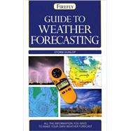
Guide to Weather Forecasting : All the Information You'll Need to Make Your Own Weather Forecast

by
  • ISBN13:

    9781554073696

  • ISBN10:

    1554073693

  • Format: Paperback
  • Copyright: 2008-02-15
  • Publisher: Firefly Books Ltd
  • Purchase Benefits
List Price: $19.95

Summary

A concise guide to weather systems and weather forecasting.Weather affects everyone, and Guide to Weather Forecasting covers every aspect involved in making a forecast. Storm Dunlop provides detailed information and expert explanations on a fascinating topic, covering: What causes the weather Understanding weather systems and how they change Recognizing clouds and sky appearance Weather conditions such as depressions, anticyclones, lows and highs, wind systems and wind direction, dew point, humidity levels, visibility, frost and snow Weather events such as hurricanes and tornadoes, thunderstorms, fog and hail Extreme weather and climate change Natural events that affect the weather Optical effects such as rainbows, halos and mirages.The full range of forecasting is covered, from professional forecasts and charts to satellite images and weather watching, including instruments that can be used at home. With its many color photographs and diagrams, handy glossary, and useful index, this is an ideal quick reference for the amateur weather forecaster.

Author Biography

Storm Dunlop is a well-known authority on meteorology. He is the author of Practical Astronomy.

Table of Contents

The origins of weather
The atmosphere and the global circulation
The global circulation
Winds and the Coriolis
Effect Clouds
Cloud forms
Optical phenomena
Sky and cloud colors
Weather systems
Local weather
North American weather
European and Mediterranean weather
Weather over Australia and New Zealand
Observing the weather
Observing instruments, methods, and plotting
Other observations
Synoptic charts
Professional forecasts
Making a forecast
Observing and photographing the sky
Further information
Glossary
Index
Acknowledgements
Table of Contents provided by Publisher. All Rights Reserved.

Supplemental Materials

What is included with this book?

The New copy of this book will include any supplemental materials advertised. Please check the title of the book to determine if it should include any access cards, study guides, lab manuals, CDs, etc.

The Used, Rental and eBook copies of this book are not guaranteed to include any supplemental materials. Typically, only the book itself is included. This is true even if the title states it includes any access cards, study guides, lab manuals, CDs, etc.

Excerpts

Excerpted from Chapter 1: The Origins of Weather The Atmosphere and the Global Circulation It may seem a little strange to begin talking about weather forecasting by describing conditions over the whole Earth, but in fact it makes sense. Forecasting the weather requires a knowledge of the situation over a large area 'upwind' (so to speak) of the area in which you are interested. To forecast just one day ahead, professional weather forecasters in Europe, for example, need to know what is happening right across the Atlantic. Similarly, forecasters on the West Coast of North America require details of the situation across the Pacific as far as Japan. In preparing forecasts for three days ahead, forecasters need detailed information about conditions across the whole Earth, including data from the southern hemisphere and Antarctica. An understanding of the basic mechanisms driving the weather is extremely helpful for predicting what is going to happen on even a local scale. The structure of the atmosphere Most weather phenomena, including the majority of clouds, occur in the lowest layer of the atmosphere, the troposphere. This is extremely thin compared with the size of the Earth, which has an equatorial diameter of 7,926 mi (12,756 km) and 7,900 ml (12,714 km) measured across the poles. Yet the troposphere extends to about 11-12 mi (18-20 km) at the most (in the equatorial regions) and to just about 4.3 mi (7 km) at the poles. The level of the top of the troposphere, called the tropopause, is defined by a change in the way the temperature behaves with increasing altitude. Between the surface and the tropopause the temperature generally decreases with height -- albeit often in an irregular manner. The changes in temperature with height are extremely important for the formation of clouds, as we shall see later (p.24). At the tropopause, the decline ceases, and the temperature tends to remain constant in the lowest region of the next layer, the stratosphere (p.5). It then starts to increase with height, reaching a maximum at an altitude of about 31 mi (50 km). This heating in the stratosphere is the result of the absorption of ultraviolet radiation from the Sun by molecules of ozone whose greatest concentration occurs at about 12-15.5 mi (20-25 km). The destruction of this ozone by manmade chemicals has led to the formation of the seasonal 'ozone holes' over the Antarctic and Arctic regions. There are few clouds in the stratosphere, although sometimes there are ice-crystal clouds in the lowermost region, including, on rare occasions, beautiful nacreous clouds (pp.51 -2). At the top of the stratosphere, at the stratopause, which lies at an altitude of approximately 31 mi (50 km), the temperature again begins to decrease with height within the layer known as the mesosphere. The very lowest temperatures in the atmosphere (-260 to -148?F (-163 to -100?C)) are found at the top of the mesosphere, at the mesopause, which is generally at an altitude of about 53 mi (86 km) (or roughly 62 mi (100 km) over the polar regions in summer). Conditions in the mesosphere have no direct effect on the weather down at the surface, but the highest clouds in the atmosphere, noctilucent clouds (pp.52-3), occur just below the mesopause and are sometimes visible from high latitudes, in summer, in the middle of the night. Above the mesosphere lies the outermost layer of the atmosphere, the thermosphere. The uppermost region of the mesosphere and lowest part of the thermosphere (between 40 and 620 mi (60 and 1,000 km), approximately) is also known as the ionosphere. Although this region is significant for communications because of its effects on radio waves, and is also the site of the aurorae, it, and the thermosphere in general, have little direct effect on the weather at surface level.

Rewards Program