did-you-know? rent-now

Amazon no longer offers textbook rentals. We do!

did-you-know? rent-now

Amazon no longer offers textbook rentals. We do!

We're the #1 textbook rental company. Let us show you why.

9781609181666

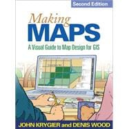
Making Maps, Second Edition A Visual Guide to Map Design for GIS

by ;
  • ISBN13:

    9781609181666

  • ISBN10:

    1609181662

  • Edition: 2nd
  • Format: Paperback
  • Copyright: 2011-03-23
  • Publisher: The Guilford Press
  • View Upgraded Edition
  • Purchase Benefits
  • Free Shipping Icon Free Shipping On Orders Over $35!
    Your order must be $35 or more to qualify for free economy shipping. Bulk sales, PO's, Marketplace items, eBooks and apparel do not qualify for this offer.
  • eCampus.com Logo Get Rewarded for Ordering Your Textbooks! Enroll Now
List Price: $55.47

Summary

Acclaimed for its innovative use of visual material, this book is engaging, clear, and compelling -exactly how an effective map should be. Nearly every page is organized around maps and other figures (many in full color) that illustrate all aspects of map making, including instructive examples of both good and poor design choices. The book covers everything from locating and processing data to making decisions about layout, symbols, color, and type. Readers are invited to think critically about both the technical features and social significance of maps as they learn to create better maps of their own. New to this edition: extensively revised and expanded core chapters on map design an annotated map design exemplar is used to show how the concepts in each chapter play out on an actual map updated to reflect current technological developments larger size and redesigned pages make the book even more user friendly.

Author Biography

John Krygier teaches in the Department of Geology and Geography at Ohio Wesleyan University, with teaching and research specializations in cartography, geographic information systems (GIS), and environmental and human geography. He has published on map design, educational technology, cultural geography, multimedia in cartography, planning, the history of cartography, and participatory GIS. Denis Wood curated the award-winning Power of Maps exhibition for the Smithsonian and writes widely about maps. A former professor of design at North Carolina State University, Wood is a currently an independent scholar living in Raleigh, North Carolina.

Table of Contents

1. How to Make a Map 2. What\u2019s Your Map For? 3. Mappable Data 4. Map-Making Tools 5. The Geographic Framework 6. The Big Picture 7. Inner Workings 8. Map Generalization and Classification 9. Map Symbolization 10. Words on Maps 11. Color on Maps

Supplemental Materials

What is included with this book?

The New copy of this book will include any supplemental materials advertised. Please check the title of the book to determine if it should include any access cards, study guides, lab manuals, CDs, etc.

The Used, Rental and eBook copies of this book are not guaranteed to include any supplemental materials. Typically, only the book itself is included. This is true even if the title states it includes any access cards, study guides, lab manuals, CDs, etc.

Rewards Program