did-you-know? rent-now

Amazon no longer offers textbook rentals. We do!

did-you-know? rent-now

Amazon no longer offers textbook rentals. We do!

We're the #1 textbook rental company. Let us show you why.

9780321896827

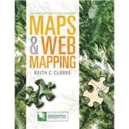
Maps & Web Mapping Plus MyGeosciencePlace with Pearson eText -- Access Card Package

by
  • ISBN13:

    9780321896827

  • ISBN10:

    0321896823

  • Edition: 1st
  • Format: Package
  • Copyright: 2014-05-06
  • Publisher: Pearson

Note: Supplemental materials are not guaranteed with Rental or Used book purchases.

Purchase Benefits

  • Free Shipping Icon Free Shipping On Orders Over $35!
    Your order must be $35 or more to qualify for free economy shipping. Bulk sales, PO's, Marketplace items, eBooks and apparel do not qualify for this offer.
  • eCampus.com Logo Get Rewarded for Ordering Your Textbooks! Enroll Now
  • Complimentary 7-Day eTextbook Access - Read more
    When you rent or buy this book, you will receive complimentary 7-day online access to the eTextbook version from your PC, Mac, tablet, or smartphone. Feature not included on Marketplace Items.
List Price: $106.65 Save up to $50.41
  • Rent Book $86.63
    Add to Cart Free Shipping Icon Free Shipping

    TERM
    PRICE
    DUE

    7-Day eTextbook Access 7-Day eTextbook Access

    USUALLY SHIPS IN 2-3 BUSINESS DAYS
    *This item is part of an exclusive publisher rental program and requires an additional convenience fee. This fee will be reflected in the shopping cart.

Supplemental Materials

What is included with this book?

Summary

ALERT: Before you purchase, check with your instructor or review your course syllabus to ensure that you select the correct ISBN. Several versions of Pearson's MyLab & Mastering products exist for each title, including customized versions for individual schools, and registrations are not transferable. In addition, you may need a CourseID, provided by your instructor, to register for and use Pearson's MyLab & Mastering products.


Packages

Access codes for Pearson's MyLab & Mastering products may not be included when purchasing or renting from companies other than Pearson; check with the seller before completing your purchase.


Used or rental books

If you rent or purchase a used book with an access code, the access code may have been redeemed previously and you may have to purchase a new access code.


Access codes

Access codes that are purchased from sellers other than Pearson carry a higher risk of being either the wrong ISBN or a previously redeemed code. Check with the seller prior to purchase.


--

For general education mapping/cartography courses

Maps and Web Mapping establishes an innovative, eText-only introduction to the history, principles, and current technologies used in mapping and cartography in a way that’s never been done before. Created to work with resources in Mygeoscienceplace.com, this solution engages you with interactive tools, including MapMaster™ interactive maps, Google Earth™ exercises, lecture videos, Map Projection animations, and more. This affordable online-only solution seamlessly integrates narrative text with a dynamic, interactive media experience, creating a rich learning environment and working together to help you develop spatial reasoning skills and practice observation, experimentation, and critical thinking.

This program presents a better teaching and learning experience—for you. It provides:
  • Personalized learning with Mygeoscienceplace.com: The online-only eText and Mygeoscienceplace.com work together to provide interactive, cutting-edge cartography and learning tools that engages you in the study of mapping and cartography.
  • Current cartography tools and technologies: The author’s expert knowledge of the most current, contemporary technologies and applications of mapping and cartography is integrated throughout the book, covering both commercial and open sources as well as desktop and mobile access. Many images and locations in the book include coordinates that you can click to directly link to online maps. 
  • Time-saving navigation and study tools: Study and move through the course material, using the eText’s learning path with chapter-opening Learning Outcomes, Checkpoint questions, summaries, and end of chapter questions.


0321896823 / 9780321896827 Maps & Web Mapping Plus MyGeosciencePlace with Pearson eText -- Access Card Package
This package consists of:
0321972589 / 9780321972583 MyGeosciencePlace -- Pearson eText -- for Maps & Web Mapping
0321972597 / 9780321972590 MyGeosciencePlace -- Instant Access -- for Maps & Web Mapping
Author Biography

Keith C. Clarke received his PhD and MA from the University of Michigan (Analytical Cartography, Geography), and his BA from Middlesex Polytechnic, London (Geography and Economics). He is professor of geography at UC Santa Barbara, where he runs the state-of-the-art GIS lab and regularly teaches GIS and intro cartography. Keith was Chair of the Department 2001 to 2006. He was elected President of CaGIS in 2001, was selected as UCGIS Educator of the Year in 2002, and is a recipient of the 2005 John Wesley Powell Award, the USGS's highest award for achievement. In 2006, he became a Fellow of the ACSM, the Chair of the NAS Mapping Sciences Committee, and was appointed to the National Geographic Committee on Research and Exploration; in 2007, Keith received a UK Leverhulme Trust award and Fulbright Distinguished Scholarship. He has worked on numerous funded research projects, including:
  • UCIME: An NSF-funded project with the University of California at Santa Barbara, the United States Geological Survey and the Los Alamos National Laboratory to develop an integrated modeling environment (IME) for the cross-disciplinary study of a wide range of questions pertaining to urban change
  • Project Gigaopolis: A USGS and NSF funded project that explores growing urban structure containing billions of people worldwide. It extends and refines the SLEUTH urban and land use change model enabling predictions at regional, continental and eventually global scales.
  • Project CORONA: NSF funded project that included: The first photo taken from a satellite; The first recovery of an object from space and the first in mid-air; The first mapping of Earth from space; The first use of multiple re-entry vehicles; The first space program to fly 100 missions
  •  NGA Uncertainty Project: Funded by the National Imagery and Mapping Agency and NSF, the goal of this Uncertainty in Geospatial Information Representation, Analysis, and Decision Support project was to improve the mechanisms by which users of the defense geospatial information infrastructure are made aware of the presence of uncertainty in data, and its implications for decision-making
  • IGERT in Interactive Digital Multimedia: An NSF funded integrative graduate education and research traineeship program. Clarke is the Pearson GIS series editor, and is the author of scores of GIS, Remote Sensing, and mapping articles and chapters for various journals and books. He is the author of Pearson’s Getting Started with GIS 5e.

Table of Contents

1 Why Maps?
1.1 Why Maps?
1.2 The Earliest Maps
1.3 Using a Geobrowser
1.4 What Will I Learn?
1.5 References and Readings
2 The Figure of the Earth
2.1 What Shape is Our Planet?
2.2 How Big Is The Earth?
2.3 How Far Can We See?
2.4 Pumpkins and Eggs
2.5 Lumps and Bumps
2.6 References and Readings
3 Sizing Up Earth
3.1 Map Transformations
3.2 The Scale Transformation
3.2 The Representative Fraction
3.4 A Word on Units
3.5 How to Calculate Map Scale
3.6 Levels of Detail, Zooming and Generalization
3.7 References and Readings
4 Distorting the Globe
4.1 Map Transformations Again
4.2 The Graticule
4.3 Conformal or Equivalent?
4.4 Tangent or Secant?
4.5 References and Readings
5 Coordinate Systems and Global Grids
5.1 Why coordinates?
5.2 The Civilian Universal Tranverse Mercator Grid
5.3 Military Grid Reference System and the US National Grid
5.4 Universal Polar Stereographic and the Polar Regions
5.5 The State Plane Coordinate System
5.6 Other Grids
5.7 References and Readings
6 Partitioning the Land
6.1 Points and Areas
6.2 Land Partitioning in History
6.3 Metes and Bounds
6.4 The United States Public Land Survey System
6.5 Tracts, Parcels and Real Estate
6.6 References and Readings
7 Cartometry: Position and Direction
7.1 Maps as Models
7.2 The Map Legend
7.3 Distances and Bearings on Maps
7.4 Distances in the Field
7.5 Directions in the Field
7.6 Bearings
7.7 Understanding the Compass
7.8 Declination
7.9 References and Readings
8 Cartometry: Lines and Areas
8.1 Maps and the Feature Model
8.2 Measuring Lines
8.3 Line Features on Maps: Roads
8.4 Measuring Areas
8.5 Area Features on Maps: Swamps
8.6 Measuring Landscapes
8.7 References and Readings
9 Map Generalization
9.1 Map Scales and Zooming
9.2 Standard Map Scales and ScaleMaster
9.3 Selection
9.4 Simplification
9.5 Combination
9.6 Displacement and Exaggeration
9.7 Information Loss and Generalization
9.8 References and Readings
10 Positioning
10.1 Positioning in History
10.2 Resection and Intersection
10.3 Global Navigation Satellite Systems
10.4 The Global Positioning System
10.5 How GPS works
10.6 Understanding Error in GPS
10.7 WAAS, Differential, CORS and Carrier Phase
10.8 Mobile Positioning, the Web and Location Based Services
10.9 References and Readings
11 Route Selection and Navigation
11.1 Directions on Maps
11.2 Orienting the Map
11.3 Walking along a Bearing
11.4 Goals for Navigation
11.5 Routes at Sea and Aids to Navigation
11.6 Routes in the Air
11.7 References and Readings
12 Location Based Services and Web Mapping
12.1 What Are Location-Based Services?
12.2 Geobrowsers
12.3 Sensors on the GeoWeb
12.4 Precision Agriculture
12.5 Community Mapping and Volunteered Geographic Information
12.6 Place Names and Gazetteers
12.7 References and Readings
3 Mapping the Third Dimension
13.1 Terrain on Ancient Maps
13.2 Benchmarks and Height Control
13.3 Terrain Visualization
13.4 Contours
13.5 Block Diagrams and Perspectives
13.6 Virtual Worlds
13.7 References and Further Readings
14 Representing Terrain with Contours
14.1 The Rules of Contours
14.2 Contour Interpretation and Slope Types
14.3 Slope Maps and Cut and Fill
14.4 Profiles and Line of Sight
14.5 References and Readings
15 Landscape Features on Maps
15.1 Forces Shaping the Landscape
15.2 The Terrain Skeleton
15.3 Examples of Surface Features
15.4 Examples of Landscapes
15.5 The Importance of Streams
15.6 Tectonics on Maps
15.7 Reading the Natural Landscape
15.8 References and Readings
16 Heights and Height Mapping
16.1 Height and Technology
16.2 Triangulation and Plane Table
16.3 Photogrammetry
16.4 Stereo Mapping
16.5 Earth-Centered Mapping
16.6 Mapping with Radar
16.7 Mapping with LiDAR
16.8 Reference and Readings
17 Features, Dimensions and Data Levels
17.1 Reference vs. Thematic Cartography
17.2 Features, Objects and Dimensions
17.3 Levels of Measurement
17.4 Nominal Maps
17.5 Ordinal Maps
17.6 Interval Maps
17.7 Ratio Maps
17.8 Map Types and Data Continuity
17.9 References and Readings
Measuring Shape and Distribution
18.1 Objects, Landscapes and Distributions
18.2 Measuring the Shape of Features
18.3 Distributions on Maps
18.4 Measuring Distribution: Quadrats
18.5 Measuring Distribution: Nearest Neighbor Analysis
18.7 Measuring Map Correspondence
18.8 A Curious Property of Maps
18.9 References and Readings
19 Networks
19.1 Networks are Everywhere!
19.2 The Language of Networks
19.3 Networks and Graph Theory
19.4 Trees and Branching
19.5 Network Solutions
19.6 References and Readings
20 Special-Purpose Maps
20.1 What is a Multivariate Thematic Map?
20.2 Cartograms
20.3 Extraterrestrial Maps
20.4 Paper maps
20.5 Maps and Climate Change
20.6 Geological Maps
20.7 Historical and Historic Maps
20.8 Invisible Maps
20.9 Popular Maps
20.12 References and Readings
21 Cartography’s Sister Disciplines
21.1 Cartography’s Sister Disciplines
21.2 Photogrammetry and Air Photo Interpretation
21.3 Computer-Assisted Cartography
21.4 Visual Analytics and Infoviz
21.5 Remote Sensing
21.6 Geographic Information Systems and Science
21.7 References and Readings
22 Geobrowsing
22.1 What is a Geobrowser?
22.2 Google Earth Hacks
22.3 Google Streetview
22.4 References and Readings
23 How to Lie with Maps
23.1 From the Zeno Brothers to Monmonier
23.2 Promotion with Maps
23.3 Claiming with Maps
23.4 Maps with a Viewpoint
23.5 Wartime Maps
23.6 Cartographic Ethics
23.8 References and Readings
24 Thinking Spatially
24.1 Spatial literacy
24.2 Humans and the Environment
24.3 Time and Space
24.4 Reading A Streetscape
24.5 Integrating Spatial Knowledge
24.6 References and Readings
Glossary
Index

Supplemental Materials

What is included with this book?

The New copy of this book will include any supplemental materials advertised. Please check the title of the book to determine if it should include any access cards, study guides, lab manuals, CDs, etc.

The Used, Rental and eBook copies of this book are not guaranteed to include any supplemental materials. Typically, only the book itself is included. This is true even if the title states it includes any access cards, study guides, lab manuals, CDs, etc.

Rewards Program