did-you-know? rent-now

Amazon no longer offers textbook rentals. We do!

did-you-know? rent-now

Amazon no longer offers textbook rentals. We do!

We're the #1 textbook rental company. Let us show you why.

9781408146460

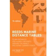
Reeds Marine Distance Tables 59,000 distances and 500 ports around the world

by ;
  • ISBN13:

    9781408146460

  • ISBN10:

    1408146460

  • Edition: 12th
  • Format: Paperback
  • Copyright: 2012-06-15
  • Publisher: Thomas Reed
  • Purchase Benefits
  • Free Shipping Icon Free Shipping On Orders Over $35!
    Your order must be $35 or more to qualify for free economy shipping. Bulk sales, PO's, Marketplace items, eBooks and apparel do not qualify for this offer.
  • eCampus.com Logo Get Rewarded for Ordering Your Textbooks! Enroll Now
List Price: $39.95
We're Sorry.
No Options Available at This Time.

Summary

Reeds Marine Distance Tablesare the perfect ready-reckoner for captains, navigators and owners of merchant and cruise ships large and small wanting a quick and accurate distance reference between allthe regularly used commercial ports around the world.The book is divided into key 'market areas', and includes a pull-outmap for area indentification and chartlets for easy see-at-a-glanceport reference. Traffic Separation Schemes are calculated into thetables and the distance to any port not included can easily bedetermined by making an approximation from the next closest port. Useful tables of major 'turning points' around the world(such as Cape Finisterre, Cape Horn and the Dover Straits), time zones and time and speed conversion tables are also included.Reeds Marine Distance Tablesare an invaluable reference for shipowners, operators, brokers and navigators. Using this one reference,anyone can calculate the shortest or most economical distances betweenall the major ports in the world.This new edition sees some port names modernised, corrected routing for the Kiel Canal and the valuable addition of several new ports to reflect the importance of growing trading areas around the world, including two major Chinese ports; Antigua; Brest; Istanbul; and extended coverage of Felixstowe.'A first class reference' Nautical Magazine'Clear and simple support for anyone wanting to calculate the shortestor most economical distance between major ports' Telegraph

Supplemental Materials

What is included with this book?

The New copy of this book will include any supplemental materials advertised. Please check the title of the book to determine if it should include any access cards, study guides, lab manuals, CDs, etc.

The Used, Rental and eBook copies of this book are not guaranteed to include any supplemental materials. Typically, only the book itself is included. This is true even if the title states it includes any access cards, study guides, lab manuals, CDs, etc.

Rewards Program