The New copy of this book will include any supplemental materials advertised. Please check the title of the book to determine if it should include any access cards, study guides, lab manuals, CDs, etc.
The Used, Rental and eBook copies of this book are not guaranteed to include any supplemental materials. Typically, only the book itself is included. This is true even if the title states it includes any access cards, study guides, lab manuals, CDs, etc.
Introduction
The Ridgeway is an 87-mile (137km) long trail stretching across five counties, starting in Wiltshire and passing through Oxfordshire, Berkshire and Hertfordshire before finishing in Buckinghamshire. The pathway has been used for millennia by travellers, traders and drovers as the most convenient route through these areas of countryside.
Nowadays it is used only by travellers, most of them walking for pleasure, away from the cities and towns that we spend most of our lives in. The Ridgeway is easily accessible from major cities such as Swindon, Oxford, Reading and London making it an ideal destination for millions of people though very few of them seem to take the opportunity.
From its official starting point in Wiltshire, the trail immediately takes you up onto high land giving constantly far-reaching views across the surrounding countryside. Walking up here is isolated and open to the elements and you’ll meet very few other people on this long, wind-swept stretch. The path descends as it gets closer to the river Thames and its character changes completely. You’ll pass through a number of attractive villages as the trail runs parallel to the banks of the river before it turns eastwards and starts the next distinctive stage of the Ridgeway. Woodland is now the principal terrain as you make your way through the undulating landscape, passing through market towns and villages before finishing back out on high, open, windswept land. With so much variety in the walking along the Ridgeway it always proves to be an interesting experience.
Overton Hill in Wiltshire marks the present day start of the trail but you are soon taken back to the distant past as it passes through the huge Iron Age forts of Barbury Castle and Liddington Castle. More ancient remains await you at Wayland’s Smithy Neolithic long barrow, before you arrive at the magnificent Uffington White Horse. From here on you are likely to be treading a solitary path for some miles, open to the elements and walking some of the most enjoyable sections of the Ridgeway where the only towns and villages are far down below the path. After reaching the village of East Ilsley you’ll feel the environment starting to change. Human habitation along the path becomes more frequent and you are no longer following the highest ground. You’ll arrive at the village of Streatley, on the banks of the Thames, before crossing the river into the neighbouring town of Goring. From here an easy trail parallels the tranquil banks of the Thames for several miles, passing through the attractive villages of South Stoke and North Stoke before turning eastwards just before the towns of Wallingford and Crowmarsh Gifford. The path now follows an ancient earthwork, Grim’s Ditch, for several miles until it reaches Nuffield where the Ridgeway crosses a golf course. From here on the woodlands become a common companion with many ascents and descents before you have the chance to visit some of the old market towns just off the official route such as Watlington, Chinnor and Princes Risborough. The trail continues through some fine beech woodlands, occasionally opening out to remind you how high you are above the surrounding landscape and passes through the Chequers Estate, country home of the Prime Minister. The final sections of the path pass close to small, picturesque villages such as Wigginton and Aldbury before entering the final section of woodland as you climb continually towards the end of the path. When the trees thin out you can see your goal, up ahead in the distance, several more hills away. By the time you reach the end at Ivinghoe Beacon you will certainly be tired, but will also be treated to some spectacular, panoramic views of the countryside below.
Walking the Ridgeway is not difficult. It can be done in five days, but this won’t leave much time for relaxation or simply slowing down to enjoy the countryside you are walking through. Remember, too, that taking time to explore some of the towns along the way and perhaps meeting some of the local people is all part of the experience.
About this book
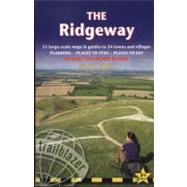
This guidebook contains all the information you need; the hard work has been done for you so you can plan your trip from home without the usual pile of books, maps, guides and tourist brochures. It includes:
· All standards of accommodation from campsites to luxurious guesthouses
· Walking companies if you want an organized tour
· A number if suggested itineraries for all types of walkers
· Answers to all your questions: when to go, degree of difficulty, what to pack and the approximate cost of the whole walking holiday
When you’re all packed and ready to go, there’s detailed information to get you to and from the Ridgeway and 53 detailed maps (1:20,000) and 5 town plans to help you find your way along it. The route guide section includes:
· Walking times in both directions
· Reviews of campsites, hostels, B&Bs and guesthouses
· Caf és, pubs, teashops, takeaways, restaurants and shops for buying supplies
· Rail, bus and taxi information for all the villages and towns along the path
· Street maps of the towns and villages along the route
· Historical, cultural and geographical background information.