did-you-know? rent-now

Amazon no longer offers textbook rentals. We do!

did-you-know? rent-now

Amazon no longer offers textbook rentals. We do!

We're the #1 textbook rental company. Let us show you why.

9780711231771

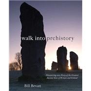
Walk into Prehistory Discovering over Forty of the Greatest Ancient Sites of Britain and Ireland

by
  • ISBN13:

    9780711231771

  • ISBN10:

    071123177X

  • Format: Hardcover
  • Copyright: 2011-10-25
  • Publisher: Frances Lincoln
  • Purchase Benefits
List Price: $40.00

Summary

A unique illustrated guidebook to walking 40 of Britain and Ireland's most important and impressive prehistoric monuments.Ranging from stone circles and henges to hillforts and burial chambers, Bill Bevan describes how these monuments were deliberately built and located to be seen and approached from certain directions. Processional routes led to ceremonies at stone circles, henges and tombs. Hillforts were built and designed to look imposing from specific directions to deter potential attackers. There are even ancient long-distance paths like the Ridgeway which are accessible today. The walks lead you back in time from the modern landscape to reconstruct in the mind's eye what the prehistoric landscape would have looked like. The history and significance of each monument is discussed and generously illustrated with new colour photographs. For each walk there is a specially commisioned colour map and directions and there are also grid references OS map recommendations and difficulty gradings, with family friendly walks highlighted.From Stonehenge to Skara Brae, from the imposing hillfort at Ingleborough to the Newgrange tomb illuminated by the widwinter sunrise, this book helps you to follow in the footsteps of the people who created Britain's extraordinary ancient heritage.

Author Biography

Over 21 years as an archaeologist Bill Bevan has written four books and numerous articles about archaeology, prehistory and history including Ancient Peakland (2007). As a photographer Bill has spent the last two years working on the Stonehenge Riverside Project to create a pictorial document of the archaeologists at work, with unprecedented access to photograph inside the circle. Bill has appeared on Channel 4's Time Team, and was a consultant to BBC TV's Time Flyers.

Table of Contents

IRELAND

Uragh

Beaghmore Stone Circle Newgrange

Hill of Tara

Navan Fort

Carrowkeel

Poulnabrone


SCOTLAND

Balnuaran of Clava

Callanish

Dun Carloway

Skara Brae

Ring of Brodgar

Stones of Stenness

Maes Howe

Watch Stone

Broch of Gurness

Kilmartin

Loanhead of Daviot

Glenelg brochs

Camster Grey Cairns and Hill O'Many Staines


NORTHERN ENGLAND

Castlerigg

Mayburgh

King Arthur's Round Table

Yeavering

Mam Tor

Arbor Low


SOUTHERN ENGLAND

Ridgeway

Avebury

Stonehenge

Maiden Castle

Dartmoor

Chysauster

British Camp


WALES

Bryn Cader Faner

Tre'r Ceiri hillfort

Foel Drygarn hillfort

Pentre Ifan

Bryn Celli Ddu burial chamber

Supplemental Materials

What is included with this book?

The New copy of this book will include any supplemental materials advertised. Please check the title of the book to determine if it should include any access cards, study guides, lab manuals, CDs, etc.

The Used, Rental and eBook copies of this book are not guaranteed to include any supplemental materials. Typically, only the book itself is included. This is true even if the title states it includes any access cards, study guides, lab manuals, CDs, etc.

Excerpts

Rock and a hard place: Poulnabrone, Co ClareThe hard, grey limestone skeleton of the Burren rises up above Galway Bay and the fertile green lowlands where lush hedges are alive with may blossom and gorse. Sunlight refuses to reflect off the rock where colour is leached away; light transformed into a dull monochrome that flattens the three-dimensional landscape. The Burren is a vast plateau of unremitting limestone pavement; lines of grey rock divided by dark shadows of joints and fractures. Climbing on to the Burren, whether on foot or by vehicle, is to ascend onto another world, however it has not always been like this. Visiting Poulnabrone dolmen is to look through a portal into a past over 4,500 years ago before the Burren was turned into this stark alien landscape.Ordinarily a stone tomb such as Poulnabrone dolmen would stand out against a grass field. Not on the Burren. On first sight the stone slabs of the dolmen are lost amongst the fractured blocks of grey limestone pavement around it. Poulnabrone sadly does not lie on one of the Burren's footpaths so the only way to visit it is by driving or cycling along the road from Ballyvaghan to Corofin. The approach from the nearby car park is heavily landscaped and the dolmen is hidden behind grey limestone walls. Tour groups buzz around it, coming and going for thirty-minute stops on coach tours of the Burren. A site that could so easily disappoint requires a little time, plenty of imagination and ideally visiting late in the day to watch the sun go down and witness a little bit of magic as colour is brought upside down into the grey world.Avoid the temptation to walk straight over to the dolmen and instead carry on over the limestone pavement beyond the tomb to approach the dolmen from the front and to get a feel for how the characteristic Burren landscape is today. The land dips gently down towards the south from low cliffs and a narrow gorge created by a spring in the north east. North to south aligned fissures split the limestone into round-edged longitudinal blocks which are eroded by water into patterns of dimples and hollows. The fissures hold water in this barren land so are flush with green and, during late spring to early summer, patches of colour as orchids, guelder roses, primroses, dwarf gorse and vetches come into flower. Look carefully to find low banks of stone criss-crossing the ground which may be ancient field boundaries that hint at a past when the land was very different here. During the Neolithic, when Poulnabrone was built, the Burren was a fertile plateau dominated by pine forests. Elms and hazels grew alongside the pines while the woodland was broken in places with open grasslands where the dolmen builders pastured cattle and grew crops. They built at least 70 dolmens during the centuries around 2,500 BC across this productive wooded land to mark their territorial claims. Poulnabrone is the most impressive dolmen that survives, and as you turn back towards it you can make out its graceful form. A thin limestone cap stone, almost rectangular, rests at an angle on top of four narrow limestone uprights, each almost 2 metres (6 feet) high, which define two sides of a tomb. You are approaching the original entrance and the nearest uprights are the portal stones guarding this entrance. As you get nearer you can make out the entrance's sill stone slotted into one of the natural east-west aligned grikes.The dolmen is built on top of a low stone and earth mound. When it was built and used about 4,500 years ago the dolmen you see today was a chamber buried deep in a stone mound. Only the entrance and possibly the cap stone would have been visible from the outside. Stone-robbing for walls have exposed the chamber, just as the rocky skeleton of the Burren has been revealed by erosion following the loss of the prehistoric forests. The magic of light happens at Poulnabrone when the setting sun is close to the horizon. Its rays reach in to the exposed chamber so that the underneath of the cap stone glows with a warm orange light for a short while. You will only see the cold grey limestone being dispelled on a sunny evening by being close to the dolmen, an illumination missed by all of the tour parties who stop off at Poulnabrone.Poulnabrone was excavated in 1985 to replace a cracked portal stone that now lies beside the tomb. The bones of approximately 16 to 22 adults, six children and a newborn baby were found inside the chamber. Only the larger bones were found and these were not laid out as individual burials. The people interred in Poulnabrone were defleshed elsewhere after they died, then some of their larger bones were taken to be placed together in the tomb alongside carefully chosen objects such as a polished stone axe, flint and chert tools, fragments of pottery, two stone disc beads, a perforated bone pendant, a bone pin and two quartz crystals. The community who lived and farmed in the area around the tomb probably made the deposits over years as parts of ancestor rituals. They didn't know over the generations, their descendents would slowly strip away the soil and woodland through centuries of farming which eventually made it all but impossible to live and farm on most of the Burren. Pockets of soil survived for smaller populations to farm during the Iron Age over 2,000 years after Poulnabrone was built. The homes of these Iron Age communities, dating from the first thousand years AD, survive as ring forts dotted across the plateau. Caherconnell Fort lies 1,000 yards (1 km) to the south of Poulnabrone. If you wish to walk across the Burren to discover other dolmens and ring forts you can find walking routes in local tourist information points. They are all reminders of a more fertile past when the bones of the Burren were fleshed out with soil, fields and trees.Start - Poulnabrone car park on the R480 north of Ballydoora Cross. Site location - M236003, OSI Discovery Map 51Distance - 1000 yardsTime - 30 minutesDifficulty - easyAccessible

Rewards Program