did-you-know? rent-now

Amazon no longer offers textbook rentals. We do!

did-you-know? rent-now

Amazon no longer offers textbook rentals. We do!

We're the #1 textbook rental company. Let us show you why.

9780679035985

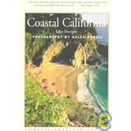
Coastal California

by ; ;
  • ISBN13:

    9780679035985

  • ISBN10:

    0679035982

  • Format: Paperback
  • Copyright: 1998-06-01
  • Publisher: Fodors Travel Pubns
  • View Upgraded Edition
  • Purchase Benefits
  • Free Shipping Icon Free Shipping On Orders Over $35!
    Your order must be $35 or more to qualify for free economy shipping. Bulk sales, PO's, Marketplace items, eBooks and apparel do not qualify for this offer.
  • eCampus.com Logo Get Rewarded for Ordering Your Textbooks! Enroll Now
List Price: $19.95

Summary

Created by local writers and photographers, Compass American Guides are the ultimate insider's guides, providing in-depth coverage of the history, culture and character of America's most spectacular destinations. Covering everything there is to see and do as well as choice lodging and dining, these gorgeous full-color guides are perfect for new and longtime residents as well as vacationers who want a deep understanding of the region they're visiting. Outstanding color photography, plus a wealth of archival images Topical essays and literary extracts Detailed color maps Great ideas for things to see and do Capsule reviews of hotels and restaurants Winner of the Lowell Thomas Award Gold Medal for Best Guidebook About the Author John Doerperhas been traveling the California Coast for more than 30 years, enjoying its beaches, inns, restaurants, and prime camping sites. He is the author of four food books describing the pleasures of travel on the Pacific Coast, including Wine Country for Compass American Guides. He has acted as editor and columnist for several publications and has published articles in Travel & Leisure and Pacific Northwest Magazine. Mr. Doerper in the publisher and editor of Pacific Epicure, A Quarterly Journal of Gastronomic Literature. About the Photographer Galen Rowell, one of the most prominent nature photographers in the U.S. today, is the author and photographer of more than a dozen large-format books, including Mountain Light: In Search of the Dynamic Landscape, his valuable introduction to outdoor photography, and Bay Area Wild. A regular contributor to National Geographic, Outdoor Photographer, and Life, he is also a noted mountaineer, who has climbed in Nepal, Tibet, Alaska, and Patagonia, as well as making more than 100 first ascents in California's High Sierra. Major exhibitions of his work have been held at galleries across the United States, including the Smithsonian Institution in Washington D.C. and San Francisco's California Academy of Sciences.

Table of Contents

Overview
Introduction
Landscape
History First Immigrants Spanish Galleons and British Buccaneers Spanish Missions; Reluctant Indians Rancho Era Yankee Traders, American Settlers Gold, Vineyards, and Railroad Modern Times
San Francisco Bay
Travel Overview and Basics Fog and Ferry Boats on the Bay Telegraph Hill North Beach Ambling Through Chinatown Embarcadero Fisherman's Wharf Alcatraz Island Angel Island Hyde Street Pier and Aquatic Park Fort Mason and Marina Green Fort Point Golden Gate Bridge Presidio Bayside to the Pacific Beaches of San Francisco Golden Gate Park Bayside Marin County Marin Headlands Sausalito China Camp Carneros Winery Tour
Marin Coast
Travel Overview and Basics Heading North from San Francisco Muir Beach Stinson Beach Bolinas Lagoon and Bolinas Point Reyes National Seashore Town of Point Reyes Station Along Tomales Bay Tomales to Bodega Bay
Sonoma & Mendocino
Travel Overview and Basics Sonoma Coast Beaches Jenner Russian River Winery Tour Fort Ross Timber Cove to Salt Point Manchester State Beach Elk and Navarro Beach Mendocino Riviera Mendocino Anderson Valley Winery Tour Russian Gulch and Jughandle Reserve Fort Bragg MacKerricher State Park Westport
Redwood Coast
Travel Overview and Basics Land of Mist and Wild Scenery Lost Coast Shelter Cove Shelter Cove to Mattole River Hwy Humboldt Redwoods Mattole River Road and Beach Cape Mendocino Ferndale Eel River Delta Loleta Eureka Humboldt Bay Arcata Trinidad Patrick's Point State Park Lagoon Coast Prairie Creek Redwoods State Park Klamath River and Klamath Lagoon Creek and Yurok Loop Trail North to Crescent City Crescent City Lake Earl and Points North
Golden Gate to San Simeon
Travel Overview and Basics Overview of a Rural Coastline Pacifica Half Moon Bay Near San Gregorio and Pomponio Town of Pescadero Pigeon Point Point Año Nuevo State Reserve Davenport Santa Cruz South of Santa Cruz on Monterey Bay Monterey Peninsula Monterey's Fisherman's Wharf Cannery Row Monterey Bay Aquarium Pacific Grove 17-Mile Drive Carmel Carmel Valley Wineries Point Lobos Big Sur Coast Northern Big Sur Beaches and Woods Nepenthe Road to San Simeon
Hearst Castle San Simeon State Beach Central Coast Riviera
Travel Overview and Basics Point Mugu North Channel Islands Ventura
The Banana Belt Rincon Point Rincon Point to Santa Barbara Santa Barbara What to Do and See in Santa Barbara UC Santa Barbara Goleta Point Refugio State Beach Santa Ynez and Santa Maria Valley Winery Tours Point Conception Lompoc Guadalupe-Nipomo Dunes Pismo Beach San Luis Bay Pecho Coast Trail San Luis Obispo History and Ambiance Visiting San Luis Obispo Arroyo Grande-Edna Valley Winery Tour York Mountain-Templeton Winery Tour Morro Bay What to Do a
Table of Contents provided by Publisher. All Rights Reserved.

Supplemental Materials

What is included with this book?

The New copy of this book will include any supplemental materials advertised. Please check the title of the book to determine if it should include any access cards, study guides, lab manuals, CDs, etc.

The Used, Rental and eBook copies of this book are not guaranteed to include any supplemental materials. Typically, only the book itself is included. This is true even if the title states it includes any access cards, study guides, lab manuals, CDs, etc.

Excerpts

Imagine yourself aboard a Manila galleon, one of the Spanish treasure ships that, once every year in the mid-1700s, made the trip from Manila across the wild Pacific Ocean on the prevailing westerly winds, then scooted south to Acapulco on the California Current and favorable winds.


Storms have driven you a bit north of the standard route. As the galleon turns south you catch glimpses of a rocky, surf-washed shore overtowered by huge conifers. The pilot turns the ship's bow out to sea, for he sees whitewater and spume ahead, indicating that a reef runs far out into the ocean from the shore, posing danger to the galleon. Soon the water turns muddy, and huge driftwood logs, with roots as big around as whales, bob in the waves. You suspect that large rivers flow into the ocean here. You want to land at an estuary to take on fresh water, but the pilot counsels against it, reminding you that several galleons have sunk off this coast since the Manila trade began.


Suddenly a huge headland emerges from the fog. Cape Mendocino. You're back on the regular galleon route. Steep mountains loom forbiddingly off the starboard bow. A few leagues further south, cliffs give way to sand dunes-still overtowered by those huge trees, some of which you estimate must be more than 50 brazos tall.


After you pass a large sandy hook reaching far into the ocean (later named Point Arena) the galleon once again runs along a shore of rocky cliffs. Sea otters watch you from the safety of kelp beds and sea lions bark from offshore rocks. You pass a rocky headland sheltering a secure harbor (later to be known as Bodega Bay) and shortly after sail past Point Reyes, with its white cliffs (that were likened to the cliffs of Dover by that notorious pirate, Francis Drake). Just south you note a muddy discoloration of the water. Surely a large river must flow into the ocean through a gap in these steep headlands, but the pilot points to the unbroken wall of cliffs and a white line of the surf and says it's impossible. He refuses to risk the ship by sailing closer to shore. Yet it is here that in 1769 a land expedition led by Gaspar de Portola discovers San Francisco Bay, the greatest harbor on the coast, and in 1775 your acquaintance Manuel de Ayala will brave the entrance and moor in the vast protected waters off
beautiful Angel Island.


Now, the forest-clad mountains retreat from the shore. Coastal terraces are covered with meadows of lush grass, studded with oaks, pines, and cypresses. Occasionally, you spot herds of deer and elk. Lagoons, marked by swarms of waterfowl and shorebirds, interrupt a grim line of cliffs.


South of Point Año Nuevo, where huge elephant seals loll on the beaches, the shore recedes at "Santa Cruz" to form a vast bay with a long crescent of sandy beach. At its southern end a rocky headland, covered with pines and cypresses growing almost to the water's edge, shelters the bay. The sand here is so white you think at first it must be snow. Surely this must be the port of Monterey described in his logs by Sebastian Vizcaino 150 years ago.


South of this bay there is no safe anchorage for a hundred leagues or more. Tall mountains rise straight from the sea, their southern slopes covered with meadows and oaks. As the galleon scuds ahead of the wind, every sail set and drawing well, the mountains give way to rolling hills. You see miles of sand dunes, a few almost as high as mountains, before you reach Point Conception, the most notorious cape on the coast, a place of fogs and storms. But you're lucky and have the wind and current on your side. Racing past the dreaded rocks, you suddenly find yourself in a changed world. A golden sun shines above a cobalt-blue sea, highlighting the white sands and tawny hills of the shore and setting off the chain of Channel Islands in dark relief against the sea. You can clearly see the large domed huts of the natives on the bluffs. As you sail past San Miguel Island (where Juan Cabrillo, the explorer, died and was buried more than 150 years ago) the natives approach the galleon in their canoes, hoping to trad
e fruit and meat for fish hooks and trinkets.


Sailing between the islands and the shore, you note that the landscape becomes drier, more barren; scrub and chaparral rather than forest cover the seaward slopes of mountains rising from the sea. The air is warm, the light fine and clear. A large plain opens up to the east. Grass and cactus dominate the vegetation of the coastal terraces, but here and there copses of oaks and pines interrupt the open prairies.


Every few leagues, the line of cliffs is broken by freshwater lagoons. From the heaving deck of the galleon, you can just make out the tops of the tule and willow thickets, and see the line of thick-trunked sycamore trees marching down to the sea along stream and river banks.


Soon you sail past Point Loma and stop for a few days at the sheltered harbor of San Diego with its long sand spit. Rumor has it that this will be the sight of Alta California's first presidio and mission to be established by the Viceroy of Mexico. Just south of here, the pilot tells you, the land turns very dry. You've reached the desert shores of the California Peninsula, and the pilot turns the galleon's bow seaward. From here to Cabo San Lucas you will sail far out to sea, to avoid the hidden reefs of this arid shore. And then, 2,000 miles south of San Diego you will reach Acapulco with your treasure ship.

Excerpted from Coastal California by John Doerper
All rights reserved by the original copyright owners. Excerpts are provided for display purposes only and may not be reproduced, reprinted or distributed without the written permission of the publisher.

Rewards Program