did-you-know? rent-now

Amazon no longer offers textbook rentals. We do!

did-you-know? rent-now

Amazon no longer offers textbook rentals. We do!

We're the #1 textbook rental company. Let us show you why.

9780878425600

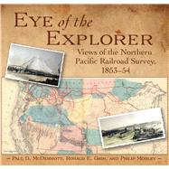
Eye of the Explorer

by
  • ISBN13:

    9780878425600

  • ISBN10:

    0878425608

  • Format: Hardcover
  • Copyright: 2010-07-01
  • Publisher: Mountain Pr
  • Purchase Benefits
  • Free Shipping Icon Free Shipping On Orders Over $35!
    Your order must be $35 or more to qualify for free economy shipping. Bulk sales, PO's, Marketplace items, eBooks and apparel do not qualify for this offer.
  • eCampus.com Logo Get Rewarded for Ordering Your Textbooks! Enroll Now
List Price: $45.00

Summary

In the 1850s, Congress authorized and funded five railroad surveys to determine the most practical route for a transcontinental railroad through the western frontier. The northernmost survey, headed by Maj. Isaac Stevens, was the most successful, both scientifically and geographically. Along with the data assembled by numerous scientists and surveyors was the work of two artists, John Mix Stanley and Gustavus Sohon. Their illustrations graphically documented the physical and cultural geography of the northern Great Plains and Pacific Northwest, with a particular eye for Native American life. Eye of the Explorer: Views of the Northern Pacific Railroad Survey reproduces all seventy of the lithographs that appeared with Steven's final congressional report, published in 1860, as well as twelve of the lovely water color images from which the final prints were prepared. The accompanying text tells the story of the survey party's adventures, struggles, and day-to-day activities, and describes each image's historical, geographical, and geological importance. Liberally scattered throughout are quotations from the report. Dozens of detailed maps, illustrations, and historical photos further illuminate this engaging history.

Author Biography

Paul D. McDermott taught geography and cartography for thirty-four years at Montgomery College in Rockville, Maryland. He is an avid photographer and has written and lectured extensively on historical geography. Ronald E. Grim worked in the Cartographic and Archives and Records Service and in the Geography and Map Division at the Library of Congress. He is currently the curator of maps at the Normal B. Leventhal Map Center at the Boston Public Library. Phillip Mobley, a professional cartographer, is and adjunct professor of geography at George Mason University and has also taught cartography and geography courses at Montgomery College and George Washington University.

Supplemental Materials

What is included with this book?

The New copy of this book will include any supplemental materials advertised. Please check the title of the book to determine if it should include any access cards, study guides, lab manuals, CDs, etc.

The Used, Rental and eBook copies of this book are not guaranteed to include any supplemental materials. Typically, only the book itself is included. This is true even if the title states it includes any access cards, study guides, lab manuals, CDs, etc.

Rewards Program