did-you-know? rent-now

Amazon no longer offers textbook rentals. We do!

did-you-know? rent-now

Amazon no longer offers textbook rentals. We do!

We're the #1 textbook rental company. Let us show you why.

9781606230749

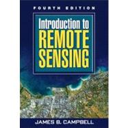
Introduction to Remote Sensing, Fourth Edition

by
  • ISBN13:

    9781606230749

  • ISBN10:

    1606230743

  • Edition: 4th
  • Format: Paperback
  • Copyright: 2008-10-28
  • Publisher: The Guilford Press
  • View Upgraded Edition
  • Purchase Benefits
  • Free Shipping Icon Free Shipping On Orders Over $35!
    Your order must be $35 or more to qualify for free economy shipping. Bulk sales, PO's, Marketplace items, eBooks and apparel do not qualify for this offer.
  • eCampus.com Logo Get Rewarded for Ordering Your Textbooks! Enroll Now
List Price: $69.33

Summary

This popular text introduces students to widely used forms of remote sensing imagery and their applications in plant sciences, hydrology, earth sciences, and land use analysis. Providing comprehensive coverage of principal topics in the field, the book’s 4 sections and 21 chapters are carefully designed as independent units that instructors can select from as needed for their courses. Relevant case studies and review questions that reinforce the concepts presented in each chapter make this book essential reading for students in remote sensing. Illustrations include 28 color plates and nearly 400 black-and-white images and figures.

Author Biography

James B. Campbell is Professor of Geography at Virginia Tech, where he teaches remote sensing, quantitative methods, and geomorphology. He has worked closely with students and faculty in related fields such as forestry, geology, agronomy, environmental sciences, and planning. Since 1997 he has served as co-director of Virginia Tech's Center for Environmental Analysis of Remote Sensing (CEARS).  The author of numerous technical articles and several books, Dr. Campbell received the Outstanding Service Award of the American Society for Photogrammetry and Remote Sensing in 1994 and its Fellow Award in 1996. In 1997 he received the Outstanding Service Medal awarded by the Remote Sensing Specialty Group of the Association of American Geographers. Dr. Campbell's research has been sponsored by numerous academic, governmental, and private organizations, including NASA, the National Science Foundation, and the United States Geological Survey.

Table of Contents

Foundations
History and Scope of Remote Sensing
Electromagnetic Radiation
Image Acquisition
Photographic Sensors
Digital Data
Image Interpretation
Land Observation Satellites
Active Microwave
Lidar
Thermal Radiation
Image Resolution
Analysis
Preprocessing
Image Classification
Field Data
Accuracy Assessment
Hyperspectral Remote Sensing
Applications
Remote Sensing and Geographic Information Systems
Plant Sciences
Earth Sciences
Hydrospheric Sciences
Land Use and Land Cover
Global Remote Sensing
Table of Contents provided by Publisher. All Rights Reserved.

Supplemental Materials

What is included with this book?

The New copy of this book will include any supplemental materials advertised. Please check the title of the book to determine if it should include any access cards, study guides, lab manuals, CDs, etc.

The Used, Rental and eBook copies of this book are not guaranteed to include any supplemental materials. Typically, only the book itself is included. This is true even if the title states it includes any access cards, study guides, lab manuals, CDs, etc.

Rewards Program