did-you-know? rent-now

Amazon no longer offers textbook rentals. We do!

did-you-know? rent-now

Amazon no longer offers textbook rentals. We do!

We're the #1 textbook rental company. Let us show you why.

9780833035479

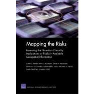
Mapping the Risks Assessing Homeland Security Implications of Publicly Available Geospatial Information

by ; ; ; ;
  • ISBN13:

    9780833035479

  • ISBN10:

    0833035479

  • Format: Paperback
  • Copyright: 3/19/2004
  • Publisher: RAND Corporation
  • Purchase Benefits
List Price: $24.00

Summary

Assesses the homeland security implications of publicly available geospatial data and information.

Table of Contents

Preface iii
Sponsor Guidance v
The RAND Corporation Quality Assurance Process vii
Figures xiii
Tables xv
Summary xvii
Acknowledgments xxxv
Abbreviations xxxvii
CHAPTER ONE Introduction 1(16)
Assessing the Homeland Security Implication of Geospatial Information
3(3)
Public Access to Geospatial Information
6(2)
Research Objectives
8(2)
Research Methodology
10(2)
Demand-Side Methodology
10(1)
Supply-Side Methodology
11(1)
Need for an Analytical Framework
12(2)
How the Report Is Organized
14(3)
CHAPTER TWO What Are the Attackers' Key Information Needs? 17(24)
Methodology
18(1)
Defining the Threat Space
19(2)
The Attacker: Motivations, Strategies, and Modalities of Attack
21(1)
The Attacker's Tool Box: Types of Weapons Considered
22(2)
A General Model of Attacker Information Needs
24(14)
Accessibility and Critical Sites
27(2)
How the Attacker Acquires the Necessary Information
29(5)
Harmonizing Objectives, Attack Modalities, and Information Requirements
34(3)
Lessons from Analysis of Attackers' Information Demands
37(1)
Attackers Have Substantial Flexibility in Fulfilling Their Information Needs
38(1)
Summary
39(2)
CHAPTER THREE What Publicly Available Geospatial Information Is Significant to Potential Attackers' Needs? 41(52)
Federal Geospatial Information in the Public Domain
42(6)
Structured Survey Used to Identify Federal Geospatial Data Sources
42(6)
Availability of Nonfederal Geospatial Information
48(11)
Diverse Range of Nonfederal Geospatial Sources
50(6)
Nonfederal Geospatial Sources Derived from Federal Sources
56(3)
Assessing Whether Sources Contain Potentially Critical Site Information
59(4)
Assessing the Potential Significance of This Information
63(10)
Assessing Potential Usefulness of the Geospatial Information
64(2)
Assessing the Uniqueness of the Geospatial Information
66(3)
Assessing the Significance
69(2)
A Closer Examination of the Potentially Significant Federal Databases
71(2)
Case Studies Comparing Federal and Nonfederal Sources of Geospatial Information
73(14)
DOI Minerals Management Service: Houchin Offshore Mining Platform Case Study
75(8)
The Environmental Protection Agency's Toxics Release Inventory: Marcus Hook Facility Case Study
83(4)
Other Observations About Publicly Accessible Federal Geospatial Information
87(2)
Key Issues in Federal Agency Data Sources
87(2)
Summary
89(4)
CHAPTER FOUR An Analytical Framework for Assessing the Homeland Security Implications of Publicly Accessible Geospatial Information 93(28)
Framework for Analysis: An Overview
94(1)
Framework for Analysis: Three Analytical Filters
95(10)
Filter 1: Assessing the Usefulness of Geospatial Information for Target Selection and Attack Planning
96(2)
Filter 2: Assessing the Uniqueness of Geospatial Information
98(1)
Filter 3: Weighing the Societal Benefits and Costs of Restricting Public Access to Geospatial Information
99(4)
Quantifying the Benefits of Public Access to Geospatial Information
103(2)
Illustrating the Framework
105(7)
Options and Precedents for Permitting Conditional Public Access
110(2)
Considerations in Restricting Public Access to Sensitive Data
112(2)
Federal, State, and Local Government Concerns About Restricting Federal Data Access
112(2)
Long-Term Need for a More Comprehensive Model
114(5)
Summary
119(2)
CHAPTER FIVE Key Findings and Recommendations 121(10)
Key Findings
121(3)
"Demand" Analysis Findings
121(2)
"Supply" Analysis Findings
123(1)
Broader Implications
124(3)
General Recommendations
127(1)
Agency-Specific Recommendations
128(3)
APPENDIX
A. Federal Agencies Examined
131(4)
B. Federal Geospatial Data Sources Identified
135(36)
C. Detailed Examples of Geospatial Information Analyses
171(8)
D. Overview of Critical U.S. Sites: Critical Infrastructure and Other Key Homeland Locations
179(12)
Bibliography 191

Supplemental Materials

What is included with this book?

The New copy of this book will include any supplemental materials advertised. Please check the title of the book to determine if it should include any access cards, study guides, lab manuals, CDs, etc.

The Used, Rental and eBook copies of this book are not guaranteed to include any supplemental materials. Typically, only the book itself is included. This is true even if the title states it includes any access cards, study guides, lab manuals, CDs, etc.

Rewards Program