did-you-know? rent-now

Amazon no longer offers textbook rentals. We do!

did-you-know? rent-now

Amazon no longer offers textbook rentals. We do!

We're the #1 textbook rental company. Let us show you why.

9781426215438

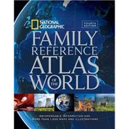
National Geographic Family Reference Atlas of the World, Fourth Edition Indispensable Information and More Than 1,000 Maps and Illustrations

by Unknown
  • ISBN13:

    9781426215438

  • ISBN10:

    1426215436

  • Edition: 4th
  • Format: Hardcover
  • Copyright: 2015-09-29
  • Publisher: National Geographic

Note: Supplemental materials are not guaranteed with Rental or Used book purchases.

Purchase Benefits

List Price: $70.00 Save up to $17.50
  • Buy Used
    $52.50
    Add to Cart Free Shipping Icon Free Shipping

    USUALLY SHIPS IN 2-4 BUSINESS DAYS

Supplemental Materials

What is included with this book?

Summary

Maps have been around in some form or other since humans first understood the need to record their physical space, and for the past hundred years, the National Geographic Society has been at the forefront of mapmaking. This Fourth Edition of our popular Family Reference Atlas of the World brings you the world and its marvels—through maps.  Using the latest technological advances, satellite data has been compiled to create some 1,400 images—maps, diagrams, graphs, and tables, as well as National Geographic’s signature color photographs—to allow you to examine the most remote corners of the globe.   In an era when political, health, climatic, and environmental crises anywhere on the globe can affect our daily lives, maps provide a time-honored way to navigate the realities we face. With this atlas, you hold a powerful yet accessible tool to understanding the interplay of global forces at work in the fast-changing but always miraculous planet that is our home.

Author Biography

NATIONAL GEOGRAPHIC cartographers bring a century of mapmaking experience and cutting-edge technology to bear on every atlas product. Over the last decade, techniques used in digital mapping have undergone remarkable changes. Today, satellite and digital imaging technology, GPS, and GIS technologies provide cartographers with new, dynamic tools to map and animate Earth. Leveraging these emerging technologies to build smart, well-designed, functional, informative atlases is one of the great strengths of National Geographic.

Supplemental Materials

What is included with this book?

The New copy of this book will include any supplemental materials advertised. Please check the title of the book to determine if it should include any access cards, study guides, lab manuals, CDs, etc.

The Used, Rental and eBook copies of this book are not guaranteed to include any supplemental materials. Typically, only the book itself is included. This is true even if the title states it includes any access cards, study guides, lab manuals, CDs, etc.

Rewards Program