did-you-know? rent-now

Amazon no longer offers textbook rentals. We do!

did-you-know? rent-now

Amazon no longer offers textbook rentals. We do!

We're the #1 textbook rental company. Let us show you why.

9780073661797

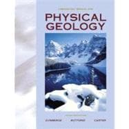
Physical Geology: Update

by
  • ISBN13:

    9780073661797

  • ISBN10:

    0073661791

  • Format: Paperback
  • Copyright: 2000-07-17
  • Publisher: McGraw-Hill Higher Education
  • View Upgraded Edition

Note: Supplemental materials are not guaranteed with Rental or Used book purchases.

Purchase Benefits

  • Free Shipping Icon Free Shipping On Orders Over $35!
    Your order must be $35 or more to qualify for free economy shipping. Bulk sales, PO's, Marketplace items, eBooks and apparel do not qualify for this offer.
  • eCampus.com Logo Get Rewarded for Ordering Your Textbooks! Enroll Now
List Price: $74.53 Save up to $18.63
  • Buy Used
    $55.90
    Add to Cart Free Shipping Icon Free Shipping

    USUALLY SHIPS IN 2-4 BUSINESS DAYS

Supplemental Materials

What is included with this book?

Summary

This laboratory manual is written for the freshman-level laboratory course in physical geology. In this lab students study Earth materials, topographic maps, aerial photographs and other imagery from remote sensing, geologic interpretation of topographic maps, aerial photographs and Earth satellite imagery, structural geology and plate tectonics and related phenomena. With nearly 30 exercises, this gives flexibility when developing the syllabus for this course. The ease of use, tremendous selection, and tried and true nature of the labs selected, have made this the leading selling physical geology manual.

Table of Contents

Materials Needed by Students Using This Manual viii
Preface ix
Part 1 Earth Materials 1(62)
Background
1(1)
Minerals
2(21)
Definition
2(1)
Mineral Identification
2(1)
Properties of Minerals
2(21)
Identification of Common Minerals
7(16)
Rocks
23(32)
Background
23(1)
Igneous Rocks
24(11)
Identification of Common Igneous Rocks
29(6)
Sedimentary Rocks
35(10)
Identification of Common Sedimentary Rocks
42(3)
Metamorphic Rocks
45(10)
Identification of Common Metamorphic Rocks
51(4)
The Geologic Column and Relative Geologic Time
55(8)
Background
55(1)
Constructing a Geologic Column
56(7)
Building a Geologic Column from a Geologic Cross Section
60(1)
Relative Ages of Igneous Rocks Intruded into Country Rock
61(2)
Part 2 Topographic Maps, Aerial Photographs, and Other Imagery from Remote Sensing 63(34)
Background
63(1)
Map Coordinates and Land Division
64(6)
Map Projection
65(3)
Range and Township
68(2)
Topographic Maps
70(17)
Definition
70(1)
Features of Topographic Maps
70(1)
Elements of a Topographic Map
71(10)
Problems on Contour Lines
76(3)
Problems in Scale Conversion
79(2)
Topographic Profiles
81(6)
Drawing Profiles from Topographic Maps
83(1)
Topographic Map Reading
84(3)
Aerial Photographs and Other Imagery from Remote Sensing
87(10)
Background
87(1)
Determining Scale on Aerial Photographs
87(1)
Stereoscopic Use of Aerial Photographs
88(1)
Interpretation of Aerial Photographs
89(2)
Landsat False Color Images
91(6)
Introduction to Aerial Photograph Interpretation
93(4)
Part 3 Geologic Interpretation of Topographic Maps, Aerial Photographs, and Earth Satellite Images 97(92)
Background
97(1)
General Instructions
97(1)
Geologic Work of Running Water
98(19)
Stream Gradients and Base Level
103(1)
Stream Gradients and Drainage Divides
104(3)
Pediments and Alluvial Fans
107(4)
Charles Creek, Canada
111(1)
Refuge Map, Arkansas-Mississippi Greenwood Map, Arkansas-Mississippi
112(5)
Groundwater Movement, Groundwater Pollution, and Groundwater as a Geologic Agent
117(12)
Water Table Contours
118(2)
Groundwater Pollution
120(4)
Karst Topography
124(2)
Sinkholes
126(3)
Sinkhole Formation
129(4)
Evolution of a Karst Terrain
131(2)
Glaciers and Glacial Geology
133(1)
Wastage and Accumulation
133(1)
Alpine Glaciers
133(12)
Mass Balance of an Alpine Glacier
136(5)
Snow Line, Moraines, and Glacier Flow
141(1)
Erosional Landforms Produced by Former Alpine Glaciers
142(3)
Continental Glaciation
145(9)
Moraines and Outwash Plains
146(2)
Drumlins
148(4)
Ice-Contact Deposits
152(2)
Landforms Produced by Wind Action
154(9)
Barchans
156(2)
Coastal Dunes
158(2)
Inactive Dune Fields
160(3)
Modern and Ancient Shorelines
163(16)
Coastal Processes and Shoreline Evolution
170(2)
Deltas of the Mississippi River
172(2)
Ancestral Lakes of Lake Erie
174(2)
Shore Erosion and Levels of Lake Michigan
176(3)
Landforms Produced by Volcanic Activity
179(10)
Mauna Loa, a Hawaiian Shield Volcano
182(6)
The Impact of the Eruption of Mount St. Helens on Surrounding Topography
188(1)
Part 4 Structural Geology 189(52)
Background
189(1)
Structural Features of Sedimentary Rocks
190(29)
Deformation of Sedimentary Strata
190(1)
Methods of Geologic Illustration
190(1)
Sedimentary Rock Structures
191(5)
Geologic Maps and Cross Sections
196(23)
Geologic Structures on Block Diagrams, Geologic Symbols, and Relative Ages of Formations
200(2)
Chase County, Kansas
202(2)
Fremont County, Wyoming
204(2)
Aerial Photograph, Arkansas
206(2)
Little Dome, Wyoming
208(2)
Harrisburg, Pennsylvania
210(2)
Lancaster Geologic Map, Wisconsin
212(2)
Swan Island Geologic Map, Tennessee
214(2)
Coleman Gap Geologic Map, Tennessee-Virginia
216(3)
Faults and Earthquakes
219(14)
Inactive Faults
219(8)
Fault Problems on Block Diagrams
221(4)
Faulted Sedimentary Strata
225(2)
Active Faults
227(6)
Relationship of Fault Planes to Fault Traces, Epicenters, and Foci
228(5)
The Use of Seismic Waves to Locate the Epicenter of an Earthquake
233(8)
Seismographs, Seismograms, and Seismic Observatories
233(8)
Locating the Epicenter of an Earthquake
238(3)
Part 5 Plate Tectonics and Related Geologic Phenomena 241(23)
Background
241(1)
The Major Components of the Earth
241(8)
Plate Boundaries
245(1)
The Nazca Plate
246(3)
Seafloor Spreading in the South Atlantic and Eastern Pacific Oceans
249(15)
Background
249(1)
The Earth's Magnetic Field
249(9)
Spreading Rates on the East Pacific Rise and the Mid-Atlantic Ridge
254(2)
Restoration of the South Atlantic Coastline 50 Million Years Before the Present
256(2)
Volcanic Islands and Hot Spots
258(6)
Movement of the Volcanoes in the Hawaiian Ridge Over the Hawaiian Hot Spot
260(1)
Islands in French Polynesia of the South Pacific Ocean
261(3)
Glossary 264

Supplemental Materials

What is included with this book?

The New copy of this book will include any supplemental materials advertised. Please check the title of the book to determine if it should include any access cards, study guides, lab manuals, CDs, etc.

The Used, Rental and eBook copies of this book are not guaranteed to include any supplemental materials. Typically, only the book itself is included. This is true even if the title states it includes any access cards, study guides, lab manuals, CDs, etc.

Rewards Program