did-you-know? rent-now

Amazon no longer offers textbook rentals. We do!

did-you-know? rent-now

Amazon no longer offers textbook rentals. We do!

We're the #1 textbook rental company. Let us show you why.

9781784270230

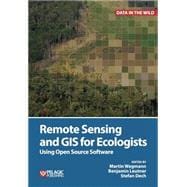
Remote Sensing and GIS for Ecologists Using Open Source Software

by ; ;
  • ISBN13:

    9781784270230

  • ISBN10:

    1784270237

  • Format: Hardcover
  • Copyright: 2016-03-21
  • Publisher: Pelagic Publishing
  • Purchase Benefits
  • Free Shipping Icon Free Shipping On Orders Over $35!
    Your order must be $35 or more to qualify for free economy shipping. Bulk sales, PO's, Marketplace items, eBooks and apparel do not qualify for this offer.
  • eCampus.com Logo Get Rewarded for Ordering Your Textbooks! Enroll Now
List Price: $91.99

Summary

This is a book about how ecologists can integrate remote sensing and GIS in their daily work. It will allow ecologists to get started with the application of remote sensing and to understand its potential and limitations. Using practical examples, the book covers all necessary steps from planning field campaigns to deriving ecologically relevant information through remote sensing and modelling of species distributions.

All practical examples in this book rely on OpenSource software and freely available data sets. Quantum GIS (QGIS) is introduced for basic GIS data handling, and in-depth spatial analytics and statistics are conducted with the software packages R and GRASS.

Readers will learn how to apply remote sensing within ecological research projects, how to approach spatial data sampling and how to interpret remote sensing derived products. The authors discuss a wide range of statistical analyses with regard to satellite data as well as specialised topics such as time-series analysis. Extended scripts on how to create professional looking maps and graphics are also provided.

This book is a valuable resource for students and scientists in the fields of conservation and ecology interested in learning how to get started in applying remote sensing in ecological research and conservation planning.
Author Biography

Martin Wegmann has a PhD in remote sensing focusing on time-series analysis on land cover change and fragmentation in Africa. He is an assistant professor at the Global Change Ecology Msc program at the University of Würzburg, Germany and runs courses in remote sensing analysis for biodiversity and conservation.

Benjamin Leutner is a research assistant at the department of remote sensing at the University of Würzburg. He has extensive experience in geo-spatial analysis of remote sensing data using Open Source software. 

Stefan Dech is director of the German Remote Sensing Data Center (DFD) since 1998, and current spokesman of the Earth Observation Center (EOC) at the German Aerospace Center (DLR). Since 2001 he has held the Chair for Remote Sensing at the Institute of Geography and Geology of the University of Würzburg. 

Supplemental Materials

What is included with this book?

The New copy of this book will include any supplemental materials advertised. Please check the title of the book to determine if it should include any access cards, study guides, lab manuals, CDs, etc.

The Used, Rental and eBook copies of this book are not guaranteed to include any supplemental materials. Typically, only the book itself is included. This is true even if the title states it includes any access cards, study guides, lab manuals, CDs, etc.

Rewards Program