did-you-know? rent-now

Amazon no longer offers textbook rentals. We do!

did-you-know? rent-now

Amazon no longer offers textbook rentals. We do!

We're the #1 textbook rental company. Let us show you why.

9781844863143

The Sea Chart

by
  • ISBN13:

    9781844863143

  • ISBN10:

    184486314X

  • Edition: 2nd
  • Format: Hardcover
  • Copyright: 2016-05-17
  • Publisher: Conway
  • Purchase Benefits
  • Free Shipping Icon Free Shipping On Orders Over $35!
    Your order must be $35 or more to qualify for free economy shipping. Bulk sales, PO's, Marketplace items, eBooks and apparel do not qualify for this offer.
  • eCampus.com Logo Get Rewarded for Ordering Your Textbooks! Enroll Now
List Price: $40.00
We're Sorry.
No Options Available at This Time.

Summary

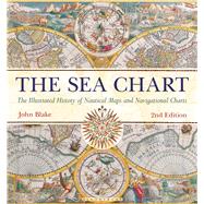
Ocean sailing needed skill, courage, and experience, and the sea chart was the tool by which ships of trade, transport, or conquest navigated. This examines the history and development of the chart and the nautical map, in both scientific and aesthetic terms as a means of safe and accurate seaborne navigation. The Italian merchant-venturers of the early thirteenth century developed the earliest “portolan” pilot charts of the Mediterranean. The subsequent speed of exploration by European seafarers to the New World, around the Cape of Good Hope, and on trade routes to the East, India, and the Spice Islands were results of the development of the sea chart. By the eighteenth century, the discovery and charting of the coasts and oceans of the globe had become a strategic naval and commercial requirement. Such involvements led to Cook's voyages in the Pacific, the search for the Northwest Passage, and races to the Arctic and Antarctic.

The volume is arranged along chronological and geographical lines. Each of the ten chapters is split into distinct halves, examining the history of charting a particular region and the context under which such charting took place, followed with specific navigational charts and other relevant illustrations. Key figures or milestones in the history of charting are then presented in stand-alone story box features.

This new edition features forty new charts and accompanying text.
Author Biography

Lieutenant-Commander John Blake, FRIN, spent twelve years in the Royal Navy. He has worked extensively with the UK Hydrographic Office, the producers of Admiralty Charts, and is a fellow of the Royal Institute of Navigation. John is the author of the acclaimed Conway publications The Sea Chart (2003) and Sea Charts of the British Isles (2005). His research interests span the maritime world, from nautical charts and surveying to merchant shipping.

Supplemental Materials

What is included with this book?

The New copy of this book will include any supplemental materials advertised. Please check the title of the book to determine if it should include any access cards, study guides, lab manuals, CDs, etc.

The Used, Rental and eBook copies of this book are not guaranteed to include any supplemental materials. Typically, only the book itself is included. This is true even if the title states it includes any access cards, study guides, lab manuals, CDs, etc.

Rewards Program