did-you-know? rent-now

Amazon no longer offers textbook rentals. We do!

did-you-know? rent-now

Amazon no longer offers textbook rentals. We do!

We're the #1 textbook rental company. Let us show you why.

9780321987280

Applied Physical Geography Geosystems in the Laboratory

by ;
  • ISBN13:

    9780321987280

  • ISBN10:

    0321987284

  • Edition: 9th
  • Format: Spiral Bound
  • Copyright: 2014-09-03
  • Publisher: Pearson
  • View Upgraded Edition

Note: Supplemental materials are not guaranteed with Rental or Used book purchases.

Purchase Benefits

  • Free Shipping Icon Free Shipping On Orders Over $35!
    Your order must be $35 or more to qualify for free economy shipping. Bulk sales, PO's, Marketplace items, eBooks and apparel do not qualify for this offer.
  • eCampus.com Logo Get Rewarded for Ordering Your Textbooks! Enroll Now
List Price: $92.00 Save up to $80.24
  • Rent Book $30.59
    Add to Cart Free Shipping Icon Free Shipping

    TERM
    PRICE
    DUE
    IN STOCK USUALLY SHIPS WITHIN 24-48 HOURS.
    *This item is part of an exclusive publisher rental program and requires an additional convenience fee. This fee will be reflected in the shopping cart.

Supplemental Materials

What is included with this book?

Summary

A variety of exercises provide flexibility in lab assignments. Each exercise includes key terms and learning concepts linked to Geosystems . The Ninth Edition includes new exercises on climate change, soils, and rock identification, a fully updated exercise on basic GIS using ArcGIS online, and more integrated media, including Quick Response (QR) codes linking to Pre-Lab videos. Supported by a web site with media resources needed for exercises, as well as a downloadable Solutions Manual for teachers. The web site for the lab manual provides online worksheets as well as KMZ files for all of the Google Earth™ exercises found in the lab manual. www.mygeoscienceplace.com
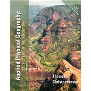
Table of Contents

1. Latitude and Longitude

2. The Geographic Grid and Time

3. Directions and Compass Readings

4. Map Projections, Map Reading, and Interpretation

5. Earth-Sun Relationships and Daylength

6. Insolation and Seasons

7. Temperature Concepts

8. Temperature Patterns

9. Temperature Maps

10. Earth’s Atmosphere: Temperature and Pressure Profiles

11. Earth’s Atmosphere: Pressure and Wind Patterns

12. Atmospheric Humidity

13. Stability and Atmospheric Processes

14. Weather Maps

15. Midlatitude Cyclones and Hurricanes

16. Water Balance and Water Resources

17. Global Climate Systems

18. Climate Change

19. Plate Tectonics: Global Patterns

20. Plate Tectonics: Faulting and Volcanism

21. The Rock Cycle and Rock Identification

22. Recurrence Intervals for Natural Events

23. Contours and Topographic Maps

24. Topographic Analysis: Fluvial Geomorphology

25. Topographic Analysis: Glacial Geomorphology

26. Topographic Analysis: Coastal and Arid Geomorphology

27. Topographic Analysis: Karst Landscapes

28. Soils

29. Biomes: Analyzing Global Terrestrial Ecosystems

30. An Introduction to Geographic Information Systems

Glossary

Graph Paper

Twelve Topographic Maps

Rock Chart

Twelve Topographic Maps

Rock Chart

¿

Supplemental Materials

What is included with this book?

The New copy of this book will include any supplemental materials advertised. Please check the title of the book to determine if it should include any access cards, study guides, lab manuals, CDs, etc.

The Used, Rental and eBook copies of this book are not guaranteed to include any supplemental materials. Typically, only the book itself is included. This is true even if the title states it includes any access cards, study guides, lab manuals, CDs, etc.

Rewards Program