did-you-know? rent-now

Amazon no longer offers textbook rentals. We do!

did-you-know? rent-now

Amazon no longer offers textbook rentals. We do!

We're the #1 textbook rental company. Let us show you why.

9781566764001

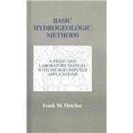
Basic Hydrogeologic Methods: A Field and Laboratory Manual with Microcomputer Applications

by ;
  • ISBN13:

    9781566764001

  • ISBN10:

    1566764009

  • Format: Paperback
  • Copyright: 1996-11-25
  • Publisher: CRC Press

Note: Supplemental materials are not guaranteed with Rental or Used book purchases.

Purchase Benefits

List Price: $185.00 Save up to $144.80
  • Rent Book $166.96
    Add to Cart Free Shipping Icon Free Shipping

    TERM
    PRICE
    DUE
    USUALLY SHIPS IN 3-5 BUSINESS DAYS
    *This item is part of an exclusive publisher rental program and requires an additional convenience fee. This fee will be reflected in the shopping cart.

Supplemental Materials

What is included with this book?

Summary

FROM THE PREFACE The approach of this book is "how-to-do and hands-on." Its purpose is to provide clear, step-by-step instruction in many of the fundamental methods of hydrogeologic investigation. These methods include both 1) the traditional techniques of data analysis, such as mathematical computation by electronic calculator and construction of graphs by hand-plotting, and 2) microcomputer techniques employing electronic spreadsheets, graphing and gridding and contouring software. The microcomputer methods employ commercial software such as Lotus 1-2-3. Microsoft Excel, Quattro-Pro, Golden Software's Grapher and Surfer, and Geraghty and Miller's AQTESOLV. Although familiarity with any of the applications is helpful, the instructions in this manual assume no prior experience with them. Basic Hydrogeologic Methods is divided into three sections: Groundwater Occurrence and Movement, Groundwater Investigations, and Well and Aquifer Hydraulics. Each section begins with a brief summary of relevant terminology and principles. This introductory chapter is followed by a case study, which may be employed to provide a practical context for the hydrogeological methods that are described in subsequent chapters. Most of the methodological exercises culminate in an analytical product, such as data table, graph, contour map, etc., which readily serve as a focus for problem-solving activities, classroom discussions, and investigative reports. Many of the exercises present at least two investigative methods for accomplishing a particular hydrogeologic task. For example, time-drawdown graphs may be produced by a hand-plotting method or by a microcomputer method. For the professional scientist, the choice of a particular method might depend on such factors as the time available to carry out the task, the degree of accuracy required, or the availability of assessory equipment and materials. The introductory student can work through a more fundamental method (e.g., hand-plotting) before advancing to a microcomputer method (e.g., spreadsheet and graphing).

Table of Contents

Preface xi
Part 1: Groundwater Occurrence and Movement
Principles of Groundwater Occurrence and Movement
3(18)
Definition and Classification of Groundwater
3(1)
Aquifers and Confining Units
3(2)
Depth to Groundwater
5(2)
Water Level Fluctuations
7(3)
Water Table Geometry
10(1)
Rock Properties Affecting Groundwater
11(3)
Direction of Groundwater Flow
14(4)
Rate of Groundwater Flow
18(1)
References
19(2)
Case Study: Hydrogeologic Investigation of a Proposed Flyash Storage Site
21(6)
Statement of the Problem
21(1)
Purpose and Scope
21(1)
Background and Project Setting
22(1)
Methods of Investigation
23(2)
Report of Findings
25(1)
References
25(2)
Field Procedure for Measuring Depth to Water Level in Wells and Piezometers
27(6)
Introduction to Methods
27(1)
Wetted Tape Method
28(1)
Electric Sounder Method
29(2)
References
31(2)
Analytical Procedure for Determining Elevation of Water Level and Depth to Water Level Below Land Surface
33(10)
Introduction to Methods
33(1)
Electronic Calculator and Worksheet Method
34(2)
Microcomputer and Electronic Spreadsheet Method
36(7)
Method for Graphing Water Level Fluctuations
43(20)
Introduction to Methods
43(1)
Hand Plotting and Graphing Method
43(3)
Microcomputer and Electronic Spreadsheet Method
46(9)
Microcomputer and Graphing Software Method
55(8)
Method for Preparing Water Level Maps
63(18)
Introduction to Methods
63(2)
Hand Drafting Method
65(4)
Microcomputer and Grid-Based Contouring Software Method
69(10)
Reference
79(2)
Method for Preparing Flow Line Maps
81(6)
Introduction to Methods
81(1)
Contour Map Method
81(3)
Three Point Method
84(1)
Reference
85(2)
Analytical Procedure for Estimating Rate of Groundwater Flow
87(12)
Introduction to Methods
87(1)
Electronic Calculator and Worksheet Method
87(5)
Microcomputer and Electronic Spreadsheet Method
92(7)
Part 2: Groundwater Investigations
Principles of Groundwater Investigations
99(30)
An Overview of Groundwater Investigations
99(3)
Characterizing the Hydrogeologic Setting
102(11)
Siting Water Supply Wells
113(10)
Designing Groundwater Monitoring Systems
123(3)
References
126(3)
Case Study: Siting Test Wells for a Public Water Supply System
129(4)
Statement of the Problem
129(1)
Purpose and Scope
129(1)
Background and Project Setting
129(1)
Methods of Investigation
130(1)
Report of Findings
131(2)
Method for Characterizing The Hydrogeologic Setting
133(12)
Introduction to Methods
133(1)
Preparing a Geologic Base Map
133(1)
Preparing a Geologic Column
134(4)
Preparing a Structure Section
138(3)
Preparing a Fracture Trace Map
141(2)
References
143(2)
Analytical Procedure for Determining Well Yield Frequency Distributions
145(12)
Introduction to Methods
145(2)
Electronic Calculator and Worksheet Method
147(2)
Microcomputer and Electronic Spreadsheet Method
149(6)
References
155(2)
Method for Graphing Well Yield Distributions
157(10)
Introduction to Methods
157(1)
Hand Plotting and Graphing Method
157(2)
Microcomputer and Graphing Software Method
159(8)
Method for Preparing Groundwater Availability Maps
167(6)
Introduction to Method
167(1)
Estimating Potential Well Yield
168(2)
Preparing a Groundwater Availability Map
170(2)
Reference
172(1)
Method for Preparing Test Well Site Maps
173(8)
Introduction to Methods
173(1)
Construction of a Test Well Sites Map
173(4)
Reference
177(4)
Part 3: Aquifer and Well Hydraulics
Principles of Aquifer and Well Hydraulics
181(20)
Elements of Pumping Wells
181(1)
Aquifer Properties
182(3)
Aquifer Tests
185(1)
Flow toward a Pumping Well
185(3)
Drawdown in Ideal Aquifers
188(6)
Effects of Lateral Boundaries
194(2)
Leaky Confining Beds
196(1)
Effects of Anisotropy
197(1)
References
198(3)
Case Study: Analysis of the Hydraulic Properties of an Aquifer
201(4)
Statement of the Problem
201(1)
Purpose and Scope
201(1)
Background and Project Setting
201(2)
Methods of Investigation
203(1)
Report of Findings
204(1)
Field Procedure for Conducting Aquifer Tests
205(6)
Introduction to Methods
205(3)
Constant Rate--Multiple Well Method
208(2)
References
210(1)
Analytical Procedure for Determining Time and Drawdown from Pumping Test Measurements
211(10)
Introduction to Methods
211(1)
Electronic Calculator Method
211(3)
Microcomputer and Electronic Spreadsheet Method
214(7)
Method for Graphing Time-Drawdown Curves
221(20)
Introduction to Methods
221(1)
Hand Plotting and Graphing Method
221(1)
Microcomputer and Electronic Spreadsheet Method
222(11)
Microcomputer and Graphic Software Method
233(8)
Analytical Procedure for Estimating Hydraulic Properties of Ideal Aquifers: Theis Nonequilibrium Method
241(14)
Introduction to Methods
241(3)
Hand Plotting and Curve Matching Method
244(5)
Microcomputer and Type Curve Matching Software Method
249(4)
References
253(2)
Analytical Procedure for Estimating Hydraulic Properties of Ideal Aquifers: Modified Theis Nonequilibrium (Cooper-Jacob) Method
255(18)
Introduction to Methods
255(1)
Hand Plotting and Graphing Method
256(3)
Microcomputer and Graphing Software Method
259(7)
Microcomputer and Type Curve Matching Software Method
266(5)
References
271(2)
Analytical Procedure for Estimating Hydraulic Properties of Leaky Aquifers: Hantush-Jacob Method
273(14)
Introduction to Methods
273(4)
Hand Plotting and Curve-Matching Method
277(4)
Microcomputer and Type Curve Matching Software Method
281(4)
References
285(2)
Analytical Procedure for Estimating Hydraulic Properties of Unconfined Aquifers: Neuman Method
287(16)
Introduction to Methods
287(4)
Hand Plotting and Curve-Matching Method
291(5)
Microcomputer and Type Curve Matching Software Method
296(4)
References
300(3)
Appendix: Preparing a Hydrodata Diskette 303(6)
Index 309

Supplemental Materials

What is included with this book?

The New copy of this book will include any supplemental materials advertised. Please check the title of the book to determine if it should include any access cards, study guides, lab manuals, CDs, etc.

The Used, Rental and eBook copies of this book are not guaranteed to include any supplemental materials. Typically, only the book itself is included. This is true even if the title states it includes any access cards, study guides, lab manuals, CDs, etc.

Rewards Program