did-you-know? rent-now

Amazon no longer offers textbook rentals. We do!

did-you-know? rent-now

Amazon no longer offers textbook rentals. We do!

We're the #1 textbook rental company. Let us show you why.

9781462549405

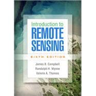
Introduction to Remote Sensing

by ; ;
  • ISBN13:

    9781462549405

  • ISBN10:

    1462549403

  • Edition: 6th
  • Format: Hardcover
  • Copyright: 2022-08-23
  • Publisher: The Guilford Press

Note: Supplemental materials are not guaranteed with Rental or Used book purchases.

Purchase Benefits

  • Free Shipping Icon Free Shipping On Orders Over $35!
    Your order must be $35 or more to qualify for free economy shipping. Bulk sales, PO's, Marketplace items, eBooks and apparel do not qualify for this offer.
  • eCampus.com Logo Get Rewarded for Ordering Your Textbooks! Enroll Now
  • Buyback Icon We Buy This Book Back!
    In-Store Credit: $7.88
    Check/Direct Deposit: $7.50
    PayPal: $7.50
List Price: $105.60 Save up to $63.36
  • Rent Book $42.24
    Add to Cart Free Shipping Icon Free Shipping

    TERM
    PRICE
    DUE
    IN STOCK USUALLY SHIPS WITHIN 24-48 HOURS.
    *This item is part of an exclusive publisher rental program and requires an additional convenience fee. This fee will be reflected in the shopping cart.

Supplemental Materials

What is included with this book?

Summary

Now in full color, the sixth edition of this leading text features new chapters on remote sensing platforms (including the latest satellite and unmanned aerial systems), agriculture (including agricultural analysis via satellite imagery), and forestry (including fuel type mapping and fire monitoring). The book has introduced tens of thousands of students to the fundamentals of collecting, analyzing, and interpreting remotely sensed images. It presents cutting-edge tools and practical applications to land and water use analysis, natural resource management, climate change adaptation, and more. Each concise chapter is designed as an independent unit that instructors can use in any sequence. Pedagogical features include over 400 figures, chapter-opening lists of topics, case studies, end-of-chapter review questions, and links to recommended online videos and tutorials.
 
New to This Edition
*Discussions of Landsat 8 and Sentinel-2; the growth of unmanned aerial systems; mobile data collection; current directions in climate change detection, fire monitoring, and disaster response; and other timely topics.
*Additional cases, such as river erosion; the impact of Hurricane Sandy on Mantoloking, New Jersey; and Miami Beach as an exemplar of challenges in coastal communities.
*Revised throughout with 60% new material, including hundreds of new full-color figures.
*New chapters on remote sensing platforms, agriculture, and forestry.
 

Author Biography

James B. Campbell, PhD, is Professor of Geography at Virginia Tech, where he teaches remote sensing, quantitative methods, and geomorphology. He has worked closely with students and faculty in forestry, geology, agronomy, and environmental sciences. The author of numerous technical articles and several books, Dr. Campbell has received the Outstanding Service Award and the Fellow Award from the American Society for Photogrammetry and Remote Sensing, as well as the Outstanding Service Medal from the Remote Sensing Specialty Group of the Association of American Geographers. In 2020, Dr. Campbell received the AmericaView Lifetime Achievement Award. Dr. Campbell has served as a principal investigator for the VirginiaView consortium and as a member and chair of the AmericaView Board of Directors.
 
Randolph H. Wynne, PhD, is Professor in the Department of Forest Resources and Environmental Conservation at Virginia Tech. He also serves as Director of the Interdisciplinary Graduate Education Program in Remote Sensing. He teaches courses focused on the environmental and natural resources applications of remote sensing at the senior and graduate levels. Dr. Wynne's research interests are in the applications of remote sensing to forestry, natural resource management, ecosystem ecology, and earth system science. He is a recipient of the Award in Forest Science from the Society of American Foresters. Dr. Wynne is Coeditor of the journal Science of Remote Sensing and Associate Editor of Remote Sensing of Environment.
 
Valerie Thomas, PhD, is Professor in the Department of Forest Resources and Environmental Conservation at Virginia Tech. She also serves as Co-Director of the Center for Environmental Analytics and Remote Sensing within the College of Natural Resources and Environment. Dr. Thomas teaches remote sensing courses in forest lidar applications and hyperspectral applications for natural resources. She also teaches about the linkages between forests, society, and climate. Dr. Thomas's research related to remote sensing of forest cover, function, and change has been funded through federal and state agencies and by industry.  


Table of Contents

I. Foundations
1. Introducing Remote Sensing Basics
2. Electromagnetic Radiation
3. Remote Sensing Platforms
II. Image Acquisition
4. Digital Mapping Cameras
5. Digital Imagery
6. Image Interpretation
7. Land Observation Satellites
8. Active Microwave
9. Lidar
10. Thermal Imagery
III. Analysis
11. Statistics and Preprocessing
12. Image Classification
13. Accuracy Assessment
14. Hyperspectral Remote Sensing
15. Change Detection
IV. Applications
16. Plant Science Fundamentals
17. Agricultural Remote Sensing
18. Forestry
19. Earth Sciences
20. Coastal Processes and Landforms 
21. Land Use and Land Cover
Index
 

Supplemental Materials

What is included with this book?

The New copy of this book will include any supplemental materials advertised. Please check the title of the book to determine if it should include any access cards, study guides, lab manuals, CDs, etc.

The Used, Rental and eBook copies of this book are not guaranteed to include any supplemental materials. Typically, only the book itself is included. This is true even if the title states it includes any access cards, study guides, lab manuals, CDs, etc.

Rewards Program