did-you-know? rent-now

Amazon no longer offers textbook rentals. We do!

did-you-know? rent-now

Amazon no longer offers textbook rentals. We do!

We're the #1 textbook rental company. Let us show you why.

9780712356626

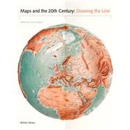
Maps and the 20th Century: Drawing the Line

by
  • ISBN13:

    9780712356626

  • ISBN10:

    0712356622

  • Format: Hardcover
  • Copyright: 2017-04-01
  • Publisher: British Library Publishing

Note: Supplemental materials are not guaranteed with Rental or Used book purchases.

Purchase Benefits

  • Free Shipping Icon Free Shipping On Orders Over $35!
    Your order must be $35 or more to qualify for free economy shipping. Bulk sales, PO's, Marketplace items, eBooks and apparel do not qualify for this offer.
  • eCampus.com Logo Get Rewarded for Ordering Your Textbooks! Enroll Now
List Price: $69.33 Save up to $20.80
  • Rent Book $48.53
    Add to Cart Free Shipping Icon Free Shipping

    TERM
    PRICE
    DUE
    USUALLY SHIPS IN 3-5 BUSINESS DAYS
    *This item is part of an exclusive publisher rental program and requires an additional convenience fee. This fee will be reflected in the shopping cart.

Supplemental Materials

What is included with this book?

Summary

The 20th century was a period of profound political, social and technological change. Population growth and movement, revolutions in transportation and communication, and the onset of the digital age meant that life would never be the same. It is impossible to overstate the significance of maps, which crept into everyday life during this period. They are always subjective, and always worthy of interrogation. Highlights of this global study include a trench-map of the Somme battlefields, a bomb damage map of London, early maps of the ocean floor, a poster showing Mao studying a map on his Long March and a Russian moon globe from 1961. Other maps discussed here include: the United Nations flag, the first stamps of Independent Latvia (1918) printed on the backs of maps, and a motorway sign. As well as sheet maps and atlases, the book gathers models, stamps, medals, manuscripts, printed books, embroidery and photographs. It also examines changes in mapping technology, from the land surveys of 1900 to the development of satellite imagery by 2000.
Author Biography

Tom Harper is lead curator of antiquarian maps at the British Library and the coauthor of A History of the Twentieth Century in 100 Maps.

Supplemental Materials

What is included with this book?

The New copy of this book will include any supplemental materials advertised. Please check the title of the book to determine if it should include any access cards, study guides, lab manuals, CDs, etc.

The Used, Rental and eBook copies of this book are not guaranteed to include any supplemental materials. Typically, only the book itself is included. This is true even if the title states it includes any access cards, study guides, lab manuals, CDs, etc.

Rewards Program