did-you-know? rent-now

Amazon no longer offers textbook rentals. We do!

did-you-know? rent-now

Amazon no longer offers textbook rentals. We do!

We're the #1 textbook rental company. Let us show you why.

9780072828238

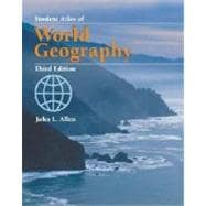
Student Atlas of World Geography

by
  • ISBN13:

    9780072828238

  • ISBN10:

    0072828234

  • Edition: 3rd
  • Format: Paperback
  • Copyright: 2002-08-28
  • Publisher: MCG
  • View Upgraded Edition
  • Purchase Benefits
  • Free Shipping Icon Free Shipping On Orders Over $35!
    Your order must be $35 or more to qualify for free economy shipping. Bulk sales, PO's, Marketplace items, eBooks and apparel do not qualify for this offer.
  • eCampus.com Logo Get Rewarded for Ordering Your Textbooks! Enroll Now
List Price: $27.00

Summary

The Student Atlas of World Geography combines full-color maps and data sets to introduce students to the importance of the connections between geography and other areas of study. The thematic atlas gives students a clear picture of the recent agricultural, industrial, demographic, environmental, economic, and political changes in every world region.

Table of Contents

Part I Global Physical Patterns

Map 1. World Countries

Map 2. World Physical

Map 3a. Average Annual Precipitation

Map 3b. Seasonal Average Precipitation¿November Through April

Map 3c. Seasonal Average Precipitation¿May Through October

Map 3d. Variation in Annual Precipitation

Map 4a. Temperature Regions and Ocean Currents

Map 4b. Average July Temperature

Map 4c. Average January Temperature

Map 5a. Atmospheric Pressure and Predominant Surface Winds¿January

Map 5b. Atmospheric Pressure and Predominant Surface Winds¿July

Map 6. World Climate Regions

Map 7. Vegetation Types

Map 8. World Soil Orders

Map 9. World Ecological Regions

Map 10. Plate Tectonics

Map 11. World Topography

Map 12a. World Resources: Mineral Fuels

Map 12b. World Resources: Critical Metals

Map 13. World Natural Hazards

Part II The Human Environment: Global Patterns

Map 14. World Population Density

Map 15. World Economic Activity

Map 16. World Urbanization

Map 17. World Transportation Patterns

Map 18. World Religions

Map 19. World Languages

Map 20. World External Migrations in Modern Times

Part III Global Demographic Patterns

Map 21. Population Growth Rates

Map 22. Total Fertility Rates

Map 23. Infant Mortality Rates

Map 24. Child Mortality Rates

Map 25. Average Life Expectancy at Birth

Map 26. Population by Age Group

Map 27. World Daily Per Capita Food Supply

Map 28. Illiteracy Rate

Map 29. Female/Male Inequality in Education and Employment

Map 30. Global Scourges: Major Infectious Diseases

Map 31. The Quality of Life: Human Development Index

Part IV Global Economic Patterns

Map 32. Rich and Poor Countries: Gross National Income

Map 33. Gross National Income Per Capita

Map 34. Economic Growth: GDP Change Per Capita

Map 35. Total Labor Force

Map 36. Employment by Sector

Map 37. Agricultural Production Per Capita

Map 38. Exports of Primary Products

Map 39. Dependence on Trade

Map 40. Global Flow of Investment Capital

Map 41. Central Government Expenditures Per Capita

Map 42. Purchasing Power Parity

Map 43. Energy Production

Map 44. Energy Consumption Per Capita

Part V Global Patterns of Environmental Disturbance

Map 45. Global Air Pollution: Sources and Wind Currents

Map 46. The Acid Deposition Problems: Air, Water, Soil

Map 47. Major Polluters and Common Pollutants

Map 48. Global Carbon Dioxide Emissions

Map 49. Potential Global Temperature Change

Map 50. World Water Resources: Availability of Renewable Water Per Capita

Map 51. World Water Resources: Annual Withdrawal Per Capita

Map 52. Pollution of the Oceans

Map 53. Food Supply from the World’s Marine and Freshwater Systems

Map 54. Changes in Cropland Per Capita, 1987–1997

Map 55. Annual Change in Forest Cover, 1990–1995

Map 56. The Loss of Biodiversity: Globally Threatened Animal Species

Map 57. The Loss of Biodiversity: Globally Threatened Plant Species

Map 58. Global Hotspots of Biodiversity

Map 59. The Risks of Desertification

Map 60. Global Soil Degradation

Map 61. Degree of Human Disturbance

Part VI Global Political Patterns

Map 62. Political Systems

Map 63. Sovereign States: Duration of Independence

Map 64. Post–Cold War International Alliances

Map 65. International Conflicts in the Post–World War II World

Map 66. International Terrorist Incidents, 2000

Map 67. The Political Geography of a Global Religion: The Islamic World

Map 68. Global Distribution of Minority Groups

Map 69. World Refugee Population

Part VII World Regions

Map 70. North America: Political

Map 71. North America: Physical

Map 72. North America: Thematic

Map 72a. Environment and Economy

Map 72b. Population Density

Map 72c. Population Distribution: Clustering

Map 73. Canada

Map 74. United States

Map 75. Middle America

Map 76. Caribbean

Map 77. South America: Political

Map 78. South America: Physical

Map 79. South America: Thematic

Map 79a. Environment and Economy

Map 79b. Population Density

Map 79c. Environmental Problems

Map 80. Northern South America

Map 81. Southern South America

Map 82. Europe: Political

Map 83. Europe: Physical

Map 84. Europe: Thematic

Map 84a. Environment and Economy

Map 84b. Population Density

Map 84c. Political Change in the 1990s

Map 85. Western Europe

Map 86. Eastern Europe

Map 87. Northern Europe

Map 88. Africa: Political

Map 89. Africa: Physical

Map 90. Africa: Thematic

Map 90a. Environment and Economy

Map 90b. Population Density

Map 90c. Colonial Patterns

Map 91. Northern Africa

Map 92. Southern Africa

Map 93. Asia: Political

Map 94. Asia: Physical

Map 95. Asia: Thematic

Map 95a. Environment and Economy

Map 95b. Population Density

Map 95c. Asia: Industrialization and Resources

Map 96. Northern Asia

Map 97. Southwestern Asia

Map 98. Southern Asia

Map 99. East Asia

Map 100. Southeast Asia

Map 101. Australasia: Political

Map 102. Australasia: Physical

Map 103. Australasia: Thematic

Map 103a. Environment and Economy

Map 103b. Population Density

Map 103c. Climatic Patterns

Map 104. The Pacific Rim

Map 105. The Atlantic Ocean

Map 106. The Indian Ocean

Map 107. The Arctic

Map 108. Antarctica

Part VIII

Tables

Table A. World Countries: Area, Population, Population Density, 2000

Table B. World Countries: Form of Government, Capital City, Major Languages

Table C. World Countries: Basic Economic Indicators, 1999

Table D. World Countries: Population Growth, 1950–2025

Table E. World Countries: Basic Demographic Data, 1975–2000

Table F. World Countries: Mortality, Health, and Nutrition, 1980–1999

Table G. World Countries: Education and Literacy, 1990–1999

Table H. World Countries: Agricultural Operations, 1996–2000

Table I. World Countries: Land Use and Deforestation, 1980–2000

Table J. World Countries: Energy Production and Consumption, 1980–1998

Table K. World Countries: Energy Efficiency and Emissions, 1980–1998

Table L. World Countries: Power and Transportation

Table M. World Countries: Communications, Information, and Science and Technology

Table N. World Countries: Water Resources

Table O. World Countries: Globally Threatened Plant and Animal Species

Part IX Geographic Index

Part IX Geographic Index

Supplemental Materials

What is included with this book?

The New copy of this book will include any supplemental materials advertised. Please check the title of the book to determine if it should include any access cards, study guides, lab manuals, CDs, etc.

The Used, Rental and eBook copies of this book are not guaranteed to include any supplemental materials. Typically, only the book itself is included. This is true even if the title states it includes any access cards, study guides, lab manuals, CDs, etc.

Rewards Program