did-you-know? rent-now

Amazon no longer offers textbook rentals. We do!

did-you-know? rent-now

Amazon no longer offers textbook rentals. We do!

We're the #1 textbook rental company. Let us show you why.

9781462516483

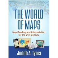
The World of Maps Map Reading and Interpretation for the 21st Century

by
  • ISBN13:

    9781462516483

  • ISBN10:

    1462516483

  • Format: Hardcover
  • Copyright: 2014-09-22
  • Publisher: The Guilford Press

Note: Supplemental materials are not guaranteed with Rental or Used book purchases.

Purchase Benefits

  • Free Shipping Icon Free Shipping On Orders Over $35!
    Your order must be $35 or more to qualify for free economy shipping. Bulk sales, PO's, Marketplace items, eBooks and apparel do not qualify for this offer.
  • eCampus.com Logo Get Rewarded for Ordering Your Textbooks! Enroll Now
List Price: $73.60 Save up to $31.65
  • Rent Book $41.95
    Add to Cart Free Shipping Icon Free Shipping

    TERM
    PRICE
    DUE
    USUALLY SHIPS IN 24-48 HOURS
    *This item is part of an exclusive publisher rental program and requires an additional convenience fee. This fee will be reflected in the shopping cart.

Supplemental Materials

What is included with this book?

Summary

Maps have power--they can instruct, make life easier, mislead, or even lie. This engaging text provides the tools to read, analyze, and use any kind of map and assess its strengths and weaknesses. Requiring no advanced math skills, the book presents basic concepts of symbolization, scale, coordinate systems, and projections. It gives students a deeper understanding of the types of maps they encounter every day, from turn-by-turn driving directions to the TV weather report. Readers also learn how to use multiple maps and imagery to analyze an area or region. The book includes 168 figures, among them 22 color plates; most of the figures can be downloaded as PowerPoint slides from the companion website. Appendices contain a glossary, recommended resources, a table of commonly used projections, and more.
Author Biography

Judith A. Tyner, PhD, is Professor Emerita of Geography at California State University, Long Beach. She taught in the Geography Department for over 35 years, where she served as Department Chair for 6 years and as Director of the Cartography/GIS Certificate Program from its inception (1980) until her retirement. While at California State Dr. Tyner taught beginning and advanced cartography, map reading and interpretation, history of cartography, and remote sensing. She is a member of the Association of American Geographers, the North American Cartographic Information Society, the Cartography and Geographic Information Society, and the California Map Society. She is the author of several textbooks, including Principles of Map Design, and over 30 articles.

Table of Contents

I. Map Reading Basics
1. Introduction: The Importance of Map Reading
2. Landmarks of Mapmaking
3. Map Basics
4. The Figure of the Earth and Coordinate Systems
5. Map Projections: The Round Earth on Flat Paper
6. The Earth from Above: Remote Sensing and Image Interpretation
II. Map Types and Their Analysis
7. Virtual Maps and GPS
8. Topographic Maps
9. Thematic Maps
10. Maps for Navigation
11. Maps for Special Purposes
III. Putting It All Together
12. Map Interpretation
13. Epilogue: The Future of Maps and Map Reading
Appendix A. Glossary
Appendix B. Abbreviations
Appendix C. Useful Figures
Appendix D. Resources
Appendix E. Commonly Used Projections
Bibliography

Supplemental Materials

What is included with this book?

The New copy of this book will include any supplemental materials advertised. Please check the title of the book to determine if it should include any access cards, study guides, lab manuals, CDs, etc.

The Used, Rental and eBook copies of this book are not guaranteed to include any supplemental materials. Typically, only the book itself is included. This is true even if the title states it includes any access cards, study guides, lab manuals, CDs, etc.

Rewards Program