did-you-know? rent-now

Amazon no longer offers textbook rentals. We do!

did-you-know? rent-now

Amazon no longer offers textbook rentals. We do!

We're the #1 textbook rental company. Let us show you why.

9781878867483

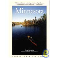
Compass American Guides Minnesota

by ; ;
  • ISBN13:

    9781878867483

  • ISBN10:

    1878867482

  • Format: Paperback
  • Copyright: 1997-05-01
  • Publisher: Fodors Travel Pubns
  • View Upgraded Edition
  • Purchase Benefits
  • Free Shipping Icon Free Shipping On Orders Over $35!
    Your order must be $35 or more to qualify for free economy shipping. Bulk sales, PO's, Marketplace items, eBooks and apparel do not qualify for this offer.
  • eCampus.com Logo Get Rewarded for Ordering Your Textbooks! Enroll Now
List Price: $18.95

Summary

Created by local writers and photographers, Compass American Guides are the ultimate insider's guides, providing in-depth coverage of the history, culture, and character of America's most spectacular destinations. Covering everything there is to see and do as well as choice lodging and dining, these gorgeous full-color guides are perfect for new and longtime residents as well as vacationers who want a deep understanding of the region they're visiting. Outstanding color photography, plus a wealth of archival images Topical essays and literary extracts Detailed color maps Great ideas for things to see and do Capsule reviews of hotels and restaurants

Table of Contents

Introduction
History
Wisconsin Ice Ages Ancient Indian Cultures
Modern Indian Tribes
French Arrive
British Inherit
Yankees in Wisconsin
Growing State
Changing Population
Modern Times Seasons Of The State
Fox Valley and Door Peninsula
Upper Fox River and Country Towns
Portage
Montello Princeton
Green Lake Ripon Berlin Wolf River Valley Tigerton and Posse Comitatus Shawano
Historic and Industrial Cities Oshkosh
Appleton and the Lower Fox Joe McCarthy Land Green Bay Door Peninsula
Southeast Wisconsin Settling the Southeast Manitowoc Sheboygan and Kohler Kohler Industrial Empire Road America and Bratwurst Northern Kettle Moraine
Horicon Marsh Port Washington to Hartford West Bend Cedar Creek Settlement Hartford
Holy Hill
Waukesha County and Lakes Southern Kettle Moraine
Watertown, Rock River Drainage Aztalan
Jefferson Fort Atkinson Cambridge and Rockdale
Lake Koshkonong Yahara River Valley
Stoughton
Lower Rock River Valley
Southeast Lake District
Kingdom of Voree East Troy Racine and Kenosha Milwaukee Early History Enter the United States
Immigrant Era Politics and Parks Lay of the Land
East Side Prospect Avenue Gold Coast Kilbourntown and Western Milwaukee
South Side
Table of Contents provided by Publisher. All Rights Reserved.

Supplemental Materials

What is included with this book?

The New copy of this book will include any supplemental materials advertised. Please check the title of the book to determine if it should include any access cards, study guides, lab manuals, CDs, etc.

The Used, Rental and eBook copies of this book are not guaranteed to include any supplemental materials. Typically, only the book itself is included. This is true even if the title states it includes any access cards, study guides, lab manuals, CDs, etc.

Excerpts

LANDSCAPE AND HISTORY

In Northern Minnesota, somewhere north of Hibbing in a forest of conifers and aspen near County Road 5, lies a spot at once prosaic and remarkable.  Here, at a point unmarked and for practical purposes inexact, a falling raindrop has an equal chance of draining east through a maze of tributaries to the Great Lakes and the Atlantic Ocean, north to Hudson bay, or south down the Mississippi to the Gulf of Mexico.  Because of this confluence of major divides, historian William E. Lass calls Minnesota "mother of three seas."  I've never heard the phrase elsewhere, even though I'm a life-long Minnesotan.  But we'd do well to adopt it.  It's a beautiful metaphor and symbolizes as well as anything the crossroads of geology, geography, landscapes, people, and cultures that make Minnesota the diverse state that it is today.


OVERVIEW

Minnesota's deep woods, thousands of lakes, picturesque farmland, and progressive cities attract visitors who want to enjoy a convival urban environment or the state's natural beauty and -- secretly, perhaps -- to brave the extremes of its climate.  Though it boasts no mountains, Minnesota stands as a subtle topographical divide, each region distinct.

Prairie Path of the Southwest and Red River Valley

Once a seemingly endless grassland roamed by bison and Dakotas on horseback; the Southwest is now Minnesota's richest farmland.  Historic towns, monuments, and parks tell the tales of pioneers and their efforts to homestead on the prairie.


Southeastern Hills and Mississippi River

Passed over by the last ice age, southeastern Minnesota is carved by deep river valleys.  Picturesque towns from the 1800s sit in the shadows of limestone bluffs.  Quick waters provide trout fishing and pleasant canoe trips.  Trails and country roads make for pleasant bike routes.


Minneapolis

Look to Minneapolis for its hustle and bustle, big business, and lively nightlife.  Stroll the city's many lakeside parks or tour the remnants of its milling days.  This is truly one of America's most "civilized" cities -- friendly, safe, and clean.


St. Paul

Born of the trade and exploration along the Mississippi River, Minneapolis and St. Paul grew up as rivals, each with its own character and sense of itself.  Visit St. Paul, the state's capital, for historic sites such as the Landmark Center and the James J. Hill House, and for Victorian neighborhoods, intimate old bars, and ethnic restaurants.


St. Croix River Valley

Once the heart of Minnesota's white-pine logging industry, the St. Croix River Valley is today known for its natural beauty.  The river was one of the nation's first designated wild and scenic rivers.  Towns such as Stillwater and Taylors Falls are among the state's oldest and most picturesque.


North Shore and the Arrowhead

Lake Superior has a powerful presence.  People visit the rugged North Shore for the crashing surf, tumultuous streams and waterfalls, and brilliant fall color.  In the arrowhead-shaped tip of northeastern Minnesota lie the famous Boundary Waters Canoe Area Wilderness and the Mesabi Range, which provided the iron that built early 20th-century America.


Northern Reaches

This is bog country where the landscape consists of vast, wet flatlands.  The Northwest Angle, the Northernmost point of the contiguous United States, juts into the enormous Lake of the Woods -- a sportsman's paradise.

Glacial Lakes

When Minnesotans want to get away they "go to the lake," often a cabin tucked away among central Minnesota's glacial hills and sparkling lakes.  The region caters to folks on vacation, whether they fish, ride bikes, or play golf.  Of historic interest is the headwaters of the Mississippi River.


Excerpted from Minnesota by Compass American Staff, Greg Breining
All rights reserved by the original copyright owners. Excerpts are provided for display purposes only and may not be reproduced, reprinted or distributed without the written permission of the publisher.

Rewards Program