rent-now

Rent More, Save More! Use code: ECRENTAL

5% off 1 book, 7% off 2 books, 10% off 3+ books

9781667821450

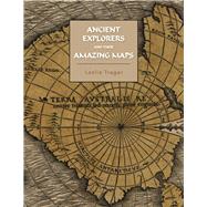
Ancient Explorers and Their Amazing Maps

by
  • ISBN13:

    9781667821450

  • ISBN10:

    1667821458

  • Format: Paperback
  • Copyright: 2022-05-18
  • Publisher: BookBaby
  • Purchase Benefits
  • Free Shipping Icon Free Shipping On Orders Over $35!
    Your order must be $35 or more to qualify for free economy shipping. Bulk sales, PO's, Marketplace items, eBooks and apparel do not qualify for this offer.
  • eCampus.com Logo Get Rewarded for Ordering Your Textbooks! Enroll Now
List Price: $58.67 Save up to $0.06
  • Buy New
    $58.61
    Add to Cart Free Shipping Icon Free Shipping

    PRINT ON DEMAND: 2-4 WEEKS. THIS ITEM CANNOT BE CANCELLED OR RETURNED.

Summary

This book analyses western maps made between the 13th to 17th centuries and shows them to be copies of maps made by ancient explorers going back as far as 5000 years. Thirteenth through fifteenth century Portolan Charts of the Mediterranean Sea, Black Sea and the Atlantic coasts of Europe and North Africa reflect geography going back 5000 years and are as accurate as a Mercator Projection. Sixteenth and seventh century maps of North America, South America, Greenland, and Antarctica are found to be copies of maps surveyed about 3700 years ago. Because the maps of Northern Greenland and Antarctica show their coasts very accurately and ice free, the book examines the temperature data for these areas and finds that there was sufficient warmth at that time to allow such coastal melting of the glaciers to have occurred. This finding indicates that present warming climate change is likely to melt these glacier faster than currently anticipated. The book discusses the technology available to the ancient explorers which allowed them to make such accurate maps and suggests civilizations as candidates responsible for creating them.

Author Biography

Leslie Trager is a retired lawyer, whose hobby is studying early western maps. He has previously published: Henry Hudson- Cree History and Ancient Maps. His articles include: Mysterious Mapmakers, Exploring the Impossibly Accurate 16th Century Maps of Antarctica and Greenland, Explorers Journal, Winter 2006/07, and Isostatic Rebound in Lower James Bay and Locating Thomas James' and Henry Hudson's Camps. He is a member of the Explorers Club, the New York Map Society and the Washington, DC Map Society.

Supplemental Materials

What is included with this book?

The New copy of this book will include any supplemental materials advertised. Please check the title of the book to determine if it should include any access cards, study guides, lab manuals, CDs, etc.

The Used, Rental and eBook copies of this book are not guaranteed to include any supplemental materials. Typically, only the book itself is included. This is true even if the title states it includes any access cards, study guides, lab manuals, CDs, etc.

Rewards Program