did-you-know? rent-now

Amazon no longer offers textbook rentals. We do!

did-you-know? rent-now

Amazon no longer offers textbook rentals. We do!

We're the #1 textbook rental company. Let us show you why.

9781589480742

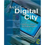
ArcGIS and the Digital City : A Hands-On Approach for Local Government

by
  • ISBN13:

    9781589480742

  • ISBN10:

    1589480740

  • Format: Paperback
  • Copyright: 2004-04-01
  • Publisher: Esri Pr
  • Purchase Benefits
  • Free Shipping Icon Free Shipping On Orders Over $35!
    Your order must be $35 or more to qualify for free economy shipping. Bulk sales, PO's, Marketplace items, eBooks and apparel do not qualify for this offer.
  • eCampus.com Logo Get Rewarded for Ordering Your Textbooks! Enroll Now
List Price: $59.95

Summary

Both a textbook for GIS classes in urban planning and a workbook for local governments, this book shows how to do real tasks that are required when a city decides to go digital and use geographic information systems (GIS) to store and access information. With this book, planners, analysts, and other local government staff use data from a real city to perform tasks such as creating buildings and parcels, setting coordinate systems, and building geodatabase topology. After creating a geodatabase, working with attribute data, and geocoding data, planners will be able to perform spatial analysis to find possible drug houses near playgrounds, find buildable vacant lots, produce land use reports, and more.

Author Biography

Eric M. Fowler teaches GIS at the University of Wisconsin-Milwaukee.

Table of Contents

Acknowledgments vii
Introduction ix
Creating a geodatabase
1(104)
Examine the existing Arc City data
5(8)
Create the Arc City geodatabase and import CAD data
13(20)
Create separate parcel and building feature classes
33(13)
Correct digitizing errors and create a topology
46(13)
Create parcel polygon features
59(8)
Find and fix errors in parcel polygon features
67(17)
Create building polygon features
84(10)
Create block features
94(9)
Review and clean up the database
103(2)
Using and geocoding attribute data
105(50)
Join tax assessment data to parcel features
108(6)
Add census data to the blocks
114(7)
Create districts from blocks
121(10)
Calculate sales values
131(5)
Query attribute files
136(13)
Geocode parcels with blocks and districts
149(6)
Reporting and performing spatial analysis
155(92)
Produce the Arc City land-use report
162(28)
Produce the Arc City residential density report
190(8)
Produce the floodplain report and map
198(23)
Produce the mosquito analysis and report
221(10)
Find possible drug houses near playgrounds
231(16)
Updating spatial and attribute data
247(48)
Convert CAD drawing of Weil addition to a geodatabase feature class
251(17)
Update the Arc City parcel data with new parcels in the Weil addition
268(27)
Conclusion 295(6)
References 301(2)
How to install data from the CD 303

Supplemental Materials

What is included with this book?

The New copy of this book will include any supplemental materials advertised. Please check the title of the book to determine if it should include any access cards, study guides, lab manuals, CDs, etc.

The Used, Rental and eBook copies of this book are not guaranteed to include any supplemental materials. Typically, only the book itself is included. This is true even if the title states it includes any access cards, study guides, lab manuals, CDs, etc.

Rewards Program