did-you-know? rent-now

Amazon no longer offers textbook rentals. We do!

did-you-know? rent-now

Amazon no longer offers textbook rentals. We do!

We're the #1 textbook rental company. Let us show you why.

9780415306638

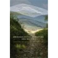
Archaeological Surveying and Mapping: Recording and Depicting the Landscape

by ;
  • ISBN13:

    9780415306638

  • ISBN10:

    0415306639

  • Edition: 1st
  • Format: Nonspecific Binding
  • Copyright: 2007-02-26
  • Publisher: Routledge

Note: Supplemental materials are not guaranteed with Rental or Used book purchases.

Purchase Benefits

  • Free Shipping Icon Free Shipping On Orders Over $35!
    Your order must be $35 or more to qualify for free economy shipping. Bulk sales, PO's, Marketplace items, eBooks and apparel do not qualify for this offer.
  • eCampus.com Logo Get Rewarded for Ordering Your Textbooks! Enroll Now
List Price: $54.95 Save up to $20.94
  • Rent Book $38.46
    Add to Cart Free Shipping Icon Free Shipping

    TERM
    PRICE
    DUE
    USUALLY SHIPS IN 3-5 BUSINESS DAYS
    *This item is part of an exclusive publisher rental program and requires an additional convenience fee. This fee will be reflected in the shopping cart.

Supplemental Materials

What is included with this book?

Summary

A comprehensive and practical guide to surveying for archaeologists, with clear instructions in how to record their field work effectively, archaeological mapping and detailed case studies from the UK, Europe and the US.

Author Biography

Phil Howard is currently employed at Durham University, where he specialises in surveying, geophysical prospection, geographic information systems and archaeological computing

Table of Contents

List of illustrationsp. vi
The science and profession of surveyingp. 1
The aims of an archaeological surveyp. 7
Basic methods of surveyingp. 12
Control surveyingp. 27
Application of surveying instrumentsp. 59
Surveying on a global scalep. 73
Using CAD softwarep. 85
GIS in archaeological mappingp. 108
The shape of the groundp. 126
Sources of digital map datap. 135
The Butter Market, Barnard Castle, County Durhamp. 149
The Boeotia field survey projectp. 168
A survey of an earthwork feature on Cockfield Fell, County Durhamp. 178
Durham Cityp. 228
Terrain model of Lomellop. 237
Sandoval County, New Mexicop. 264
Bibliographyp. 286
Indexp. 289
Table of Contents provided by Ingram. All Rights Reserved.

Supplemental Materials

What is included with this book?

The New copy of this book will include any supplemental materials advertised. Please check the title of the book to determine if it should include any access cards, study guides, lab manuals, CDs, etc.

The Used, Rental and eBook copies of this book are not guaranteed to include any supplemental materials. Typically, only the book itself is included. This is true even if the title states it includes any access cards, study guides, lab manuals, CDs, etc.

Rewards Program