did-you-know? rent-now

Amazon no longer offers textbook rentals. We do!

did-you-know? rent-now

Amazon no longer offers textbook rentals. We do!

We're the #1 textbook rental company. Let us show you why.

9781573420471

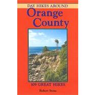
Day Hikes Around Orange County

by
  • ISBN13:

    9781573420471

  • ISBN10:

    1573420476

  • Edition: 1st
  • Format: Paperback
  • Copyright: 2005-04-01
  • Publisher: Day Hike Books
  • Purchase Benefits
  • Free Shipping Icon Free Shipping On Orders Over $35!
    Your order must be $35 or more to qualify for free economy shipping. Bulk sales, PO's, Marketplace items, eBooks and apparel do not qualify for this offer.
  • eCampus.com Logo Get Rewarded for Ordering Your Textbooks! Enroll Now
List Price: $15.95

Summary

Orange County invites exploration! This southern California county is framed by the Pacific Coast on one side while the Santa Ana Mountains run along its backside, offering incredibly diverse landscape and scenery. Despite the presence of the Orange County metropolis, nearly 30% of the county's acreage is parklands, wildlife sanctuaries, national forests, and wilderness preserves.Day Hikes Around Orange Countyis a comprehensive guide to 108 day hikes in and around the county, providing access to these natural, undeveloped areas and hundreds of miles of hiking trails, from the dramatic coastline to the interior mountains and valleys. Residents and travelers will find this 256-page book an essential guide to exploring Orange County. Highlights include magnificent rock formations, bay-side coves and caves, eroding sandstone cliffs, marine terraces, tidal estuaries, peninsulas, mountain peaks, waterfalls, ridge walks, weather-sculpted canyons, old ranch roads, historical ruins, large public parks, and sweeping views from the ocean to the cities. Each hike includes a detailed map, accurate driving and hiking directions, distance/time/elevation statistics, a list of relevant maps, and summaries to help hikers find a trail appropriate to their ability and desire. Larger overall maps show the hike locations in the greater metropolitan area. All hikes can be completed during the day, and a range of difficulty levels is included. (Map sources and references are included for extending the hikes). Companion hiking guides in the Day Hike Books series includeDay Hikes On The California Southern Coast, Day Hikes Around Los Angeles, andDay Hikes Around Ventura County.

Author Biography

For more than a decade, veteran hiker Robert Stone has been writer, photographer, and publisher of Day Hike Books. Robert has hiked every trail in the Day Hike Book series. With twenty-one hiking guides in the series, many in their second, third, and fourth editions, he has hiked over a thousand trails throughout the western United States and Hawaii. When not hiking, he is researching, writing, and mapping the hikes before returning to the trails. An active member of the Outdoor Writers Association of California and a Los Angeles Times Best Selling Author, he resides summers in the Rocky Mountains of Montana and winters on the California Central Coast.

Table of Contents

About the Hikes and Orange County 10(2)
MAP OF THE HIKES 12(2)
THE HIKES
Palos Verdes Peninsula • Long Beach • Belmont Shore (Los Angeles County)
PALOS VERDES TO CORONA DEL MAR MAP (Hikes 1-15)
14(32)
1. Long Point (Marineland)
16(2)
2. Abalone Cove and Portuguese Point
18(2)
3. Crenshaw Extension Trail and Portuguese Bend Overlook
20(2)
4. South Coast Botanic Garden
22(2)
5. White Point to Point Fermin
24(2)
6. Sunken City
26(2)
7. Long Beach Oceanfront Trail
28(2)
8. Belmont Pier to Alamitos Bay Channel
30(2)
9. El Dorado Nature Center-El Dorado Park
32
Huntington Beach • Costa Mesa • Newport Beach • Corona Del Mar
10. Bolsa Chica Ecological Reserve
34(2)
11. Huntington Beach • Bluff Top Park Bolsa Chica State Beach to Huntington Pier
36(2)
12. Newport Beach • Balboa Peninsula Newport Pier to West Jetty View Park
38(2)
13. Corona Del Mar State Beach
40(2)
14. Upper Newport Bay Ecological Reserve North Corridor from Interpretive Center
42(2)
15. Back Bay Drive Upper Newport Bay Ecological Reserve
44(2)
Laguna Beach • South Laguna • Laguna Niguel • Laguna Hills • Laguna Woods • Aliso Viejo
NEWPORT BEACH TO SAN CLEMENTE MAP (Hikes 16-45)
46(64)
16. Crystal Cove Oceanfront Bluffs Crystal Cove State Park
48(1)
17. No Name Ridge-Ticketron-Redtail Ridge Loop Crystal Cove State Park
49(5)
18. El Moro Canyon-Slow N' Easy Loop Crystal Cove State Park
54(2)
19. Emerald Bay Overlook Crystal Cove State Park
56(1)
20. El Moro Canyon-Moro Ridge Loop Crystal Cove State Park
57(3)
21. Big Bend-Bommer Ridge-Laguna Ridge Loop Laguna Coast Wilderness Park
60(1)
22. Emerald Canyon-Bommer Ridge Loop Laguna Coast Wilderness Park
61(3)
23. Laurel Canyon-Willow Canyon Loop Laguna Coast Wilderness Park
64(2)
24. Barbara's Lake Loop James Dilley Greenbelt Preserve
66(2)
25. Laguna Beach Bluffs and Heisler Park Crescent Bay Point Park to Main Beach
68(2)
26. Carolyn Wood View Knoll from Temple Hill
70(2)
27. West Ridge-Rock-It-Mathis Canyon Loop Aliso and Wood Canyons Wilderness Park
72(1)
28. West Ridge-Wood Canyon-Rock-It Loop Aliso and Wood Canyons Wilderness Park
73(2)
29. Aliso Canyon and Wood Canyon Aliso and Wood Canyons Wilderness Park
75(3)
30. Aliso Summit Trail Aliso and Wood Canyons Wilderness Park
78(1)
31. Aliso Peak Trail from Seaview Park Aliso and Wood Canyons Wilderness Park
79(3)
32. Seaview Trail and Badlands Trail from Badlands Park
82(2)
33. South Laguna Ridge Trail to Aliso Peak Aliso and Wood Canyons Wilderness Park
84(2)
34. Valido and Toovet Trails to Aliso Peak Aliso and Wood Canyons Wilderness Park
86(2)
35. Sulphur Creek Reservoir Loop Laguna Niguel Regional Park
88(2)
Dana Point • San Juan Capistrano • San Clemente
36. Salt Creek Beach Park
90(2)
37. Salt Creek Trail
92(2)
38. Dana Point Harbor
94(2)
39. Hide "Blufftop" Trail-Dana Point Bluffs
96(2)
40. Heritage Park
98(2)
41. Doheny State Beach • Capistrano Beach Park
100(2)
42. Rancho San Clemente Ridgeline Trail
102(2)
43. San Clemente State Beach to San Mateo Point
104(1)
44. Trestles Beach-San Onofre State Beach North
105(3)
45. San Onofre Bluffs-San Onofre State Beach South
108(2)
Brea • Yorba Linda • Chino Hills
CHINO HILLS STATE PARK MAP (Hikes 46-57)
110(50)
46. Carbon Canyon Creek Nature Trail Carbon Canyon Regional Park
112(2)
47. Gilman Peak-Chino Hills State Park
114(1)
48. North Ridge-Telegraph Canyon Loop Chino Hills State Park
115(3)
49. South Ridge-Telegraph Canyon Loop (west) Chino Hills State Park
118(1)
50. San Juan Hills from Rim Crest Drive Chino Hills State Park
119(3)
51. Upper Aliso Canyon Loop-Chino Hills State Park
122(1)
52. Upper Aliso Canyon-Raptor Ridge Loop Chino Hills State Park
123(3)
53. Hills for Everyone-Four Corners-Telegraph Canyon Loop Chino Hills State Park
126(1)
54. Telegraph Canyon-South Ridge Loop to San Juan Hill
127(3)
55. Skully Ridge-Lower Aliso Canyon Loop Chino Hills State Park
130(1)
56. Water Canyon-Chino Hills State Park
131(3)
57. McLean Overlook-Chino Hills State Park
134(2)
Anaheim • Anaheim Hills • Orange • Tustin
58. Yorba Regional Park
136(2)
59. Oak Canyon Nature Trail
138(2)
60. Santiago Creek-Wilderness Loop Trails Santiago Oaks Regional Park
140(1)
61. Windes Nature Trail and Pacifica Loop Santiago Oaks Regional Park
141(3)
62. Oak-Anaheim Hills Trail to Robber's Peak Santiago Oaks Regional Park
144(2)
63. Anaheim Hills Trail-Serrano Avenue Loop Santiago Oaks Regional Park
146(1)
64. Weir Canyon Loop-Weir Canyon Wilderness Park
147(3)
65. Puma Ridge-Horseshoe Loop Irvine Regional Park
150(1)
66. Horseshoe-Santiago Creek Loop Irvine Regional Park
151(1)
67. Roadrunner Loop-Irvine Regional Park
152(4)
68. Lake View Trail-Peters Canyon Regional Park
156(1)
69. Peters Canyon-East Ridge View Loop Peters Canyon Regional Park
157(3)
Lake Forest • Foothill Ranch • Mission Viejo • Rancho Santa Margarita • Coto de Caza
70. Borrego Canyon to Vista Look Out Limestone Canyon-Whiting Ranch Wilderness Park
160(1)
71. Borrego Canyon and Red Rock Canyon Limestone Canyon-Whiting Ranch Wilderness Park
161(1)
72. Serrano Canyon-Sleepy Hollow-Dreaded Hill Loop Limestone Canyon-Whiting Ranch Wilderness Park
162(4)
73. Live Oak Trail to Vista Point-O'Neill Regional Park
166(1)
74. Edna Spaulding Nature Trail-O'Neill Regional Park
167(3)
75. Arroyo Trabuco Trail-O'Neill Regional Park
170(2)
O'NEILL REGIONAL PARK MAP (Hikes 73-75)
172(4)
76. Wagon Wheel Canyon-Pheasant Run-Oak Canyon Loop General Thomas F. Riley Wilderness Park
174(2)
Santa Ana Mountains from Santiago Canyon Road Silverado • Modjeska • Trabuco Canyon
SANTIAGO CANYON ROAD MAP (Hikes 77-85)
176(20)
77. Black Star Canyon
178(1)
78. Silverado Trail to Overlook-Silverado Canyon
179(3)
79. Silverado Trail to Bedford Peak-Silverado Canyon
182(2)
80. Harding Road to Santiago Canyon Viewpoint-Modjeska Canyon
184(1)
81. Harding Road to Harding Canyon Overlook and Laurel Spring Modjeska Canyon
185(1)
82. Santiago Trail-Modjeska Grade to Vulture Crags
186(4)
83. Holy Jim Falls-Holy Jim Canyon
190(1)
84. Trabuco Canyon to West Horsethief Trail
191(1)
85. Trabuco Canyon-West Horsethief Loop
192(4)
Caspers Wilderness Park
CASPERS WILDERNESS PARK MAP (Hikes 86-92)
196(16)
86. Juaneno-San Juan Creek Loop
198(1)
87. East Ridge-Sun Rise-Bell Canyon Loop
199(3)
88. Pinhead Peak Trail
202(2)
89. Bell Canyon-Oso-Cougar Pass Loop
204(1)
90. Bell Canyon-Oso-East Ridge-Quail Run Loop
205(3)
91. Bell Canyon-Star Rise-Oak Trail Loop
208(1)
92. West Ridge-Oak Trail Loop
209(3)
Ortega Highway Corridor
ORTEGA HIGHWAY MAP (Hikes 93-101)
212(22)
93. Bear Canyon-Bear Ridge Loop
214(2)
94. San Juan Loop
216(2)
95. Lower Chiquito Trail to the Lion Canyon Overlook
218(1)
96. Upper Chiquito Trail into Lion Canyon
219(3)
97. Viejo Tie Trail
222(2)
98. Upper Hot Spring Canyon to Falls
224(1)
99. Los Pinos Peak from North Main Divide Road
225(3)
100. El Cariso Nature Trail
228(1)
101. Morgan Trail
229
Santa Ana Mountains from Riverside County • Wildomar • Murrieta • Temecula
102. Tenaja Falls-San Mateo Canyon Wilderness
232(1)
103. San Mateo Canyon-Fisherman's Camp Loop San Mateo Canyon Wilderness
233(1)
104. Tenaja Trail-Fisherman's Camp Loop San Mateo Canyon Wilderness
234(2)
SAN MATEO CANYON WILDERNSS MAP (Hikes 93 • 101-104)
236(2)
SANTA ROSA PLATEAU ECOLOGICAL RESERVE MAP (Hikes 105-109)
238(1)
105. Vernal Pools and Historic Adobes Loop
240(1)
106. Coyote-Oak Tree Loop
241(1)
107. Tovashal-Sylvan Meadows-Torino Loop
244(1)
108. Granite-Vista Grande-Waterline Loop
246(1)
109. Wiashal Trail Loop to Cole Canyon
248(2)
Companion Guides 250(3)
Index 253

Supplemental Materials

What is included with this book?

The New copy of this book will include any supplemental materials advertised. Please check the title of the book to determine if it should include any access cards, study guides, lab manuals, CDs, etc.

The Used, Rental and eBook copies of this book are not guaranteed to include any supplemental materials. Typically, only the book itself is included. This is true even if the title states it includes any access cards, study guides, lab manuals, CDs, etc.

Excerpts

Hike 27, West Ridge--Mathis Canyon Loop in Aliso and Wood Canyons Wilderness Park. . "From Laguna Beach, the San Joaquin Hills rise abruptly from the sea to an elevation over 1,000 feet. Large undeveloped areas have been preserved as public parks and wilderness land, with an extensive network of hiking, mountain biking, and equestrian trails. One of these treasures, Aliso and Wood Canyons Wilderness Park, spreads across 4,000 acres and includes more than 30 miles of trails. The park has massive sandstone formations, several forested canyons, two year-round streams, lush riparian vegetation, oaks, elderberries, sycamores, and native grasslands. This hike begins from the Top of the World trailhead on Temple Hill, the highest point in the park at 1,036 feet. The awesome bird's-eye views extend across the Pacific Ocean and into Laguna and Wood Canyons. The undulating path follows a ridge separating the canyons and drops into the upper end of Wood Canyon, shaded by ancient oaks and sycamores."

Excerpted from Day Hikes Around Orange County by Robert Stone
All rights reserved by the original copyright owners. Excerpts are provided for display purposes only and may not be reproduced, reprinted or distributed without the written permission of the publisher.

Rewards Program