did-you-know? rent-now

Amazon no longer offers textbook rentals. We do!

did-you-know? rent-now

Amazon no longer offers textbook rentals. We do!

We're the #1 textbook rental company. Let us show you why.

9780897325684

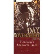
Day and Overnight Hikes: Kentucky's Sheltowee Trace

by
  • ISBN13:

    9780897325684

  • ISBN10:

    0897325680

  • Format: Paperback
  • Copyright: 2004-09-01
  • Publisher: Menasha Ridge Pr
  • Purchase Benefits
  • Free Shipping Icon Free Shipping On Orders Over $35!
    Your order must be $35 or more to qualify for free economy shipping. Bulk sales, PO's, Marketplace items, eBooks and apparel do not qualify for this offer.
  • eCampus.com Logo Get Rewarded for Ordering Your Textbooks! Enroll Now
List Price: $16.95
We're Sorry.
No Options Available at This Time.

Summary

This book details the 282 miles of Kentucky's master path, the Sheltowee Trace, from the trail's southern terminus in Tennessee's Pickett State Park, north through the Big South Fork National River and Recreation Area and on through the length of the Daniel Boone National Forest nearly to the state of Ohio.
Author Biography

Johnny Molloy is an outdoor writer based in Tennessee. He has averaged over 100 nights in the wild per year since the early 1980's, backpacking and canoe camping throughout our country. He has written numerous books covering much of the U.S. from Florida to Wisconsin to Colorado and articles for magazines and Web sites.

Table of Contents

(1) Introduction (2) Southern Terminus to Yamacraw (3) Yamacraw to Cumberland Falls (4) Cumberland Falls to Billows (5) Billows to South Tree (6) South Tree to Turkey Foot (7) Turkey Foot to Kentucky River (8) Kentucky River to Red River Gorge (9) Red River Gorge to Cave Run Lake (10) Cave Run Lake to Northern Terminus

Supplemental Materials

What is included with this book?

The New copy of this book will include any supplemental materials advertised. Please check the title of the book to determine if it should include any access cards, study guides, lab manuals, CDs, etc.

The Used, Rental and eBook copies of this book are not guaranteed to include any supplemental materials. Typically, only the book itself is included. This is true even if the title states it includes any access cards, study guides, lab manuals, CDs, etc.

Excerpts

Sheltowee Trace, Southern Terminus to Yamacraw

Length: 29.6 miles
Trail Condition: Fair to good
Highs: Waterfalls, arches, rock shelters, old homesites, old mines
Lows: Potentially overgrown trail, major ford of Rock Creek
Difficulty: Moderate
Use: Moderate
Tips: Plan campsites between dry ridge walks
Established Campsites: 2.6, 3.5, 5.6, 7.6, 11.5, 19.6, 22.8, 27.2 miles
Potential Campsites: 13.9, 22.5 miles

Pickett State Park Trailhead:
From Jamestown, TN, take US 127 north for 2 miles to TN 154. Turn right on TN 154 and follow it for 10 miles. The park entrance will be on your left. Go to ranger station at park entrance for parking instructions. STT starts .25 mile north of park entrance on TN 154. You can also call ahead for parking instructions at (931) 879-5821.

Yamacraw Trailhead:
From Whitley City, KY, take US 27 south a short distance to KY 92. Turn right, and head west on KY 92 for 5.6 miles to the Yamacraw Bridge. Cross over to the west side of the bridge and turn left onto KY 1363 and immediately turn left again to the Yamacraw River Access of the Big South Fork National River.

This section of the Trace offers spectacular natural features amid an everywhere-you-look beauty. The very beginning of the entire trail, at Pickett State Park, starts with a bang. Within one mile, the Sheltowee Trace (ST) passes a waterfall, an arch, and a rockhouse, making its way through the Hidden Passage, the namesake of the path with which the Trace shares treadway along Thompson Creek. The scenery continues with a walk along a cliff line above Thompson Creek, offering rocky vistas, before dropping to Rock Creek near the boundary of the Big South Fork National River and Recreation Area (BSF). From here, the Trace trails Rock Creek into the Daniel Boone National Forest. Once in the Daniel Boone, Rock Creek becomes a designated Kentucky Wild River, very deserving of its status. Big boulders crowd the stream between deep pools while noisy shoals course beneath a cathedralesque forest.

Excerpted from Day and Overnight Hikes: Kentucky's Sheltowee Trace by Johnny Molloy
All rights reserved by the original copyright owners. Excerpts are provided for display purposes only and may not be reproduced, reprinted or distributed without the written permission of the publisher.

Rewards Program