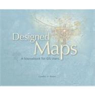
What is included with this book?
| Reference Maps Topographic | p. 1 |
| Redesigns: USGS Digital Topographic Map | p. 2 |
| USGS Topographic Maps, 1980 and 1990 | p. 6 |
| Netherlands Topographic Map | p. 8 |
| Swiss Topographic Map | p. 10 |
| Cordillera Huayhuash Climber's Map | p. 12 |
| Central Oregon Protection District Map | p. 14 |
| Two Koreas Reference Map | p. 16 |
| Kyrgyzstan Reference Map | p. 18 |
| United States Physical Map | p. 20 |
| Arctic Conservation Area Map | p. 22 |
| Reference Maps Navigation | p. 23 |
| Redesigns: Spokane Road Map | p. 24 |
| Oahu Bus Map | p. 28 |
| Fairfax Bus Ridership Analysis Map | p. 30 |
| Toronto City Map | p. 32 |
| Paris City Map | p. 34 |
| Spain City Maps | p. 36 |
| Spain Road Maps at two Scales | p. 38 |
| Oregon Road Map | p. 41 |
| Washington, D.C., Vicinity Map | p. 44 |
| Norwegian Aeronautical Chart | p. 46 |
| Swedish Nautical Chart | p. 47 |
| Special-Purpose Maps Visitor and Recreation | p. 49 |
| Redesigns: Penn State Campus Map | p. 50 |
| 3D Philadelphia Map | p. 54 |
| Harvard University Map | p. 56 |
| Chicago Bike Map | p. 58 |
| Denver Bike Map | p. 60 |
| 3D Prague Map | p. 62 |
| Adirondack Park Trail Map | p. 63 |
| Acadia National Park Map | p. 66 |
| Blue Ridge Berryessa Natural Area Map | p. 68 |
| Backbone Trail Map | p. 70 |
| Mount Whitney High Country Trail Map | p. 72 |
| Special-Purpose Maps Infrastructure | p. 75 |
| Redesigns: Telecommunications Map | p. 76 |
| New York City Road Resurfacing Map | p. 80 |
| Dedham Sanding Routes Map | p. 82 |
| Downey Utilities Map | p. 84 |
| Kirkland Water Utilities Map | p. 86 |
| The Colony Electric Utilities Map | p. 88 |
| Waltham Assessor's Index Map | p. 90 |
| West Linn Plats Map | p. 92 |
| Salinas Zoning Map | p. 94 |
| Texas Lease Summary Map | p. 96 |
| Harris County Floodplain Map | p. 98 |
| Iceland Hydroelectric Project Map | p. 100 |
| Antarctic Region Map | p. 102 |
| Thematic Maps Categorical | p. 103 |
| Redesigns: Border Region Planned Land-Use Map | p. 104 |
| Hong Kong Land-Use Map | p. 108 |
| Whitefeather Forest Area Land-Use Map | p. 110 |
| Tahoe Forest Dynamics Map | p. 112 |
| Natural Earth Basemap | p. 114 |
| Africa Chimpanzee Conservation Maps | p. 116 |
| Newport Coast Archaeological Map | p. 118 |
| Global Soil Regions Map | p. 120 |
| Little Belt Mountains Geologic Map | p. 122 |
| Great Salt Lake Shoreline Map | p. 124 |
| Pacific Tropical Cyclones Map | p. 126 |
| Las Vegas Airport Traffic Map | p. 128 |
| Thematic Maps Quantitative | p. 129 |
| Redesigns: Colorado Snow Load Map | p. 130 |
| U.S. Seismic Hazard Map | p. 134 |
| San Diego Area Water Sources Map | p. 136 |
| Mexico Dominant Soil Texture Map | p. 138 |
| Columbia River Bird Species Richness Map | p. 140 |
| U.S. Change in Unemployment Map | p. 142 |
| Alaska Forest Fire Progression Map | p. 144 |
| Gettysburg Growth Map | p. 146 |
| Oregon Population and Growth Maps | p. 148 |
| Geysers Area Depth-Dependent Seismicity Map | p. 150 |
| Los Angeles Perchlorate Concentration Map | p. 152 |
| Puerto Rico Cruise Ship Waste Discharge Map | p. 154 |
| Tauranga Harbour Tidal Movements Map | p. 156 |
| California Net Migration Map | p. 158 |
| ArcMap Tips | p. 161 |
| Resources | p. 169 |
| Table of Contents provided by Blackwell. All Rights Reserved. |
The New copy of this book will include any supplemental materials advertised. Please check the title of the book to determine if it should include any access cards, study guides, lab manuals, CDs, etc.
The Used, Rental and eBook copies of this book are not guaranteed to include any supplemental materials. Typically, only the book itself is included. This is true even if the title states it includes any access cards, study guides, lab manuals, CDs, etc.