rent-now

Rent More, Save More! Use code: ECRENTAL

5% off 1 book, 7% off 2 books, 10% off 3+ books

9781589480216

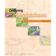
Designing Geodatabases : Case Studies in GIS Data Modeling

by
  • ISBN13:

    9781589480216

  • ISBN10:

    158948021X

  • Format: Paperback
  • Copyright: 2004-09-01
  • Publisher: Esri Pr
  • Purchase Benefits
  • Free Shipping Icon Free Shipping On Orders Over $35!
    Your order must be $35 or more to qualify for free economy shipping. Bulk sales, PO's, Marketplace items, eBooks and apparel do not qualify for this offer.
  • eCampus.com Logo Get Rewarded for Ordering Your Textbooks! Enroll Now
List Price: $44.95

Summary

This guide to creating a dynamic GIS data model helps database managers design a schema that has comprehensive and descriptive query definitions, a user-friendly cartographic display, and increased performance standards. The five steps for taking a data model through its conceptual, logical, and physical phases, including modeling the user's view, defining objects and relationships, selecting geographic representations, matching geodatabase elements, and organizing the geodatabase structure are studied in detail. A look at nine decision points that deal with concerns common to all data modeling exercises, such as validating feature geometries, modeling linear networks, managing raster data, and labeling map features help database managers fine-tune their GIS data models. Several design models for a variety of applications are considered including addresses and locations, census units and boundaries, stream and river networks, and topography and the base map.

Author Biography

David Arctur is a product specialist at ESRI and is part of the geodatabase development team. He has written for the Earth Observation & Mapping Magazine, IEEE Computer Magazine, and International Journal of Geographical Information Science. He lives in Austin, Texas. Michael Zeiler is a technical writer and data model specialist at ESRI with experience in diagramming GIS concepts, building data models, and programming. He is the author of Exploring ArcObjects, Inside ARC/INFO, and Modeling Our World. He lives in Santa Fe, New Mexico.

Table of Contents

Prefacep. vii
How to use this bookp. x
Companion web site for ArcGIS data modelsp. xii
Geodatabase designp. 2
Streams and river networksp. 36
Census units and boundariesp. 86
Addresses and locationsp. 126
Parcels and the cadastrep. 166
Surveying federal landsp. 220
Using raster datap. 280
Cartography and the base mapp. 306
Building geodatabasesp. 374
Table of Contents provided by Ingram. All Rights Reserved.

Supplemental Materials

What is included with this book?

The New copy of this book will include any supplemental materials advertised. Please check the title of the book to determine if it should include any access cards, study guides, lab manuals, CDs, etc.

The Used, Rental and eBook copies of this book are not guaranteed to include any supplemental materials. Typically, only the book itself is included. This is true even if the title states it includes any access cards, study guides, lab manuals, CDs, etc.

Rewards Program