did-you-know? rent-now

Rent More, Save More! Use code: ECRENTAL

did-you-know? rent-now

Rent More, Save More! Use code: ECRENTAL

5% off 1 book, 7% off 2 books, 10% off 3+ books

9781319230753

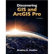
Discovering GIS and ArcGIS Pro

by
  • ISBN13:

    9781319230753

  • ISBN10:

    131923075X

  • Edition: 3rd
  • Format: Paperback
  • Copyright: 2020-07-29
  • Publisher: W. H. Freeman

Note: Supplemental materials are not guaranteed with Rental or Used book purchases.

Purchase Benefits

  • Free Shipping Icon Free Shipping On Orders Over $35!
    Your order must be $35 or more to qualify for free economy shipping. Bulk sales, PO's, Marketplace items, eBooks and apparel do not qualify for this offer.
  • eCampus.com Logo Get Rewarded for Ordering Your Textbooks! Enroll Now
  • Buyback Icon We Buy This Book Back!
    In-Store Credit: $47.25
    Check/Direct Deposit: $45.00
    PayPal: $45.00
List Price: $192.24 Save up to $125.88
  • Rent Book $124.96
    Add to Cart Free Shipping Icon Free Shipping

    TERM
    PRICE
    DUE
    USUALLY SHIPS IN 3-5 BUSINESS DAYS
    *This item is part of an exclusive publisher rental program and requires an additional convenience fee. This fee will be reflected in the shopping cart.

Supplemental Materials

What is included with this book?

Summary

Shellito’s Discovering GIS and ArcGIS Pro provides students with hands-on work with GIS software, while explaining the “how” and “why” behind each application. Software changes quickly—the theory has a longer shelf life. The goal of Discovering GIS and ArcGIS Pro is to teach students how to combine GIS concepts with ArcGIS Pro software skills, preparing students for successful careers in the real world. Each chapter focuses on using a variety of ArcGIS tools in a real-world context. At the start of each chapter, a scenario puts the student in a particular role with a number of tasks to accomplish.

Table of Contents

Preface
Acknowledgments and Thanks
Module 1 How to Use Geospatial Data with ArcGIS Pro
Module 2 How to Use Tables, Attributes, and Queries in ArcGIS Pro
Module 3 How to Create a Layout with ArcGIS Pro
Module 4 How to Publish Layers from ArcGIS Pro and Build Web Apps with ArcGIS Online
Module 5 How to Obtain Online GIS Data and Use Them in ArcGIS Pro
Module 6 How to Create Geospatial Data with ArcGIS Pro
Module 7 How to Edit Data with ArcGIS Pro
Module 8 How to Perform Spatial Analysis in ArcGIS Pro
Module 9 How to Perform Geoprocessing in ArcGIS Pro
Module 10 How to Perform Geocoding in ArcGIS Pro
Module 11 How to Perform Network Analysis in ArcGIS Pro
Module 12 How to Use Raster Data in ArcGIS Pro
Module 13 How to Use Remotely Sensed Imagery in ArcGIS Pro
Module 14 How to Perform Spatial Interpolation with ArcGIS Pro
Module 15 How to Work with Digital Elevation Models in ArcGIS Pro
Module 16 How to Work with Contours, TINs, and 3D Imagery in ArcGIS Pro
Module 17 How to Work with Lidar Data in ArcGIS Pro
Module 18 How to Represent Geospatial Data in 3D with ArcGIS Pro
Module 19 How to Use Distance Calculations and Cost Distance in ArcGIS Pro
Module 20 How to Perform Map Algebra in ArcGIS Pro
Module 21 How to Build a Model in ArcGIS Pro
Module 22 How to Use Hydrologic Modeling Tools in ArcGIS Pro
Appendix A: Transitioning from ArcMap to ArcGIS Pro
Appendix B: Using Coordinate Systems in ArcGIS (Online-only)
Glossary
Index

Supplemental Materials

What is included with this book?

The New copy of this book will include any supplemental materials advertised. Please check the title of the book to determine if it should include any access cards, study guides, lab manuals, CDs, etc.

The Used, Rental and eBook copies of this book are not guaranteed to include any supplemental materials. Typically, only the book itself is included. This is true even if the title states it includes any access cards, study guides, lab manuals, CDs, etc.

Rewards Program