did-you-know? rent-now

Amazon no longer offers textbook rentals. We do!

did-you-know? rent-now

Amazon no longer offers textbook rentals. We do!

We're the #1 textbook rental company. Let us show you why.

9781119545880

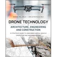
Drone Technology in Architecture, Engineering and Construction A Strategic Guide to Unmanned Aerial Vehicle Operation and Implementation

by ;
  • ISBN13:

    9781119545880

  • ISBN10:

    1119545889

  • Edition: 1st
  • Format: Paperback
  • Copyright: 2021-02-03
  • Publisher: Wiley

Note: Supplemental materials are not guaranteed with Rental or Used book purchases.

Purchase Benefits

List Price: $72.48 Save up to $24.28
  • Rent Book $48.20
    Add to Cart Free Shipping Icon Free Shipping

    TERM
    PRICE
    DUE
    USUALLY SHIPS IN 3-4 BUSINESS DAYS
    *This item is part of an exclusive publisher rental program and requires an additional convenience fee. This fee will be reflected in the shopping cart.

Supplemental Materials

What is included with this book?

Summary

A start-to-finish roadmap on incorporating drone technology into your AEC firm workflow 

Drone Technology in Architecture, Engineering and Construction: A Strategic Guide to Unmanned Aerial Vehicle Operation and Implementation is the only process-driven, step-by-step handbook to implement drone technology in AEC workflows. It provides a comprehensive and practical roadmap for architecture, engineering, and construction firms to incorporate drones into their design and construction processes. 

The book offers extensive information on drone data processing, and includes guidance on how to acquire, manipulate and use the various data types produced from drone flights. The creation of three-dimensional data and visualizations are covered in-depth. Drone Technology reviews how to select and fly drones based on data needs and initial costs, and how to collect and maintain required flight logs, licenses, and permits.  

Drone Technology uses several real-world project examples that demonstrate and explain how drones can be used to collect: 

·         Full-color orthorectified imagery 

·         Accurate 3D point cloud and mesh models 

·         Topographic contours 

·         Digital Elevation Models (DEMs) 

The project examples also describe how these datasets can be integrated with 3D models of proposed conditions, photos, and other project datasets. 

Drone Technology in Architecture, Engineering and Construction is an essential guide for a wide variety of professionals, from civil engineers to landscape architects. It provides information on professional use of drones for those just considering the technology, to those already flying drones professionally. It is an invaluable guide for anyone working in the design or construction of buildings and landscapes.  
Author Biography

Daniel Tal, ASLA is a registered landscape architect with over 22 years of experience. Daniel is the visualization and drone manager for DHM Design. He is the author of SketchUp for Site Design, Second Edition and Rendering in SketchUp. Daniel designs and operates 3D modeling software apps including www.suplacemaker.com and www.SketchUrbanPaint.com. He has a tutorial website at www.danieltal.com. Daniel speaks nationally on technology, provides lectures to universities and publishes blogs and articles.

Jon Altschuld, RLA is a licensed landscape architect with over 12 years' experience and is the founder and principal at Chinook Landscape Architecture (www.chinookLA.com) in Denver, CO. He is also an FAA registered remote pilot, and a board member of the Professional TrailBuilders Association (PTBA). In his career he has focused on using emerging technologies such as drone data collection and 3D visualization to approach complex design issues, often in environmentally sensitive areas. He has worked on projects ranging from major transportation corridors, to non-motorized trails master plans, to floodplain and habitat restorations. Jon also teaches workshops and gives professional training on SketchUp, Vue, CAD, Lumion, and Adobe Graphics programs within the AEC community.

Table of Contents

Acknowledgements

1  How to Use This Book

2  A Paradigm Shift in Viewing the World

3  Drone Data Visualization as a Full Cycle Tool

4  Buy In

5  Getting Started

6  Documentation, Permissions and License

7  Best Practices for Flying Drones

8  Imagery and Videos

9  Photogrammetry

10 Working with 3D Models

11 The Future of UAV’s

Index

Supplemental Materials

What is included with this book?

The New copy of this book will include any supplemental materials advertised. Please check the title of the book to determine if it should include any access cards, study guides, lab manuals, CDs, etc.

The Used, Rental and eBook copies of this book are not guaranteed to include any supplemental materials. Typically, only the book itself is included. This is true even if the title states it includes any access cards, study guides, lab manuals, CDs, etc.

Rewards Program