rent-now

Rent More, Save More! Use code: ECRENTAL

5% off 1 book, 7% off 2 books, 10% off 3+ books

9780470844274

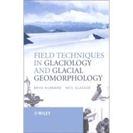
Field Techniques In Glaciology And Glacial Geomorphology

by ;
  • ISBN13:

    9780470844274

  • ISBN10:

    0470844272

  • Edition: 1st
  • Format: Paperback
  • Copyright: 2005-05-20
  • Publisher: WILEY
  • Purchase Benefits
  • Free Shipping Icon Free Shipping On Orders Over $35!
    Your order must be $35 or more to qualify for free economy shipping. Bulk sales, PO's, Marketplace items, eBooks and apparel do not qualify for this offer.
  • eCampus.com Logo Get Rewarded for Ordering Your Textbooks! Enroll Now
List Price: $77.81 Save up to $8.21
  • Buy New
    $77.73
    Add to Cart Free Shipping Icon Free Shipping

    PRINT ON DEMAND: 2-4 WEEKS. THIS ITEM CANNOT BE CANCELLED OR RETURNED.

Summary

All Geography and Earth Science students carry out fieldwork as part of their studies, either on supervised field courses or independently as part of an extended project. Field Techniques in Glaciology and Glacial Geomorphology provides students with accepted and practicable techniques for addressing their chosen research.

Author Biography

Bryn Hubbard is the author of Field Techniques in Glaciology and Glacial Geomorphology, published by Wiley.

Neil F. Glasser is the author of Field Techniques in Glaciology and Glacial Geomorphology, published by Wiley.

Table of Contents

Preface ix
Acknowledgements xi
1 Introduction
1(14)
1.1 Aim
1(1)
1.2 The scope of this book
1(1)
1.3 Book format and content
2(1)
1.4 The role of fieldwork in glaciology and glacial geomorphology
3(1)
1.5 The relationship between field glaciology and glaciological theory
4(11)
2 Planning and conducting glaciological fieldwork
15(15)
2.1 Aim
15(1)
2.2 Designing and planning field-based research
15(5)
2.3 Logistical preparations for fieldwork
20(6)
2.4 Fieldwork data
26(4)
3 Glacier ice: Character, sampling and analysis
30(35)
3.1 Aim
30(1)
3.2 Ice masses and ice facies: Principles, definition and identification
30(8)
3.3 Sampling glacier ice
38(17)
3.4 Ice analysis
55(8)
3.5 Student projects
63(2)
4 Glacier meltwater: Character, sampling and analysis
65(50)
4.1 Aim
65(1)
4.2 Background
65(3)
4.3 Measuring bulk meltwater discharge: Stage-discharge rating curves
68(11)
4.4 Sampling and analysing glacial meltwaters
79(17)
4.5 Automated measurements by sensors and loggers
96(5)
4.6 Tracer investigations
101(11)
4.7 Student projects
112(3)
5 Hot-water borehole drilling and borehole instrumentation
115(33)
5.1 Aim
115(1)
5.2 Introduction
115(1)
5.3 Hot-water drilling
116(8)
5.4 Borehole instrumentation
124(22)
5.5 Summary
146(1)
5.6 Student projects
146(2)
6 Ice radar
148(31)
6.1 Aim
148(1)
6.2 Background and physical principles
148(7)
6.3 Ice radar equipment
155(4)
6.4 Radar data presentation
159(2)
6.5 Field radar surveys
161(10)
6.6 Processing
171(3)
6.7 Field application and interpretation of ice radar
174(3)
6.8 Student projects
177(2)
7 Glacier mass balance and motion
179(38)
7.1 Aim
179(1)
7.2 Surface energy budget
180(7)
7.3 Mass balance
187(12)
7.4 Glacier motion and ice velocity
199(17)
7.5 Student projects
216(1)
8 Glacigenic sediments
217(52)
8.1 Aim
217(1)
8.2 Introduction to field sedimentology
217(9)
8.3 Colour and organic content
226(3)
8.4 Sediment texture
229(3)
8.5 Particle morphology: The shape and roundness of sedimentary particles
232(7)
8.6 Bedding
239(4)
8.7 Sedimentary structures
243(2)
8.8 Palaeocurrent data
245(1)
8.9 Other properties
246(1)
8.10 Field sampling techniques
247(4)
8.11 Fabric analysis: General considerations
251(1)
8.12 Clast macrofabrics
252(7)
8.13 Clast microfabrics and microstructural description
259(1)
8.14 Clast mesofabrics
260(1)
8.15 Laboratory analysis
260(2)
8.16 Interpreting the environment of deposition of sediments
262(4)
8.17 Presentation of sedimentological data
266(1)
8.18 Student projects
267(2)
9 Mapping glaciers and glacial landforms
269(62)
9.1 Aim
269(1)
9.2 General considerations
269(1)
9.3 Aims of the mapping and the areal extent of the map
270(1)
9.4 Desk-based studies
271(3)
9.5 Remotely sensed data
274(13)
9.6 Geomorphological mapping
287(3)
9.7 Field mapping
290(14)
9.8 Field surveying techniques
304(4)
9.9 Ground-penetrating radar and shallow seismic reflection investigations of sediment bodies
308(3)
9.10 Electrical resistivity surveys
311(2)
9.11 Aquatic (marine and lacustrine) geophysical techniques
313(8)
9.12 Mapping glacier structures (structural glaciology)
321(4)
9.13 Final map compilation
325(2)
9.14 Mapping and measurement of landforms change over time
327(2)
9.15 Student projects
329(2)
10 Monitoring and reconstructing glacier fluctuations 331(36)
10.1 Aim
331(1)
10.2 Remotely sensed images
332(3)
10.3 Fieldwork mapping and historical documents
335(4)
10.4 Dating glacier fluctuations using 'absolute age' (numerical-age) and 'relative age' estimates
339(1)
10.5 Numerical-age dating techniques
340(10)
10.6 Relative-age dating techniques
350(14)
10.7 Dating glacier fluctuations - concluding remarks
364(1)
10.8 Student projects
364(3)
References 367(29)
Index 396

Supplemental Materials

What is included with this book?

The New copy of this book will include any supplemental materials advertised. Please check the title of the book to determine if it should include any access cards, study guides, lab manuals, CDs, etc.

The Used, Rental and eBook copies of this book are not guaranteed to include any supplemental materials. Typically, only the book itself is included. This is true even if the title states it includes any access cards, study guides, lab manuals, CDs, etc.

Rewards Program