did-you-know? rent-now

Amazon no longer offers textbook rentals. We do!

did-you-know? rent-now

Amazon no longer offers textbook rentals. We do!

We're the #1 textbook rental company. Let us show you why.

9783540222637

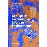
Geo-Spatial Technologies in Urban Environments

by ; ;
  • ISBN13:

    9783540222637

  • ISBN10:

    3540222634

  • Format: Hardcover
  • Copyright: 2005-01-13
  • Publisher: Springer Verlag
  • Purchase Benefits
  • Free Shipping Icon Free Shipping On Orders Over $35!
    Your order must be $35 or more to qualify for free economy shipping. Bulk sales, PO's, Marketplace items, eBooks and apparel do not qualify for this offer.
  • eCampus.com Logo Get Rewarded for Ordering Your Textbooks! Enroll Now
List Price: $139.00 Save up to $95.46
  • Digital
    $94.33
    Add to Cart

    DURATION
    PRICE

Supplemental Materials

What is included with this book?

Summary

The purpose of this book is to investigate and develop alternate methodological approaches to understand urban environments and urban change. In particular, the study demonstrates the application of remote-sensing data and geographic information systems to the exploration of issues often ignored by the mainstream community of geo-technical specialists such as urban forestry, urban traffic, migration or quality of life in urban areas. Case studies show how disciplines like environmental science and planning, sociology, landscape ecology and architecture, regional science and policy design, and assessment can benefit from employing remote-sensing data and GIS.

Author Biography

Daniel D. McLean is Professor and Chair of Indiana State University's Department of Sport and Recreation Management.

Table of Contents

Applying Geospatial Technologies in Urban Environments
1(4)
Ryan R. Jensen
Jay D. Gatrell
Daniel D. McLean
About this book
1(1)
Chapters
2(3)
References
4(1)
Remote Sensing of Impervious Surfaces and Building Infrastructure
5(18)
John R. Jensen
Michael E. Hodgson
Jason A. Tullis
George T. Raber
Introduction
5(1)
Conventional Methods
6(1)
Remote Sensing Process
6(14)
Analog and Digital Aerial Photography
7(1)
Satellite Imagery
7(2)
Light Detection and Ranging (Lidar)
9(1)
Case Study 1 -- Extraction of Impervious Surfaces
10(5)
Case Study 2 -- Extraction of Building Infrastructure
15(5)
Conclusion
20(3)
References
20(3)
Policy Implications of Remote Sensing in Understanding Urban Environments: Developing a Wetlands Inventory for Community Decision-Making in Lucas County, Ohio
23(14)
Patrick L. Lawrence
Kevin Czajowski
Nathan Torbick
Wetlands
24(1)
Study Area
25(2)
Background
27(3)
Analysis
30(4)
Data Preprocessing
30(1)
Classification
31(1)
Results
32(2)
Conclusions
34(1)
Acknowledgements
35(2)
References
35(2)
Making Spatial Data Usable to the General Public: a Case Study in Tax Mapping
37(10)
Daniel R. Morgan
Ryan R. Jensen
Daniel D. McLean
Background
37(2)
GIS and Public Access to Tax Data
39(1)
Organizing GIS Data Layers
39(1)
Creation of the Tax Map Public Access Website
40(3)
Implementation of the Website
43(1)
Discussion
44(1)
Conclusion
44(3)
References
46(1)
Modeling Human-Environment Interactions with the Expansion Method
47(8)
Jay D. Gatrell
The Expansion Method
47(1)
Making Sense of the Local: The Use of the Expansion Method to Assess and Explore Contingency
48(2)
Human & Physical Applications: Combination
50(1)
Rationale for Adopting Casetti to Model Human-Environment Interaction
51(1)
Conclusion
51(4)
References
53(2)
The Relationship Between Urban Leaf Area and Summertime Household Energy Usage
55(8)
Ryan R. Jensen
James R. Boulton
Bruce T. Harper
Introduction
55(1)
Methods
56(3)
Study Area
56(1)
LAI Field Measurements
56(2)
Satellite Imagery
58(1)
LAI Model
58(1)
Household Energy
59(1)
Results
59(1)
Discussion
60(3)
Acknowledgement
61(1)
Bibliography
61(2)
The Urban Environment, Socioeconomic Conditions, and Quality of Life: An Alternative Framework for Understanding and Assessing Environmental Justice
63(10)
Ryan R. Jensen
Jay D. Gatrell
James R. Boulton
Bruce T. Harper
Introduction
63(3)
Urban Forestry
64(1)
Environmental Justice
65(1)
Methods
66(3)
Study Area
66(1)
Socioeconomic Variables
67(1)
Leaf Area Index
67(1)
The models
68(1)
Results
69(1)
Discussion
70(3)
References
70(3)
Image Homogeneity and Urban Demographics: An Integrated Approach to Geo-Techniques
73(8)
Ryan R. Jensen
Jay D. Gatrell
Image Texture
73(1)
Methods
74(2)
Study Area
74(1)
Remote Sensing Data
74(1)
Census Block Groups
75(1)
Gray Level Co-Occurrence Matrix
75(1)
Results
76(2)
Discussion
78(3)
References
79(2)
Local Government Perceptions of Urban Foresty
81(10)
Daniel D. McLean
Ryan R. Jensen
Paul M. Hightower
Sister Alma M. Anderson
Composition and Size of the Urban Forest
83(1)
Policy Learning
83(1)
The Political Leader's View of the Urban Forest
84(5)
Knowledge, the Relationship Model, Understanding and Closing the Gap in Local Government Perceptions of the Urban Forest
89(2)
References
89(2)
Satellite Remote Sensing of Urban Heat Islands: Current Practice and Prospects
91(22)
Qihao Weng
Robert Larson
Current Practice in Remote Sensing of UHIs
92(1)
Basic Theory of Thermal Remote Sensing of LST
93(4)
Retrieval of LST
93(1)
Emissivity
94(1)
Fractional Vegetation Cover
95(1)
Thermal Properties and Moisture Content of the Soil
95(1)
Relations of NDVI with LST and Vegetation Abundance
96(1)
Recent Trends
97(1)
Effect of Urban Morphology
97(1)
Landscape Ecology Approach
97(1)
Fractal Analysis
98(1)
Urban Heat Island vs. Urban Heat Sink: Case Studies
98(7)
The Urban Heat Island Phenomenon of Indianapolis
99(3)
The Urban Heat Sink Phenomenon of Indianapolis
102(3)
Discussion and Conclusions
105(8)
References
107(6)
Remote Sensing as a Program Assessment Device: The case of Urban Forestry and the Competition for Local Investment
113(24)
Jay D. Gatrell
Ryan R. Jensen
The Politics of Local Economic Development
114(1)
From Grassroots to Public Policy: Environmentalism
115(8)
Urban Forestry
116(7)
Urban Forestry Assessment Case Studies
123(3)
Urban Forestry Policies Up Close
126(4)
Methods
130(2)
Discussion
132(5)
Acknowledgement
132(1)
References
132(5)
Urban Sprawl Detection Using Satellite Imagery and Geographically Weighted Regression
137(16)
Robert Hanham
J. Scott Spiker
Introduction
137(3)
From Change Detection Techniques
140(1)
Geographically Weighted Regression
141(1)
Data and Methods
142(2)
Results
144(6)
Conclusion
150(3)
Acknowledgement
150(1)
References
150(3)
Satellites, Census, and the Quality of Life
153(18)
Valerie A. Muller
Frank Gossette
Study Area
153(1)
Census Data
154(1)
Factor Analysis
155(2)
Observed Values
157(5)
Structural Variables from Landsat Imagery
162(1)
NDVI from Multispectral Imagery
162(1)
Predicted Values
162(4)
Regression
166(3)
Summary and Conclusion
169(2)
References
169(2)
Urban Environmental Approaches: Policy, Application & Method
171(4)
Jay D. Gatrell
Ryan R. Jensen
Daniel D. McLean
Case Studies
171(2)
Policy
172(1)
Application
172(1)
Method
173(1)
Conclusion
173(2)
References
174(1)
Index 175

Supplemental Materials

What is included with this book?

The New copy of this book will include any supplemental materials advertised. Please check the title of the book to determine if it should include any access cards, study guides, lab manuals, CDs, etc.

The Used, Rental and eBook copies of this book are not guaranteed to include any supplemental materials. Typically, only the book itself is included. This is true even if the title states it includes any access cards, study guides, lab manuals, CDs, etc.

Rewards Program