did-you-know? rent-now

Amazon no longer offers textbook rentals. We do!

did-you-know? rent-now

Amazon no longer offers textbook rentals. We do!

We're the #1 textbook rental company. Let us show you why.

9780226300719

Historical Atlases

by
  • ISBN13:

    9780226300719

  • ISBN10:

    0226300714

  • Format: Hardcover
  • Copyright: 2003-07-15
  • Publisher: Univ of Chicago Pr
  • Purchase Benefits
  • Free Shipping Icon Free Shipping On Orders Over $35!
    Your order must be $35 or more to qualify for free economy shipping. Bulk sales, PO's, Marketplace items, eBooks and apparel do not qualify for this offer.
  • eCampus.com Logo Get Rewarded for Ordering Your Textbooks! Enroll Now
List Price: $92.00
  • Digital
    $119.24
    Add to Cart

    DURATION
    PRICE

Supplemental Materials

What is included with this book?

Summary

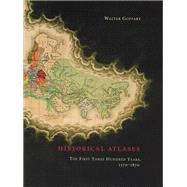
Today we can walk into any well-stocked bookstore or library and find an array of historical atlases. The first thorough review of the source material, Historical Atlases traces how these collections of "maps for history"--maps whose sole purpose was to illustrate some historical moment or scene--came into being. Beginning in the sixteenth century, and continuing down to the late nineteenth, Walter Goffart discusses milestones in the origins of historical atlases as well as individual maps illustrating historical events in alternating, paired chapters. He focuses on maps of the medieval period because the development of maps for history hinged particularly on portrayals of this segment of the postclassical, "modern" past. Goffart concludes the book with a detailed catalogue of more than 700 historical maps and atlases produced from 1570 to 1870. Historical Atlases will immediately take its place as the single most important reference on its subject. Historians of cartography, medievalists, and anyone seriously interested in the role of maps in portraying history will find it invaluable.

Author Biography

Walter Goffart was professor of medieval history at the University of Toronto until his retirement in 1999. He now lectures in history at Yale University. He is the author of Barbarians and Romans, A.D. 418 584: The Techniques of Accommodation and the prizewinning Narrators of Barbarian History, A.D. 550- 800, among other books.

Table of Contents

List of Illustrations
xi
Preface xiii
System of Citation and Abbreviation xix
Catalogues and Reference Works xix
Libraries and Other Map Collections xxi
Introduction 1(12)
Sixteenth- and Seventeenth-Century Atlases Relevant to History
13(38)
Claudius Ptolemy and ``Ancient Geography''
13(7)
The Comparison of Old and New Geography
20(2)
World Atlases: Vessels of Diffuse History
22(2)
``One Size Fits All''
24(3)
Nouvelle metode de geografie historique [sic]
27(3)
``Ancient Geography, Sacred and Secular''
30(8)
History Everywhere and Nowhere
38(1)
Notes
39(12)
The Middle Ages in Sixteenth- and Seventeenth-Century Maps
51(80)
Bygone Kingdoms
52(28)
The Anglo-Saxon Heptarchy
52(5)
Where Is Austrasia?
57(4)
Austrasia Foreshadows Habsburg Austria
61(5)
The Rest of France
66(3)
The Empire of Charlemagne
69(5)
Mementos of a Shifting Province
74(2)
Southern Netherlanders
76(4)
Poster Maps: English Battles and Far-Flung French Royalty
80(6)
Outside Northern Europe
86(6)
Frisia: Tidal Flats and Historical Cartography
92(12)
The Foreshadowing of Historical Atlases to 1700
104(8)
Notes
112(19)
From 1700, New Departures
131(56)
Atlases Called ``Historical''
132(3)
Moving on from Ancient Geography
135(5)
Innovative but Unrealized Atlases
140(7)
Atlases Reflecting the Course of Written History
147(5)
Universal History in Sixty-six Maps
152(3)
A Disconnected Fragment
155(1)
The First Fully Published Sequential Atlas
156(5)
The History of France in Sequential Maps
161(7)
The Lost Atlas of Johann Christoph Gatterer
168(6)
Notes
174(13)
Eighteenth-Century Maps of the Middle Ages
187(116)
Single Maps and Small Sets
187(67)
Isolated Scenes
187(1)
Barbarian Invasions
187(7)
Carolingian Sidelights
194(2)
Europe as Seen By . . .
196(5)
Poster or Catalogue Maps
201(4)
Divisions and Limits of Medieval Lands
205(17)
``Outside Europe''
222(1)
Byzantines, Crusaders
222(4)
Asiatic Peoples
226(3)
European Travelers to Asia
229(2)
Getting It Wrong
231(8)
Beginnings without Continuations: The History of France
239(11)
Other Countries at Medieval Moments
250(4)
Historical Atlases
254(26)
Delisle's Unrealized Outline of History
254(2)
The Succession of Great Empires
256(6)
World Chronicles in Maps
262(6)
The History of France Graphically Unfolded
268(4)
A Geography of the Migration Age
272(2)
Isolated Initiatives: Beaurain, Tomka Szaszky, Andrews
274(6)
Innovative Atlases and Perplexing Maps
280(2)
Notes
282(21)
Historical Atlases Come of Age
303(76)
The Midas Touch of Emmanuel de Las Cases
303(11)
Kruse's Europe at 100-Year Intervals
314(7)
The Historical Atlas Still Unknown and Disavowed
321(2)
Scholars in a Time of Ferment: C. G. Koch and C. Malte-Brun
323(4)
Minor Works on the Sequential Plan
327(2)
Lithography and Other Innovations of the 1820s
329(1)
Ambitious History from the Weimar Geographical Institute
330(7)
The Burgeoning of National Atlases
337(2)
A Creative Burst: 1829--30
339(4)
Edward Quin: End of an Era in Maps for History
343(4)
Conservatism and Change in the 1830s
347(3)
A New Format for Comprehensive Historical Atlases
350(3)
Karl Spruner's Historisch-geographischer Hand-Atlas (1837--46)
353(3)
Packing Much in Little
356(3)
Maps for History Attain Maturity
359(2)
Notes
361(18)
Nineteenth-Century Maps of the Middle Ages
379(64)
An Estrangement Not Yet Healed
379(4)
A Canon of Maps for Medieval Europe
383(8)
Medievalia in the Atlas Lesage
391(3)
Tracks for Crusaders
394(7)
Medieval and Modern in the Last Sequential Atlases of Universal History
401(4)
The Middle Ages in Maps of National History
405(8)
Large Atlases Warmly Welcoming the Middle Ages
413(5)
Spruner's Hand-Atlas and the Problem of Geographic Order
418(4)
To Condense so as to Teach
422(5)
Honorably Mentioned
427(3)
Notes
430(13)
Conclusion
443(20)
Map Types and Written Glosses
443(8)
Recapitulation
451(9)
Notes
460(3)
Catalogue of Maps and Atlases
463(106)
Historical Atlases and Maps; Atlases with Historical Additions
464(76)
H, M, G---Sixteenth and Seventeenth Centuries
464(8)
H, M, G---Eighteenth Century
472(28)
H, M, G---Nineteenth Century
500(40)
Ancient and Ecclesiastical History
540(14)
A---Ancient, Sacred, and Comparative Atlases (Sixteenth to Nineteenth Centuries)
540(10)
E---Ecclesiastical and Sacred Collections (Exclusively)
550(4)
Other Noteworthy Works with and without Maps
554(15)
O---Other Relevant Atlases and Maps
554(8)
B---Books, Usually without Maps
562(7)
Index of Maps and Atlases 569(8)
Index of Secondary Literature Cited in the Notes 577(12)
Subject Index 589

Supplemental Materials

What is included with this book?

The New copy of this book will include any supplemental materials advertised. Please check the title of the book to determine if it should include any access cards, study guides, lab manuals, CDs, etc.

The Used, Rental and eBook copies of this book are not guaranteed to include any supplemental materials. Typically, only the book itself is included. This is true even if the title states it includes any access cards, study guides, lab manuals, CDs, etc.

Rewards Program