did-you-know? rent-now

Amazon no longer offers textbook rentals. We do!

did-you-know? rent-now

Amazon no longer offers textbook rentals. We do!

We're the #1 textbook rental company. Let us show you why.

9781593852009

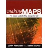
Making Maps A Visual Guide to Map Design for GIS

by ;
  • ISBN13:

    9781593852009

  • ISBN10:

    1593852002

  • Edition: 1st
  • Format: Paperback
  • Copyright: 2005-08-17
  • Publisher: The Guilford Press
  • View Upgraded Edition
  • Purchase Benefits
  • Free Shipping Icon Free Shipping On Orders Over $35!
    Your order must be $35 or more to qualify for free economy shipping. Bulk sales, PO's, Marketplace items, eBooks and apparel do not qualify for this offer.
  • eCampus.com Logo Get Rewarded for Ordering Your Textbooks! Enroll Now
List Price: $53.33

Summary

A concise, down-to-earth guide to creating maps using GIS, this book is visually engaging, clear, and compelling--exactly how an effective map should be. Featuring over 300 maps and other figures, including instructive examples of both good and poor design choices, the book covers everything from locating and processing data to making decisions about layout, map symbols, color, and type. For students, professionals, and others who want to make better maps, this is an essential, uniquely helpful resource. The author's website (http://makingmaps.owu.edu) offers excerpts from each chapter, links to related sites, and a regularly updated blog on the topic of making maps.
Author Biography

John Krygier is a geographer with degrees from the University of Wisconsin–Madison and The Pennsylvania State University. He has extensive experience with map design and production, and has taught mapping and GIS at Penn State, the University of Oregon, The Ohio State University, and the University at Buffalo, The State University of New York. He is past president of the North American Cartographic Information Society, and the editor of the journal Cartographic Perspectives. He teaches mapping, GIS, and geography at Ohio Wesleyan University, and lives in Columbus, Ohio.

Denis Wood curated the Smithsonian’s award-winning Power of Maps exhibition and wrote the bestselling The Power of Maps (Guilford). More recently he has published Seeing Through Maps (ODT) and Five Billion Years of Global Change: A History of the Land (Guilford). He is an independent scholar living in Raleigh, North Carolina.

Table of Contents

It's a Map
3(22)
Why Are You Making Your Map?
25(26)
Mappable Data
51(22)
Map-Making Tools
73(18)
Geographic Framework
91(34)
Map Layout
125(20)
Intellectual and Visual Hierarchies
145(16)
Map Generalization and Classification
161(34)
Map Symbolization
195(38)
Type on Maps
233(22)
Color on Maps
255(22)
Finishing Your Map
277(15)
Index 292

Supplemental Materials

What is included with this book?

The New copy of this book will include any supplemental materials advertised. Please check the title of the book to determine if it should include any access cards, study guides, lab manuals, CDs, etc.

The Used, Rental and eBook copies of this book are not guaranteed to include any supplemental materials. Typically, only the book itself is included. This is true even if the title states it includes any access cards, study guides, lab manuals, CDs, etc.

Rewards Program