did-you-know? rent-now

Amazon no longer offers textbook rentals. We do!

did-you-know? rent-now

Amazon no longer offers textbook rentals. We do!

We're the #1 textbook rental company. Let us show you why.

9780375708503

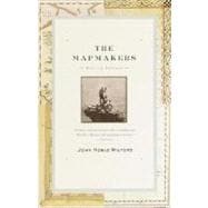
The Mapmakers

by
  • ISBN13:

    9780375708503

  • ISBN10:

    0375708502

  • Edition: Revised
  • Format: Trade Paper
  • Copyright: 2001-12-04
  • Publisher: Vintage

Note: Supplemental materials are not guaranteed with Rental or Used book purchases.

Purchase Benefits

  • Free Shipping Icon Free Shipping On Orders Over $35!
    Your order must be $35 or more to qualify for free economy shipping. Bulk sales, PO's, Marketplace items, eBooks and apparel do not qualify for this offer.
  • eCampus.com Logo Get Rewarded for Ordering Your Textbooks! Enroll Now
List Price: $18.95 Save up to $13.27
  • Rent Book
    $5.68
    Add to Cart Free Shipping Icon Free Shipping

    TERM
    PRICE
    DUE
    IN STOCK USUALLY SHIPS IN 24 HOURS.
    *This item is part of an exclusive publisher rental program and requires an additional convenience fee. This fee will be reflected in the shopping cart.

Supplemental Materials

What is included with this book?

Summary

In his classic text, two-time Pulitzer Prizewinner John Noble Wilford recounts the history of cartography from antiquity to the space age. With this revised edition, Wilford brings the story up to the present day, as he shows the impact of new technologies that make it possible for cartographers to go where no one has been before, from the deepest reaches of the universe (where astronomers are mapping time as well as space) to the inside of the human brain. These modern-day mapmakers join the many earlier adventurersincluding ancient Greek stargazers, Renaissance seafarers, and the explorers who mapped the American Westwhose exploits shape this dramatic story of human inventiveness and limitless curiosity.

Author Biography

John Noble Wilford is a science correspondent for <i>The New York Times. </i>He lives in New York.

Table of Contents

Preface ix
Preface to the Revised Edition xiii
PART One Prologue at Dana Butte 3(104)
The Map Idea
6(12)
The Librarian Who Measured Earth
18(11)
First Principles by Ptolemy
29(11)
The Topography of Myth and Dogma
40(26)
1492
66(21)
Mercator Squares the Circle
87(20)
PART Two Yaki Point 107(158)
The Matter of a Degree
111(21)
The Family That Mapped France
132(20)
John Harrison's Timepiece
152(11)
Surveyors of Sea and Shore
163(26)
Soldiers, Pundits, and the India Survey
189(16)
Mapping America: The Boundary Makers
205(18)
Mapping America: Westward the Topographers
223(30)
Meters, Meridians, and a New World Map
253(12)
PART Three Bright Angel Point 265(104)
The Winged Mappers
268(12)
Radar Over the Amazon
280(16)
Deep Horizons
296(16)
A Continent Beneath the Ice
312(13)
Mountains of the Sea
325(28)
Base Lines Across a Continent
353(16)
PART Four The Flight Out 369(100)
Geodesy from Space
372(17)
Mapping from Space
389(20)
Dynamic Maps: A New Geography
409(17)
Extraterrestrial Mapping: The Moon
426(20)
Extraterrestrial Mapping: Mars
446(17)
Cosmic Cartographers
463(6)
Epilogue at Bright Angel 469(6)
Bibliographical Notes 475(18)
Acknowledgments 493(2)
Index 495

Supplemental Materials

What is included with this book?

The New copy of this book will include any supplemental materials advertised. Please check the title of the book to determine if it should include any access cards, study guides, lab manuals, CDs, etc.

The Used, Rental and eBook copies of this book are not guaranteed to include any supplemental materials. Typically, only the book itself is included. This is true even if the title states it includes any access cards, study guides, lab manuals, CDs, etc.

Excerpts

Chapter 1

The Map Idea

The origin of the map is lost to history. No one knows when or where or for what purpose someone got the first idea to draw a sketch to communicate a sense of place, some sense of here in relation to there. It must have been many millennia ago, probably before written language. It certainly was long before the human mind could conceive of the worlds beyond shore and horizon, beyond Earth itself, that would be embraced through mapping.

All the evidence suggests that the map evolved independently among many peoples in many separate parts of Earth. Before Europeans reached the Pacific, the Marshall Islanders were making stick charts. Sticks were lashed together with fibers to depict prevailing winds and wave patterns; shells or coral were inserted at the appropriate places to represent islands. The smaller stick charts were carried by the islanders in their outrigger canoes, while the larger ones were kept on land for instruction. When a Tahitian communicated his knowledge of South Pacific geography to Captain Cook by drawing a map, it was clear that he and his people were quite familiar with the map idea. Pre-Columbian maps in Mexico indicated roads by lines of footprints. Cortés traveled through Central America guided by a calico map provided by a local cacique. It has also been discovered that centuries ago Eskimos carved accurate coastal maps in ivory, the Incas built elaborate relief maps of stone and clay, and early Europeans drew sketch maps on their cave walls.

One of antiquity's great civilizations, China, fully grasped the map idea thousands of years ago. Most of our knowledge of this comes not from any extant maps, all of which are of more recent vintage, but indirectly through references in Chinese documents. A town-building prospectus submitted to the emperor in 1020 b.c. mentions an illustrative map, now lost. The Zhou dynasty in the immediately succeeding centuries had a standing order that each principality be mapped, and a royal geographer always accompanied the emperor on his tours of the realm. Maps, it seems, had already become instruments of bureaucracy and political power.

The oldest extant Chinese map came to the attention of scholars in the 1990s. Examining artifacts excavated two decades earlier in Hebei province, scientists discovered a large bronze plate engraved with the Zhao Yu Tu ("map of the area of the mausoleum"). The map, dated to the fourth century b.c., marked locations of buildings in the five mausoleums of Emperor Wang Cuo, his empress, and his concubines. Historians of cartography were impressed by the map as evidence of rather advanced practices in mapmaking, such as the use of symbols and numerals to show distances. Du Naisong, of the Palace Museum in Beijing's Forbidden City, said: "It is not only the oldest map ever found in China, but the oldest numeral-bearing map in the world."

Archeological excavations in Hunan province have uncovered silk maps in the tombs of a prime minister, his wife, and one of his sons, who had died in the second century b.c. According to A. Gutkind Bulling, an American authority on Chinese archeology, the maps were prepared by cartographers to the king of Ch'ang-sha, whose kingdom included modern Hunan and adjacent regions. "Their great significance," Bulling wrote of the maps after their discovery in 1973-74, "lies in the fact that they are in part surprisingly accurate and detailed and show that the art of cartography was well advanced at this time."

One of the maps, measuring 96 by 96 centimeters, depicts at a scale of between 1:170,000 and 1:190,000 (the ratio of distance on the map to actual distance) much of the topography of what is modern Hunan and regions as far south as the South China Sea. In some parts of the map the accuracy suggests to Bulling that on-the-spot surveys were employed. Another hallmark of the map's sophistication, compared to most ancient maps, is its use of standardized symbols and legends, which indicate the existence of a cartographic tradition based on considerable thought and practice. The names of all provinces are placed in squares, and cities and villages in circles. The names of tributary rivers are written near their confluence with larger rivers. Irregular double wavy lines depict mountain ranges. Roads are drawn in rather thin lines. Thicker lines delineate the more than thirty rivers on the map, the thickness not only reflecting the importance of a river but also its direction of flow.

The second map, describing the defenses of the kingdom, is embellished with some color-blue rivers, red lines enclosing towns, as well as the basic black markings. Each military encampment is represented by a rectangle outlined in red and black, the size of which indicates its importance and number of troops; the commanding officer's name is inscribed inside each rectangle. Other symbols, usually assorted triangles, represent walled fortresses, supply depots, and observation towers. According to Bulling, the map shows the organization of defense in a war that began twelve or thirteen years before the death of the man in the tomb. It also hints at the war's toll: next to the names of some towns are written phrases such as "35 families, all moved away" or "108 families, none back" or "now nobody."

If these two maps are any indication, Chinese cartography in ancient times was more advanced than that in contemporary cultures elsewhere in the world.

The earliest direct evidence of mapmaking comes from the Middle East, where archeologists have discovered several maps inscribed on clay tablets that are centuries older than the Chinese examples, though more primitive in execution. One of the earliest of these clay maps was found at Nuzi, in northern Iraq, and dated 2300 b.c., the age of Sargon of Akkad. The map shows settlements, streams, and hills or mountains, the latter indicated by a scalelike pattern. Written information on it gives the dimensions of cultivated plots of land. In addition, the Nuzi map specifies its orientation by naming three of the four cardinal points, each given by the appropriate wind: the west wind is at the bottom, the east at the top, the north on the left, but the south wind is missing. Ancient maps were oriented east (hence the expression "orientation") presumably because that was the direction of sunrise; medieval Christian maps resumed the practice because east was supposed to be the direction to Paradise.

Clay tablets from about the same period as the Nuzi map contain surveying notes for the purpose of taxing property. Cadastral (real-estate) maps seem to have been a staple of ancient cartography in Mesopotamia and Egypt. Plans of properties and towns in ancient Babylonia were inscribed on clay tablets, a number of which survive, the earliest dating from 2000 b.c. An interesting example is a clay map of Kassite Nippur, dated about 1300 b.c. It describes a number of privately owned fields, each recorded with the name of the owner, separated by streams and irrigation canals. In the center of the map is the king's field, designated as "field between the canals, the holding of the palace." Another surviving example is an Egyptian map of the Nubian gold mines between the Nile and the Red Sea. Drawn on a papyrus roll in about 1300 b.c., the map shows the gold-bearing basin east of Coptos marked in red; in addition, it shows the main road, the temple of Ammon, and some houses.

The city map seems also to have been a prevalent type of cartography in ancient Mesopotamia. In the late nineteenth century an expedition from the University Museum of the University of Pennsylvania discovered a clay map of the city of Nippur on the Euphrates in the second half of the second millennium b.c. Such a map was the answer to an archeologist's prayer, for it shows the outlines of the entire city, including its foremost temples, the central park, the "canal in the heart of the city," the river, moats, walls, and the city gates.

The Babylonians may have been the first to produce a map of the world-after a fashion, that is. The earliest extant world map is a Babylonian clay tablet from the sixth century b.c., on which Earth is shown as a flat circular disk surrounded by ocean and several mythical islands. This world is little more than the kingdom of Babylonia, schematically portrayed, with the city of Babylon shown as a long rectangle and with the Assyrians shown to the east and the Chaldeans to the southwest.

Whatever the mapmaker's ambitions, a paucity of knowledge and a chauvinistic conceit rendered the Babylonian world-mapping efforts meaningless, except perhaps as a philosophical or political statement. What the Babylonians knew, their property lines and city walls, they mapped with some attention to accuracy; what they did not know, the lands beyond their own, they chose either to ignore or to fabricate. This was to be true of world mapping for many centuries, even to some extent until the nineteenth and twentieth centuries.

The Greeks were soon trying their hand at mapmaking, with about as much sophistication at first as the Babylonians. Herodotus told a story of the use of one such world map in political decision-making. At the time of the Ionian Revolt, 499-494 b.c., Aristagoras of Miletus, the leader of the revolt, went to Greece to persuade Sparta, the dominant military power of the Hellenic world, to join the revolt and dispatch an army to fight against Persia. Aristagoras took with him a map of the world engraved on a bronze tablet, the work of Hecataeus. The tablet showed "the whole circuit of the earth, the seas and the rivers." According to Herodotus, Aristagoras appealed to the greed of Cleomenes, the Spartan king, by pointing out on the map the Persian lands that could be his and then delivering the first documented map-illustrated discourse on economic geography.

Aristagoras told Cleomenes that he could see for himself on the map that next to the Ionians were the Lydians, who had a wealthy country. Then came the Phrygians, farther east, who were richer in cattle and crops than all other known nations. And there, adjoining them, were the Cappadocians, and next to them the Cilicians, with their territory extending to the coast. He pointed to the island of Cyprus, where the people paid an annual tribute to the Persian king of five hundred talents, and to the land of the Armenians, who had cattle in abundance. Farther east lay Cissia and the city of Susa, where the great king lived and kept his treasure. "Why," Aristagoras concluded, "if you take Susa, you need not hesitate to compete with God himself for riches."

Tempted, Cleomenes asked how long it would take to go from Ephesus to Susa following the route of the Persian royal road. At this point, Herodotus wrote, Aristagoras made his big mistake, for he told the truth. When Cleomenes heard that the journey would take at least three months, he refused to commit any Spartan troops to the enterprise and ordered Aristagoras to leave the city before sunset.

Since none of the early world maps by the Greeks has survived, an assessment is impossible, but the Herodotus story suggests that the concept of a map of the world drawn to scale was unfamiliar to people of the fifth century b.c. Herodotus scoffed at the maps he saw, though his own ideas of geography were also off the mark. However, his ideas about how to represent geographic knowledge in graphic terms indicated some progress toward scientific mapping. In his writings Herodotus discussed the arrangement of places along parallels and meridians; the preparation of itineraries, the forerunners of modern road maps; and the idea of breaking down the world map into sectional maps.

The map idea was taking hold in Greek culture. Aristophanes, in his comedy The Clouds, produced in 423 b.c., had a geometrical instrument brought on stage "to measure up land." One of the characters asked: "Do you mean the allotment land?" No, he was told, the whole world. His attention was then called to a world map that had also been brought on stage. Another character said: "Here you have the circuit of all the earth. D'ye see? Here is Athens."

Socrates is supposed to have employed a world map to deflate the ballooning ego of his pupil Alcibiades. As it was told by Aelian in Various Histories, written in the third century a.d., Alcibiades boasted of his wealth and landholdings so much that Socrates finally took him to a place in Athens where there was a plaque showing the circuit of the world. He asked Alcibiades to point out Attica, which the young man did, and then to show him his property in Attica, which the young man could not do. "These then make you boast," said Socrates, "though they are not even a part of the earth."

This story illustrates the limitations of a small world map and the potential value of a map for putting things in perspective-and people in their place, both literally and figuratively.

It must be apparent from the foregoing review that the map idea is both venerable and ubiquitous, for there is something fundamental about the map: it is a basic form of human communication.

In the first volume of the authoritative The History of Cartography, one of the editors, Brian Harley, wrote: "There has probably always been a mapping impulse in human consciousness, and the mapping experience-involving the cognitive mapping of space-undoubtedly existed long before the physical artifacts we now call maps."

Just how fundamental the map is came home to two American cartographers when they sought to develop a general theory of cartography. In their short and insightful book The Nature of Maps, Arthur H. Robinson and Barbara Bartz Petchenik of the University of Wisconsin described mapping as "the form of symbolization with special utility for encoding and transmitting human knowledge of the environment" and defined a map as "a graphic representation of the milieu." So far, simple enough. But as they contemplated the question of what there can be about the map that is so profoundly fundamental, the cartographers were astonished and frustrated. They discovered that no one seems ever to have given the question much thought, least of all cartographers and geographers. The fundamental nature of the map is simply taken for granted. Indeed, the term map is often used metaphorically to explain other types of knowing and communicating. In everyday conversation, the word map is used to convey the idea of clarification: someone maps out a plan or maps out his future or, if he seems to be a little dense, has someone ask him, Do I have to draw you a map?

Robinson and Petchenik explored some of the possible reasons for the map's being so fundamental as to be a common metaphor. They considered and generally rejected leads provided by philosophers, psychologists, and communications theorists. They noted that when an anthropologist uses the phrase "laying out a map of culture" he seems to "mean that it is possible to take isolated incidents, experiences, and so on, and arrange them intellectually so that there is some coherence, some total relation, instead of individual isolation." Clarification, coherence, plotting of information on a piece of paper-all are ingredients of the map idea.

Excerpted from The Mapmakers by John Noble Wilford
All rights reserved by the original copyright owners. Excerpts are provided for display purposes only and may not be reproduced, reprinted or distributed without the written permission of the publisher.

Rewards Program