rent-now

Rent More, Save More! Use code: ECRENTAL

5% off 1 book, 7% off 2 books, 10% off 3+ books

9780226534176

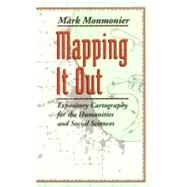
Mapping It Out

by
  • ISBN13:

    9780226534176

  • ISBN10:

    0226534170

  • Format: Paperback
  • Copyright: 1993-06-01
  • Publisher: Univ of Chicago Pr

Note: Supplemental materials are not guaranteed with Rental or Used book purchases.

Purchase Benefits

  • Free Shipping Icon Free Shipping On Orders Over $35!
    Your order must be $35 or more to qualify for free economy shipping. Bulk sales, PO's, Marketplace items, eBooks and apparel do not qualify for this offer.
  • eCampus.com Logo Get Rewarded for Ordering Your Textbooks! Enroll Now
List Price: $20.27 Save up to $8.72
  • Rent Book $11.55
    Add to Cart Free Shipping Icon Free Shipping

    TERM
    PRICE
    DUE
    USUALLY SHIPS IN 24-48 HOURS
    *This item is part of an exclusive publisher rental program and requires an additional convenience fee. This fee will be reflected in the shopping cart.

How To: Textbook Rental

Looking to rent a book? Rent Mapping It Out [ISBN: 9780226534176] for the semester, quarter, and short term or search our site for other textbooks by Monmonier, Mark S.. Renting a textbook can save you up to 90% from the cost of buying.

Summary

Writers know only too well how long it can takeand how awkward it can beto describe spatial relationships with words alone. And while a map might not always be worth a thousand words, a good one can help writers communicate an argument or explanation clearly, succinctly, and effectively. In his acclaimedHow to Lie with Maps,Mark Monmonier showed how maps can distort facts. InMapping it Out: Expository Cartography for the Humanities and Social Sciences,he shows authors and scholars how they can use expository cartographythe visual, two-dimensional organization of informationto heighten the impact of their books and articles. This concise, practical book is an introduction to the fundamental principles of graphic logic and design, from the basics of scale to the complex mapping of movement or change. Monmonier helps writers and researchers decide when maps are most useful and what formats work best in a wide range of subject areas, from literary criticism to sociology. He demonstrates, for example, various techniques for representing changes and patterns; different typefaces and how they can either clarify or confuse information; and the effectiveness of less traditional map forms, such as visibility base maps, frame-rectangle symbols, and complementary scatterplot designs for conveying complex spatial relationships. There is also a wealth of practical information on map compilation, cartobibliographies, copyright and permissions, facsimile reproduction, and the evaluation of source materials. Appendixes discuss the benefits and limitations of electronic graphics and pen-and-ink drafting, and how to work with a cartographic illustrator. Clearly written, and filled with real-world examples,Mapping it Outdemystifies mapmaking for anyone writing in the humanities and social sciences. "A useful guide to a subject most people probably take too much for granted. It shows how map makers translate abstract data into eye-catching cartograms, as they are called. It combats cartographic illiteracy. It fights cartophobia. It may even teach you to find your way."Christopher Lehmann-Haupt,The New York Times

Table of Contents

Preface ix
Maps in the Humanities and Social Sciences
1(18)
Words and Maps
4(8)
Maps, Location, and Spatial Pattern
12(7)
Scale, Perspective, and Generalization
19(36)
Scale Models and the Representation of Scale
22(9)
Global Perspective and the Distortion of Size and Shape
31(11)
Regional Perspectives and the Conservation of Distance
42(10)
Some General Rules
52(3)
Visual Variables and Cartographic Symbols
55(36)
The Visual Variables of Jacques Bertin
58(18)
Form and Function in Cartographic Representation
76(12)
Accessible Coding and Cartographic Goals
88(3)
Map Goals, Map Titles, and Creative Labeling
91(28)
Communication Goals, Map Content, and Graphic Hierarchies
93(12)
Typography as Cartographic Symbol
105(11)
Language and Cartographic Communication
116(3)
Cartographic Sources and Map Compilation
119(38)
Searching for Cartographic Information
122(17)
Copyright and Permissions
139(8)
The Mechanics of Complilation
147(9)
In Summary: Seek and Collect
156(1)
Statistical Maps, Data Scaling, and Data Classification
157(30)
Mapping Count Data
159(8)
Mapping Intensity Data
167(10)
Modifications for Greater Effectiveness
177(8)
The Ethics of One-Map Solutions
185(2)
Mapping Movement, Change, and Process
187(20)
Mapping Flows
189(4)
Spatial-Temporal Series and Maps of Change
193(5)
Distance Cartograms and Relative Space
198(2)
Fronts and Frontiers: Mapping War and Settlement
200(3)
The Map as a Narrative
203(4)
Relational Maps and Integrative Cartography
207(40)
Patterns, Trends, and Spatial Models
209(11)
Superposition and Additive Overlays
220(7)
Representing Geographic Correlation
227(15)
Integrating Maps, Graphs, Words, and Pictures
242(5)
Appendixes
A Drawing Media: Electronic Graphics or Pen-and-Ink Drafting 247(10)
Tools for Compilation
248(3)
Tools for Symbolization
251(2)
Tools for Labeling
253(1)
Software Compatibility and Planning
254(3)
B Working with a Cartographic Illustrator 257(6)
Working Relationships
257(3)
What the Illustrator Will Need to Know
260(3)
C Selected Readings 263(4)
Notes 267(22)
Sources of Illustrations 289(4)
Index 293

Supplemental Materials

What is included with this book?

The New copy of this book will include any supplemental materials advertised. Please check the title of the book to determine if it should include any access cards, study guides, lab manuals, CDs, etc.

The Used, Rental and eBook copies of this book are not guaranteed to include any supplemental materials. Typically, only the book itself is included. This is true even if the title states it includes any access cards, study guides, lab manuals, CDs, etc.

Rewards Program