did-you-know? rent-now

Amazon no longer offers textbook rentals. We do!

did-you-know? rent-now

Amazon no longer offers textbook rentals. We do!

We're the #1 textbook rental company. Let us show you why.

9780748408702

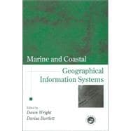
Marine and Coastal Geographical Information Systems

by ;
  • ISBN13:

    9780748408702

  • ISBN10:

    0748408703

  • Edition: 1st
  • Format: Nonspecific Binding
  • Copyright: 1999-12-23
  • Publisher: CRC Press

Note: Supplemental materials are not guaranteed with Rental or Used book purchases.

Purchase Benefits

  • Free Shipping Icon Free Shipping On Orders Over $35!
    Your order must be $35 or more to qualify for free economy shipping. Bulk sales, PO's, Marketplace items, eBooks and apparel do not qualify for this offer.
  • eCampus.com Logo Get Rewarded for Ordering Your Textbooks! Enroll Now
List Price: $110.00 Save up to $38.84
  • Rent Book $77.00
    Add to Cart Free Shipping Icon Free Shipping

    TERM
    PRICE
    DUE
    USUALLY SHIPS IN 3-5 BUSINESS DAYS
    *This item is part of an exclusive publisher rental program and requires an additional convenience fee. This fee will be reflected in the shopping cart.

Supplemental Materials

What is included with this book?

Summary

Marine and coastal applications of GIS are finally gaining wide acceptance in scientific as well as GIS communities, and cover the fields of deep sea geology, chemistry and biology, and coastal geology, biology, engineering and resource management. Comprising rigorous contributions from a group of leading scholars in marine and coastal GIS, this book will inspire and stimulate continued research in this important new application domain. Launched as a project to mark the UN International Year of the Ocean (1998) and supported by the International Geographical Union's Commission on Coastal Systems, this book covers progress and research in the marine and coastal realms, in the areas of theory, applications and empirical results. It is the first book of its kind to address basic and applied scientific problems in deep sea and coastal science using GIS and remote sensing technologies. It is designed for GIS and remote sensing specialists, but also for those with an interest in oceans, lakes and shores. Coverage ranges from seafloor spreading centres to Exclusive Economic Zones to microscale coastal habitats; and techniques include submersibles, computer modelling, image display, 3-D temporal data visualization, and development and application of new algorithms and spatial data structures. It illustrates the broad usage of GIS, image processing, and computer modelling in deep sea and coastal environments, and also addresses important institutional issues arising out of the use of these technologies.

Table of Contents

Series Introduction xi
Foreword xiii
Michael F. Goodchild
Preface xvii
Contributors xix
Down to the Sea in Ships: The Emergence of Marine GIS
1(10)
Dawn J. Wright
Working on the Frontiers of Science: Applying GIS to the Coastal Zone
11(14)
Darius J. Bartlett
PART I CONCEPTUAL/TECHNICAL ISSUES
Data Models for Marine and Coastal Geographic Information Systems
25(12)
Rongxing Li
An Algorithmic Approach to Marine GIS
37(16)
Christopher Gold
Representation of Variability in Marine Environmental Data
53(22)
Anne Lucas
Applying Spatio-Temporal Concepts to Correlative Data Analysis
75(20)
Herman Varma
Linear Reference Data Models and Dynamic Segmentation: Application to Coastal and Marine Data
95(22)
Andrew G. Sherin
Spatial Reasoning for Marine Geology and Geophysics
117(12)
Dawn J. Wright
2.5- and 3-D GIS for Coastal Geomorphology
129(8)
Jonathan Raper
PART II APPLICATIONS
Real-time GIS for Marine Applications
137(12)
Gerald A. Hatcher, Jr.
Norman Maher
Electronic Chart Display and Information Systems (ECDIS): State-of-the-art in Nautical Charting
149(14)
Robert Ward
Chris Roberts
Ron Furness
The National Oceanic and Atmospheric Administration's Vents Program GIS: Integration, Analysis, and Distribution of Multidisciplinary Oceanographic Data
163(14)
Christopher G. Fox
Andra M. Bobbitt
Integrated Geographical and Environmental Remotelysensed Data on Marginal and Enclosed Basins: The Mediterranean Case
177(12)
Vittorio Barale
Mapping Submarine Slope Failures
189(16)
Brian G. McAdoo
Applications of GIS to Fisheries Management
205(22)
Geoff J. Meaden
A User-Friendly Marine GIS for Multi-dimensional Visualisation
227(10)
Yafang Su
Active Tectonics: Data Acquisition and Analysis with Marine GIS
237(18)
Chris Goldfinger
PART III INSTITUTIONAL ISSUES
Managing Marine and Coastal Data Sources: A National Oceanographic Data Centre Perspective on GIS
255(6)
Bronwyn Cahill
Theresa Kennedy
Orla Ni Cheileachair
Significance of Coastal and Marine Geographic Information Systems within the Context of the United States National Geospatial Data Policies
261(18)
Millington Lockwood
Cindy Fowler
GIS Applications to Maritime Boundary Delimitation
279(16)
Harold Palmer
Lorin Pruett
Information Quality Considerations for Coastal Data
295(14)
Nancy von Meyer
Kenneth E. Foote
Donald J. Huebner
Epilogue
309(8)
Darius J. Bartlett
Dawn J. Wright
Index 317

Supplemental Materials

What is included with this book?

The New copy of this book will include any supplemental materials advertised. Please check the title of the book to determine if it should include any access cards, study guides, lab manuals, CDs, etc.

The Used, Rental and eBook copies of this book are not guaranteed to include any supplemental materials. Typically, only the book itself is included. This is true even if the title states it includes any access cards, study guides, lab manuals, CDs, etc.

Rewards Program