rent-now

Rent More, Save More! Use code: ECRENTAL

5% off 1 book, 7% off 2 books, 10% off 3+ books

9783540748304

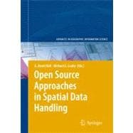
Open Source Approaches in Spatial Data Handling

by ;
  • ISBN13:

    9783540748304

  • ISBN10:

    354074830X

  • Format: Hardcover
  • Copyright: 2009-02-28
  • Publisher: Springer Verlag
  • Purchase Benefits
  • Free Shipping Icon Free Shipping On Orders Over $35!
    Your order must be $35 or more to qualify for free economy shipping. Bulk sales, PO's, Marketplace items, eBooks and apparel do not qualify for this offer.
  • eCampus.com Logo Get Rewarded for Ordering Your Textbooks! Enroll Now
List Price: $219.99 Save up to $0.22
  • Buy New
    $219.77
    Add to Cart Free Shipping Icon Free Shipping

    PRINT ON DEMAND: 2-4 WEEKS. THIS ITEM CANNOT BE CANCELLED OR RETURNED.

Summary

This book is intended to fill a niche within the growing field of Free and Open Source for Geospatial (FOSS4G) software development. The first chapters of the book discuss issues of importance to FOSS4G in general. A collection of some of the more prominent FOSS4G projects under development is then reviewed. The final three chapters each describe a different University-based FOSS4G project. The general intention of the book is to introduce new readers to the field of FOSS4G with as comprehensive a coverage if mainstream Web-based and desktop FOSS4G tools as possible. It was not possible to include all prominent projects in a single volume, and several noteworthy efforts such as Open Jump, gvSIG, uDig, MapBender, Spring, and Quantum GIS are not discussed. Despite this, the book gives both context and content to appeal to those new to FOSS4G developments as well as those already engaged in what David McIhagga describes in Chapter 3 as the 'Geospatial Web ecosystem'. Book jacket.

Table of Contents

Geospatial Open Source and Open Standards Convergencesp. 1
Free Software and Open Source Business Modelsp. 21
Communities of Practice and the Business of Open Source Web Mappingp. 49
MapServerp. 65
The Geospatial Data Abstraction Libraryp. 87
Open Source Databases and Their Spatial Extensionsp. 105
MapGuide Open Sourcep. 131
GeoToolsp. 153
GRASS GISp. 171
GeoVISTA Studio: Reusability by Designp. 201
Design and Implementation of a Map-Centred Synchronous Collaboration Tool Using Open Source Components: The MapChat Projectp. 221
TerraLib: An Open Source GIS Library for Large-Scale Environmental and Socio-Economic Applicationsp. 247
Indexp. 271
Author Biographyp. 277
Table of Contents provided by Ingram. All Rights Reserved.

Supplemental Materials

What is included with this book?

The New copy of this book will include any supplemental materials advertised. Please check the title of the book to determine if it should include any access cards, study guides, lab manuals, CDs, etc.

The Used, Rental and eBook copies of this book are not guaranteed to include any supplemental materials. Typically, only the book itself is included. This is true even if the title states it includes any access cards, study guides, lab manuals, CDs, etc.

Rewards Program