rent-now

Rent More, Save More! Use code: ECRENTAL

5% off 1 book, 7% off 2 books, 10% off 3+ books

9781467967556

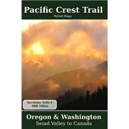
Pacific Crest Trail Pocket Maps Oregon & Washington

by
  • ISBN13:

    9781467967556

  • ISBN10:

    1467967556

  • Format: Paperback
  • Copyright: 2011-12-06
  • Publisher: Createspace Independent Pub

Note: Supplemental materials are not guaranteed with Rental or Used book purchases.

Purchase Benefits

  • Free Shipping Icon Free Shipping On Orders Over $35!
    Your order must be $35 or more to qualify for free economy shipping. Bulk sales, PO's, Marketplace items, eBooks and apparel do not qualify for this offer.
  • eCampus.com Logo Get Rewarded for Ordering Your Textbooks! Enroll Now
List Price: $34.59 Save up to $9.95
  • Rent Book $24.64
    Add to Cart Free Shipping Icon Free Shipping

    TERM
    PRICE
    DUE
    USUALLY SHIPS IN 3-5 BUSINESS DAYS
    *This item is part of an exclusive publisher rental program and requires an additional convenience fee. This fee will be reflected in the shopping cart.

How To: Textbook Rental

Looking to rent a book? Rent Pacific Crest Trail Pocket Maps Oregon & Washington [ISBN: 9781467967556] for the semester, quarter, and short term or search our site for other textbooks by Parks, K. Scott. Renting a textbook can save you up to 90% from the cost of buying.

Summary

Oregon & Washington The Pacific Crest Trail Pocket Map Series is a complete and concise set of topographic maps created with digitized base maps covering every step of the 2,655 mile trail from Mexico to Canada. The land cover, hydrology and contour data used to create these maps has been collected within the last 5 years, presented in a completely uniform manner across all 381 maps. No other complete PCT map set available can say this! Features: + 381 full color, digitized topographic maps + Seamless. Uniform styles, colors, fonts and unit of measure. + Beautiful 3D hill shading + Highly detailed elevation chart on each map + Section overview maps with sub-sections and legends + 6" x 9" (15.2cm x 22.9cm) format for easy pack stowage + Accumulated trail mileage every mile + Resupply locations within 90 miles of map center + 1:40,000 scale with WGS84 decimal degree tick marks + Data book information printed at each locale on the maps + Accurate trail trace is a hybrid of USFS, postholer.com, et al. + Over 2,000 way points and resupply locations + FREE 53 page PDF Data Book available at Postholer.Com Part of a 3 volume set, these 6" x 9" full color topographic maps are designed to stow easily into your pack, without sacrificing the detail required by a hiker in the back country. All 3 Pacific Crest Trail Pocket Maps volumes are: Southern California, Northern California and Oregon/Washington.

Supplemental Materials

What is included with this book?

The New copy of this book will include any supplemental materials advertised. Please check the title of the book to determine if it should include any access cards, study guides, lab manuals, CDs, etc.

The Used, Rental and eBook copies of this book are not guaranteed to include any supplemental materials. Typically, only the book itself is included. This is true even if the title states it includes any access cards, study guides, lab manuals, CDs, etc.

Rewards Program