rent-now

Rent More, Save More! Use code: ECRENTAL

5% off 1 book, 7% off 2 books, 10% off 3+ books

9781842652787

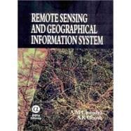
Remote Sensing And Geographical Information System

by ;
  • ISBN13:

    9781842652787

  • ISBN10:

    1842652788

  • Format: Hardcover
  • Copyright: 2006-03-20
  • Publisher: Alpha Science Intl Ltd

Note: Supplemental materials are not guaranteed with Rental or Used book purchases.

Purchase Benefits

  • Free Shipping Icon Free Shipping On Orders Over $35!
    Your order must be $35 or more to qualify for free economy shipping. Bulk sales, PO's, Marketplace items, eBooks and apparel do not qualify for this offer.
  • eCampus.com Logo Get Rewarded for Ordering Your Textbooks! Enroll Now
List Price: $79.95 Save up to $25.99
  • Rent Book $53.96
    Add to Cart Free Shipping Icon Free Shipping

    TERM
    PRICE
    DUE
    IN STOCK USUALLY SHIPS IN 24 HOURS
    *This item is part of an exclusive publisher rental program and requires an additional convenience fee. This fee will be reflected in the shopping cart.

How To: Textbook Rental

Looking to rent a book? Rent Remote Sensing And Geographical Information System [ISBN: 9781842652787] for the semester, quarter, and short term or search our site for other textbooks by Chandra, A. M.; Ghosh, S. K.. Renting a textbook can save you up to 90% from the cost of buying.

Table of Contents

Preface v
Remote Sensing
1(8)
Introduction
1(1)
Remote Sensing System
2(1)
Historical Development of Remote Sensing
3(1)
Multi-concept of Remote Sensing
4(2)
Advantages and Disadvatages of Remote Sensing
6(1)
Some Applications of Remote Sensing
7(2)
Electromagenetic Radiation
9(16)
Introduction
9(1)
Electromagnetic Energy
9(3)
Energy Interaction in the Atmosphere
12(3)
Energy Interactions with the Earth's Surface
15(7)
Resolution in Remote Sensing
22(2)
Pixel and Mixed Pixel
24(1)
Sensors and Platforms
25(34)
Introduction
25(1)
Broad Classifications of Sensors and Platform
25(1)
Land Observation Satellites and Sensors
26(14)
High Resolution Sensors
40(8)
Earth Observing-1 (EO-1)
48(3)
Weather Satellites/Sensors
51(5)
Other Weather Satellites
56(1)
Marine Observation Satellites/Sensors
57(2)
Satellite Data Products
59(14)
Introduction
59(1)
Data Reception, Transmission, and Processing
59(1)
Remote Sensing Data
60(3)
Data Products
63(2)
Referencing Scheme
65(1)
Standard Products
66(3)
Digital Data Products
69(4)
Image Interpretation
73(6)
Introduction
73(1)
Interpretation Procedure
73(1)
Elements of Photointerpretation
74(1)
Image Interpretation Strategies
75(1)
Photomorphic Analysis
76(1)
Image Interpretation Keys
77(1)
Equipment for Image Interpretation
77(1)
Automated Approach to Image Classification
78(1)
Digital Image Processing
79(36)
Introduction
79(1)
Digital Image Processing
79(2)
Overview of Digital Analysis Steps
81(1)
Initial Statistics Extraction
82(1)
Image Rectification and Restoration
83(5)
Image Enhancement
88(3)
Spatial Filtering
91(1)
Image Transformations
92(5)
Image Classification and Analysis
97(18)
Application of Remote Sensing
115(30)
Introduction
115(1)
Land use and Land Cover Mapping
115(1)
Crop Inventory Studies
116(5)
Ground Water Mapping
121(3)
Urban Growth Studies
124(1)
Flood Plain Mapping
125(3)
Hydro Morphological Studies
128(2)
Wasteland Mapping
130(2)
District Level Planning
132(3)
Disaster Management
135(3)
Concluding Remarks
138(7)
Geographic Information System
145(8)
Introduction
145(1)
Definition of GIS
145(1)
Components of GIS
146(3)
Geographical Concepts
149(1)
Input Data for GIS
150(1)
Types of output Products
150(1)
Applications of GIS
151(2)
GIS Data
153(34)
Introduction
153(1)
GIS Data Types
153(1)
Data Representation
153(1)
Data Sources
154(2)
Typical GIS Data Sets
156(1)
Data Acquisition
156(3)
Data Verification and Editing
159(1)
Georeferencing of GIS Data
160(4)
Spatial Data Errors
164(5)
Spatial Data Models
169(3)
Spatial Data Structures
172(4)
Modeling Surfaces
176(1)
Modeling Networks
177(1)
GIS Database and Database Management System
178(9)
Spatial Data Analysis
187(26)
Introduction
187(1)
Data Analysis Terminology
187(1)
Measurement of Length, Perimeter and Area
187(3)
Queries
190(1)
Reclassification
190(1)
Buffering and Neighbourhood Functions
190(2)
Data Integration - Map Overlay
192(4)
Spatial Interpolation
196(6)
Surface Analysis
202(5)
Network Analysis
207(1)
Digital Terrain Visualization
208(5)
GIS Application
213(28)
Introduction
213(1)
Problem Identification
213(1)
Designing A Data Model
214(1)
Project Management
215(1)
Implementation Problems
216(1)
Project Evaluation
216(1)
Case Studies
216(25)
Future Trends
241(40)
Introduction
241(1)
Advances in Remote Sensing
241(14)
Classification Accuracy Assessment
255(5)
Advances in GIS
260(1)
Internet GIS
260(6)
Mobile GIS
266(5)
Open GIS Consortium (OGC)
271(3)
Decision Support System
274(7)
References 281(6)
Index 287

Supplemental Materials

What is included with this book?

The New copy of this book will include any supplemental materials advertised. Please check the title of the book to determine if it should include any access cards, study guides, lab manuals, CDs, etc.

The Used, Rental and eBook copies of this book are not guaranteed to include any supplemental materials. Typically, only the book itself is included. This is true even if the title states it includes any access cards, study guides, lab manuals, CDs, etc.

Rewards Program