did-you-know? rent-now

Amazon no longer offers textbook rentals. We do!

did-you-know? rent-now

Amazon no longer offers textbook rentals. We do!

We're the #1 textbook rental company. Let us show you why.

9781589480810

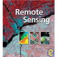
Remote Sensing for GIS Managers

by
  • ISBN13:

    9781589480810

  • ISBN10:

    1589480813

  • Format: Hardcover
  • Copyright: 2005-08-30
  • Publisher: Esri Pr
  • Purchase Benefits
  • Free Shipping Icon Free Shipping On Orders Over $35!
    Your order must be $35 or more to qualify for free economy shipping. Bulk sales, PO's, Marketplace items, eBooks and apparel do not qualify for this offer.
  • eCampus.com Logo Get Rewarded for Ordering Your Textbooks! Enroll Now
List Price: $69.95

Summary

This guide to remote sensing technology presents GIS managers who have no previous remote sensing experience with the basics of integrating it with GIS data. How to use remote sensing technology as geographic data is demonstrated, as is how remote sensing products are the perfect complement to GIS-based analysis in industries such as emergency response, meteorology, water resources, land use, and urban planning. Managers are guided through the evolution of remote sensing technology and shown the approaches that different organizations have successfully used to incorporate remote sensing data into their work. Information on remote sensing history, characteristics, sensors, image products, and practical applications of remote sensing data is also included.

Table of Contents

Foreword ix
Jack Dangermond
Acknowledgments xi
Contributors xiii
Introduction: Remote sensing and GIS
1(8)
Stan Aronoff
A brief history of remote sensing for earth observation
9(44)
Stan Aronoff
Remote sensing basics
53(16)
Stan Aronoff
Characteristics of remotely sensed imagery
69(42)
Stan Aronoff
Frame-capture sensors: Photographic cameras, digital cameras, and videography
111(36)
Stan Aronoff
Gordon Petrie
Line scanners
147(20)
Stan Aronoff
Satellite-based sensors operating in the visible and infrared wavelengths
167(30)
Stan Aronoff
Active sensors: Radar and lidar
197(48)
Stan Aronoff
Gordon Petrie
Sonar
245(14)
Stan Aronoff
Visual interpretation of aerial imagery
259(28)
James B. Campbell
Digital image analysis
287(50)
Joseph M. Piwowar
Remote sensing applications
337(78)
Remote sensing in agriculture
Stan Aronoff
Remote sensing and GIS in forestry
Michael A. Wulder
Ronald J. Hall
Steven E. Franklin
Remote sensing in geology
Zeev Berger
Danny Fortin
Remote sensing in meteorology, oceanography, and climatology
Kevin Gallo
Remote sensing in archaeology
Scott Madry
Remote sensing in the military
Stan Aronoff
David Swann
Remote sensing in geospatial intelligence analysis
Tom Last
Remote sensing in urban infrastructure and business geographics
James D. Hipple
Timothy L. Haithcoat
Remote sensing and the organization
415(6)
James W. Merchant
Appendix A: Rectification and georeferencing of optical imagery 421(34)
Gordon Petrie
Appendix B: Characteristics of selected satellite sensors 455(8)
Appendix C: Remote sensing resources 463(10)
Index 473

Supplemental Materials

What is included with this book?

The New copy of this book will include any supplemental materials advertised. Please check the title of the book to determine if it should include any access cards, study guides, lab manuals, CDs, etc.

The Used, Rental and eBook copies of this book are not guaranteed to include any supplemental materials. Typically, only the book itself is included. This is true even if the title states it includes any access cards, study guides, lab manuals, CDs, etc.

Rewards Program