rent-now

Rent More, Save More! Use code: ECRENTAL

5% off 1 book, 7% off 2 books, 10% off 3+ books

9781119159124

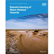
Remote Sensing of Water-Related Hazards

by ; ;
  • ISBN13:

    9781119159124

  • ISBN10:

    1119159121

  • Edition: 1st
  • Format: Hardcover
  • Copyright: 2022-04-19
  • Publisher: American Geophysical Union
  • Purchase Benefits
  • Free Shipping Icon Free Shipping On Orders Over $35!
    Your order must be $35 or more to qualify for free economy shipping. Bulk sales, PO's, Marketplace items, eBooks and apparel do not qualify for this offer.
  • eCampus.com Logo Get Rewarded for Ordering Your Textbooks! Enroll Now
List Price: $218.61 Save up to $21.81
  • Digital
    $196.80*
    Add to Cart

    DURATION
    PRICE
    *To support the delivery of the digital material to you, a digital delivery fee of $3.99 will be charged on each digital item.

Summary

Applications of remote sensing technology for monitoring and predicting water-related hazards

Water-related hazards such as floods and droughts have serious impacts on society. Their incidence has increased in recent decades, a trend set to continue with ongoing climate change. Adaptation and mitigation measures require accurate detection, monitoring, and forecasting, much of which comes from remote sensing technologies.

Remote Sensing of Water-Related Hazards takes an interdisciplinary approach, presenting recent advances in the available data, sensors, models, and indicators developed for monitoring and prediction.

Volume highlights include:

  • Progress in remote sensing of precipitation, storms, and tornados
  • Different techniques for flood mapping, forecasting, and early warning
  • Integrated approach for predicting flood and landslide cascading hazards
  • Satellite monitoring of water cycle variation, water scarcity, and drought conditions
  • Multi-indicator and multi-sensor approaches for quantifying drought impacts

The American Geophysical Union promotes discovery in Earth and space science for the benefit of humanity. Its publications disseminate scientific knowledge and provide resources for researchers, students, and professionals.

Author Biography

Ke Zhang, Hohai University, China

Yang Hong, University of Oklahoma, USA

Amir AghaKouchak, University of California, Irvine, USA

Table of Contents

Preface

Section 1. Monitoring and Detection of Natural Hazards

1. Virtual California: Earthquake statistics, surface deformation patterns, surface gravity changes and InSAR interferograms for arbitrary fault geometrics
Kasey Schultz et al. (University of California Davis)

2. Monitoring Fast-Moving Landslide in the Three Gorges Area By Offset Tracking Method with High-Resolution SAR Data
Mingsheng Liao et al. (Wuhan University, China)

3. A new method for detecting and monitoring atmospheric natural hazards with GPS RO
Riccardo Biondi et al. (University of Graz, Autria)

4. Integration between Satellite and Ground-Based Data for the Improvement of Volcanic Ash Retrievals and Eruption Characterization
Stefano Corradini et al. (INGV National Institute of Geophysics and Volcanology, Italy)

5. Detection of eruption-related microwave signals using a satellite-borne microwave radiometer AMSR2
Takashi Maeda (Japan Aerospace Exploration Agency)

6. Oil Spill Detection and Tracking Using Lipschitz Regularity and Multiscale Techniques in Synthetic Aperture Radar Imagery
Olaniyi Ajadi and Franz Meyer (University of Alaska Fairbanks)

7. Monitoring of precursor landslide surface deformation using InSAR image in Kuchi-Sakamoto, Shizuoka Prefecture
Hiroshi P Sato et al. (Nihon University, Tokyo, Japan)

8. A Landslide Monitoring Network based on Multi-source Spatial Sensors in Li County, Sichuan Province, China
Ping Lu et al. (Tongji University, Shanghai, China)

9. Robust Sparse Sensing Using Weather Radar
Kumar Vijay Mishra et al. (University of Iowa)

10.  Detection of eruption-related microwave signals using a satellite-borne microwave radiometer AMSR2

11.  Analysis of Potential Deep-Seated Landslide in Hekeng Watershed by Environment Indices

Section 2. Application of Remote Sensing in Investigating Natural Hazards

12.  Using infrared remote sensing to determine volcanic ash particle size distribution and its implications
Luke Western et al. (University of Bristol, United Kingdom)

13.  Landslide Investigations at Salmon Falls Creek Canyon in Idaho Using Satellite-Based Multitemporal Interferometric Synthetic Aperture Radar Techniques
Marius Necsoiu et al. (Southwest Research Institute, USA)

14.  Using Seismological and electromagnetic method to study the Xishancun Landslide
RiSheng Chu et al. (Institute of Geodesy and Geophysics, China)

15.  An investigation of pre-eruptive deformation for the 2004 eruption of Mount St. Helens using persistent scatterer interferometry
Mar Welch and David Schmidt (University of Washing)

16.  Optical and Radar Satellite Remote Sensing for Large Area Analysis of Landslide Activity in Southern Kyrgyzstan, Central Asia
Sigrid Roessner et al. (Helmholtz Centre Potsdam GFZ German Research Centre for Geosciences)

17.  Using Unmanned Aerial Vehicle (UAV) Imagery to Investigate Surface Displacements and Surface Features of the Super-Sauze Earthflow
Samuel Tizzard et al. (University of Lancaster)

18.  Revised and Improved Fault Maps of Washoe County, Nevada using Light Detecting and Ranging (LiDAR) Imagery
Courtney Brailo et al. (University of Nevada Reno)

19.  Using Unmanned Aerial Vehicle (UAV) Imagery to Investigate Surface Displacements and Surface Features of the Super-Sauze Earthflow
Samuel Tizzard et al. (University of Lancaster)

20.  Using Advanced Remote Sensing Data Fusion Techniques for Studying Earth Surface Processes and Hazards: A Landslide Detection Case Study

21.  GPS and Satellite InSAR Observations of Landslide Activity at the Sinking Canyon in South Central Idaho
Mohamed H Aly et al. (University of Arkansas)

Section 3. Early Warning Systems and Forecasting for Natural Hazards

22.  An Ensembel-based Remote-Sensing Driven Flash Flood-Landslide Early Warning System
Ke Zhang et al. (University of Oklahoma)

23.  Application of remotely sensed data for landslide hazard assessment and forecasting
Dalla Bach Kirschbaum et al. (NASA Goddard Space Flight Center)

24.  Forecasting Rainfall Induced Landslide using High Resolution DEM and Simple Water Budget Model
Paul Kenneth et al. (University of the Philippines, Quezon City, Philippines)

25.  Storm-triggerred debris avalanches in the Appalachians and possible trends in a future warming climate
Diandong Ren et al. (Curtin University, Australia)

26.  Probability hazard map for future vent opening at Etna volcano (Sicily, Italy).
Placido Montalto et al. (National Institute of Geophysics and Volcanology, Italy)


Supplemental Materials

What is included with this book?

The New copy of this book will include any supplemental materials advertised. Please check the title of the book to determine if it should include any access cards, study guides, lab manuals, CDs, etc.

The Used, Rental and eBook copies of this book are not guaranteed to include any supplemental materials. Typically, only the book itself is included. This is true even if the title states it includes any access cards, study guides, lab manuals, CDs, etc.

Rewards Program