did-you-know? rent-now

Amazon no longer offers textbook rentals. We do!

did-you-know? rent-now

Amazon no longer offers textbook rentals. We do!

We're the #1 textbook rental company. Let us show you why.

9781879102002

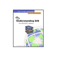
Understanding Gis

by ; ; ;
  • ISBN13:

    9781879102002

  • ISBN10:

    1879102005

  • Edition: 2nd
  • Format: Paperback
  • Copyright: 2009-10-28
  • Publisher: Esri Pr
  • Purchase Benefits
  • Free Shipping Icon Free Shipping On Orders Over $35!
    Your order must be $35 or more to qualify for free economy shipping. Bulk sales, PO's, Marketplace items, eBooks and apparel do not qualify for this offer.
  • eCampus.com Logo Get Rewarded for Ordering Your Textbooks! Enroll Now
List Price: $50.00 Save up to $6.80
  • Digital
    $86.40
    Add to Cart

    DURATION
    PRICE

Supplemental Materials

What is included with this book?

Summary

This workbook, designed primarily for beginners, uses hands-on exercises to teach the basics of GIS in the context of completing an ARC/INFO software project.

Table of Contents

Preface
Introduction
Why GIS
What is a GIS?
2(5)
Spatial operations
3(1)
Data linkage
4(3)
Questions a GIS can answer
7(1)
Sample GIS applications
8(1)
Components of a GIS
9(2)
What a GIS is not
9(2)
Using a GIS
11(19)
Summary
30
Introduction to GIS and ARC/INFO
Basic map concepts
2(2)
Map features
2(1)
Spatial relationships
3(1)
Symbols and labels depict descriptive information
3(1)
Storing geographic data
4(23)
Representing maps in the computer
5(2)
Representing multiple features
7(2)
What is topology?
9(7)
Organizing map information
16(3)
Representing descriptive data in the computer
19(1)
Connecting features and attributes
20(2)
The relate and join relational operators
22(4)
Terminology review
26(1)
Summary
27
Starting your ARC/INFO project
Project overview
2(3)
Designing the database
5(12)
Identifying data layers and attributes
5(5)
Defining each attribute
10(3)
Coordinate registration
13(4)
Starting the data automation project
17(7)
Workspace organization and naming conventions
17(1)
Backing up your data
18(6)
Advanced topic---Building an application system
24(2)
Summary
26
Getting spatial data into ARC/INFO
Data capture
2(5)
Key terms
2(1)
Digitizing
3(4)
Steps used to capture data by digitizing
7(6)
Digitizing maps in ARC/INFO
13(27)
Command usage
13(1)
The user's guides
14(2)
Starting ARC
16(1)
Starting ARCEDIT
16(5)
Drawing the coverage
21(2)
Digitizing from a map manuscript
23(11)
Adding labels
34(2)
Drawing the coverage
36(2)
Exiting ARCEDIT
38(2)
Advanced topic---Coverage creation alternatives
40(6)
Starting GENERATE
44(2)
Summary
46
Making spatial data usable
Steps for making spatial data usable
2(6)
Automating polygon data
2(6)
Constructing topology
8(7)
Feature attribute tables
8(2)
BUILD versus CLEAN
10(5)
Identifying digitizing errors
15(10)
Correcting spatial data using ARCEDIT
25(29)
Setting the environment
26(7)
Performing edits
33(3)
Preparation
36(1)
Adding missing data
37(9)
Correcting mistakes graphically
46(7)
More practice
53(1)
Reconstructing topology
54(3)
Advanced topic---Editing a line coverage
57(7)
Summary
64
Getting attribute data into ARC/INFO
Steps for getting attribute data into ARC/INFO
2(2)
Using TABLES to create a tabular data file
4(7)
Defining a relate item
6(5)
Using TABLES to enter descriptive attributes
11(5)
Using ARC/INFO to link attributes to geographic features
16(10)
Relate and join
21(5)
Advanced topic---Adding attributes from an existing digital file
26(5)
Summary
31
Managing the database
Coordinate systems for a multi-coverage database
6(18)
Thematic layers
6(1)
Spatial partitions or `tiles'
6(1)
Real-world coordinate systems
7(1)
Latitude-Longitude
8(1)
Planar coordinate systems
9(1)
Map projections
10(2)
Tic features
12(1)
Transformation
12(12)
Joining adjacent maps
24(20)
Database management
44(2)
Summary
46
Performing geographic analysis
Introduction to geographic analysis
2(1)
Steps for performing geographic analysis
2(1)
Establish the objectives and criteria of the analysis
3(6)
Prepare data for spatial operations
9(2)
Perform spatial operations
11(17)
Generating buffers
11(5)
Using coverages to manipulate spatial features
16(3)
Performing a polygon overlay
19(8)
Performing a sequence of spatial operations
27(1)
Prepare data for tabular analysis
28(3)
Perform the tabular analysis
31(5)
RESELECT
31(1)
ASELECT
31(1)
CALCULATE
32(4)
Evaluate and interpret the results
36(5)
Advanced topic---Refine the analysis as necessary
41(9)
Summary
50
Presenting the results of the analysis
What is a map?
2(2)
Geographic features
2(1)
Cartographic elements
3(1)
Using symbols
4(4)
Symbol definitions
4(1)
Symbol files
5(1)
Types of symbols
6(1)
Using symbols effectively
7(1)
Steps for creating your map
8(14)
The map message
8(1)
Intended audience
8(2)
Output medium and size
10(1)
Scale
11(1)
Balance
11(2)
Symbolizing features using their attribute values
13(6)
Key legends
19(3)
Using ARC/INFO to create your map
22(13)
Indicate the display
23(1)
Specify the geographic area
24(1)
Specify the map parameters (size, position and scale)
25(4)
Draw the coverage features
29(3)
Add the additional cartographic elements
32(3)
Report design and generation
35(3)
Advanced topic---Creating a map for display
38(9)
Summary
47
Customizing ARC/INFO
What's in an SML
2(4)
Running an SML program
2(4)
SML menus
6(5)
Anatomy of a menu
7(4)
Anatomy of an SML program
11(7)
Components of EX3.SML
14(4)
Getting more out of SML
18(11)
Local and global variables
18(3)
Passing arguments
21(1)
Flow of control
22(2)
The SHOW command
24(3)
Looping mechanisms
27(2)
Developing a user interface
29(10)
Calling the menu
30(1)
Adding a zoom function
31(5)
Adding a query function
36(3)
Summary
39
What next
Appendices
Appendix A: Confirming training data installation
Appendix B: Project database
Appendix C: Map sheets
Appendix D: Answers to written exercises
Appendix E: Sample maps
Glossary
Index
Questionnaire

Supplemental Materials

What is included with this book?

The New copy of this book will include any supplemental materials advertised. Please check the title of the book to determine if it should include any access cards, study guides, lab manuals, CDs, etc.

The Used, Rental and eBook copies of this book are not guaranteed to include any supplemental materials. Typically, only the book itself is included. This is true even if the title states it includes any access cards, study guides, lab manuals, CDs, etc.

Rewards Program