rent-now

Rent More, Save More! Use code: ECRENTAL

5% off 1 book, 7% off 2 books, 10% off 3+ books

9780415321297

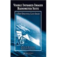
Visible Infrared Imager Radiometer Suite: A New Operational Cloud Imager

by ;
  • ISBN13:

    9780415321297

  • ISBN10:

    0415321298

  • Format: Hardcover
  • Copyright: 2005-11-14
  • Publisher: CRC Press

Note: Supplemental materials are not guaranteed with Rental or Used book purchases.

Purchase Benefits

  • Free Shipping Icon Free Shipping On Orders Over $35!
    Your order must be $35 or more to qualify for free economy shipping. Bulk sales, PO's, Marketplace items, eBooks and apparel do not qualify for this offer.
  • eCampus.com Logo Get Rewarded for Ordering Your Textbooks! Enroll Now
List Price: $215.00 Save up to $165.52
  • Rent Book $145.13
    Add to Cart Free Shipping Icon Free Shipping

    TERM
    PRICE
    DUE
    USUALLY SHIPS IN 3-5 BUSINESS DAYS
    *This item is part of an exclusive publisher rental program and requires an additional convenience fee. This fee will be reflected in the shopping cart.

How To: Textbook Rental

Looking to rent a book? Rent Visible Infrared Imager Radiometer Suite: A New Operational Cloud Imager [ISBN: 9780415321297] for the semester, quarter, and short term or search our site for other textbooks by Hutchison; Keith D.. Renting a textbook can save you up to 90% from the cost of buying.

Summary

The Visible Infrared Imager Radiometer Suite (VIIRS) is the next-generation multispectral imaging instrument to fly on US operational, polar-orbiting meteorological satellites. VIIRS will gather data across 22 spectral bands and be used to create products for a variety of applications including weather forecasting and climate change studies. VIIRS consolidates the best features of heritage instruments, including near-constant resolution and nighttime visible imagery. Visible Infrared Imager Radiometer Suite: A New Operational Cloud Imager provides the first comprehensive guide on the design and exploitation of cloud data collected by the VIIRS.Expert researchers Hutchison and Cracknell discuss the fundamental principles necessary to interpret surface and cloud features in multispectral meteorological satellite imagery. They begin by tracing the evolution of satellite meteorology and detailing previous instruments on which VIIRS is based. Next, they examine the user requirements for VIIRS data products and the studies used to convert these requirements into sensor design parameters. The focus then shifts to the principles and techniques used to exploit VIIRS cloud data. The book ends with a comprehensive discussion of automated processes to retrieve 3-dimensional cloud fields from a variety of algorithms, some of which were developed for the VIIRS.Supplying material for both experienced researchers and those new to the field, Visible Infrared Imager Radiometer Suite is a must-read for anyone interested in evaluating and using the data gathered from the VIIRS project.

Table of Contents

Introduction
1(20)
Satellite Meteorology
1(1)
Overview of Numerical Weather Prediction Modeling
1(1)
Evolution of Observational Data for Numerical Weather Prediction Modeling
2(6)
Additional Applications of Meteorological Satellite Data
8(13)
Sea Surface Temperature Analyses
9(4)
Climate Modeling
13(3)
Tropical Storm Monitoring
16(1)
Satellite-Derived Wind Fields
17(4)
Meteorological Satellite Systems
21(34)
Evolution of Satellites and Sensors
21(27)
Polar-orbiting Operational Environmental Satellite Systems
22(3)
The Advanced TIROS-N Satellite Series
25(4)
Defense Meteorological Satellite Program
29(6)
NASA Earth Observing System Program
35(5)
Other Polar-orbiting Meteorological Satellite Systems
40(1)
The Proposed EUMETSAT Meteorological Operational Series
41(2)
Geostationary Meteorological Satellite Systems
43(5)
The National Polor-orbiting Operational Environmental Satellite System
48(7)
VIIRS Imagery Design Analysis
55(12)
VIIRS Environmental Data Record Requirements Overview
55(1)
VIIRS Imagery Requirements
56(2)
Cloud Applications-Related Imagery Requirements
58(4)
Cloud Cover
60(1)
Cloud Type
60(2)
Value of Manually Generated Cloud Analyses
62(5)
Performance Verification of Automated Cloud Models
62(2)
Quality Control of Automated Cloud Analyses
64(3)
VIIRS Imagery Requirements Analysis
67(42)
Theoretical Basis for Manual Cloud Analyses
67(4)
Overview of Approach to Instrument Design
71(2)
Cloud Truth Data Sets to Flowdown Sensor Requirements
73(6)
Cloud Truth from Manual Interpretation of Multispectral Imagery
74(2)
Cloud Truth in Simulated Imagery
76(3)
Derivation of Sensing Requirements from Analysis Requirements
79(7)
Overview of VIIRS Hardware Design
86(23)
VIIRS Sensor Overview
87(4)
Detailed VIIRS Design Capabilities
91(1)
VIIRS Spectral Design Requirements
91(1)
VIIRS Spatial Capabilities
91(2)
VIIRS Horizontal Sampling Interval
93(5)
VIIRS Dynamic Range Capability
98(1)
VIIRS Sensitivity Capability
99(1)
VIIRS Sensor Polarization Sensitivity
100(1)
Detector Performance
101(1)
Band-to-Band Registration or Coregistration
101(3)
VIIRS Calibration
104(5)
Principles in Image Interpretation
109(42)
Introduction
109(4)
VIIRS Imagery Data
113(29)
VIIRS Imagery Band I1 (0.64 ± 0.040-μm)
114(1)
Theoretical Basis for Band Interpretation
114(1)
Representative Imagery of the VIIRS I1 Band (0.640- ± 0.040-μm)
115(1)
VIIRS 12 Band (0.865- ± 0.020-μm)
116(1)
Theoretical Basis for Band Interpretation
116(1)
Representative Imagery of the VIIRS I2 Band (0.865- ± 0.020-μm)
117(1)
VIIRS 13 and M10 Bands (1.61 ± 0.03-μm)
118(1)
Theoretical Basis for Band Interpretation
118(1)
Representative Imagery of the VIIRS I3/M10 Band (1.61- ± 0.03-μm)
119(1)
VIIRS 14 Band (3.74- ± 0.19-μm) and M12 Band (3.7- ± 0.09-μm)
120(1)
Theoretical Basis for Band Interpretation
120(3)
Representative Imagery of VIIRS I4 Band (3.74- ± 0.19-μm)
123(12)
VIIRS 15 Band (11.45- ± 0.95-μm)
135(1)
Theoretical Basis for Band Interpretation
135(2)
Representative Imagery of the VIIRS I5 Band (11.45- ± 0.95-μm)
137(2)
VIIRS Day-Night Band
139(1)
Theoretical Basis for Band Interpretation
139(2)
Representative Imagery of the VIIRS DNB (0.7- ± 0.2-μm)
141(1)
VIIRS Imagery Assist Data
142(9)
VIIRS M1-M4 Bands (0.412 ± 0.010, 0.445 ± 0.009, 0.488 ± 0.010, 0.555 ± 0.010-μm)
142(1)
Theoretical Basis for Band Interpretation
142(2)
Representative Imagery of the VIIRS M1 Band (0.412- ± 0.05-μm)
144(2)
VIIRS M9 Band (1.378- ± 0.0075-μm)
146(1)
Theoretical Basis for Band Interpretation
146(1)
Representative Imagery of the VIIRS M9 Band (1.378- ± 0.075-μm)
147(4)
Multicolor Composites of Multispectral Imagery
151(10)
Introduction
151(2)
Color Composites of (0.64-μm, 0.865-μm, and 12.0-μm) Surface Vegetation and Cloud Classifications
153(2)
Color Composites (3.7-μm albedo, 0.865-μm, 12.0-μm) for Snow Detection
155(1)
Color Composites of (0.64-μm, 0.64-μm, 3.7-μm albedo) Snow Mapping Through Thin Cirrus Clouds
156(2)
Color Composites of (0.412-μm, 0.865-μm, and 0.64-μm) Clouds Over Arid Regions
158(3)
Case Studies in the Use of Multicolor Composites for Scene Interpretation
161(20)
Overview
161(1)
MODIS Airborne Simulation Data Over Alaska
162(9)
Color Composite 1: Identification of Vegetated Surfaces
162(1)
Color Composite 2: Identification of Snow and Ice Features
163(1)
Color Composite 3: Cloud Type Classification Part I
164(5)
Color Composite 4: Cloud Type Classification Part II
169(2)
MODIS Airborne Simulation Success Data Collected Over Colorado
171(10)
Color Composite 1: Identification of Vegetated Surfaces
173(1)
Color Composite 2: Identification of Snow and Ice Features
174(1)
Color Composite 3: Cloud Type Classification Part I
174(3)
Color Composite 4: Cloud Type Classification Part II
177(4)
Automated 3-D Cloud Analyses from NPOESS
181(30)
Architecture for 3-D Cloud Analyses
181(3)
Automated Cloud Detection
184(5)
Single-Channel Cloud Detection Algorithms
185(1)
Multispectral Channel Cloud Detection Algorithms
185(3)
Spatial Cloud Classifier Algorithms
188(1)
Cloud Top Phase Classifications
189(3)
Cloud Optical (Thickness and Particle Size) Properties
192(12)
Retrieval for Water Clouds During Daytime Conditions
194(5)
Retrieval for Ice Cloud Microphysical Properties
199(1)
Retrieval of Ice Cloud Properties in Daytime Imagery
200(1)
Retrieval of Ice Cloud Properties in Nighttime Imagery
201(3)
Cloud Top (Temperature, Pressure, and Height) Parameters
204(1)
Cloud Base Heights
205(6)
Cloud Base Heights Retrieved for Water Clouds
205(1)
Cloud Base Heights Retrieved for Ice Clouds
206(1)
Ancillary Data and Products from Other Sensors
207(1)
Integration of VIIRS, CMIS, and Conventional Cloud Base Observations
208(3)
References 211(8)
Index 219

Supplemental Materials

What is included with this book?

The New copy of this book will include any supplemental materials advertised. Please check the title of the book to determine if it should include any access cards, study guides, lab manuals, CDs, etc.

The Used, Rental and eBook copies of this book are not guaranteed to include any supplemental materials. Typically, only the book itself is included. This is true even if the title states it includes any access cards, study guides, lab manuals, CDs, etc.

Rewards Program