did-you-know? rent-now

Amazon no longer offers textbook rentals. We do!

did-you-know? rent-now

Amazon no longer offers textbook rentals. We do!

We're the #1 textbook rental company. Let us show you why.

9781319292263

Discovering Gis and Arcgis

by
  • ISBN13:

    9781319292263

  • ISBN10:

    1319292267

  • Edition: 2nd
  • Format: Paperback
  • Copyright: 2019-06-10
  • Publisher: W. H. Freeman
  • View Upgraded Edition
  • Purchase Benefits
  • Free Shipping Icon Free Shipping On Orders Over $35!
    Your order must be $35 or more to qualify for free economy shipping. Bulk sales, PO's, Marketplace items, eBooks and apparel do not qualify for this offer.
  • eCampus.com Logo Get Rewarded for Ordering Your Textbooks! Enroll Now
List Price: $143.98 Save up to $0.72
  • Buy New
    $143.26
    Add to Cart Free Shipping Icon Free Shipping

    USUALLY SHIPS IN 24-48 HOURS

Supplemental Materials

What is included with this book?

Summary

Each chapter focuses on using a variety of ArcGIS tools in a real-world context. At the start of each chapter, a scenario puts the student in a particular role with a number of tasks to accomplish. These scenarios include the role of a park ranger trying to find the best overland route to rescue a group of stranded hikers (Chapter 19), a delivery person finding the shortest driving route between a set of libraries (Chapter 11), and an urban planner trying to determine the minimum height necessary for constructing an observation platform (Chapter 15).


Because the early chapters teach basic GIS and ArcGIS skills using data that can be easily replicated for a local area, the scenarios used are simple. The scenarios used in later chapters become more specific (as the book assumes that students have mastered the basic skills and can work with more difficult or involved tasks). In addition, each chapter describes professions and applications in the real world that make use of the chapter’s theory and skills.
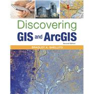
Table of Contents

Chapter 1: How to Use Geospatial Data and ArcGIS.
Chapter 2: How to Use Tables and Attributes in ArcGIS
Chapter 3: How to Create a Map Layout with ArcGIS.
Chapter 4: How to Create a Web Map and Share Data Online with ArcGIS. Chapter 5: How to Obtain and Use Online Data with ArcGIS.
Chapter 6: How to Create Geospatial Data with ArcGIS.
Chapter 7: How to Edit Data with ArcGIS.
Chapter 8: How to Perform Spatial Analysis in ArcGIS.
Chapter 9: How to Perform Geoprocessing in ArcGIS.
Chapter 10: How to Perform Geocoding in ArcGIS.
Chapter 11: How to Perform Network Analysis in ArcGIS.
Chapter 12: How to Use Raster Data in ArcGIS.
Chapter 13: How to Use Remotely Sensed Imagery in ArcGIS.
 Chapter 14: How to Perform Spatial Interpolation with ArcGIS.
Chapter 15: How to Work with Digital Elevation Models in ArcGIS.
Chapter 16: How to Work with Contours, TINs, and 3D Imagery in ArcGIS. Chapter 17: How to Work with Lidar Data in ArcGIS.
Chapter 18: How to Represent Geospatial Data in 3D with ArcGIS.
Chapter 19: How to Utilize Distance Calculations in ArcGIS.
Chapter 20: How to Perform Map Algebra in ArcGIS
Chapter 21: How to Build a Model in ArcGIS.
Chapter 22: How to Use Hydrologic Modeling Tools in ArcGIS.
Appendix A: Using Coordinate Systems in ArcGIS.
Appendix B (online only): How to Customize Toolbars in ArcMap. 

Supplemental Materials

What is included with this book?

The New copy of this book will include any supplemental materials advertised. Please check the title of the book to determine if it should include any access cards, study guides, lab manuals, CDs, etc.

The Used, Rental and eBook copies of this book are not guaranteed to include any supplemental materials. Typically, only the book itself is included. This is true even if the title states it includes any access cards, study guides, lab manuals, CDs, etc.

Rewards Program