did-you-know? rent-now

Amazon no longer offers textbook rentals. We do!

did-you-know? rent-now

Amazon no longer offers textbook rentals. We do!

We're the #1 textbook rental company. Let us show you why.

9780470850039

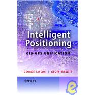
Intelligent Positioning GIS-GPS Unification

by ;
  • ISBN13:

    9780470850039

  • ISBN10:

    0470850035

  • Edition: 1st
  • Format: Hardcover
  • Copyright: 2006-05-12
  • Publisher: WILEY

Note: Supplemental materials are not guaranteed with Rental or Used book purchases.

Purchase Benefits

  • Free Shipping Icon Free Shipping On Orders Over $35!
    Your order must be $35 or more to qualify for free economy shipping. Bulk sales, PO's, Marketplace items, eBooks and apparel do not qualify for this offer.
  • eCampus.com Logo Get Rewarded for Ordering Your Textbooks! Enroll Now
List Price: $182.93 Save up to $61.28
  • Rent Book $121.65
    Add to Cart Free Shipping Icon Free Shipping

    TERM
    PRICE
    DUE
    USUALLY SHIPS IN 3-4 BUSINESS DAYS
    *This item is part of an exclusive publisher rental program and requires an additional convenience fee. This fee will be reflected in the shopping cart.

Supplemental Materials

What is included with this book?

Summary

"This book provides a technical overview of GIS, GPS and their integration, before focusing on a selection of research and development activities for real-time intelligent transport systems. It also describes a number of current commercial applications that use these combined technologies. This book is essential reading for postgraduate researchers and advanced students working with technical aspects of GIS/GPS in departments of geography, GIS, geomatics, geodesy and software engineering. It will also be valuable for professionals involved in GIS/GPS systems development in the fields of software engineering, communications, transportation and navigation."--BOOK JACKET.

Author Biography

George Taylor is the author of Intelligent Positioning: GIS-GPS Unification, published by Wiley.

Geoff Blewitt is the author of Intelligent Positioning: GIS-GPS Unification, published by Wiley.

Table of Contents

Foreword.
Preface.
Acknowledgements.
List of Abbreviations.
Introduction.
1. Do You Really Know Where You Are?
2. How Active Is Your Map?
3. Levels of GPS-GIS Integration.
4. Overview of the Book.
1 GIS: An Overview.
1. Introduction.
2. GIS.
2.1. The Basic Idea.
3. Functionality.
3.1. Input.
3.2. Storage.
3.3. Analysis.
3.4. Output.
4. Fundamental Concepts.
4.1. Features.
4.2. Spatial Elements.
4.3. Attribute Information.
5. Spatial and Geographical Data.
5.1. Spatial Referencing.
6. Spatial Data Modelling.
7. Spatial Data Visualization.
8. GIS and the Internet.
9. The Application of GIS.
9.1. Example GIS Applications.
10. Conclusion.
2 GPS: An Introduction.
1. GPS Description.
1.1. The Basic Idea.
1.2. The GPS Segments.
1.3. The GPS Signals.
2. The Pseudorange Observable.
2.1. Code Generation.
2.2. Autocorrelation Technique.
2.3. Pseudorange Observation Equations.
3. Point Positioning Using Pseudorange.
3.1. Least Squares Estimation.
3.2. Error Computation.
4. The Carrier Phase Observable.
4.1. Concepts.
4.2. Carrier Phase Observation Model.
4.3. Differencing Techniques.
5. Relative Positioning Using Carrier Phase.
5.1. Selection of Observations.
5.2. Baseline Solution Using Double Differences.
5.3. Stochastic Model.
6. Introducing High Precision GPS Geodesy.
6.1. High Precision Software.
6.2. Sources of Data and Information.
7. Conclusion.
3 Datum Transformations and Projections.
1. Integration Requirements.
2. Global Reference Systems.
2.1. WGS-84 Cartesian Coordinates.
2.2. International Terrestrial Reference System (ITRS).
2.3. WGS-84 Ellipsoidal Coordinates.
2.4. Cartesian to Ellipsoidal Transformation.
2.5. Ellipsoidal to Cartesian Transformation.
2.6. Relative Coordinates: Cartesian to Topocentric.
2.7. GPS Estimated Errors: Cartesian to Topocentric.
2.8. Dilution of Precision.
3. Regional Reference Systems.
3.1. Regional Ellipsoidal Coordinates.
3.2. Plane Coordinates.
3.3. Converting Latitude and Longitude to UTM.
3.4. Orthometric Height ‘Above Sea Level’.
4. Conclusion.
4 Commercial Applications That Integrate GIS and GPS.
1. Introduction.
2. National GIS/GPS Integration Team.
3. GIS and GPS Deformation Monitoring.
4. Location Based Services.
5. Intelligent Transport Systems.
6. Accessible Rural Public Transport (Case Study).
6.1. Overview.
6.2. Integrated Rural Transport.
6.3. Route Tracking System.
6.4. Conclusion.
7. Realtime Passenger Information and Bus Priority System.
8. Precision Farming.
9. Conclusion.
9.1. Shallow Integration.
9.2. Deep Integration.
5 GPS-GIS Map Matching: Combined Positioning Solution.
1. Introduction.
2. Map-Matching Methodologies.
3. Road Reduction Filter (RRF) Map-Matching Algorithm.
3.1. Introduction.
3.2. The Algorithm.
3.3. Determining the Correct Road Centre-line.
4. Testing VDGPS.
4.1. Testing Methodology.
4.2. Test Results.
5. Conclusion.
6 Intelligent Map Matching Using ‘Mapping Dilution of Precision’ (MDOP).
1. Introduction.
2. Least Squares Estimation of Position Error Vector.
3. Quantifying Road Geometry: Mapping Dilution of Precision (MDOP).
4. MDOP for Basic Road Shapes.
5. Testing MDOP.
6. RRF Map-Matching Enhancement.
7. Conclusion.
7 The Use of Digital Terrain Models to Aid GPS Vehicle Navigation.
1. Introduction.
2. Digital Terrain Models.
3. Spatial Interpolation of Elevation Data.
3.1. Patchwise Polynomial Interpolation.
3.2. Bicubic Interpolation.
3.3. Biquintic Interpolation.
4. Map Matching and the Road Reduction Filter.
4.1. Road Reduction Filter (RRF).
5. Data Collection and Processing.
5.1. Accuracy of Solution.
6. Results.
6.1. Height Errors – Test 1.
6.2. Position Errors – Test 1.
7. Results from Test 2 Data with a Subset of Satellites.
7.1. Position Error – Test 2.
8. Conclusion.
8 GPS Accuracy Estimation Using Map-Matching Techniques: Application to Vehicle Positioning and Odometer Calibration.
1. Introduction.
2. Methodology.
3. Map Matching.
4. Distance Correction Factor.
5. Estimating C.
5.1. Weighting Scheme for w<sub>i</sub>.
5.2. Implementing the Correction Factor Algorithm.
6. Calibration if GPS Data Is Recently Online.
7. Putting it all Together.
8. Alterations to the Correction Factor Algorithm.
9. Height Aiding.
10. Implementation.
11. Data Processing and Results.
12. Conclusion.
Appendix: Algorithms.
Algorithm 1 Estimate Location of Bus from Odometer Signal.
Algorithm 2 ‘Distance3d’ Function Used by Algorithm 4.
Algorithm 3 Update the Value of C<sub>t</sub>.
Algorithm 4 Update the Value of C.
Algorithm 5 Combine C.
Algorithm 6 Overview of Events.
Modification of Algorithm 6.
Bibliography.
Index.

Supplemental Materials

What is included with this book?

The New copy of this book will include any supplemental materials advertised. Please check the title of the book to determine if it should include any access cards, study guides, lab manuals, CDs, etc.

The Used, Rental and eBook copies of this book are not guaranteed to include any supplemental materials. Typically, only the book itself is included. This is true even if the title states it includes any access cards, study guides, lab manuals, CDs, etc.

Rewards Program